| Geology and Topography |
 | The Building Stones of Suffolk by Tony Redman |
|
| The changing coastline of Britain during the Ice Ages, 1.8 million ybp to 13,000 ybp |
|
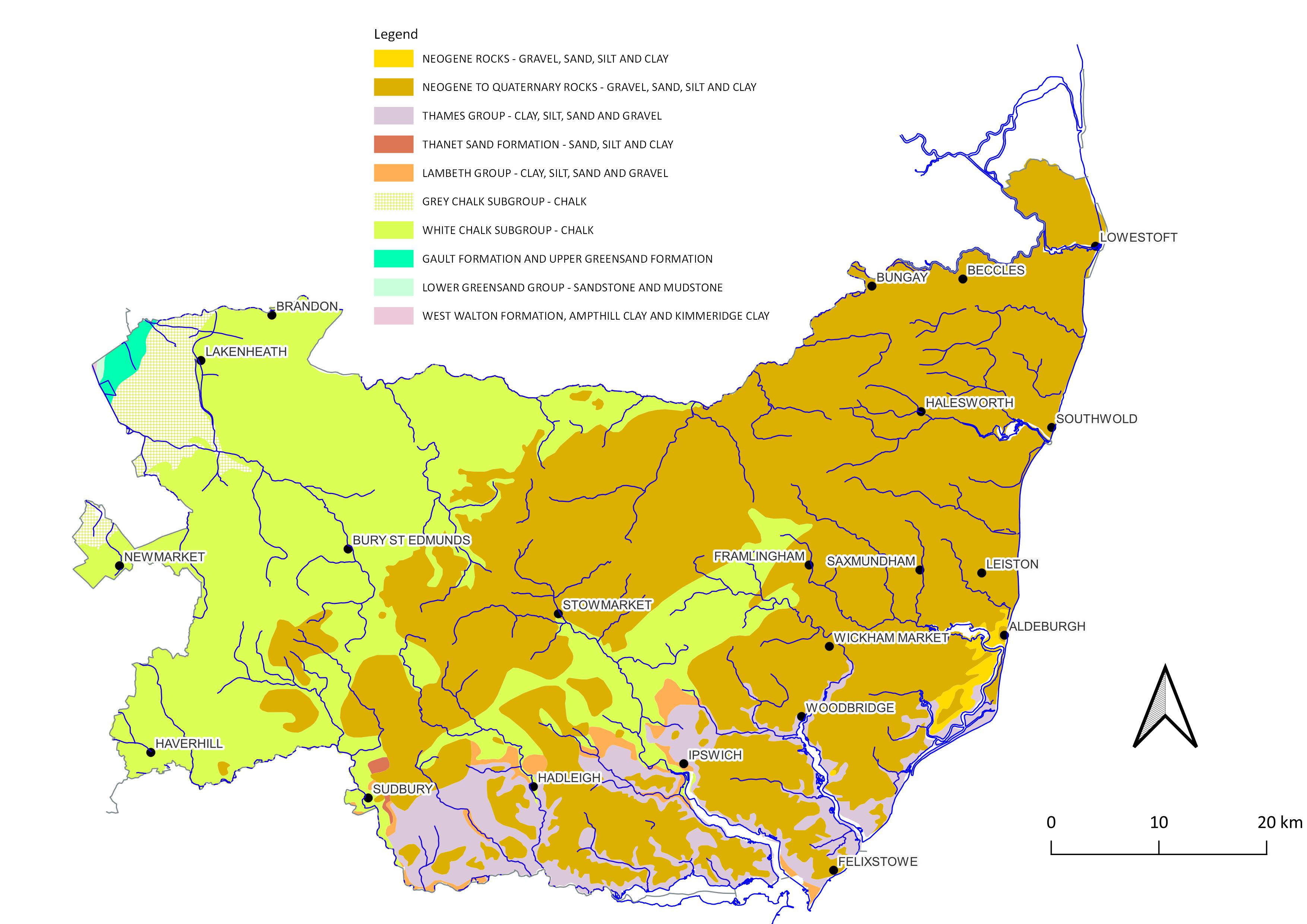
| Suffolk Bedrock - source BGS website |
|
| Surface geology around Bury St Edmunds |
|
| Surface geology- close up on Bury St Edmunds |
|
| Modern topography of East Anglia with peaty areas |
| Mapping the Roman and Anglo-Saxon periods |
|
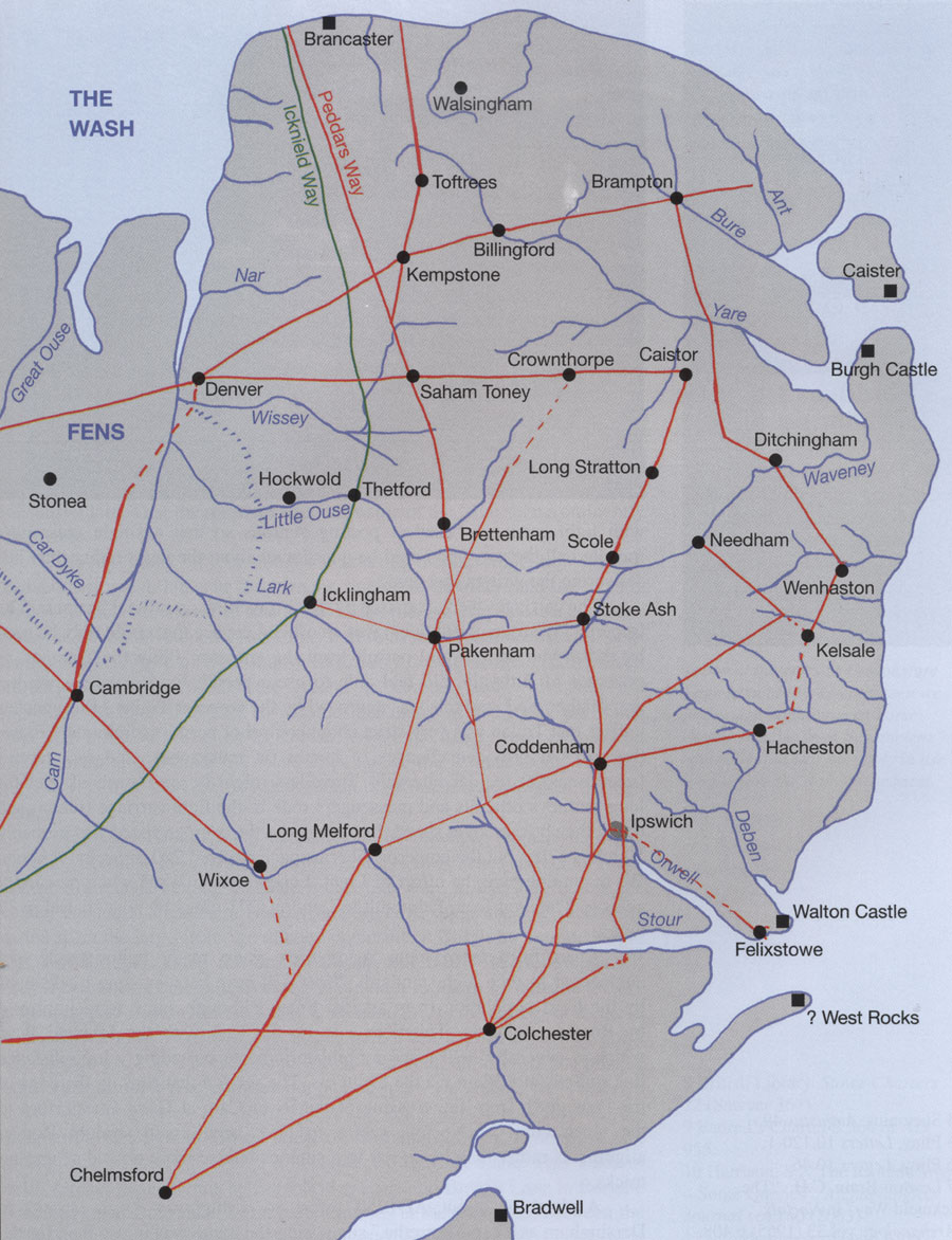
| The Roman coastline, rivers and roads by John Fairclough, 2010 |
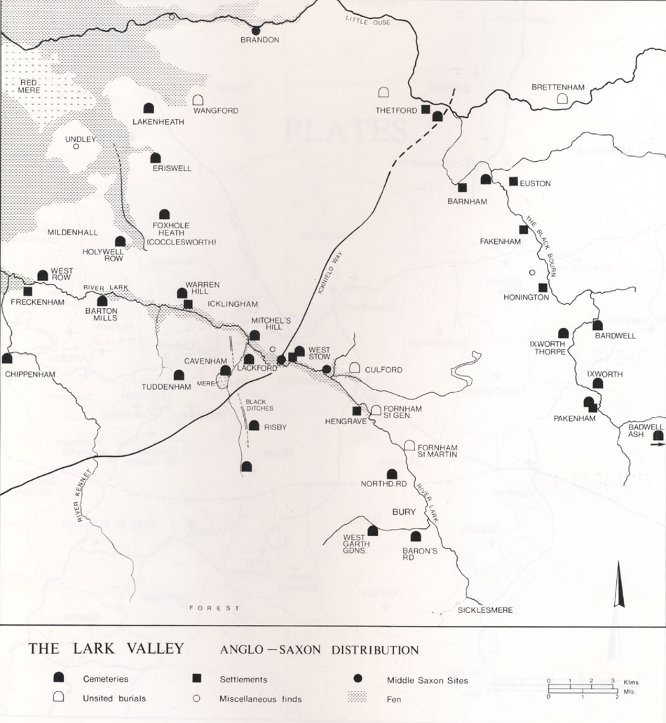
| Anglo-Saxon settlements on Rivers Lark and Blackbourne by Stanley West (EAA24 vol 2) |
|
| Development of Thetford before 1066 |
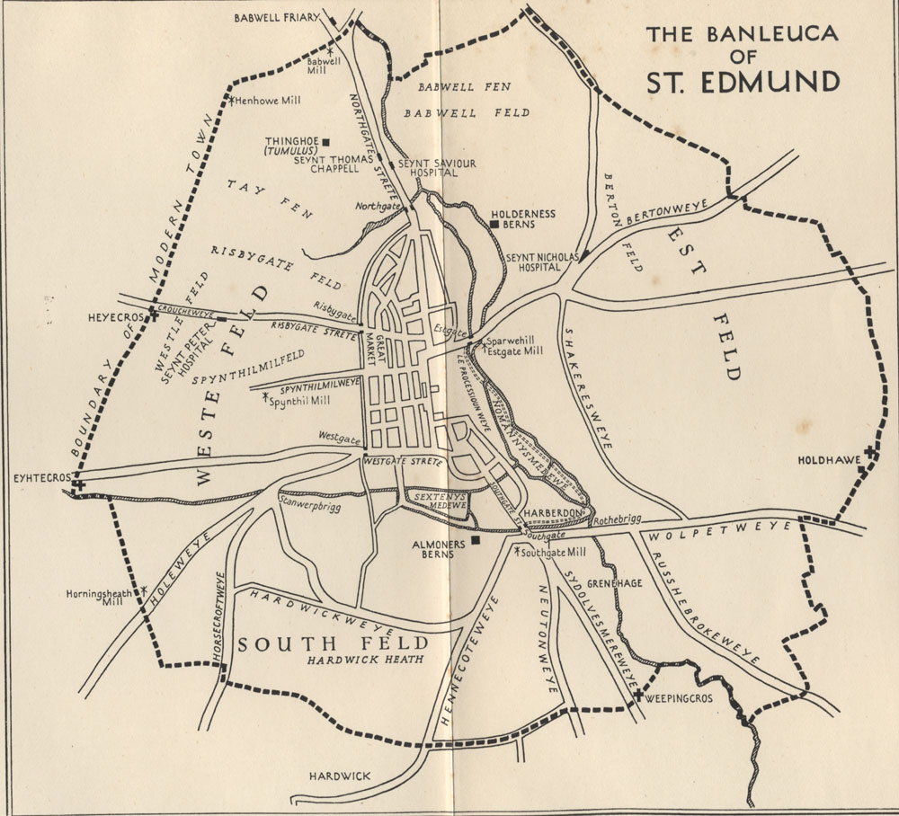
| Cyril Hart's Perambulation of the Banleuca Boundaries |
|
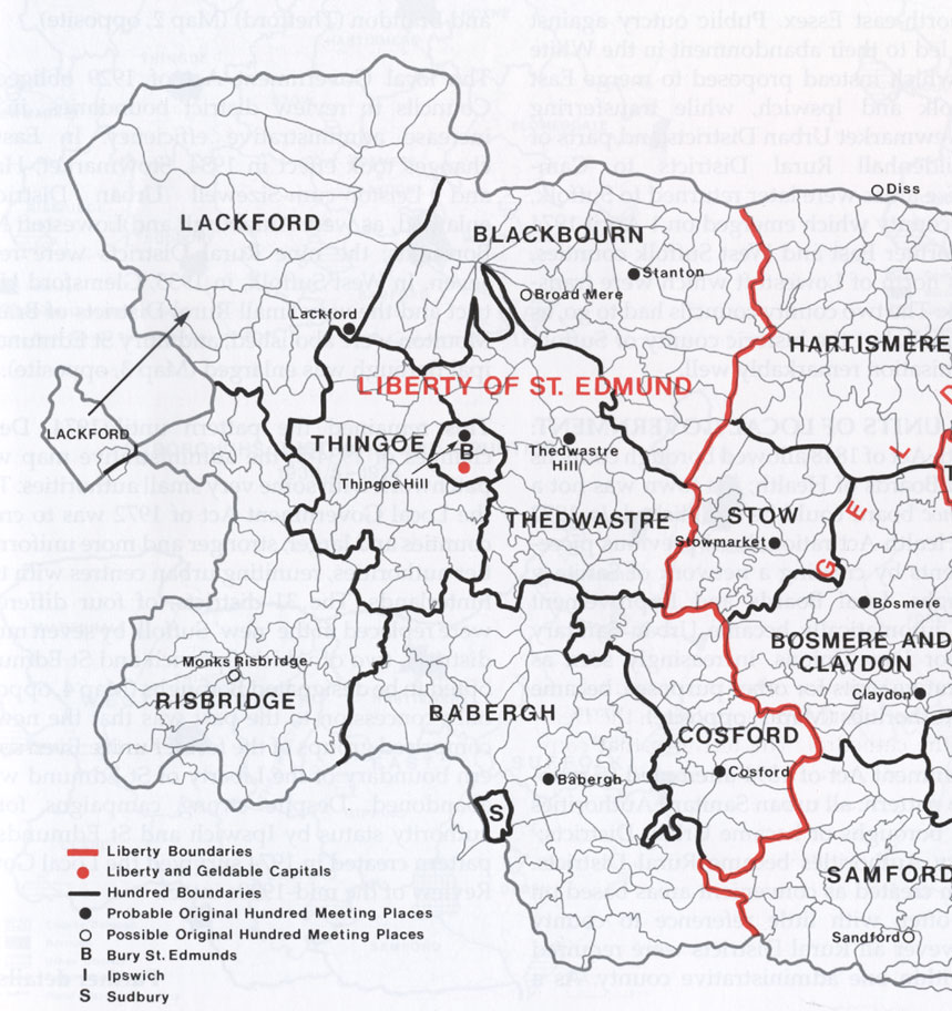
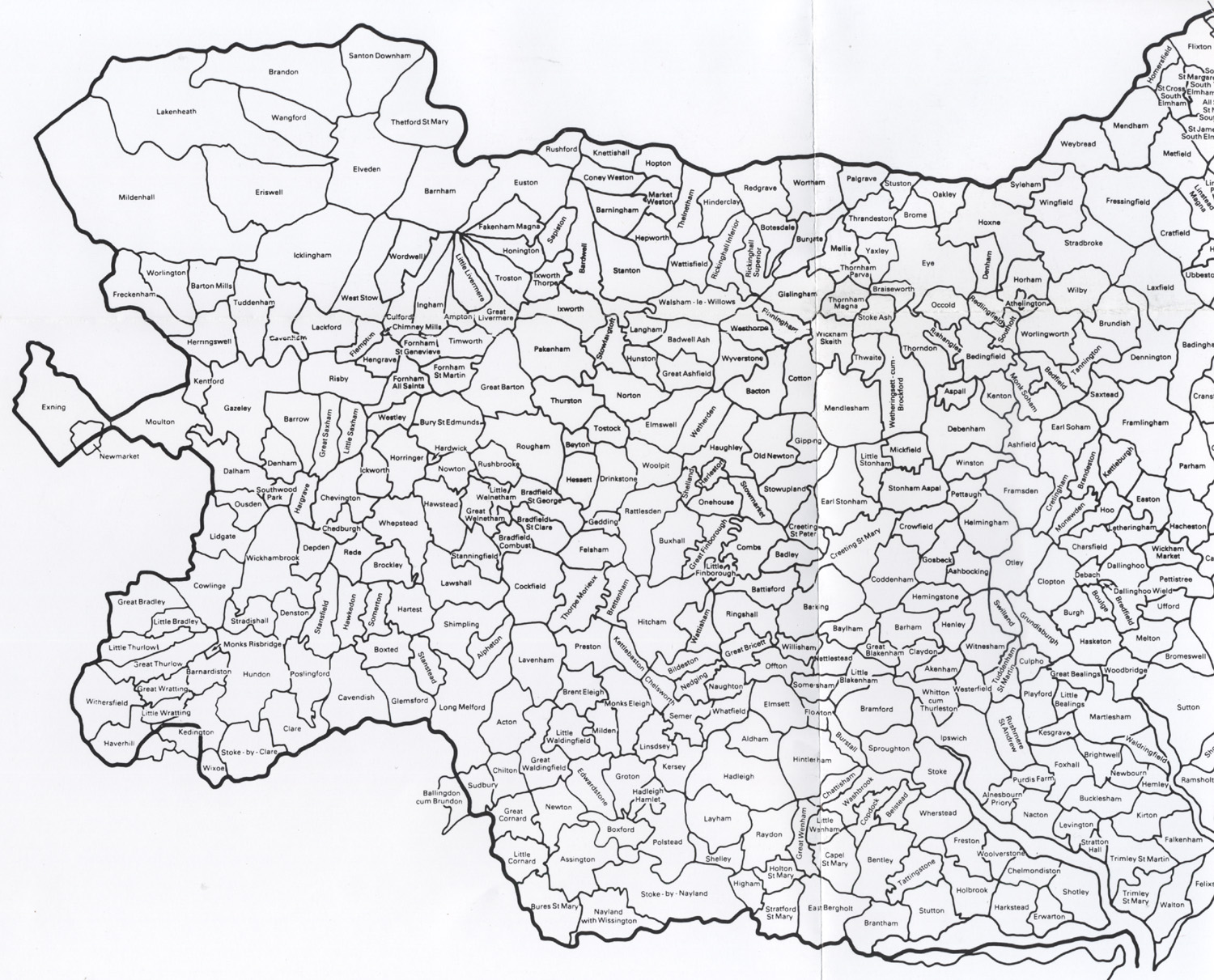
| The Hundreds of the Liberty of St Edmund by Edward Martin (Historical Atlas of Suffolk) |
|
| Ipswich in 750/850 and 1086 |
|
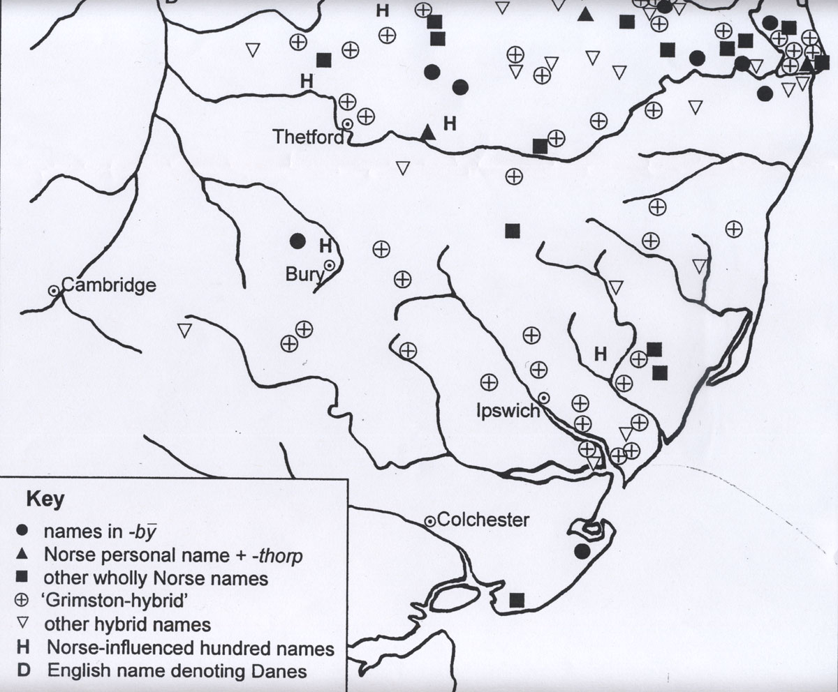
| Viking Place names by David Parsons |
| Maps and Plans of the Abbey of St Edmund |
|
| Click to go to Monastic Topics sub-page for all monastic plans |
| Maps of the landholdings of the Abbey of St Edmund in 1066 and 1086 |
| Post Conquest Medieval Maps |
| Maps of the coastal changes 1200 to 1600 Orford Ness to Goseford |
| Maps of the coastal changes Dunwich, Easton Bavents, Southwold |
|
| Suggested map of Suffolk Hundreds in 1086 |
| Liberty of St Edmund - The individual Hundreds mapped separately 1086 |
| Bradmere - the case of the disappearing Hundred 1086 to 1100 |
|
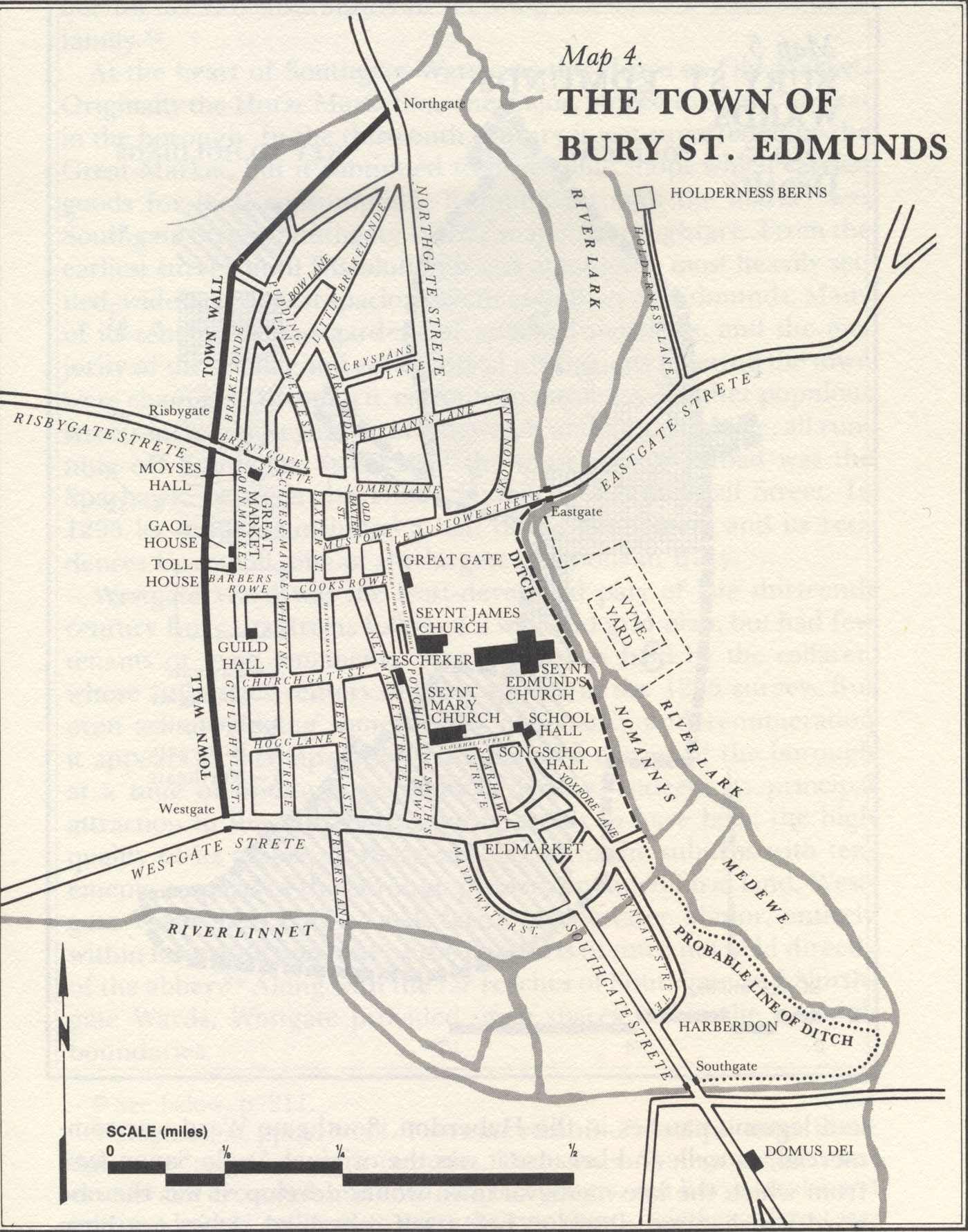
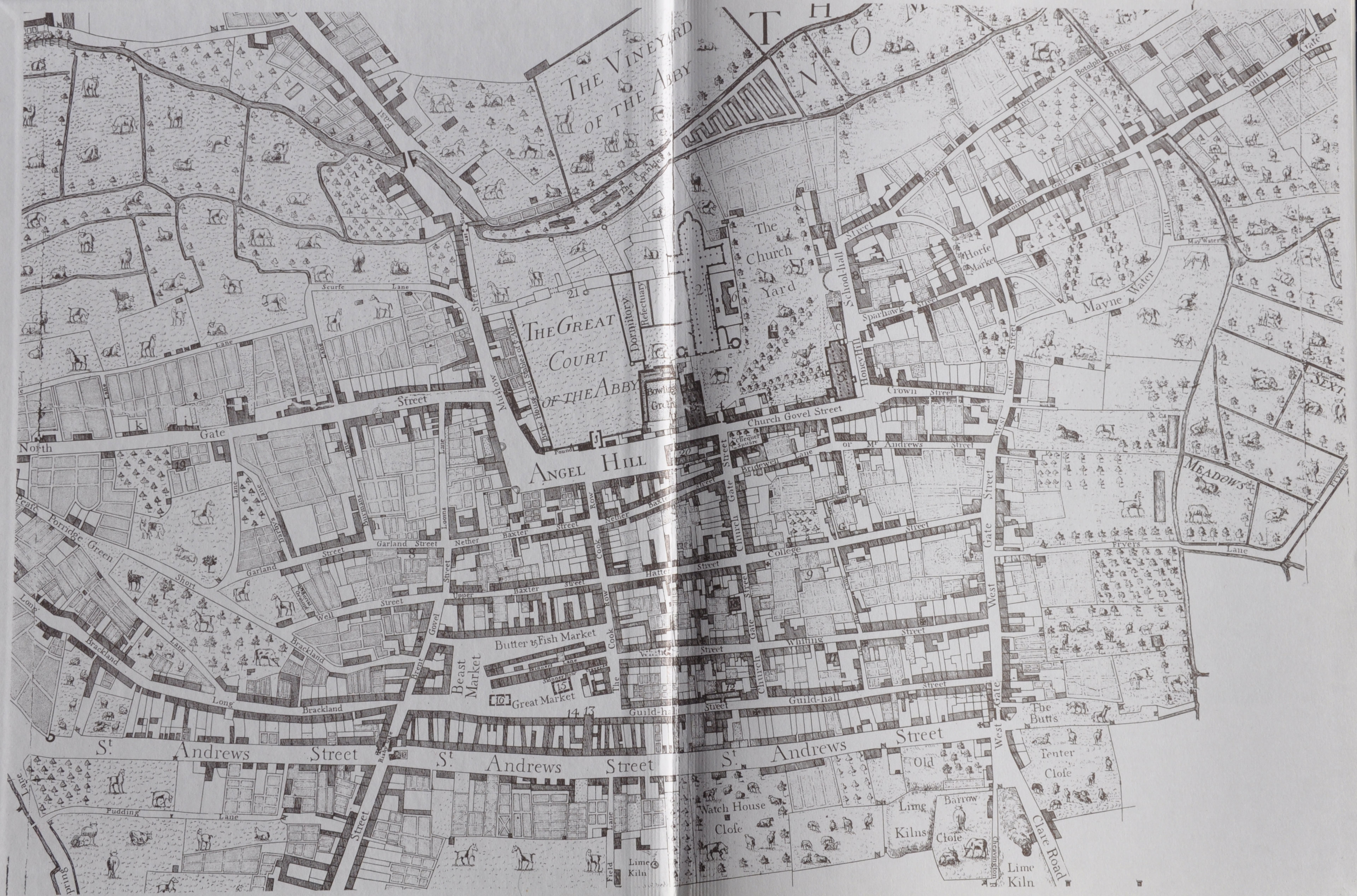
| The measured layout of Norman Bury St Edmunds by Eric Fernie |
|
| Bury in 1066, 1086 and 1150 by Bernard Gauthiez |
|
| Norwich in 1066 and 1086 |
|
| Oldest map showing St Edmunds c1170-1200 |
|
| Bury St Edmunds in 1295 by R Gottfried (1982) |
|
| The Banleuca of St Edmund's by M D Lobel (1935) |
|
| The Banleuca of St Edmund's by R S Gottfried (1982) |
|
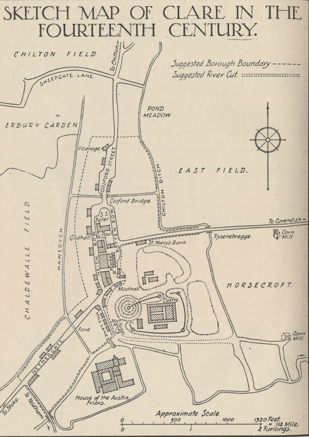
| Map of Clare in the 14th century by G A Thornton (1930) |
|
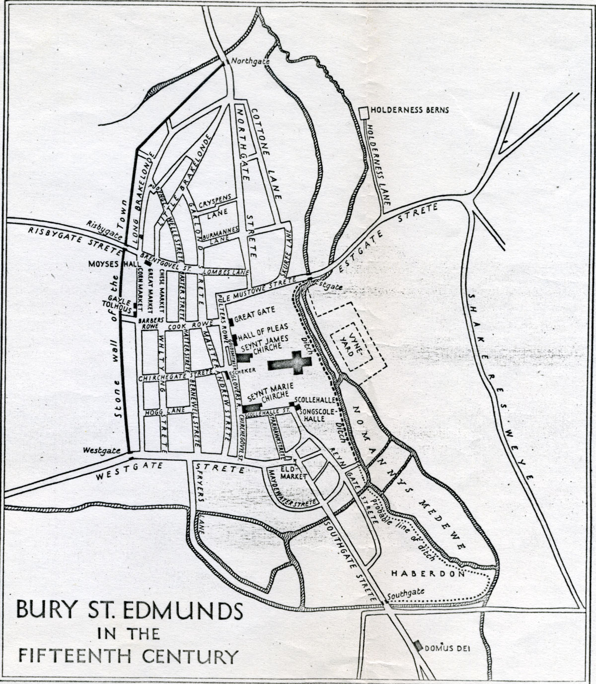
| Map of Bury in the 15th century by M D Lobel (1935) |
|
| East Anglian section of the Gough map c1410 |
|
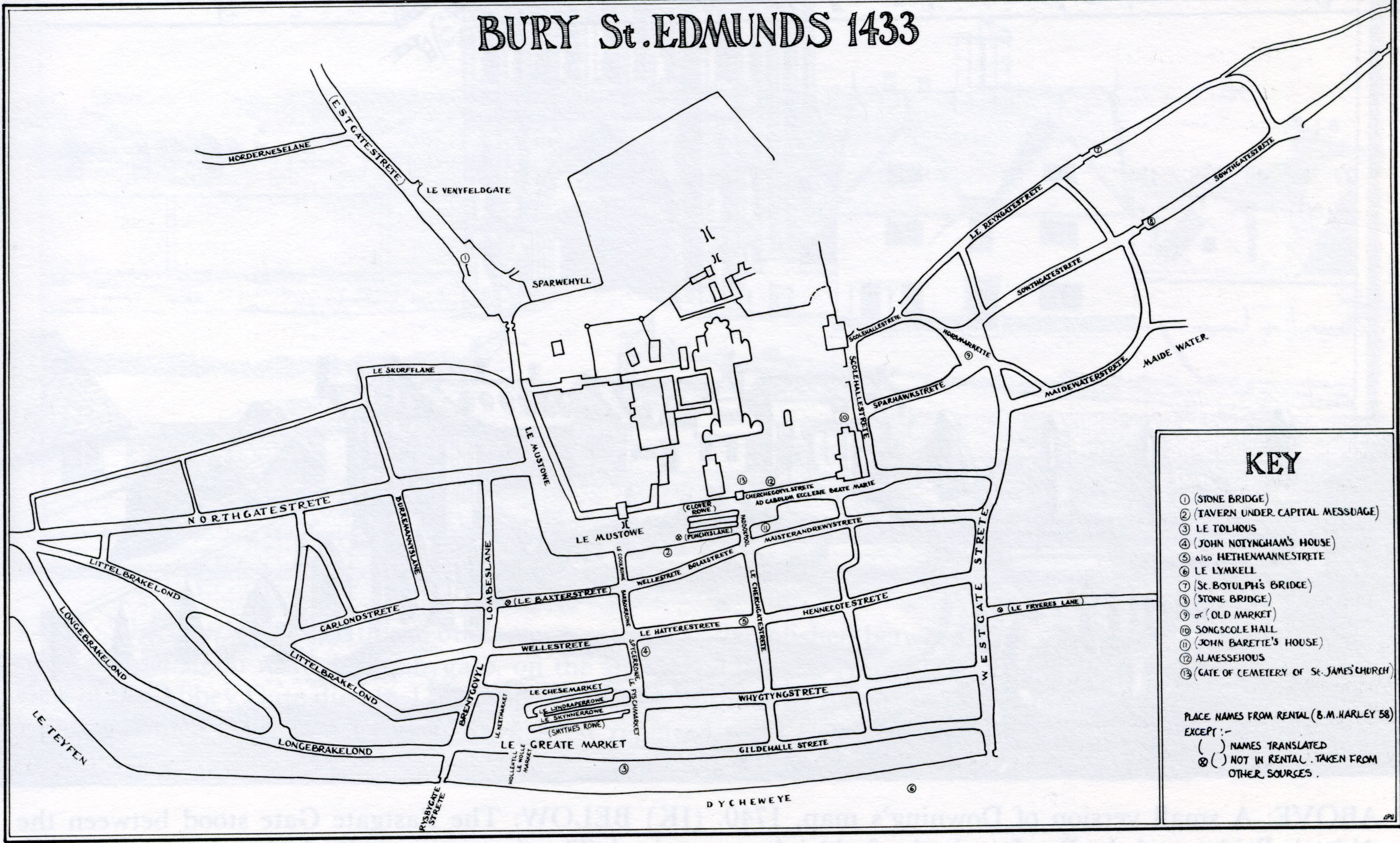
| Map of Bury in 1433 from M Statham's Book of BSE (1988) |
|
| Margaret Statham's translation of the Sacrist's Rental of 1433 (1961) |
|
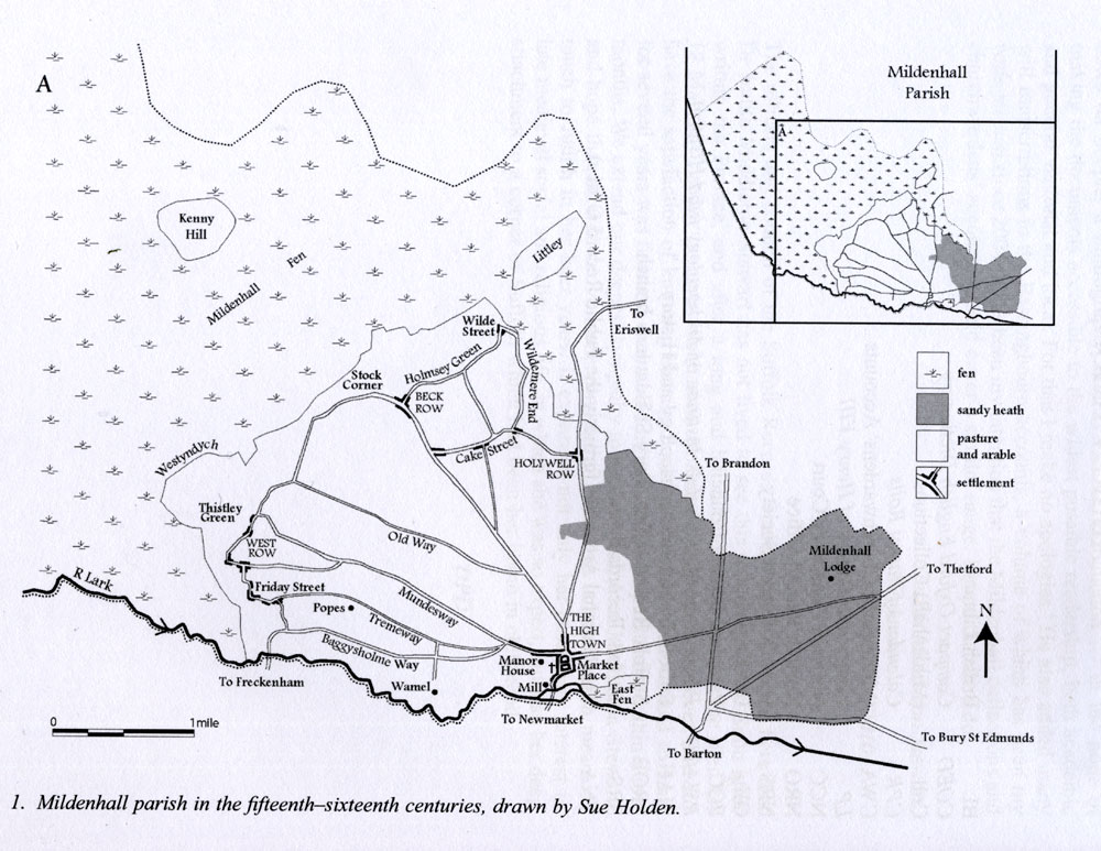
| Map of Mildenhall in C15 & C16 by Sue Holden (2011) |
|
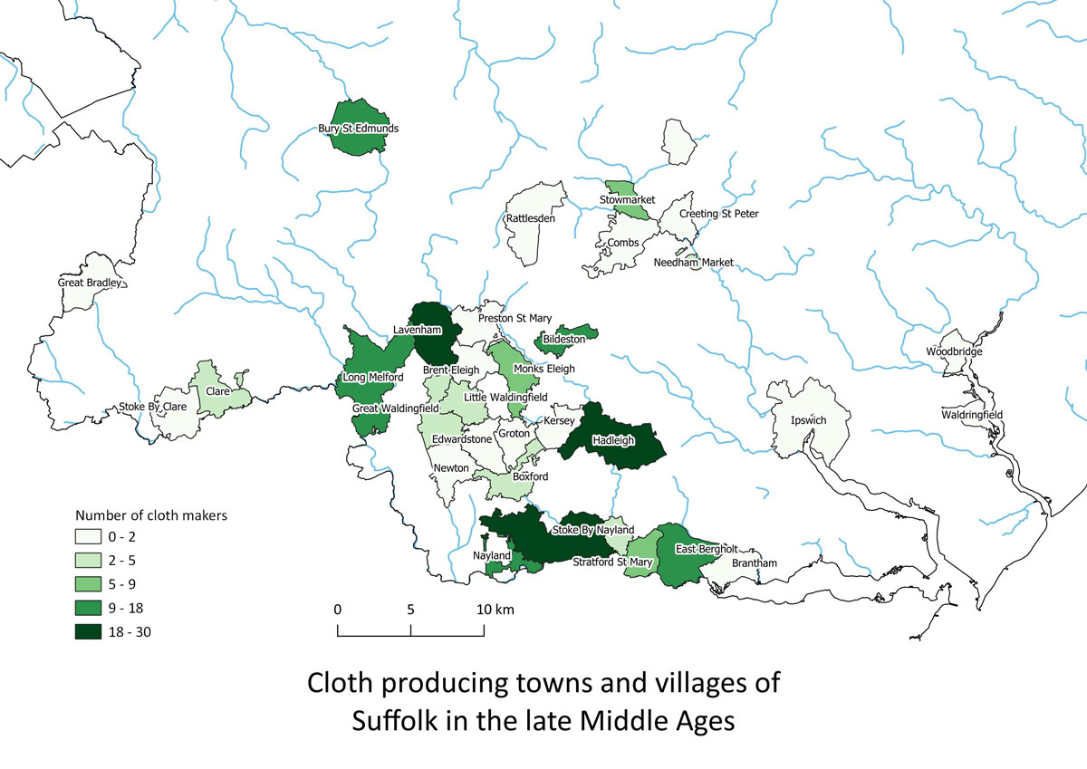
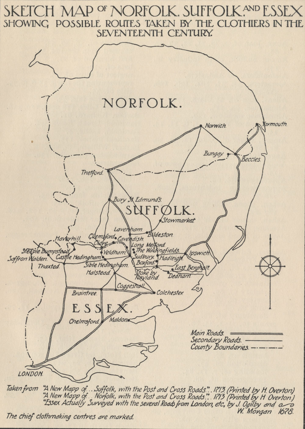
| Map of Suffolk showing cloth producing towns by later 15th century. |
|
| Maps of Newmarket in the late 15th century. After Davis and Sear, 2023 |
|
| Map of Suffolk by Christopher Saxton, 1575 |
| Seventeenth Century Maps |
|
| Reconstructed map of Wm Hayward's 1604 map of Fenland waterways by M Chisholm. |
|
| Reconstructed map of Ickworth Estate in 1665, by Mary Hesse SIAH Vol 39, pt 1 in 1997 |
|
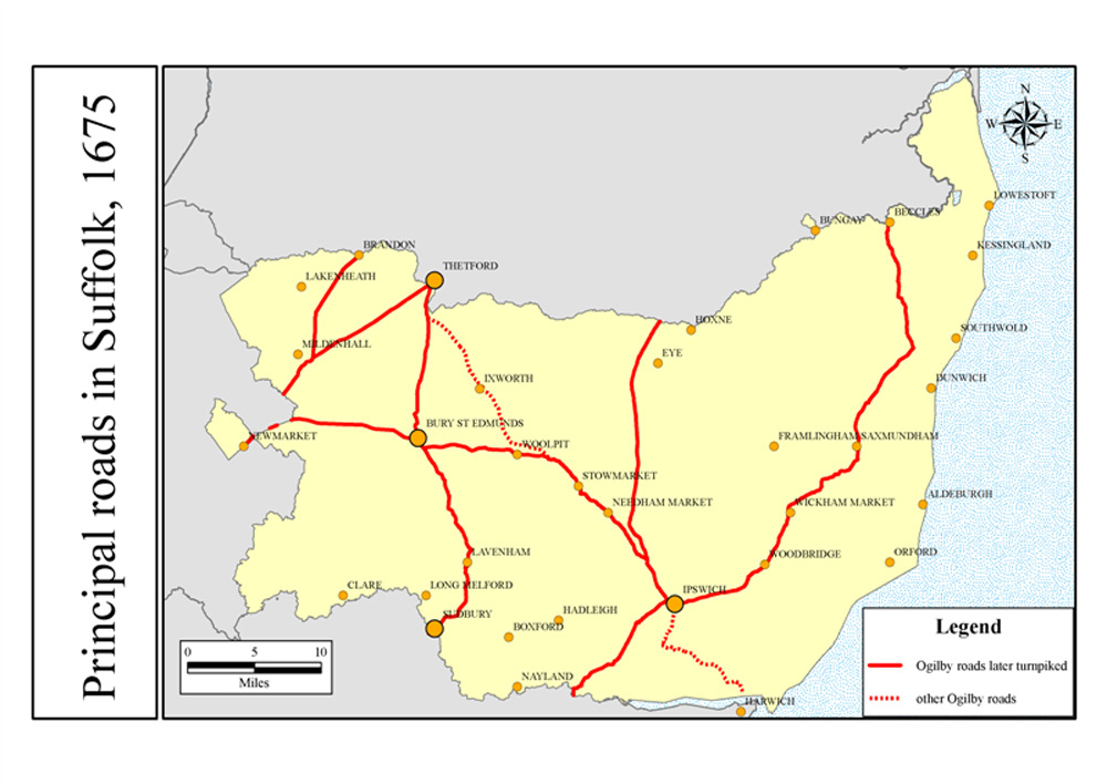
| John Ogilby - First roadmaps of Suffolk, 1675 |
|
| Cambridge University map of Ogilby's roads 1675 |
|
| Map of the Wool Trade in the 17th century by G A Thornton (1930) |
| Eighteenth Century Maps |
|
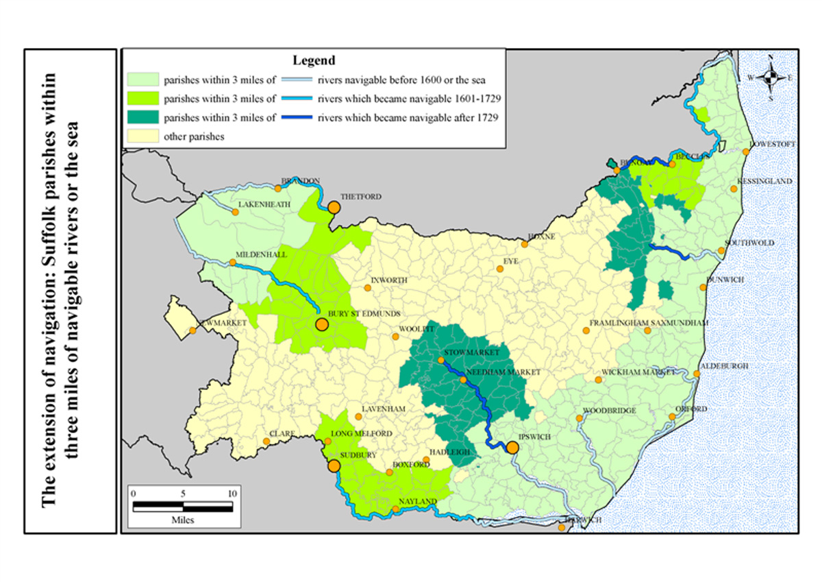
| Cambridge University map of Suffolk navigable rivers by 1729 |
|
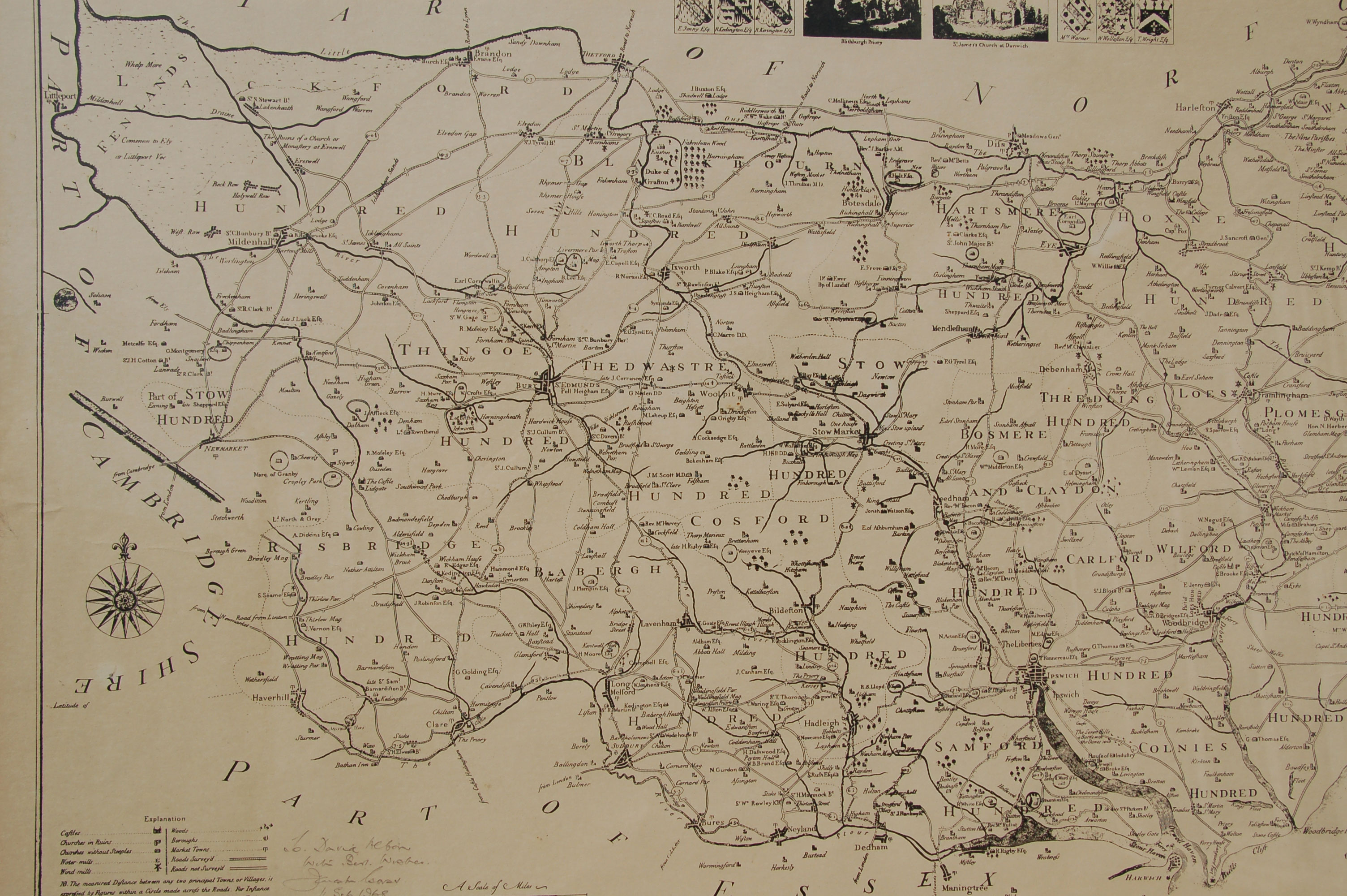
| Kirby's Map of Suffolk 1736
(Re-engraved by John Ryland in 1766, and printed and sold by Stephen Piper of Ipswich in 1825.) |
|
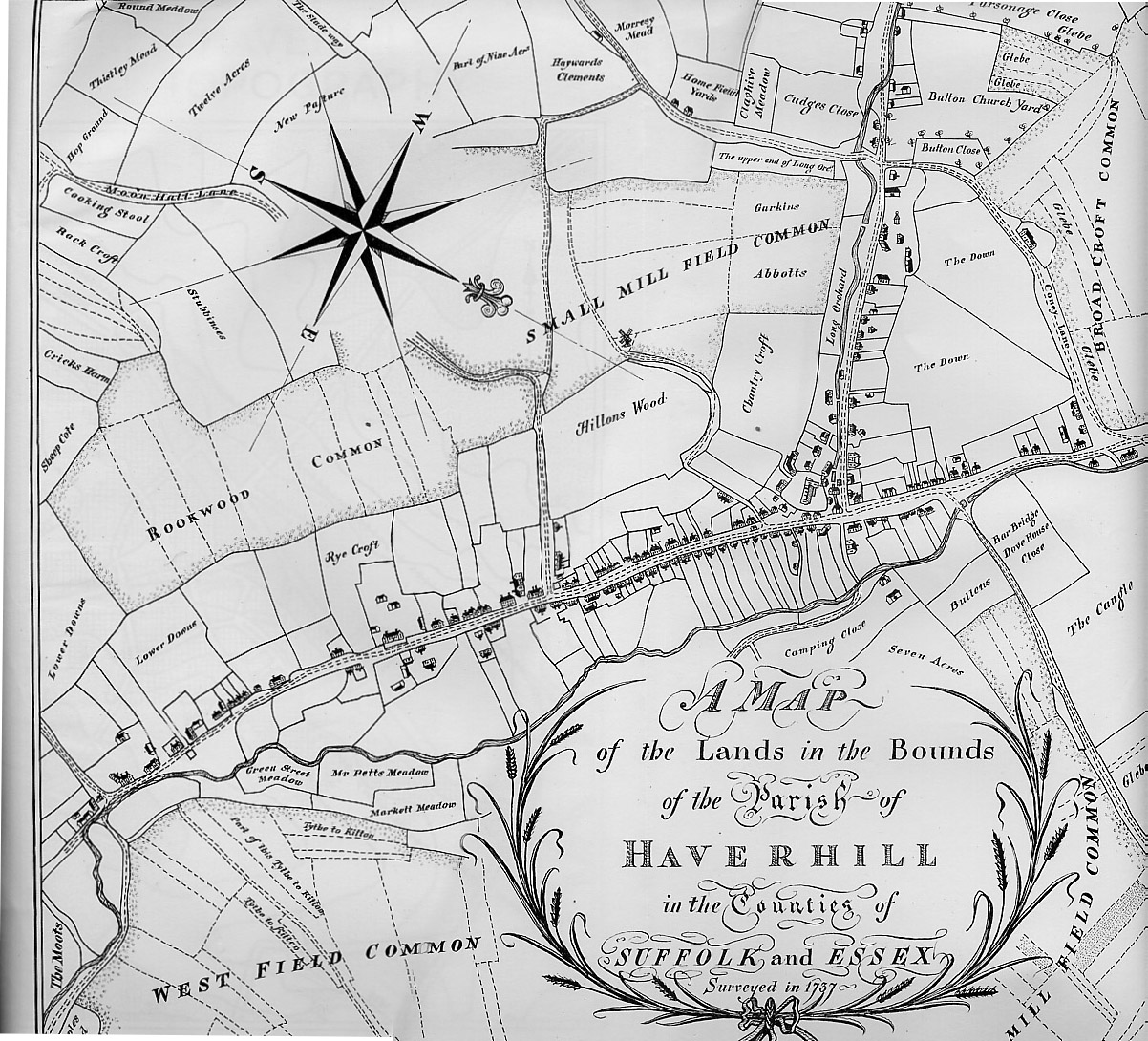
| Haverhill in 1737 (modern copy) |
|
| Downing's Map of Bury St Edmunds 1740 |
|
| The Warren Map of Bury St Edmunds 1748 |
|
| A Dury's map of Bury St Edmunds, 1764 |
|
| The Warren Map of Bury St Edmunds 1776 |
|
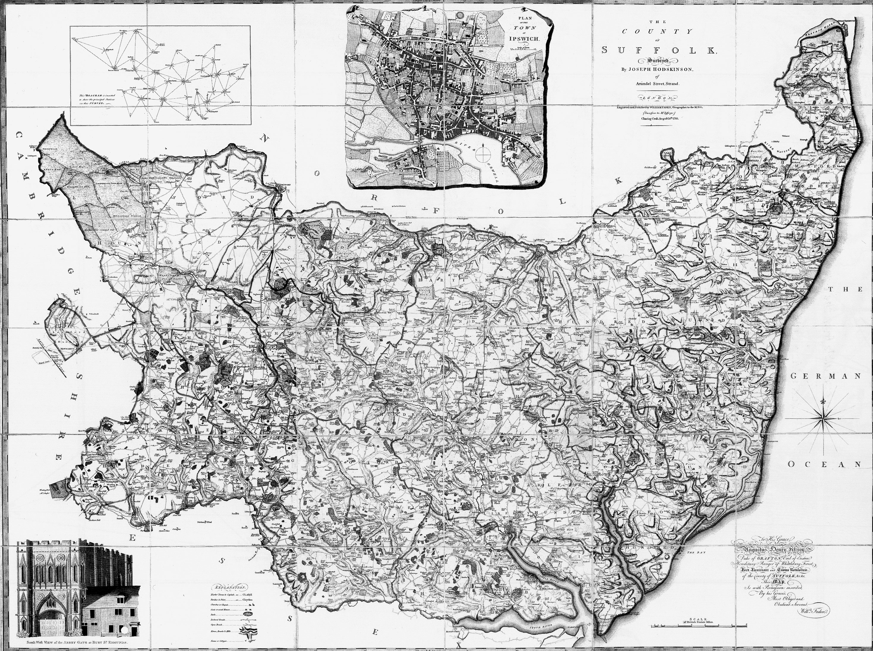
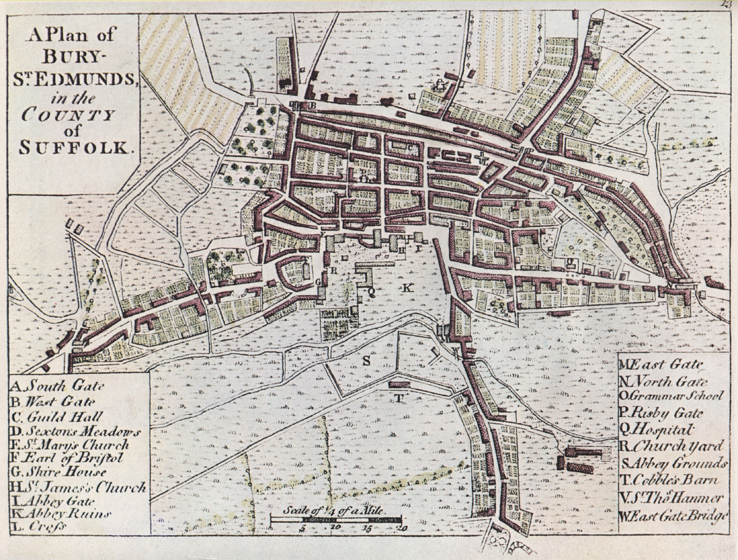
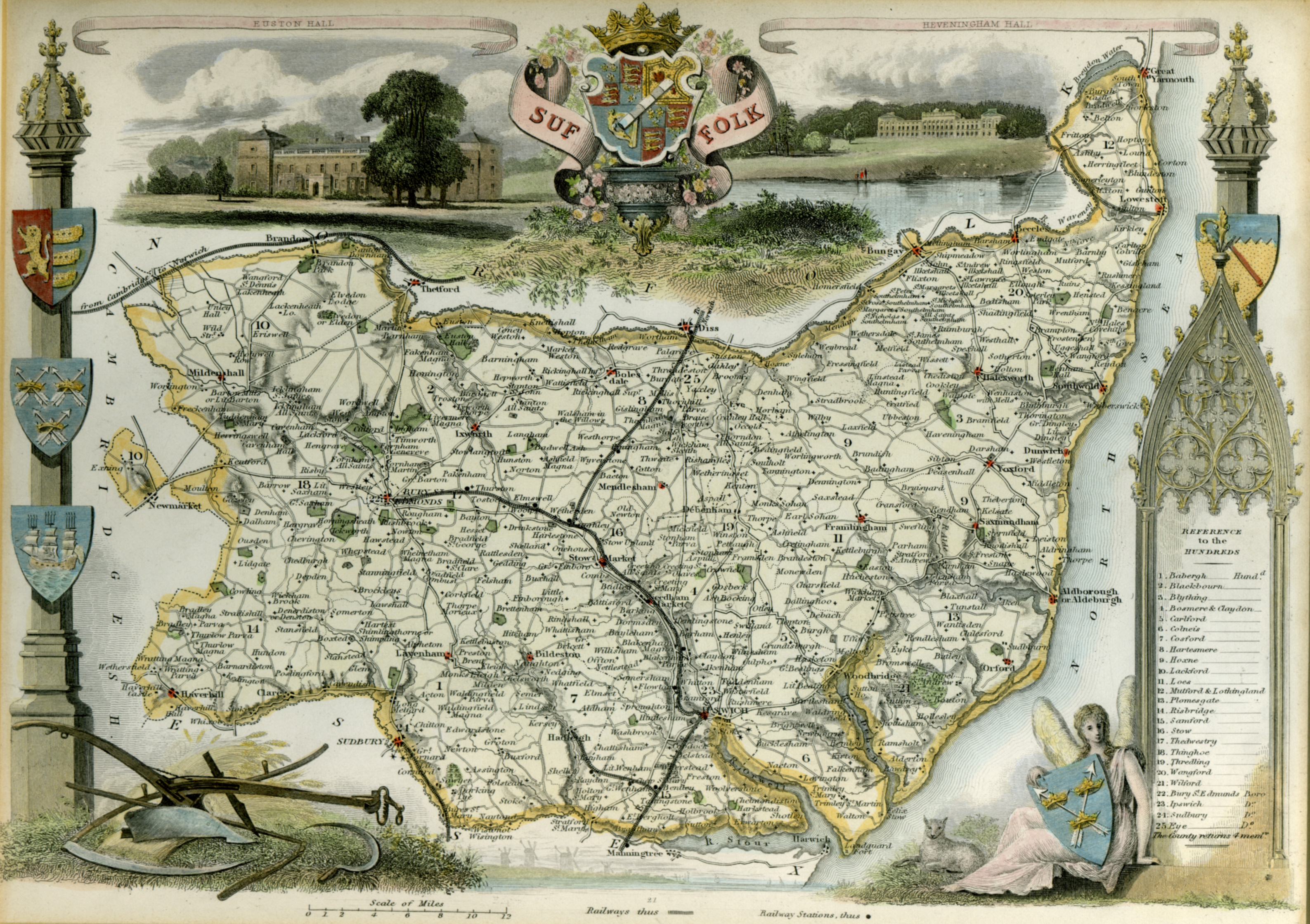
| Hodskinson's Map of Suffolk 1783 |
|
| Paterson's map of the London route from Halstead to Bury St Edmunds, 1785 |
|
| The Warren Map of Bury St Edmunds 1791 |
| Nineteenth Century Maps |
|
| Bury St Edmunds Enclosure Map 1815 |
|
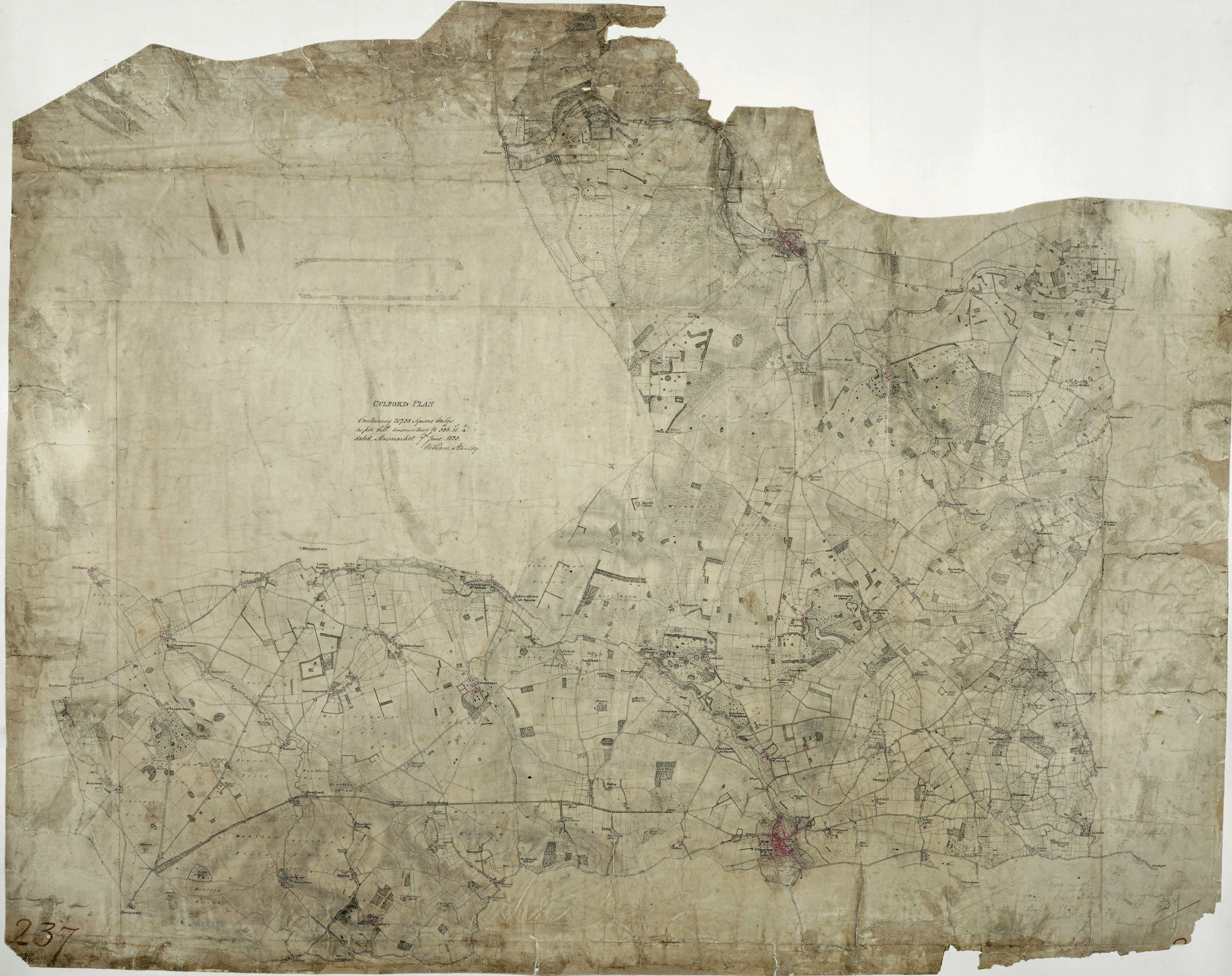
| Map entitled "Culford" by William Stanley, 1820. Bury, Culford, West Stow etc (Big! 5Meg) |
|
| Bury St Edmunds in 1823 by J G Lenny |
|
| Report of the Boundary Commission for the Reform Act of 1832 |
|
| Bury St Edmunds in 1834 by R Payne |
|
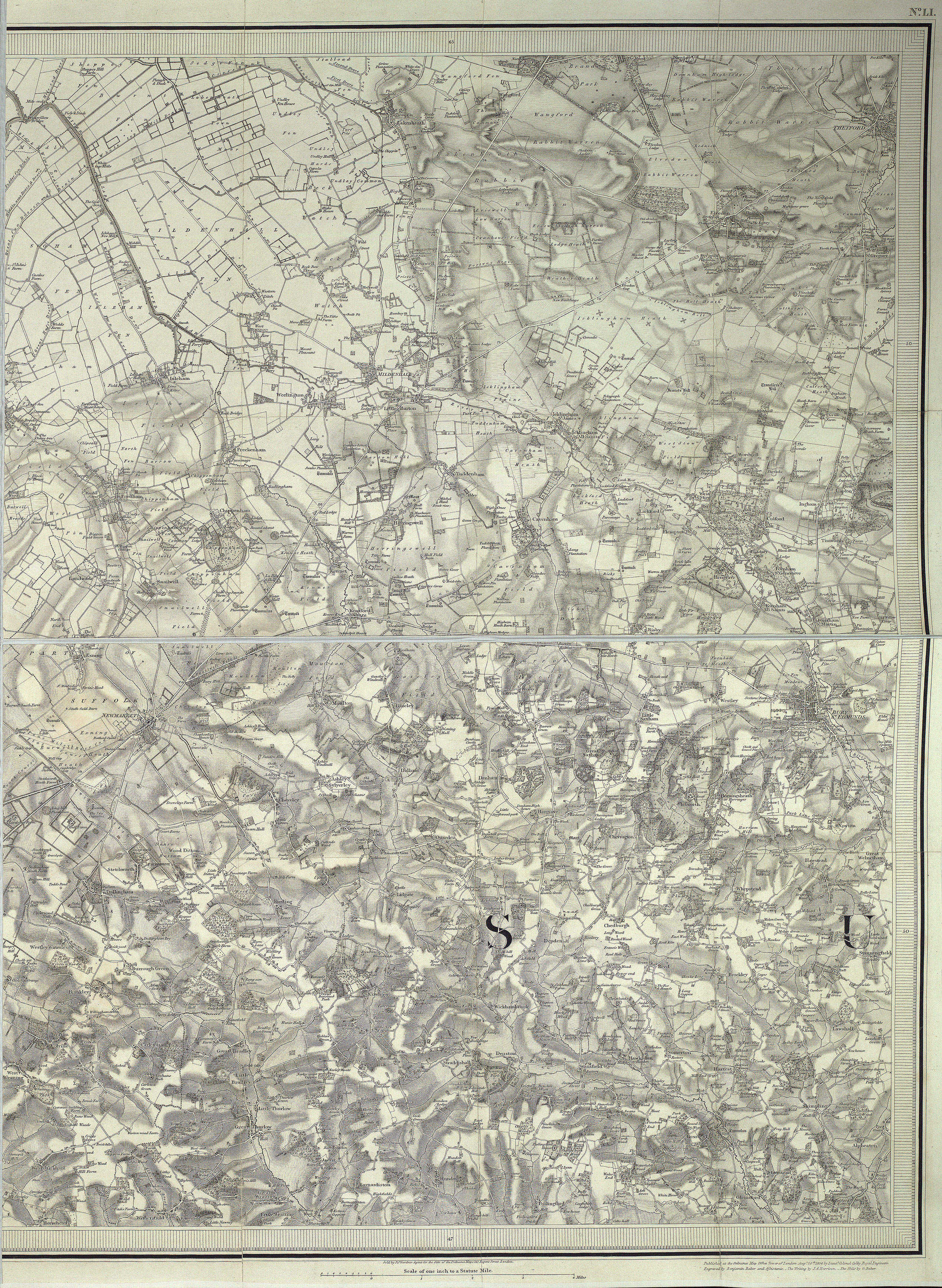
| The first Ordnance Survey one inch scale map of Bury and surrounds. (Big! 4Meg) |
|
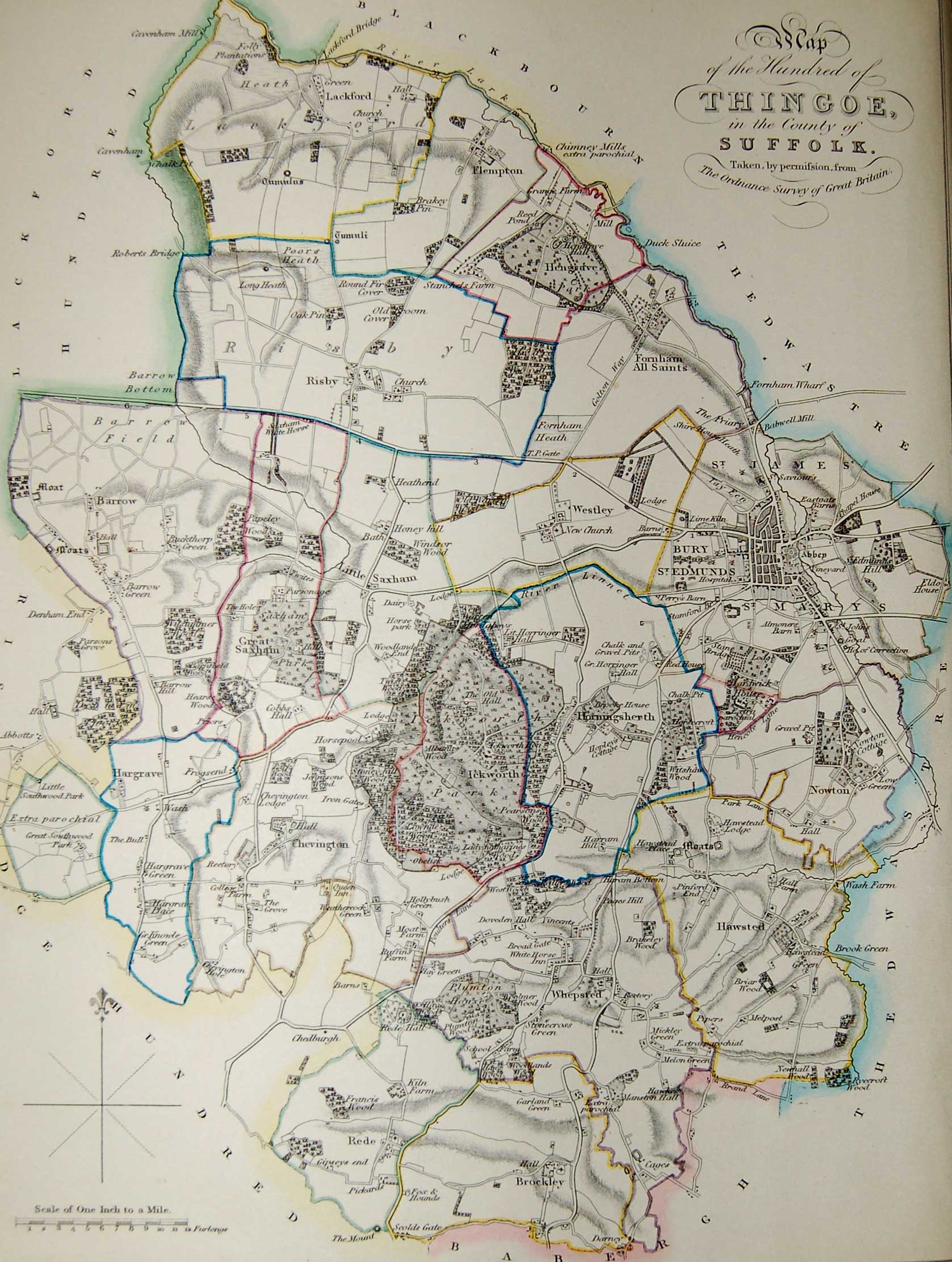
| Gage's Map of Thingoe Hundred of 1838 |
|
| The Hundreds of Suffolk in the 19th Century |
|
| Suffolk's roads and railways in the years 1850 to 1853 |
|
| The Sanitary Districts after 1872 (Historical Atlas of Suffolk) |
|
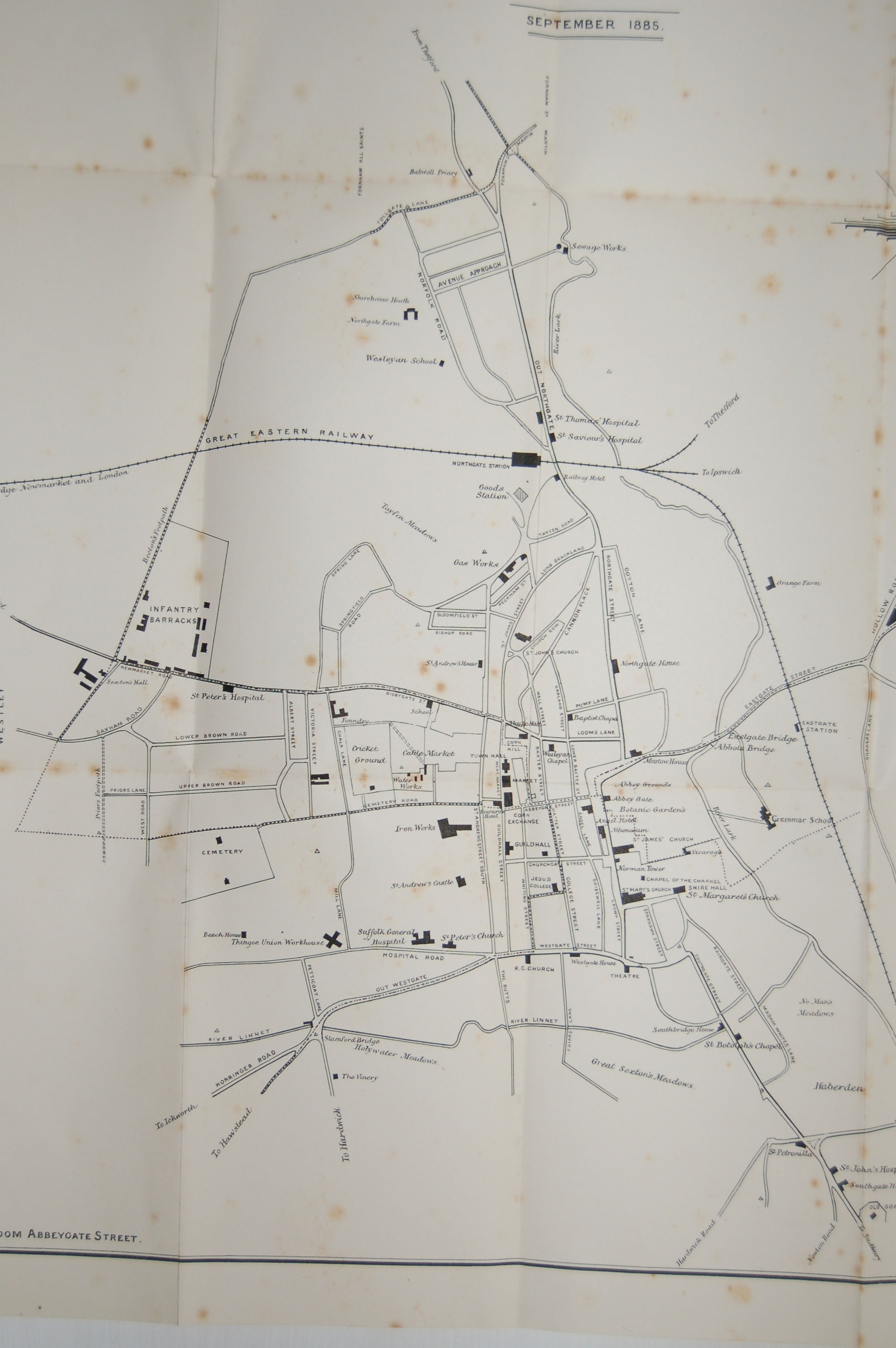
| Tymm's Handbook - Plan of Bury in 1885 |
|
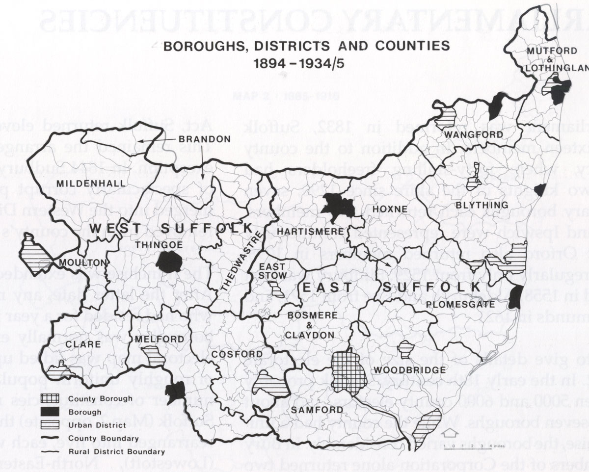
| Suffolk Local Government after 1894 (Historical Atlas of Suffolk) |
|
| West Suffolk civil parishes established in 1894 (Historical Atlas of Suffolk) |
| Twentieth Century Maps |
|
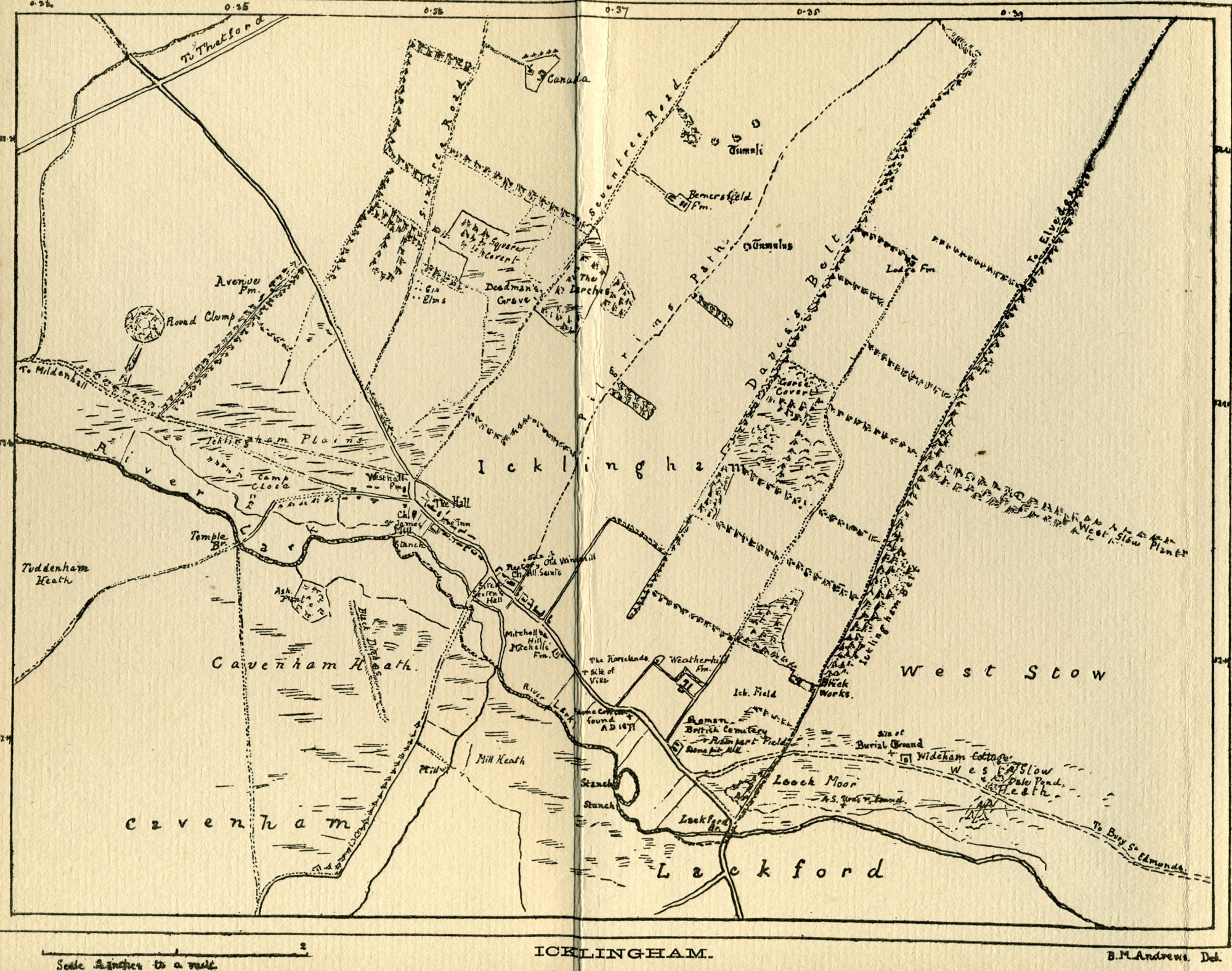
| Icklingham 1901 by Beatrice Andrews, nee Prigg |
|
| Burrow's Guidebook Sketch Plan of Bury in 1906 |
|
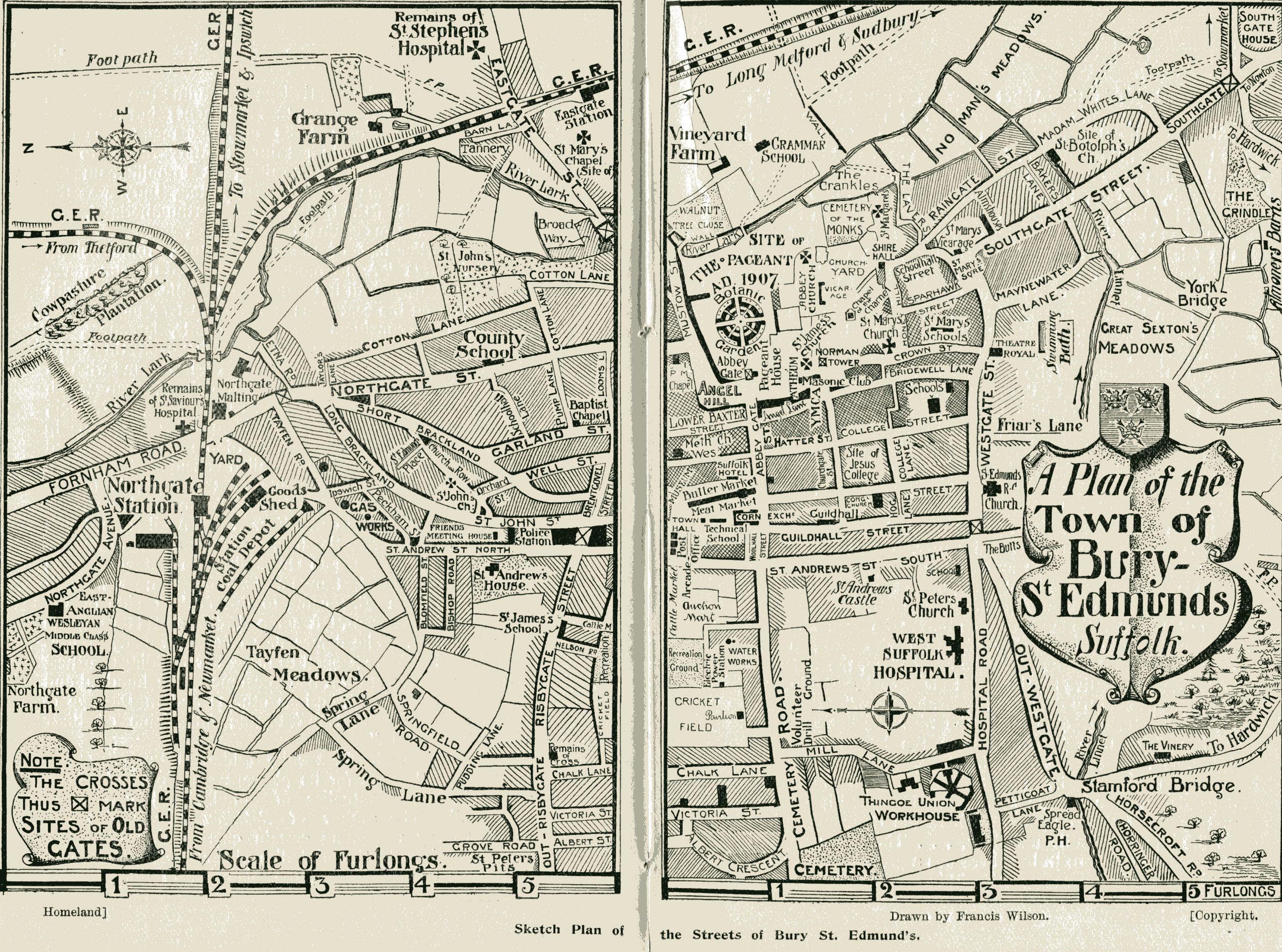
| Homeland Guidebook Sketch Plan of Bury in 1908 |
|
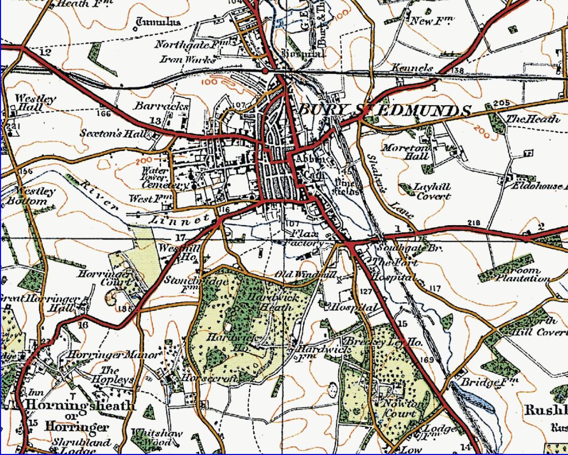
| BSE OS one inch to a mile 1920s |
|
| "Modern Suffolk" in 1930 (L Redstone) |
|
| Suffolk Local Government after 1935 (Historical Atlas of Suffolk) |
|
| BSE OS one inch to a mile c.1948 |
|
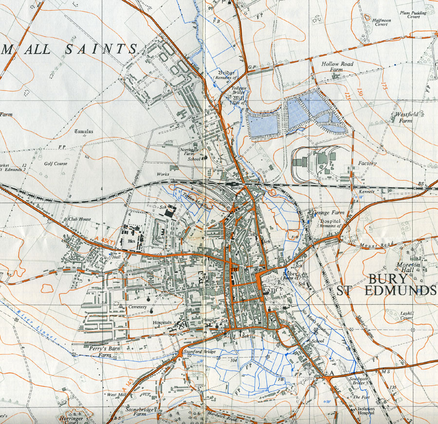
| OS 1:25000 map showing development of Bury St Edmunds dated 1955 |
|
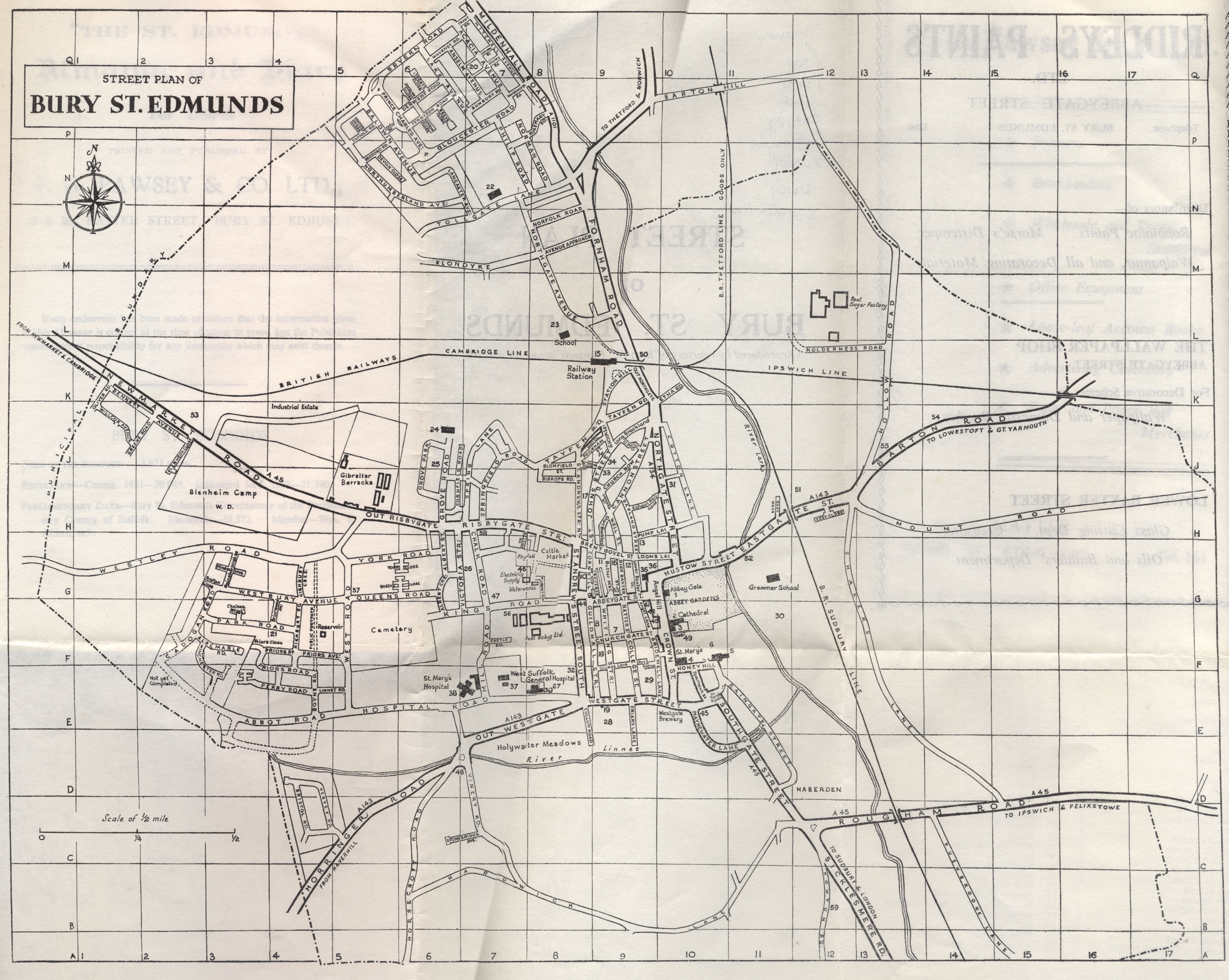
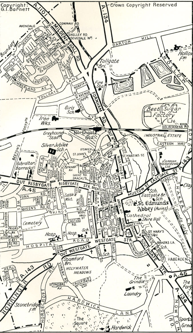
| Street Plan of Bury St Edmunds 1960/61 (Pawsey's Almanac) |
|
| Guidebook Sketch Plan of Bury in 1964 |
|
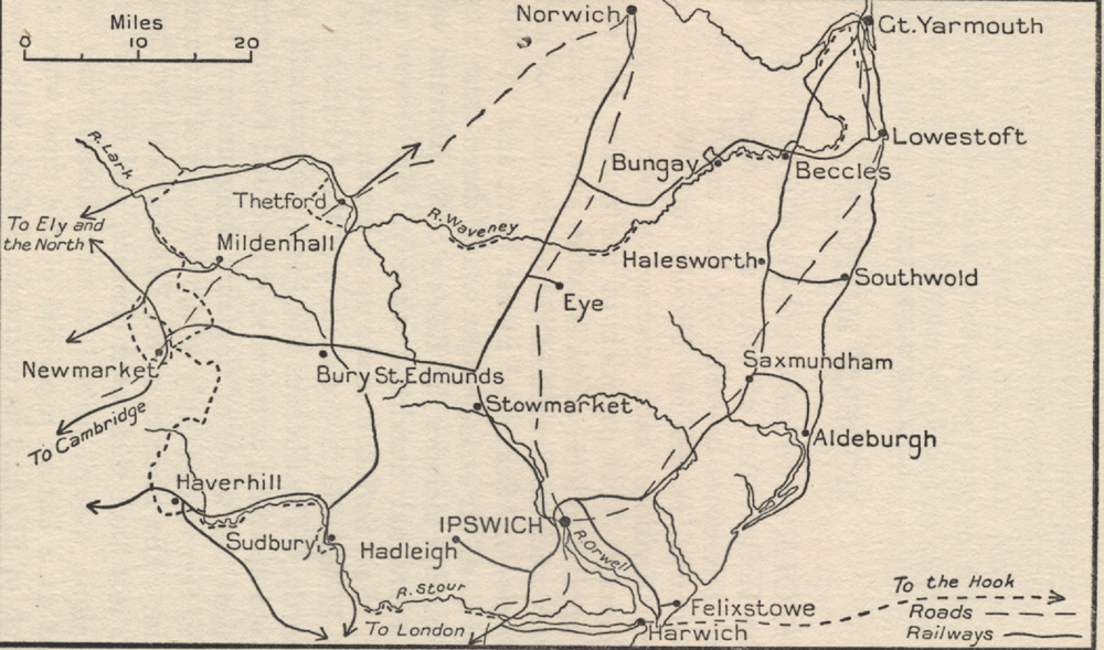
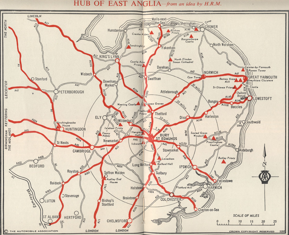
| Bury St Edmunds as the 'Hub of East Anglia' 1966 |
|
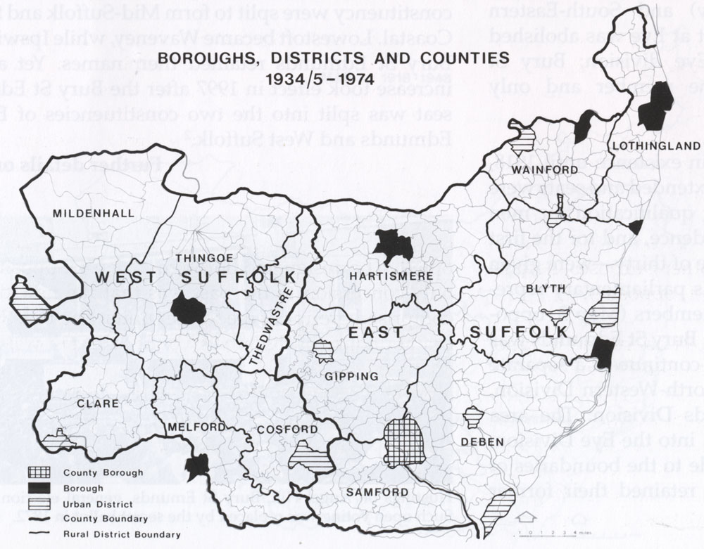
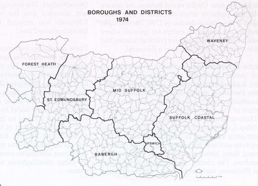
| Suffolk Local Government after 1974 (Historical Atlas of Suffolk) |
|
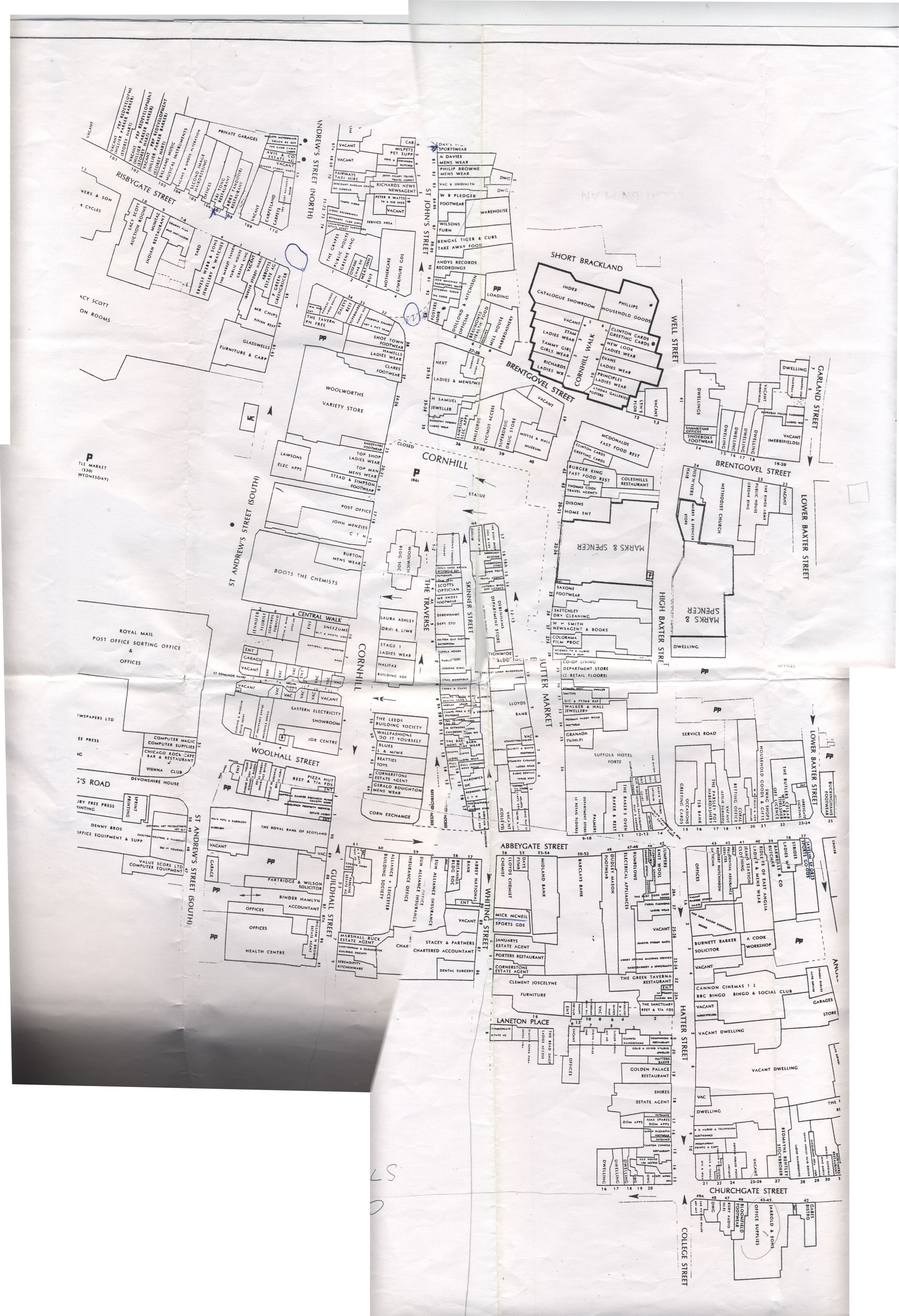
| Bury St Edmunds town centre shops 1994 |
| Twenty First Century Maps |
|
| Plan of Bury town centre shopping as at May 2007 by Centros Miller |
|
| Plan of Bury town centre shopping, with the Arc, as at February 2009 by Centros Miller |
|
| Bury St Edmunds Business Improvement District (BID) 2009, with details of every business and shop at the time. (NB a 5 meg pdf v large!) |
|
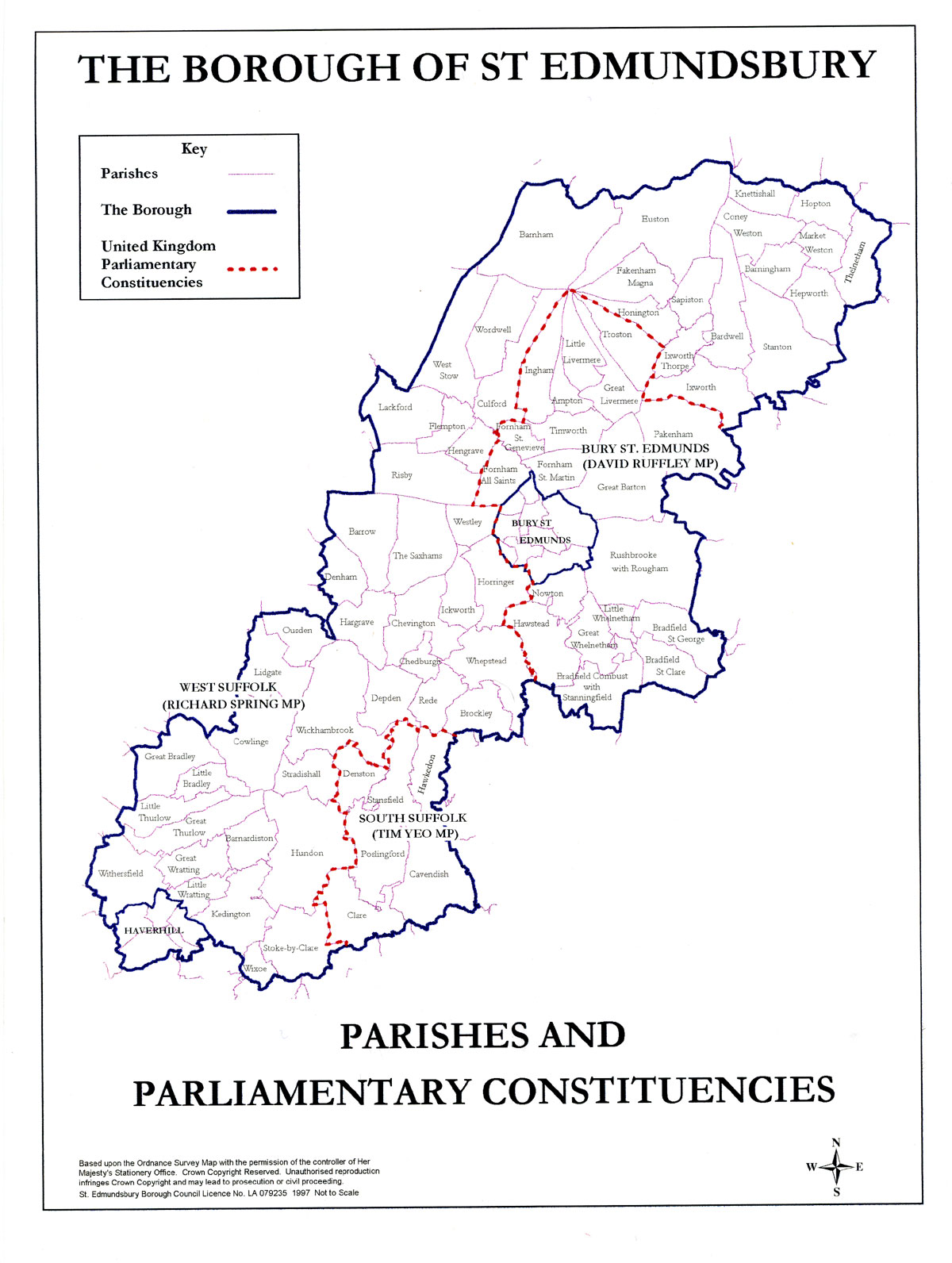
| Parliamentary Constituencies in St Edmundsbury November 2014 |
|
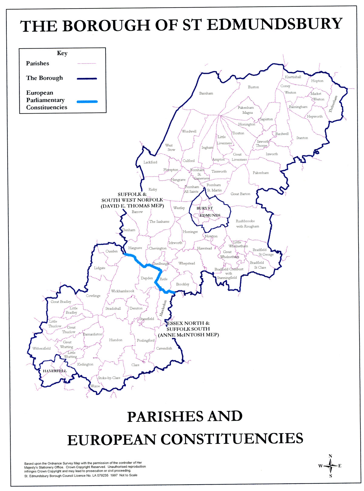
| European Parliamentary Constituencies in St Edmundsbury |
|
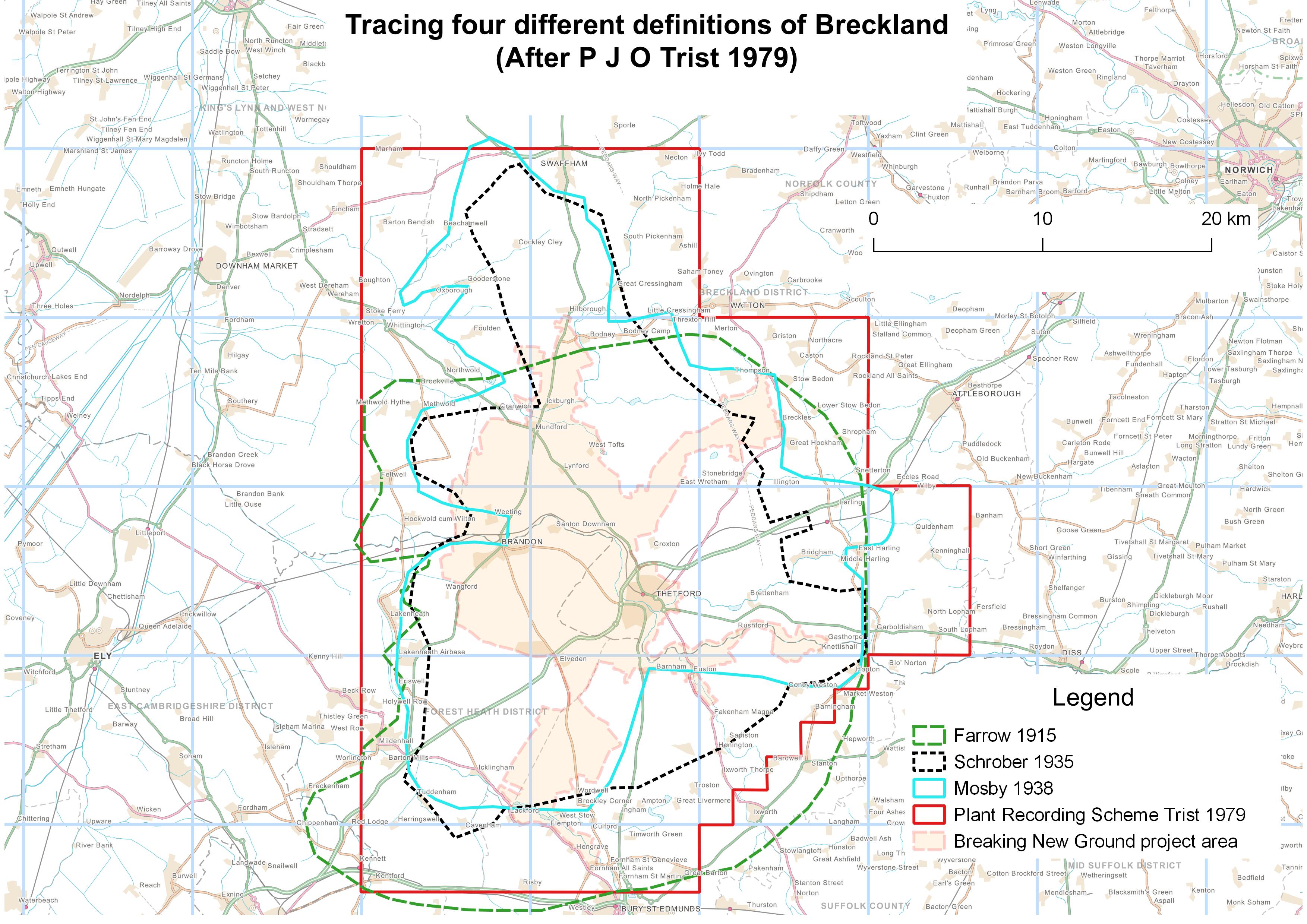
| Some boundaries of Breckland drawn for Breaking New Ground project |
|
| Suffolk new parliamentary constituencies and results July 2024 |