 |
|

The bay itself has disappeared as considerable erosion has taken place.
|
Dunwich, Easton Bavents, Walberswick, Southwold Changes from Domesday to modern times Page 1 of 1 This page contains conjectural maps of the coastal changes described in various sources.
|
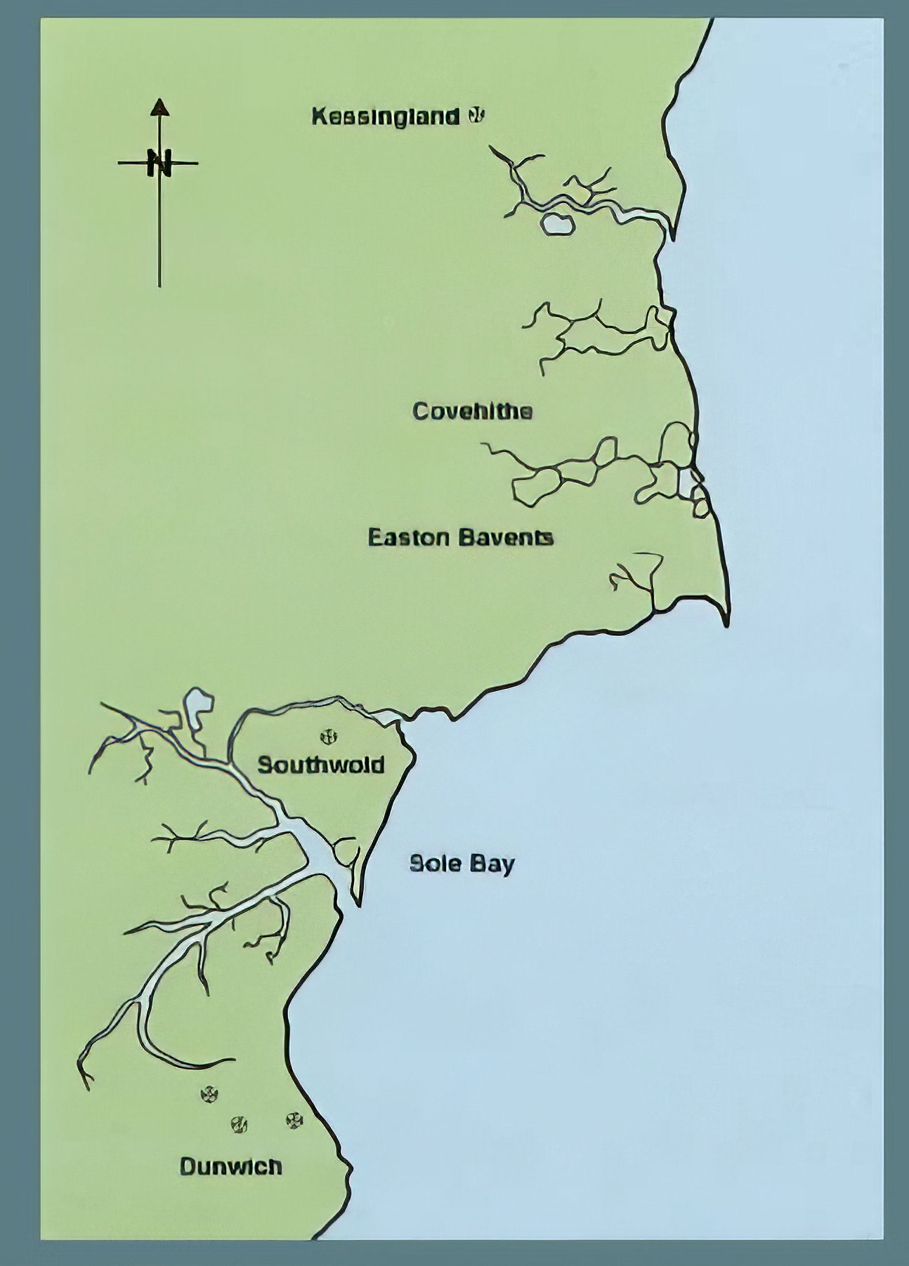 This map from the Southwold Museum's online resources shows the Sole Bay as it might have looked in the 11th Century. The Museum comments that "Sole Bay really was a bay set between the twin promontaries of Easton Bavents and Dunwich." |
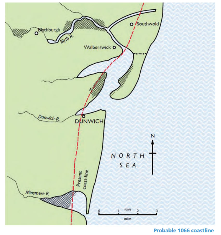 This map comes from the booklet "Southwold's Changing Fortunes". It shows a different view of the coastline around 1066 and demonstrates how the town of Dunwich commanded the entrance to the River Blyth at this time. From 1230 to 1408 Dunwich had charter powers to levy tolls on cargo ships passing upriver to Walberswick and Southwold. By about 1500 the shingle banks had extended and closed off the entrance to Dunwich and the people of Walberswick and Southwold had breached the shingle bank to drain the Blyth between those two towns. |
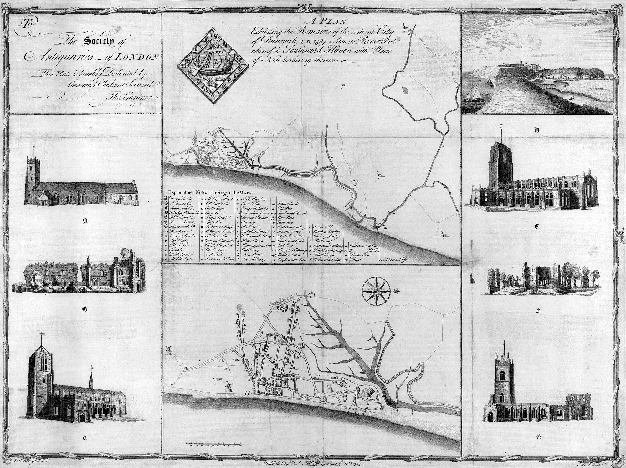 This full plan, with illustrations, was published in 1753 by Thomas Gardner for the Society of Antiquaries. It shows "The remains of the antient city of Dunwich AD 1587. Also its River, part whereof is Southwold Haven, with places of note bordering thereon." |
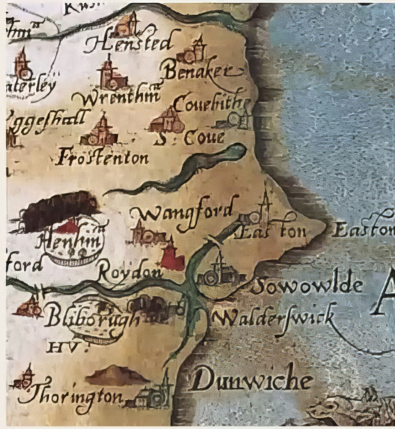
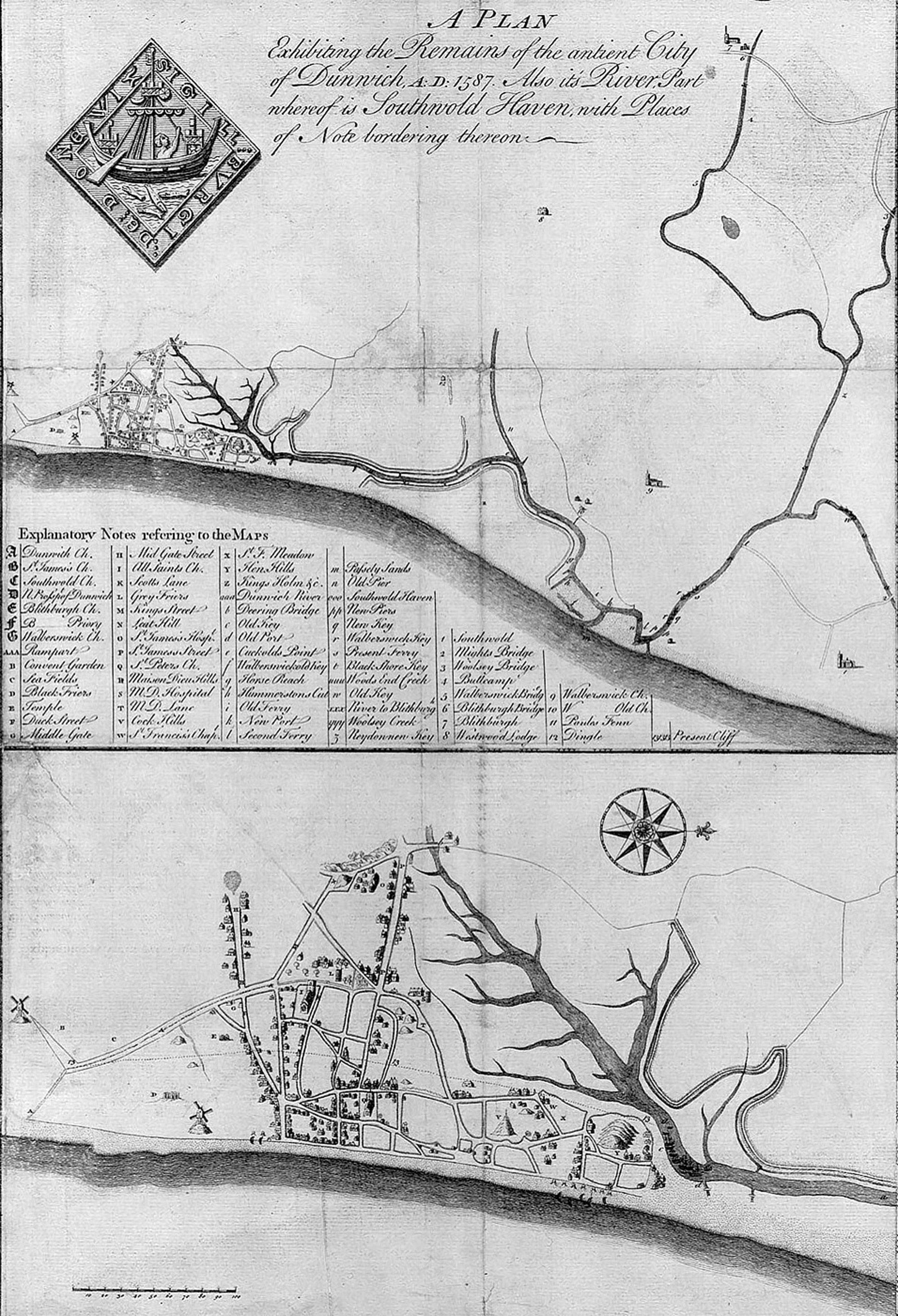 This is an extract from the map published in 1753 by Thomas Gardner for the Society of Antiquaries. It shows "The remains of the antient city of Dunwich AD 1587. Also its River, part whereof is Southwold Haven, with places of note bordering thereon." |
 Saxton's map of Suffolk from 1575 still shows Easton Bavents Ness as a considerable feature. The River Blyth is now more or less in its modern position. |
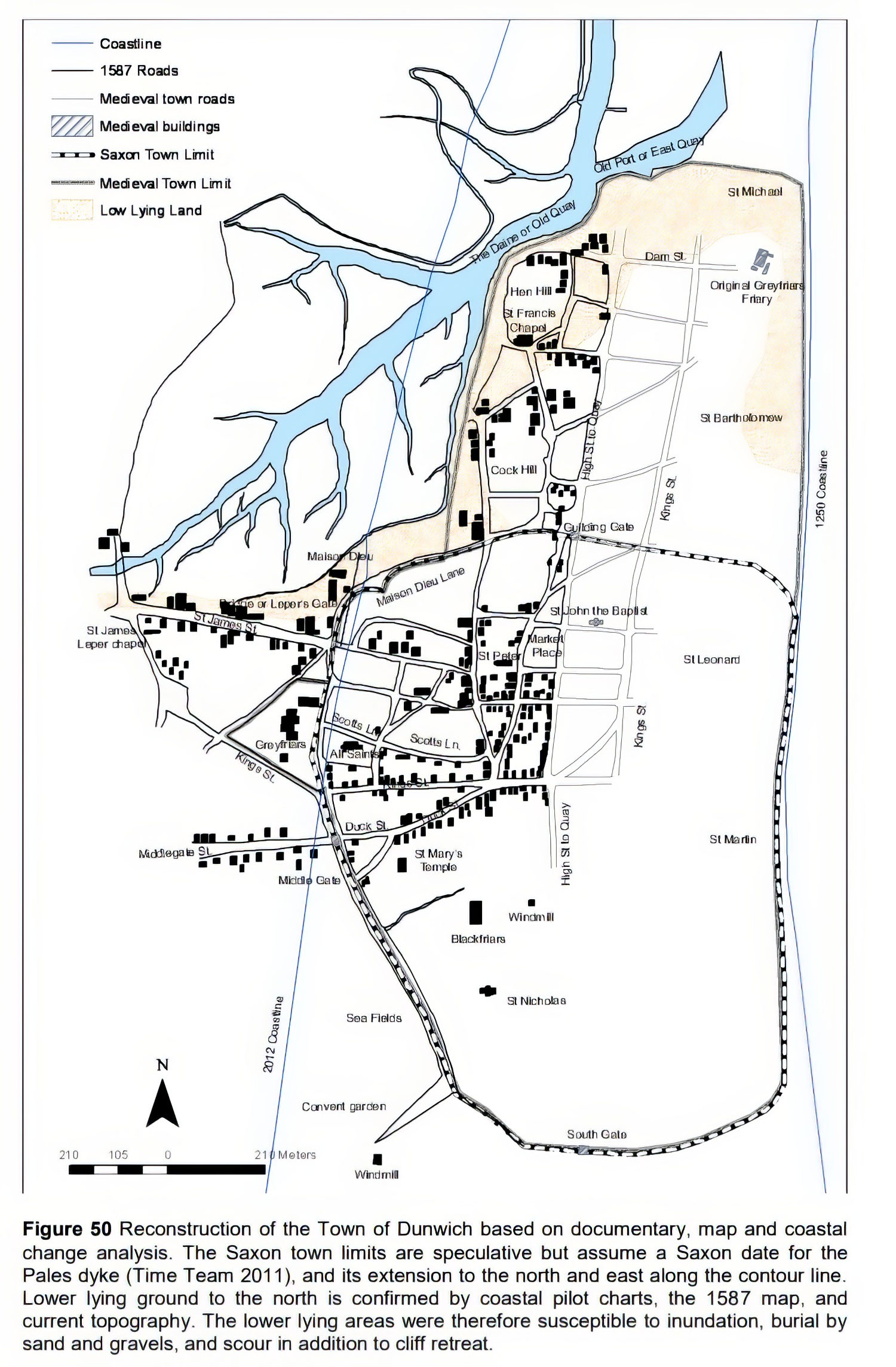 This reconstruction of old Dunwich comes from the "Dunwich Project 5883 Final Report" by David Sear, Andy Murock, Tim LeBas, Paul Baggaley and Gemma Gubbins, of March, 2013. This has resulted from a combination of historical records, coastal change analysis, geophysical surveys, diver surveys and sonar imaging. |
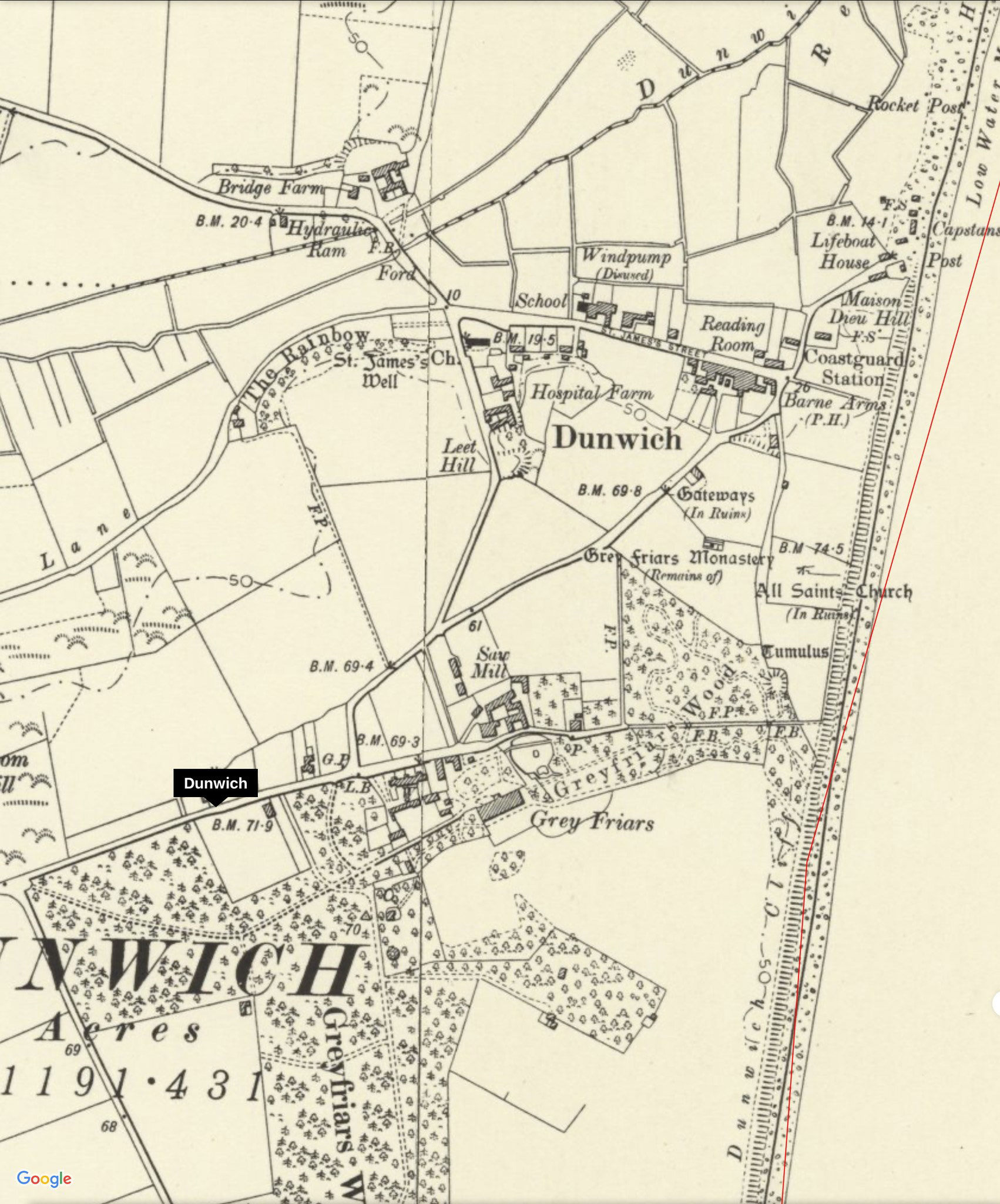 This Os map from the 1880s shows Dunwich at that time. All Saints church is shown in ruins, although it is now gone. |
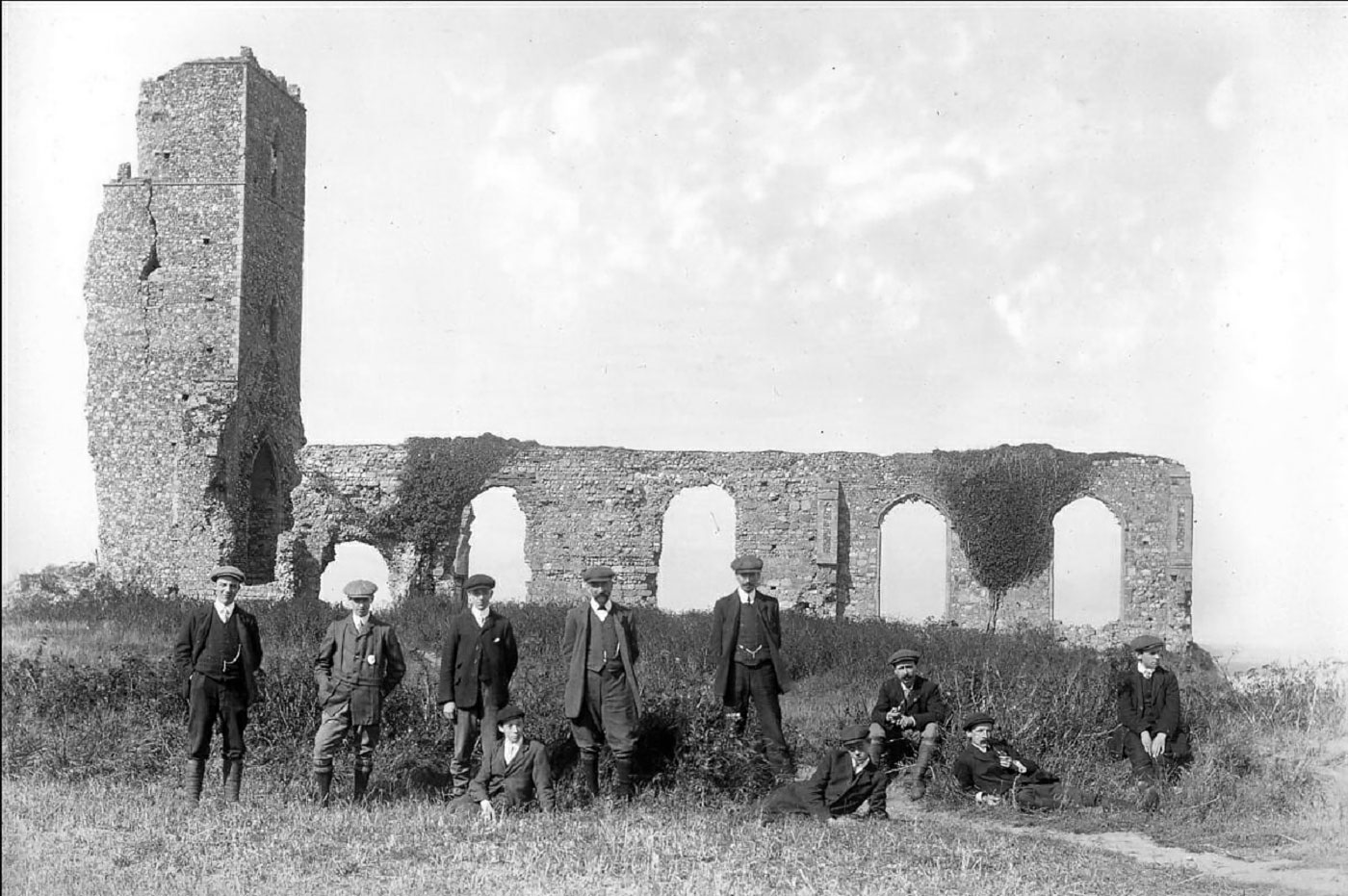 In 1904 this postcard shows the ruins of All Saints church in Dunwich. Later postcards shows these ruins gradually reducing in size as the they fall into the sea . All Saints finally disappeared in 1919. |
Page: 1 |
|
SOURCES USED
Leaflet by Sarah E Doig -"Southwold's Changing Fortunes" Coasts and Heaths Project Leaflet Page created by David Addy, 9th February, 2024
|
| Go to the Maps homepage | Last Updated and amended 15th February 2024 | Go to Main Home Page |