 |
|
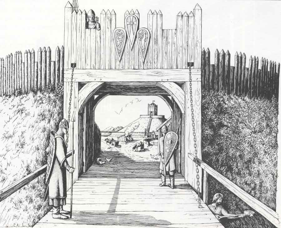
Early Norman motte and bailey
|
|
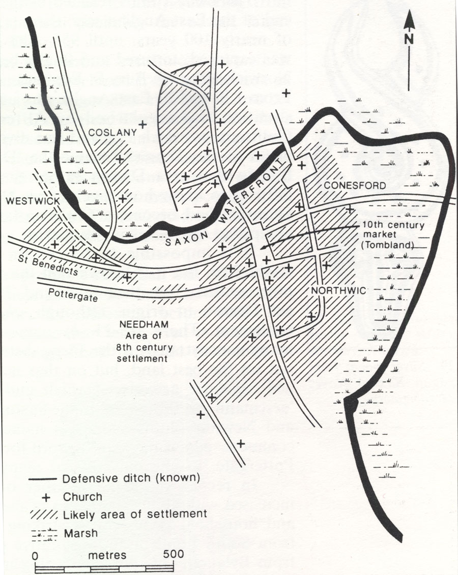 Anglo-Saxon Norwich C10 C11 This map shows the several settlements which later coalesced to make up the city of Norwich. The Anglo-Saxon town was already well developed before the Normans arrived. The Domesday Book recorded 1,320 burgesses in Norwich in the time of King Edward the Confessor.
|
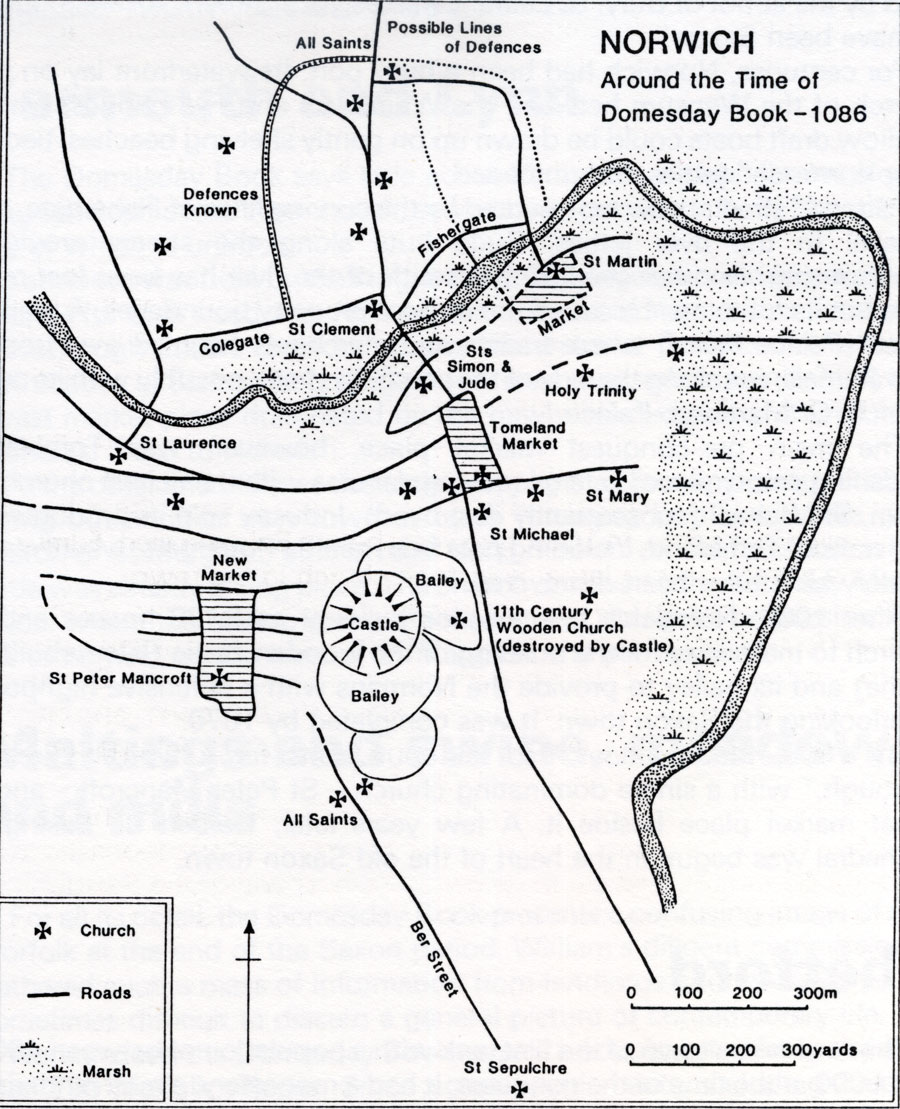 Norwich in 1086 By the time of the Domesday Book in 1086, King William I had built his first castle at Norwich, displacing some existing streets, a church and 100 dwelling houses. This structure was probably of wood. The stone keep seen today dates to after 1130. In 1075 during the siege of Norwich castle in the earls' rebellion, many more houses were destroyed by fire in the disturbances. Domesday recorded that 32 burgesses had quit Norwich for various reasons since the conquest, and 22 of them had moved to Beccles. However the recorded burgesses in 1086 numbered only 665. Some of the new burgesses were Frenchmen. The Norman town then developed to the south west of the old Tombland market area.
|
|
Sources: "A History of Norfolk" by Susanna Wade Martins |
| Go to Maps homepage | Produced 10th June 2010 | Go to Home Page |