The Liberty of St Edmund
|
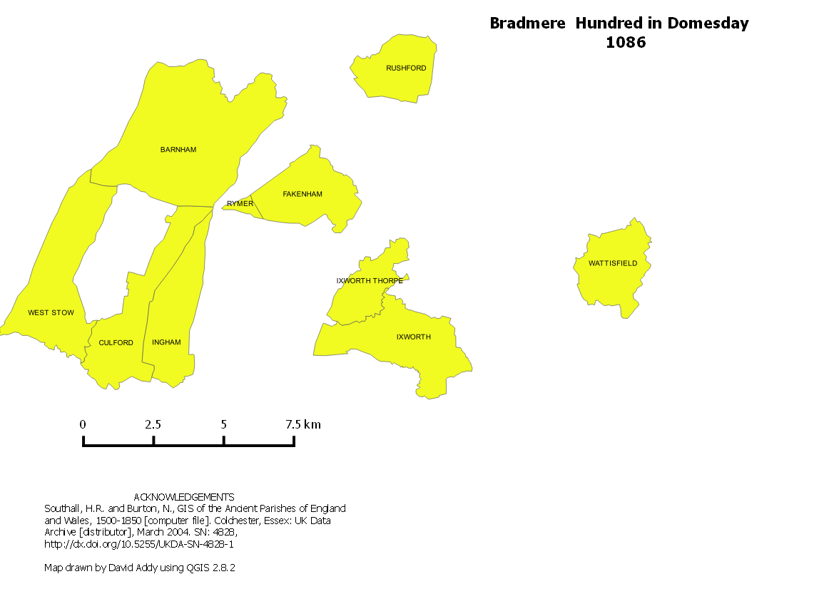
The case of Bradmere
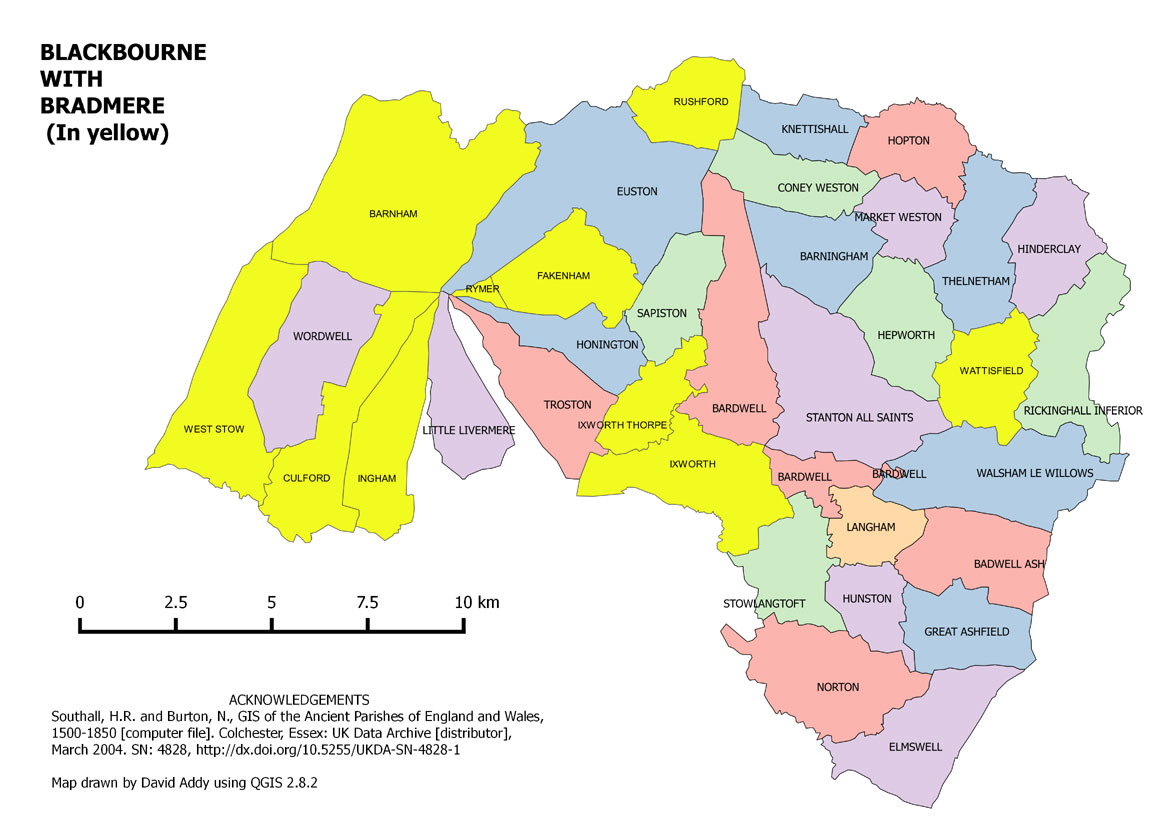
The disappearing Hundred
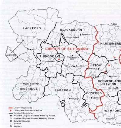
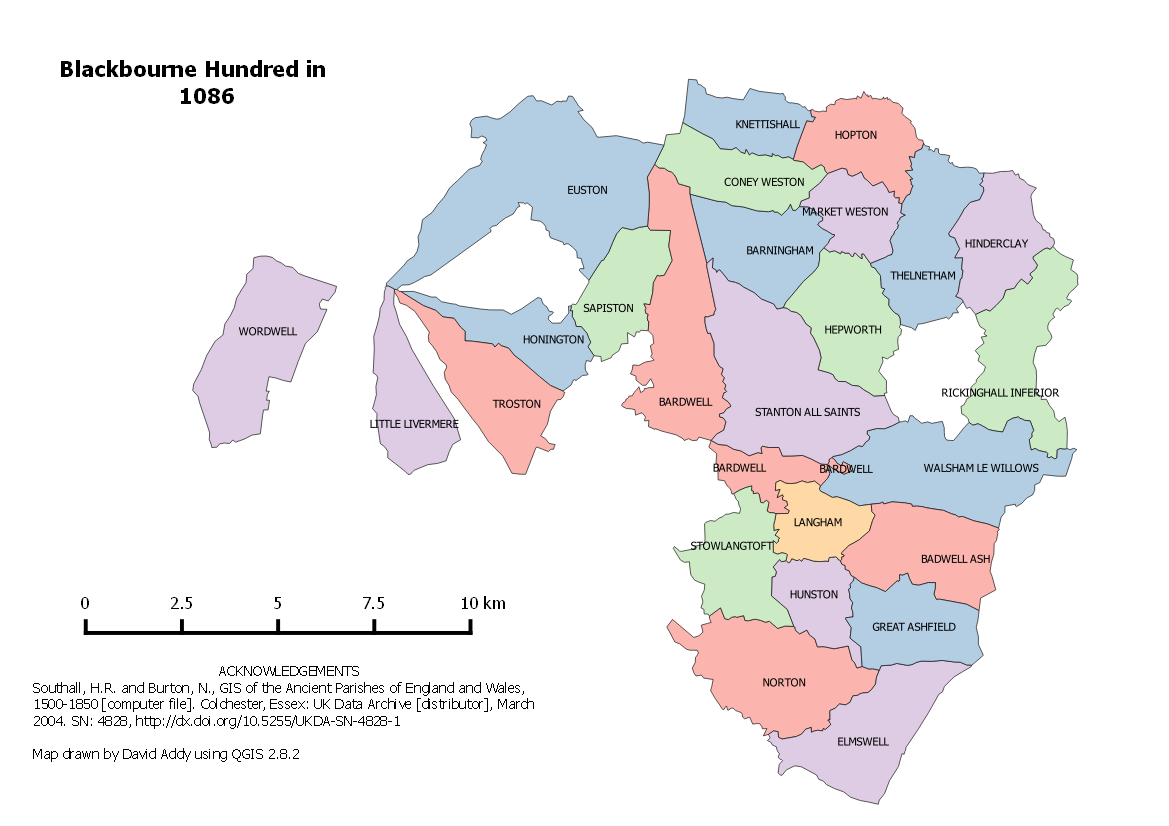
Blackbourne as one of the eight and a half hundreds pertaining to Thingoe
The origin of the administrative units known as "Hundreds" is largely unknown and may well have grown up at different times depending upon location in the country. It is usually suggested that they are sub-divisions of the shire counties. However, in East Anglia, it may well be the case that the Hundreds were in place before the region was divided into Norfolk and Suffolk. This division probably occurred under the Danish King Canute in or about 1021, after the Earl of East Anglia, Thorkell the Tall, was exiled, and Canute wanted to strengthen his own hold over that area.
The Hundreds may well have existed in the 10th century, and were thought to have been set up as taxation units, based upon the value of one hundred hides. Each hide represented the living that could be derived from an average holding of 120 acres. The much older "vills" were basically spatial units, representing an area of land holding under a single Lord, whereas Hundreds were value units, set up by the national fiscal authority.
Each Hundred had its own court under the Hundred Bailiff, second only to the County or Shire Court. They dealt with folk rights, and might be called "Things" or "Moots". These met at long established open air meeting places originally set up by the early Anglo- Saxons, probably before the Hundreds were established. These meeting places were held at well known landscape features, such as meres, fords, prominent mounds, or important boundary markers.
The old meeting place names seem to have been used to name the Hundreds, and even as late as 1894, the Hundred names were still significant enough to be inherited by the newly established Rural District Councils. A few even survived the 1974 reorganisation of local government, notably Babergh DC.
Although the names remained constant, the boundaries were in flux throughout the lives of the Hundreds. Even by the time of the Domesday Survey in 1086, it was clear that changes in lordships or land values had resulted in a much less than clear picture of the overall patterns of control. The map shown here represents an "average" view of the late Medieval arrangements. For Example,
- Blackbourne Hundred was regarded as a double hundred after it was amalgamated with Bradmere Hundred, by 1100;
- Exning was part of Cambridgeshire in 1086, but is here shown as an outlier of Lackford, which occurred in the 12th century;
- Bury St Edmunds itself must once have been part of Thingoe Hundred, but by 1086 it is apparently a separate unspecified unit.
|


