The area of the Banleuca

The Charter of 945 AD
Granting Bury to the Abbey of St Edmund

Background to the Charter of 945

The Abbey of St Edmunds grew up after about 906 when the remains of King Edmund were brought to the old town of Bedericsworth.

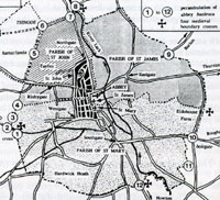
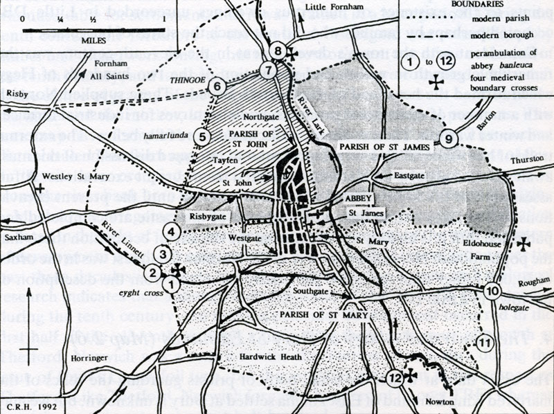
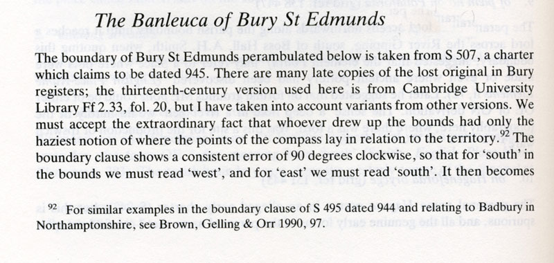
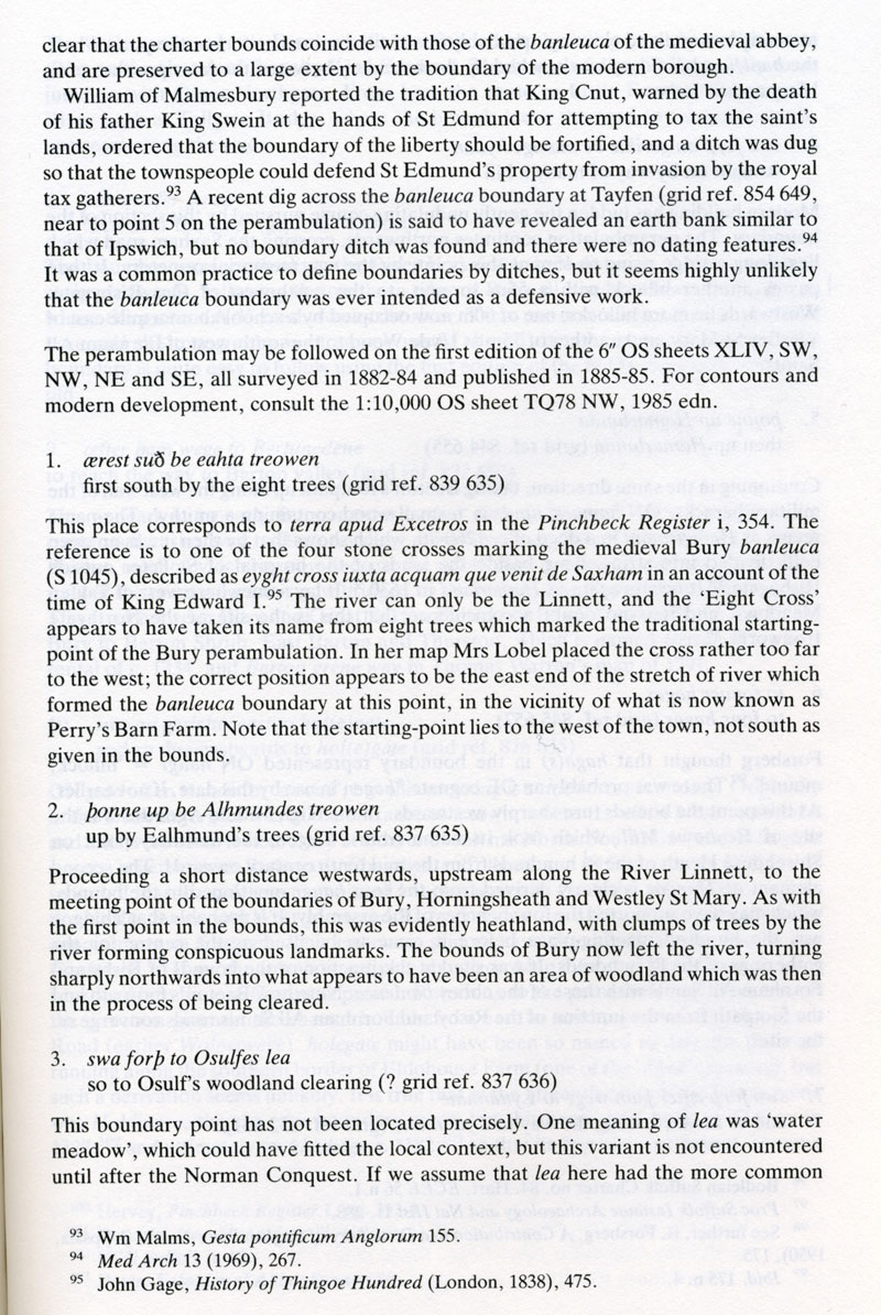
In 945 the crown granted a large area of land to the monastery, which was known as the Banleuca, an area which was still used as the boundary of the Borough of Bury St Edmunds until 1934 when it was slightly enlarged to the west.

Introduction to the Perambulation

The notes explaining the perambulation of the boundaries of the area of land granted to the Abbey of St Edmund in 945 AD are by Cyril Hart, taken from his monumental work called "The Danelaw", published in 1992, by The Hambledon Press.

The boundary of King Edmund's grant, later called the banleuca. Map by Cyril Hart 'The Danelaw' 1992
Banleuca Boundaries by C R Hart

The boundaries of King Edmund's grant, later called the banleuca. Text by Cyril Hart 'The Danelaw' 1992 The boundaries of King Edmund's grant, later called the banleuca. Text by Cyril Hart 'The Danelaw' 1992 The boundaries of King Edmund's grant, later called the banleuca. Text by Cyril Hart 'The Danelaw' 1992 The boundaries of King Edmund's grant, later called the banleuca. Text by Cyril Hart 'The Danelaw' 1992 The boundaries of King Edmund's grant, later called the banleuca. Text by Cyril Hart 'The Danelaw' 1992


Taken from "The Danelaw" by Cyril Hart
Published in 1992 by The Hambledon Press


Go to Charters Homepage Go to Maps Homepage Created 12th March 2007 Go to Home Page