 |
|

|
A book by Tony Redman Page 1 of 3 This section contains the maps of the building stones and rocks included in "The Building Stones of Suffolk."
The author, Tony Redman MA FRICS IHBC, is a conservation accredited chartered building surveyor who spent most of his working life repairing Suffolk buildings. He has been a member of the council of SIAH, is a trustee of the Suffolk Historic Churches Trust and a liveryman of the Worshipful Company of Stonemasons.
This book can be ordered here:- |
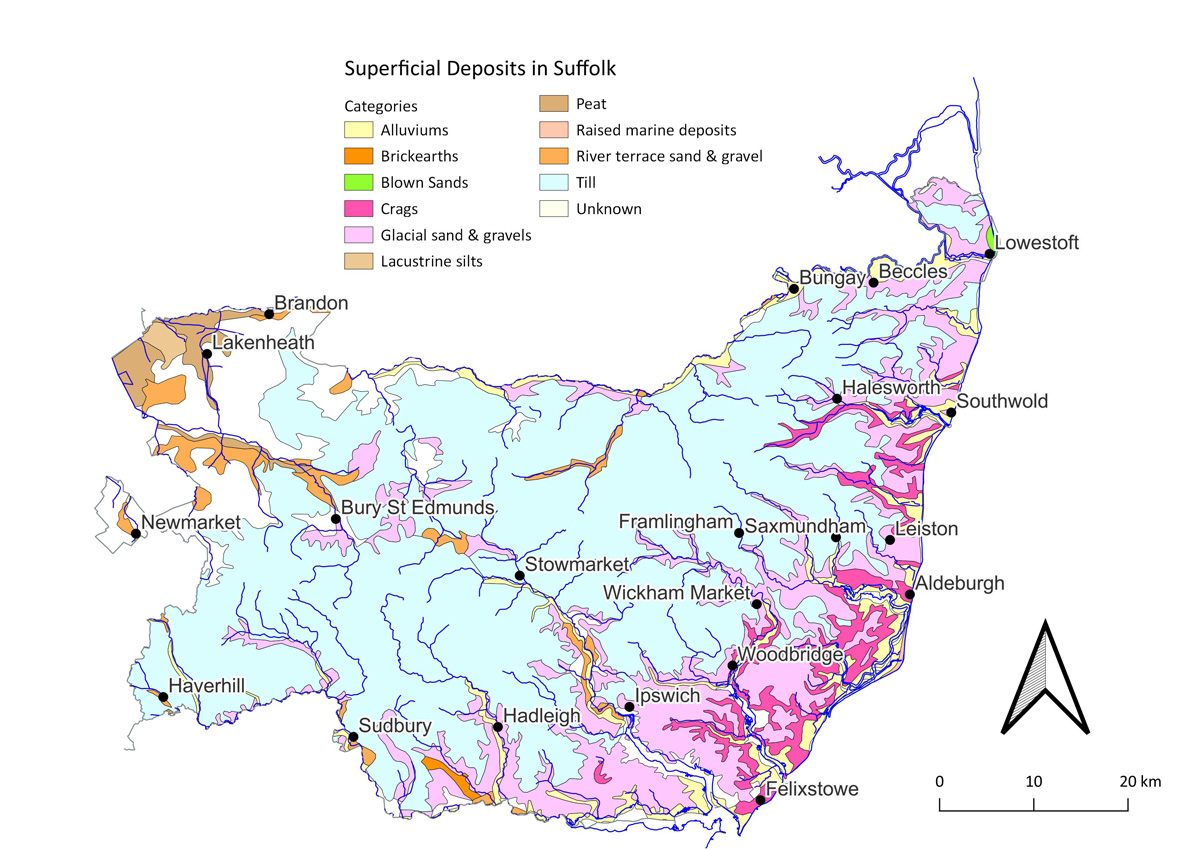 The superficial drift deposits of Suffolk. (Map 3 in the book) |
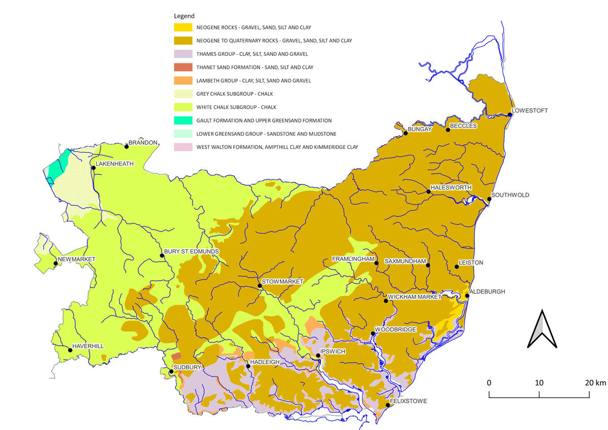 The bedrock or solid geology of Suffolk. (Map 1 in the book) |
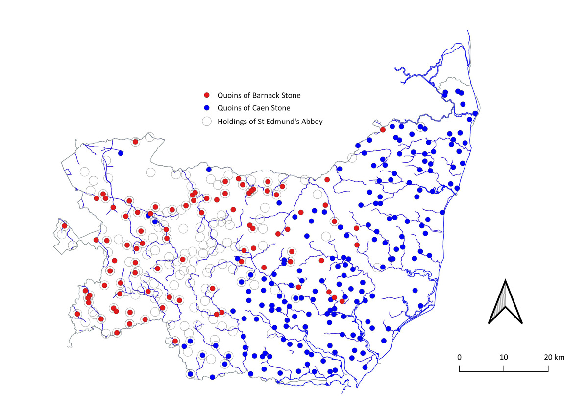 The differential use of Barnack and Caen limestones for quoin stones. Small circles show the distribution of the estates of Bury St Edmunds abbey in 1086, based on Gransden 2007. (Map 4 in the book.) |
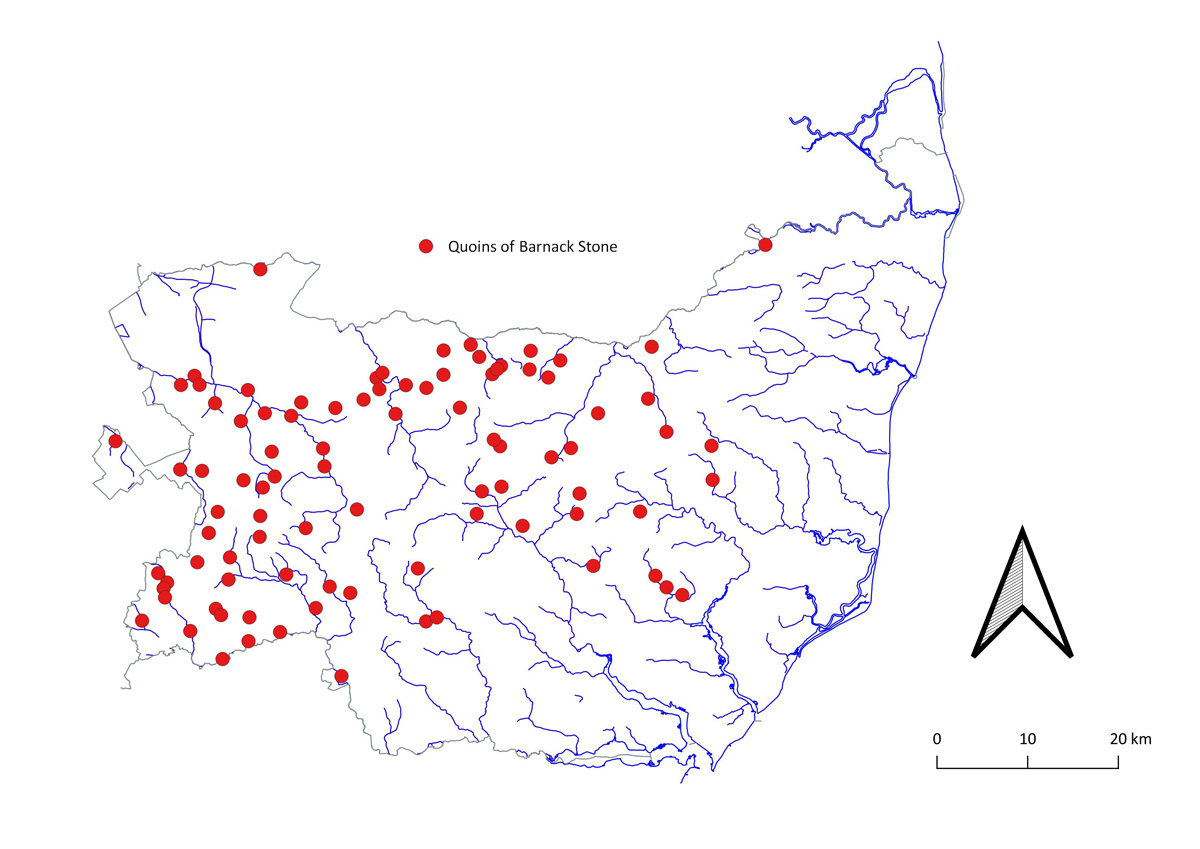 Instances of Barnack stone used as quoin stones. (Map 5 in the book) |
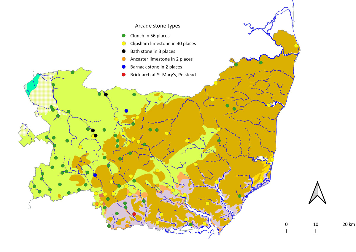 Distribution of arcades by recognisable stone types. (Map 6 in the book.) |
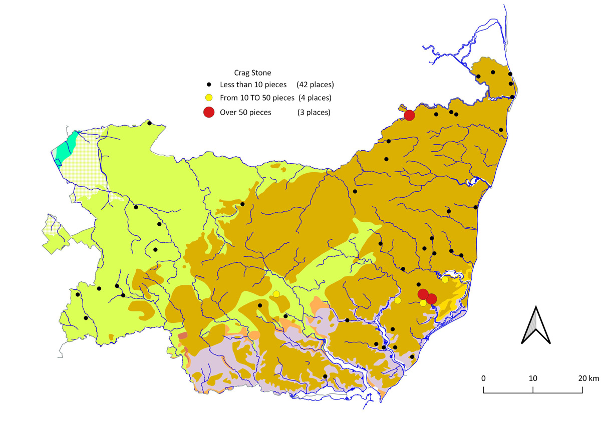 Distribution of Crag stone. (Map 7 in the book) |
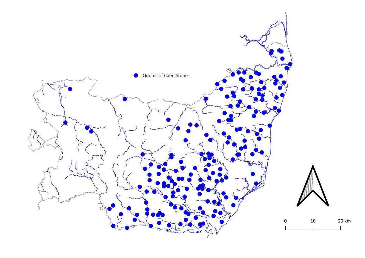 The distribution of medieval Caen Stone used as quoins. (Map 8 in the book.) The outliers in the west of Suffolk are Wangford, Rushford, Tuddenham, Flempton and Hargrave. |
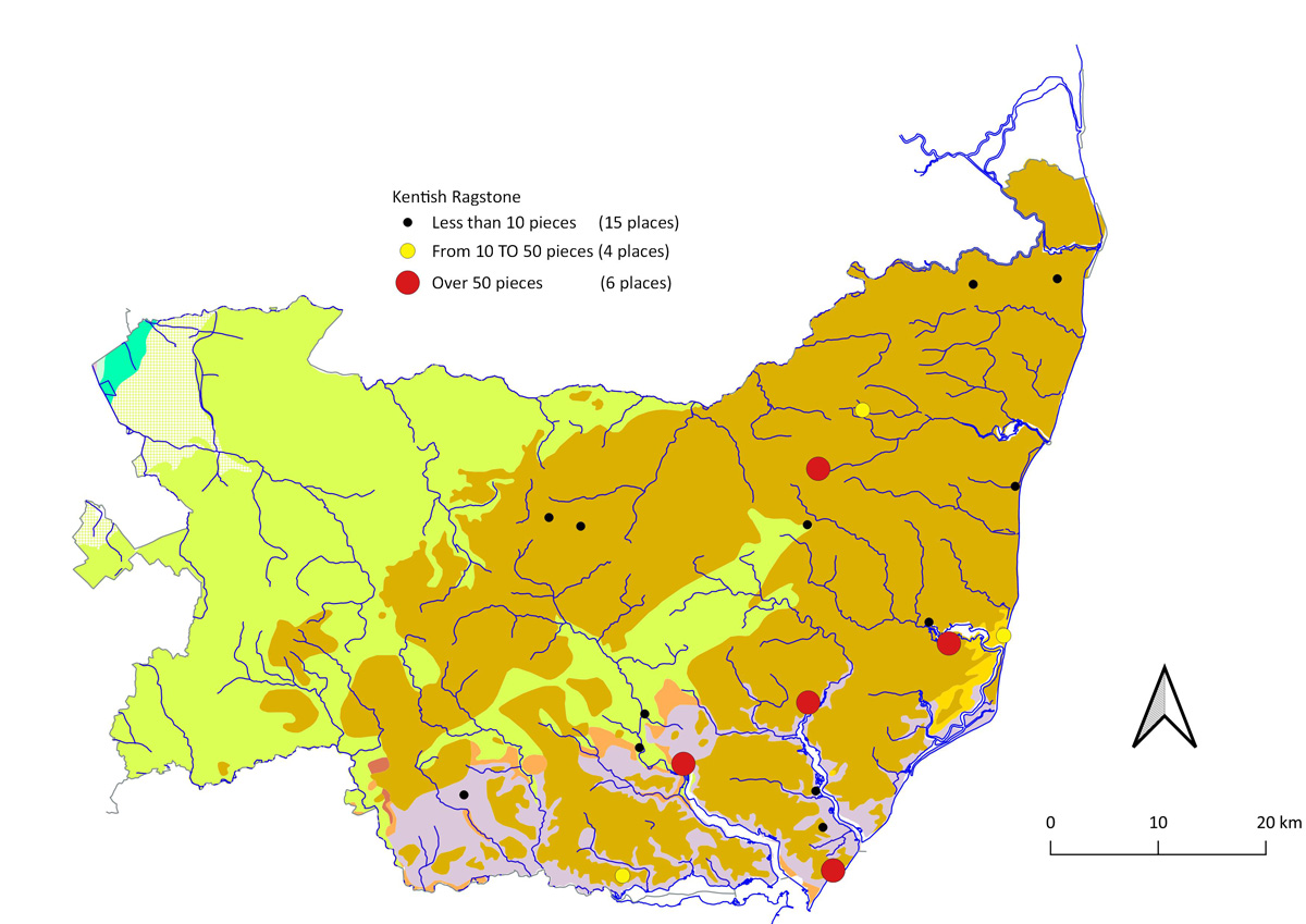 Distribution of Kentish Ragstone. (The church of St Peter and St Paul in Felixstowe has the "missing" yellow dot, obscured by the red dot of two other locations in Felixstowe.) (Map 9 in the book) |
Page: 1 2 3 |
| [ Prev ] [ Next ] |
|
These maps are drawn using the Open Source mapping program called QGIS, Version 3.34 Contains Ordnance Survey data © Crown copyright and database right 2021 Geological data reproduced with the permission of the British Geological Survey ©NERC. All rights Reserved Page created by David Addy, 10th June, 2025
|
| Go to Maps Homepage | Last Updated 10th June 2025 | Go to Main Home Page |