 |
|
|
Showing the changing coastline of Britain Source: Museum of London |
Please note that YBP means "Years Before the Present", ie "Years ago".
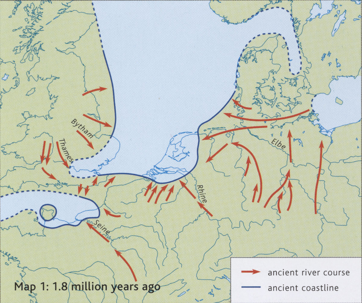 Showing Britain joined to the continent about 1.8 million years ago. Much of East Anglia is below sea level. The land now known as England drains eastwards. The Thames is clearly visible, but the Bytham River drains an area north of the Thames. |
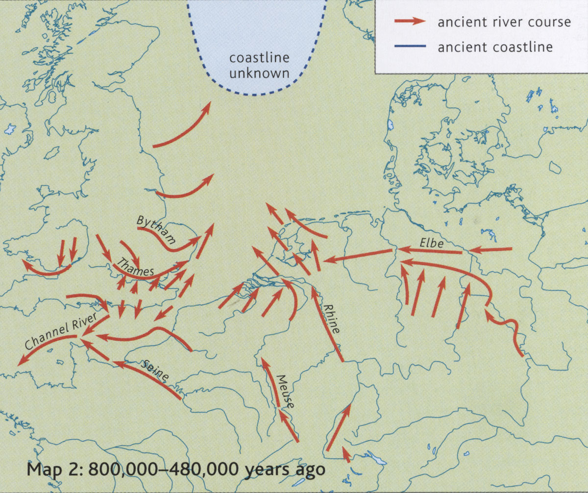 This map covers the period from 800 thousand years ago to 480 thousand years ago. Most of today's North Sea is dry land at this time. The River Thames has to turn northwards to drain to the sea, and probably flowed into the existing Bytham River before they both headed north towards the sea. Thames sediments have been found in Suffolk arising from this period. |
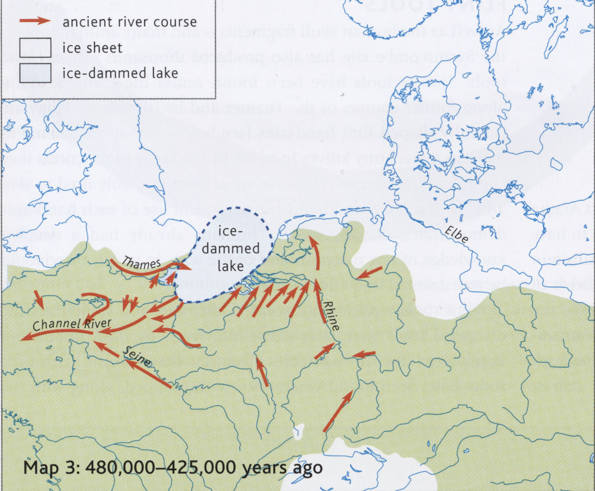 From 480 thousand years ago to 425 thousand years ago, the Anglian Glaciation left northern Britain and East Anglia under a sheet of ice. The valley of the Bytham River was swept away by the grinding ice sheet. Rivers draining northwards met the frozen ice and a giant lake was formed. The huge ice dammed lake then overflowed southwards, carving out the so-called Channel River, and eroding a way through the high ground which had once constituted a land bridge to the continent. |
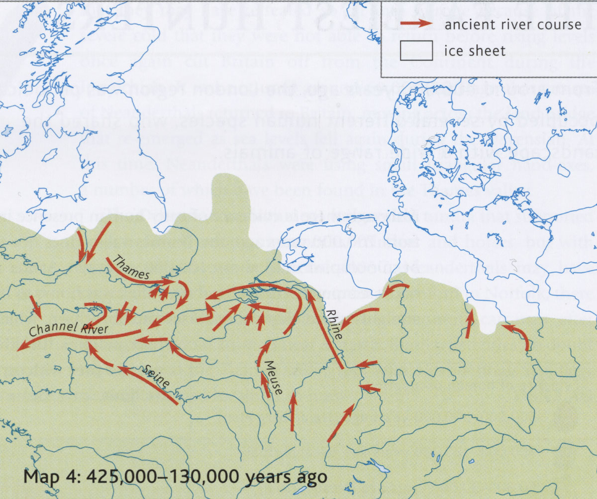 This map illustrates the position from 425 thousand years BP to 130 thousand years BP. The Thames flows into the Channel River, and this valley will be drowned when sea levels eventually rise. |
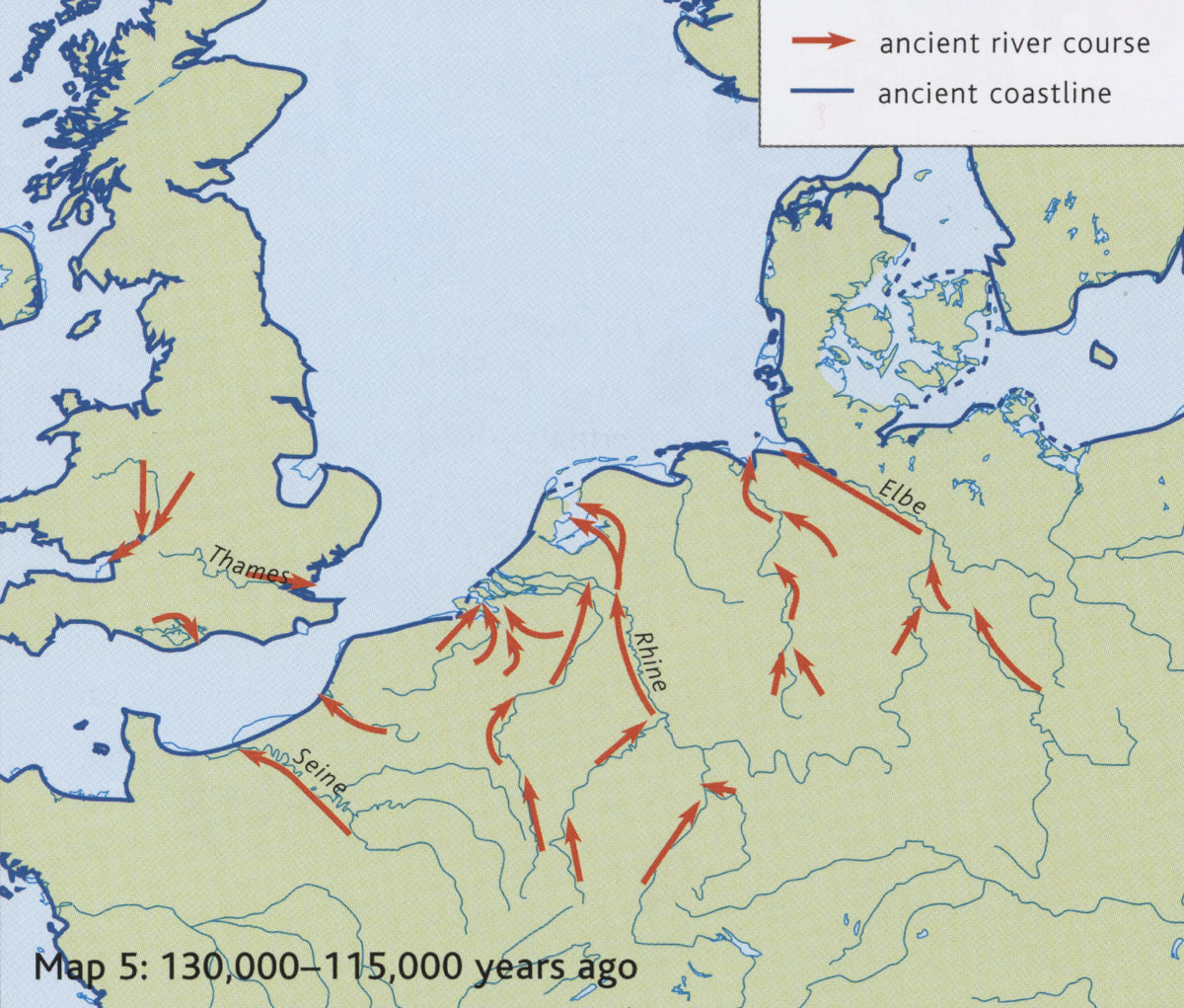 This shows the time from 130 thousand YBP to 115 thousand YBP. The English Channel has been formed because the defunct Channel River valley was now low enough to be flooded by rising sea levels. |
 This map shows Britain once again joined to the continent in the time from 25 thousand YBP to 13 thousand YBP. A new Ice Sheet has locked up so much water that sea level has fallen. The Channel River has re-emerged from below sea level to drain the Thames once again. |
 This graphic from the National Geographic website gives a further overview of the situation from 18,000 years ago up to present. Here the River Elbe is flowing to the east of Jutland, not the west as in the Museum of London graphics. |
This shows the time after 6,500 BC, when Britain became an island once again. However, the coastline was not exactly as we know it today. |
|
|
All images are
copyright of
the Museum of London Taken from "London the Illustrated History by C Ross and J Clark" Published by Allen Lane in 2008 for the Museum of London, except for the illustration from the National Geographic website. |
| Go to Maps homepage | Produced 25th March 2009 and updated 14th February, 2018. | Go to Home Page |