 |
|
|
From Davis and Sear's "Records of Medieval Newmarket 1399 to 1483"
Source - shown here, published by Suffolk Record Society 2023 Also included are the Gough map from about 1400, and two Ogilby strip maps from 1675 |
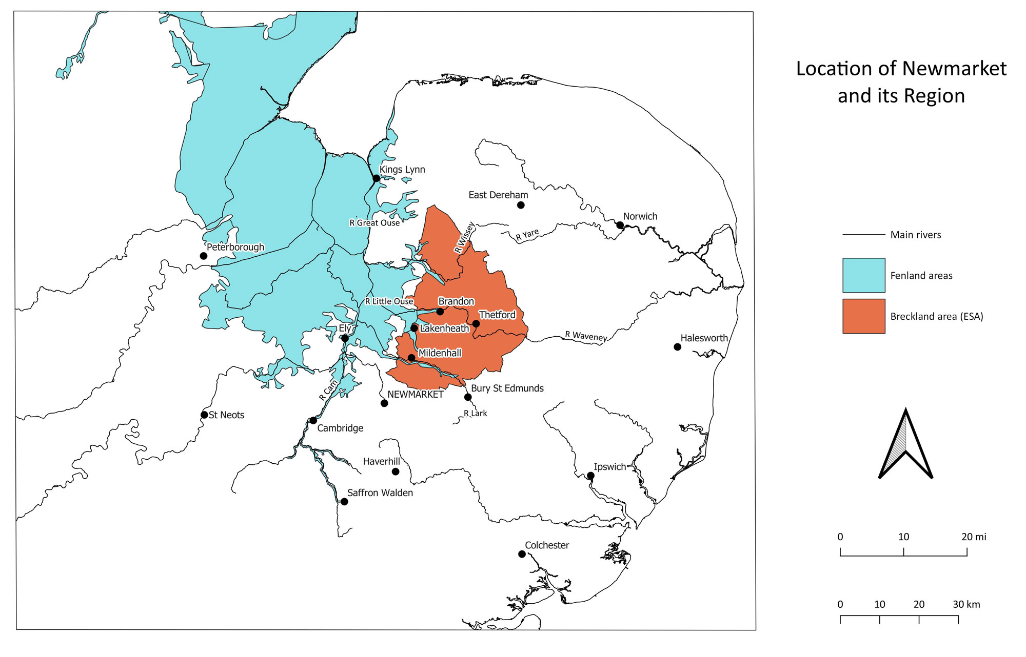 Newmarket in its regional context. Newmarket did not have the advantage of any major river connections. It was on a very minor stream east of the Great Ouse. Its road links however, were exemplary for the time, giving easy links to produce from the fens and the Breckland and surrounding agriculture, and to trade with Thetford, Norwich and relatively easy routes to London. |
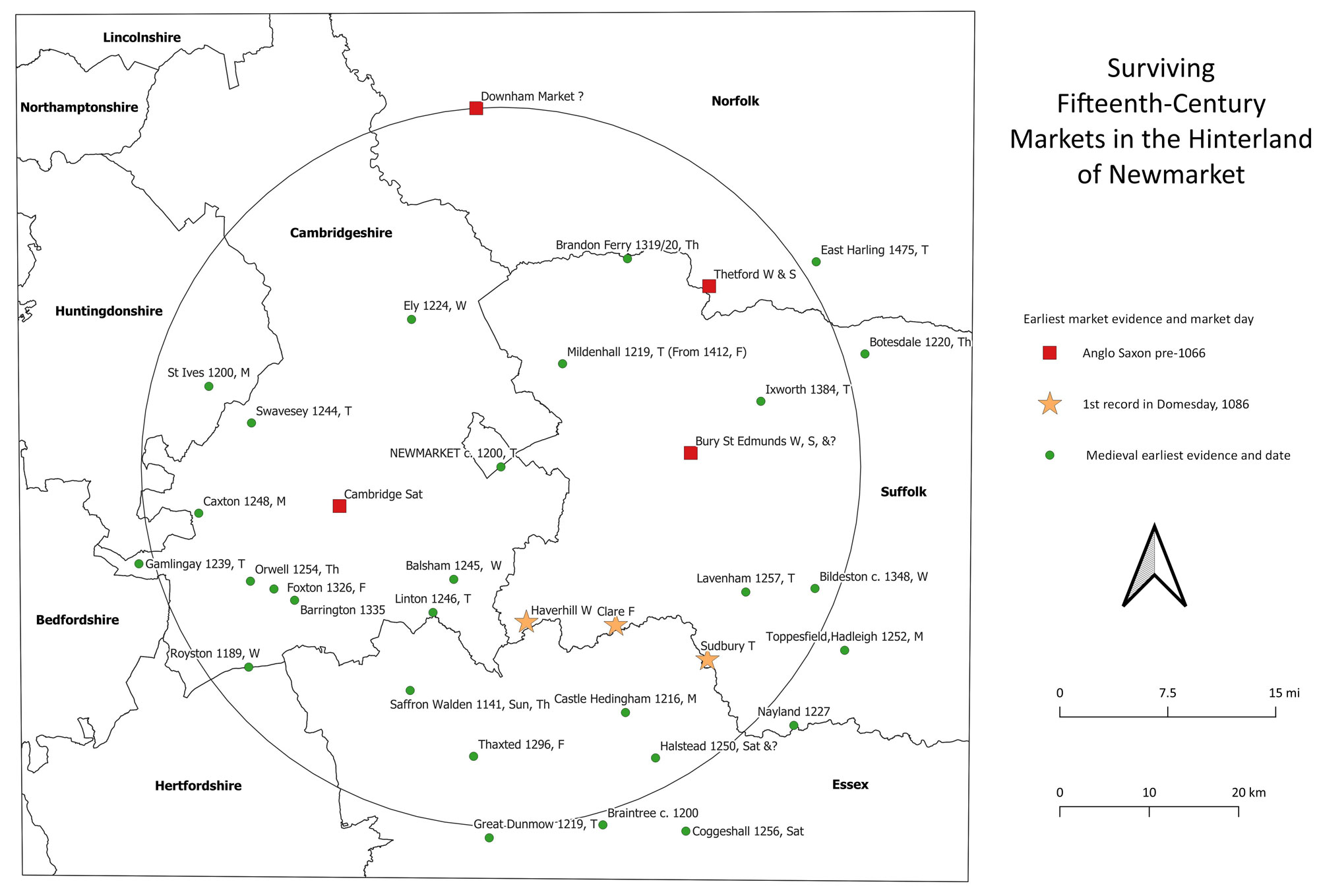 Newmarket and other markets within 25 miles radius. Newmarket's ambiguous location along county boundaries helped to keep it out of the hands of the Abbot of Bury. By the 15th century Mildenhall market never repaid the abbot's investments as might have been expected, while Newmarket continued to flourish. |
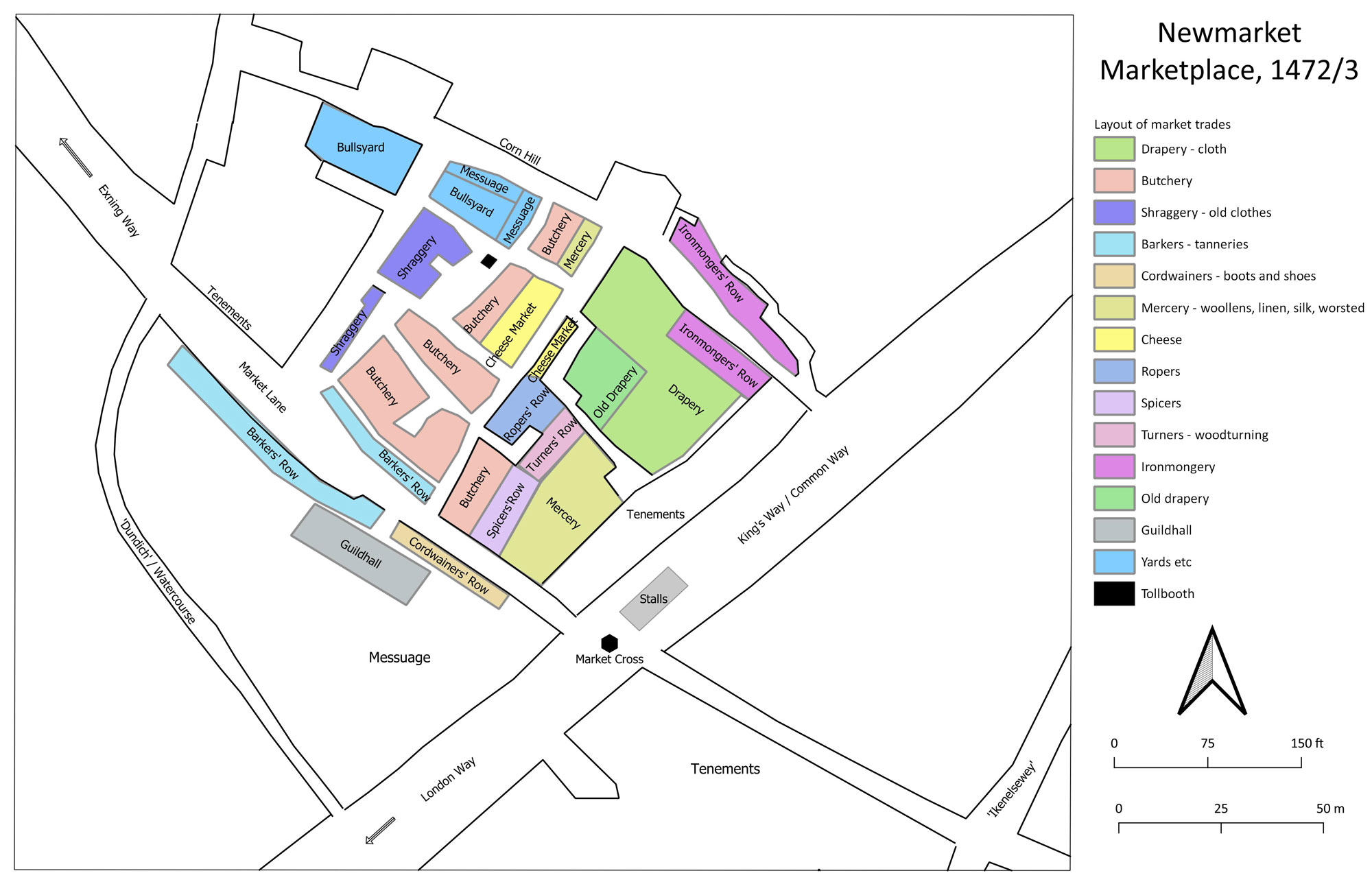 Conjectural layout of the market stalls and buildings. The comparative locations of each trade are taken from research by Dr Jo Sear on the manor account rolls for 1472/73. The plan is drawn by David Addy to place each trade within the form and layout of the market shown in the OS map of 1884. |
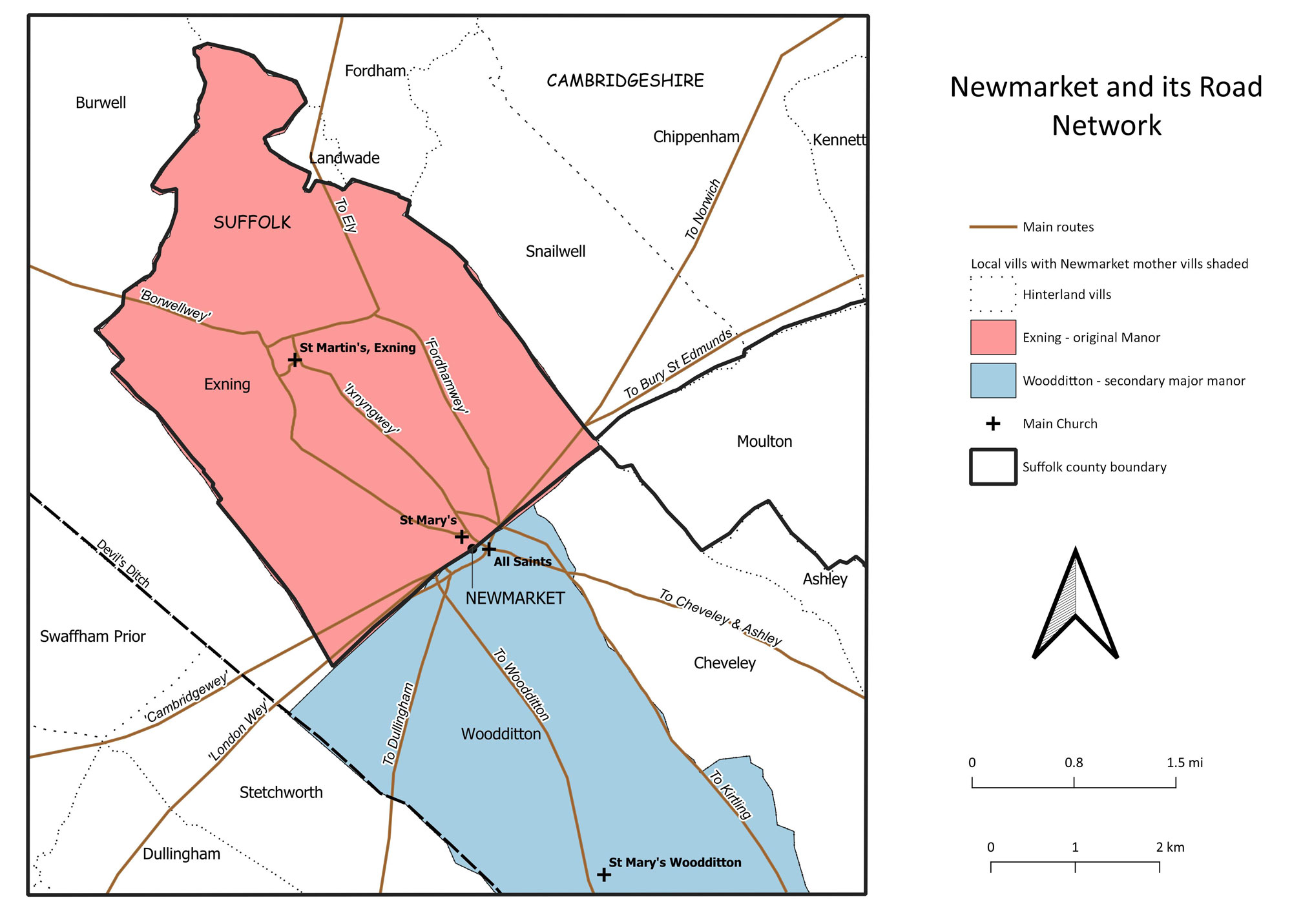 Newmarket's "mother" vills and major routeways. Newmarket High Street was basically along the route of the Icknield Way, later becoming the major route from London to Norwich. The High Street also sat between the vills of Exning in Suffolk, and Woodditton in Cambridgeshire. |
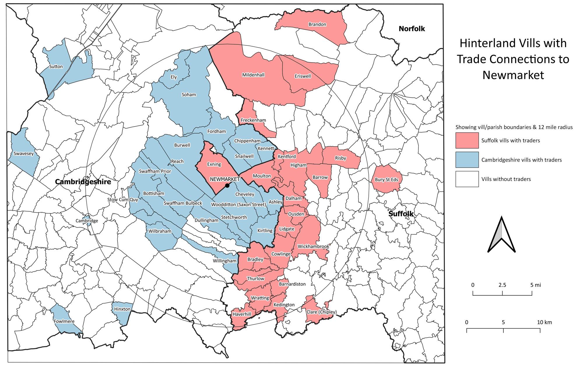 Showing named vills with sellers who traded at Newmarket. Although 41 out of the 61 total traders were within 12 miles of the town, the map shows that some traders were willing to travel well over 12 miles to trade at Newmarket. |
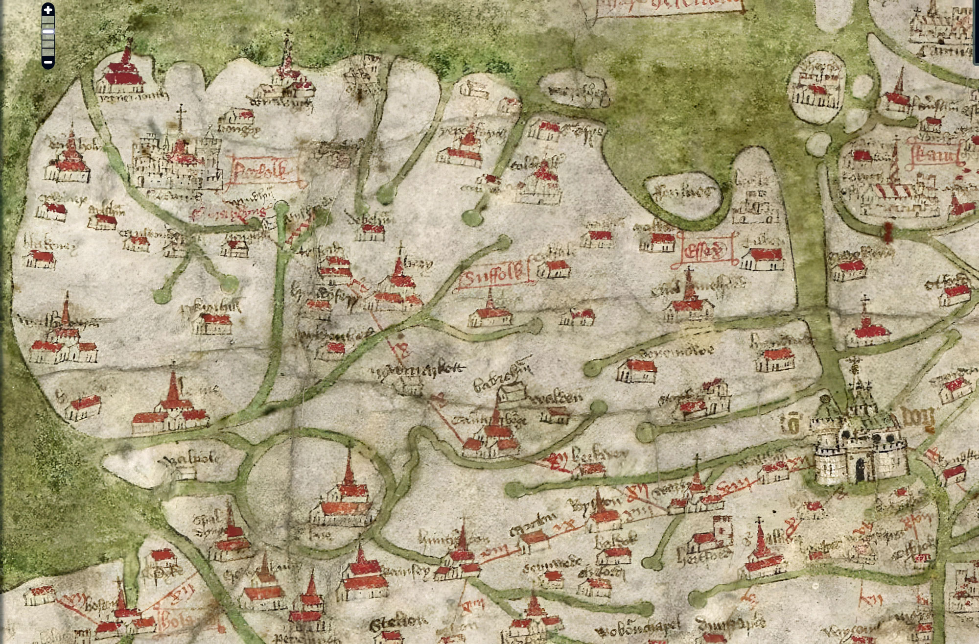 Part of the Gough Map dated circa 1400 The red route from London passes Waltham Abbey, Ware, Barkway, Cambridge, Newmarket, Bury, Thetford, Attleborough, Wymondham and so to Norwich. Newmarket is spelled "nywmarkett". |
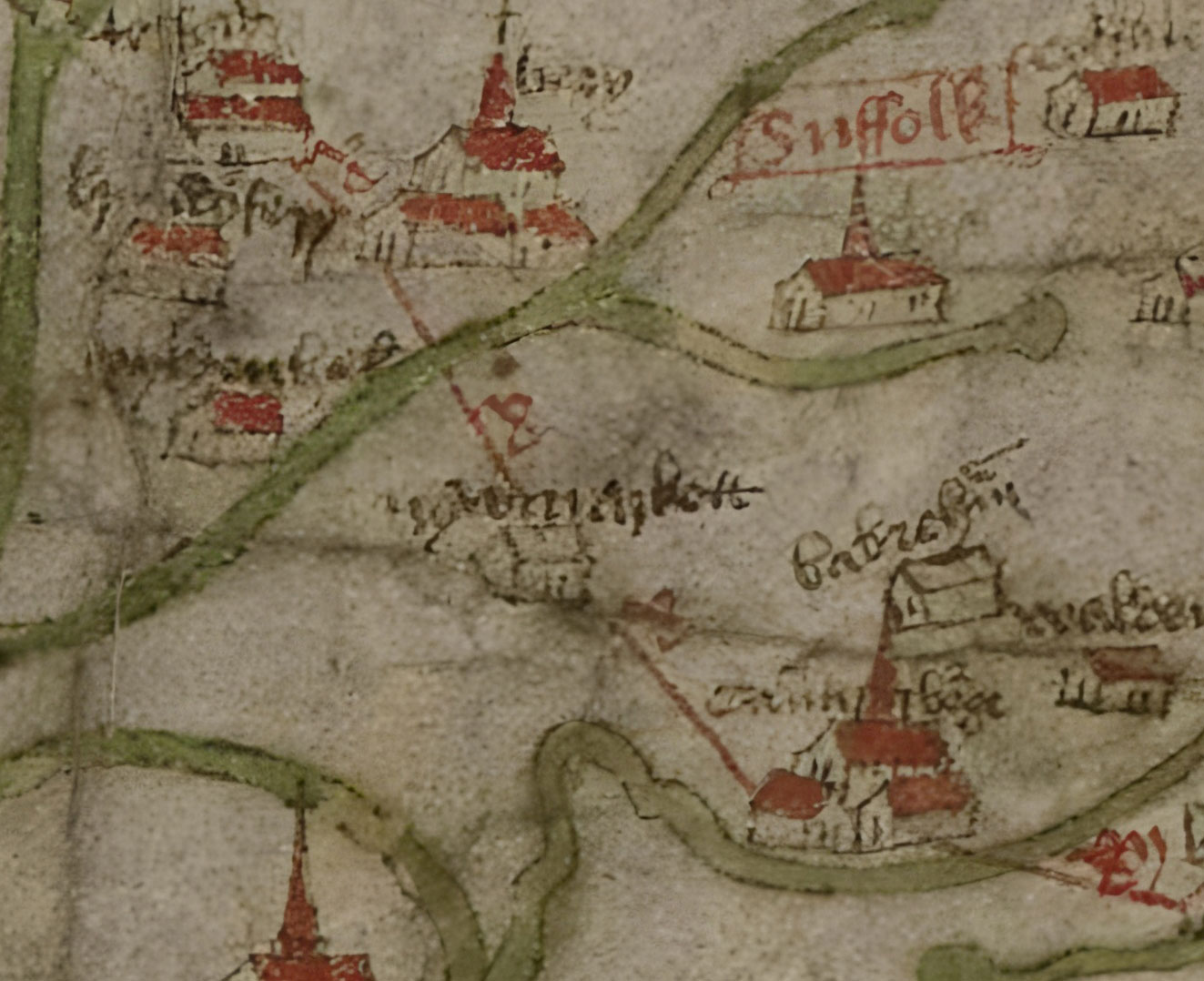 Close up on Newmarket. The Gough map showing the route from London as a red line, passing through Cambridge, on to Newmarket and then to Bury St Edmunds. |
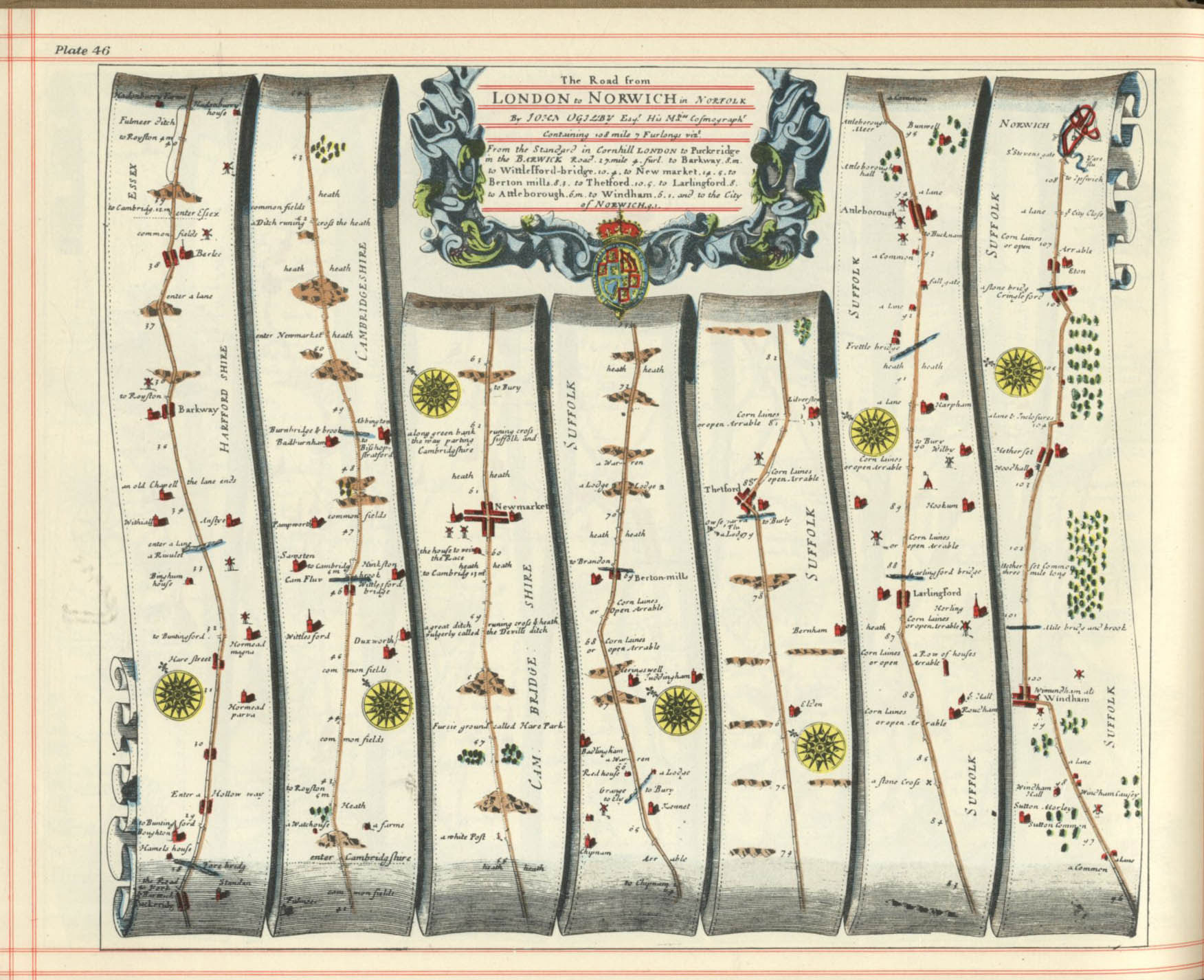 Ogilby's Plate 46 London to Newmarket, and Newmarket to Norwich. Dated to 1675/76. |
 Ogilby's Plate 52 Newmarket to Wells and Newmarket to Bury St Edmunds. Dated to 1675/76. |
| Go to Maps and Plans Homepage | Page created 13th July 2023 | Go to Main Home Page |