 |
|

|
Land holdings from 1066 to 1086 Page 1 of 1 This page contains maps of the locations of the lands and farms of the Abbey. |
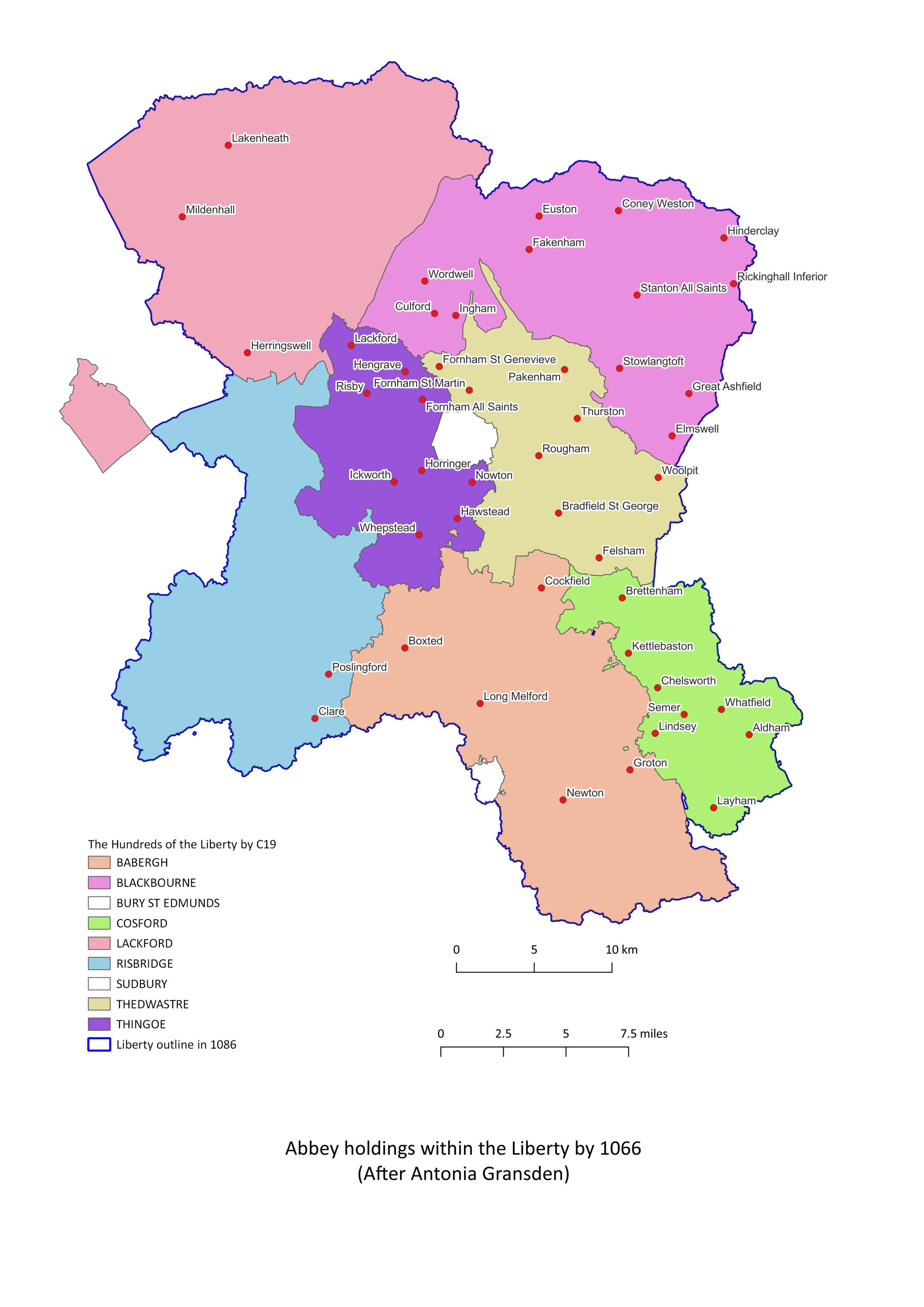 Held in 1066 Holdings of the Abbey of St Edmund in 1066 - Inside the Liberty of St Edmund. This map is based upon those included in "History of the Abbey of Bury St Edmunds", by Antonia Gransden. The shaded areas are the Hundreds within the Liberty of St Edmund. |
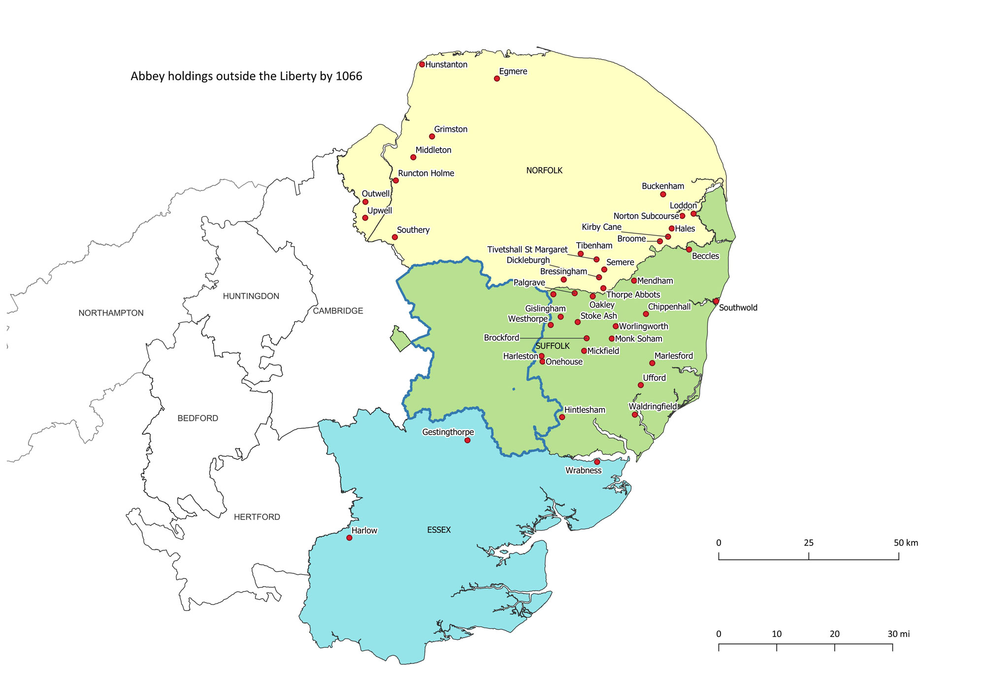 Held in 1066 Holdings of the Abbey of St Edmund in 1066 - Outside the Liberty of St Edmund. This map is based upon those included in "History of the Abbey of Bury St Edmunds", by Antonia Gransden. The shaded counties are those where some holdings are located. |
 Held in 1086 Holdings of the Abbey of St Edmund in 1086 - Inside the Liberty of St Edmund. This map is based upon those included in "History of the Abbey of Bury St Edmunds", by Antonia Gransden. The shaded areas are the Hundreds within the Liberty of St Edmund. |
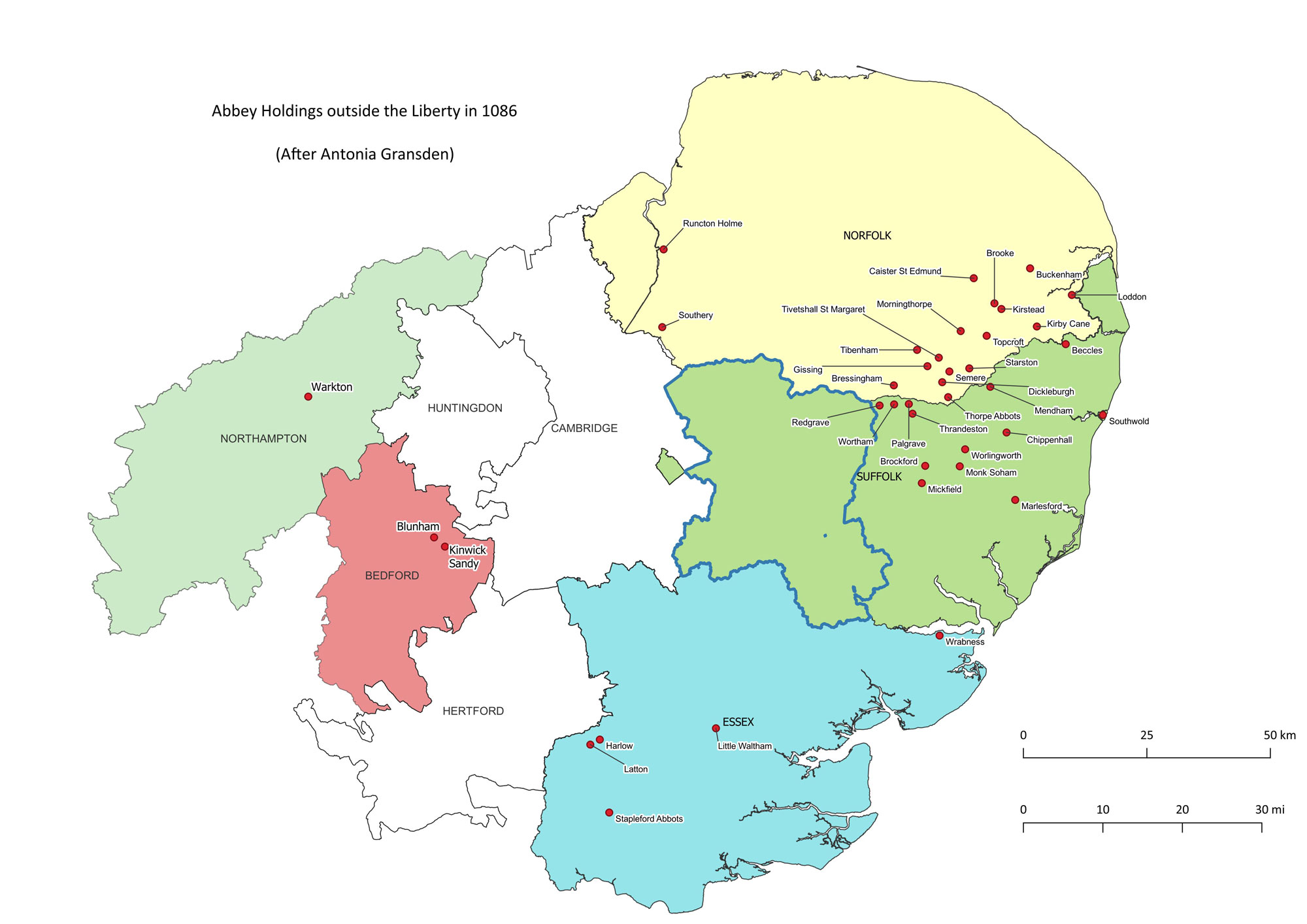 Held in 1086 Holdings of the Abbey of St Edmund in 1086 - Outside the Liberty of St Edmund. This map is based upon those included in "History of the Abbey of Bury St Edmunds", by Antonia Gransden. The shaded counties are those where some holdings are located. |
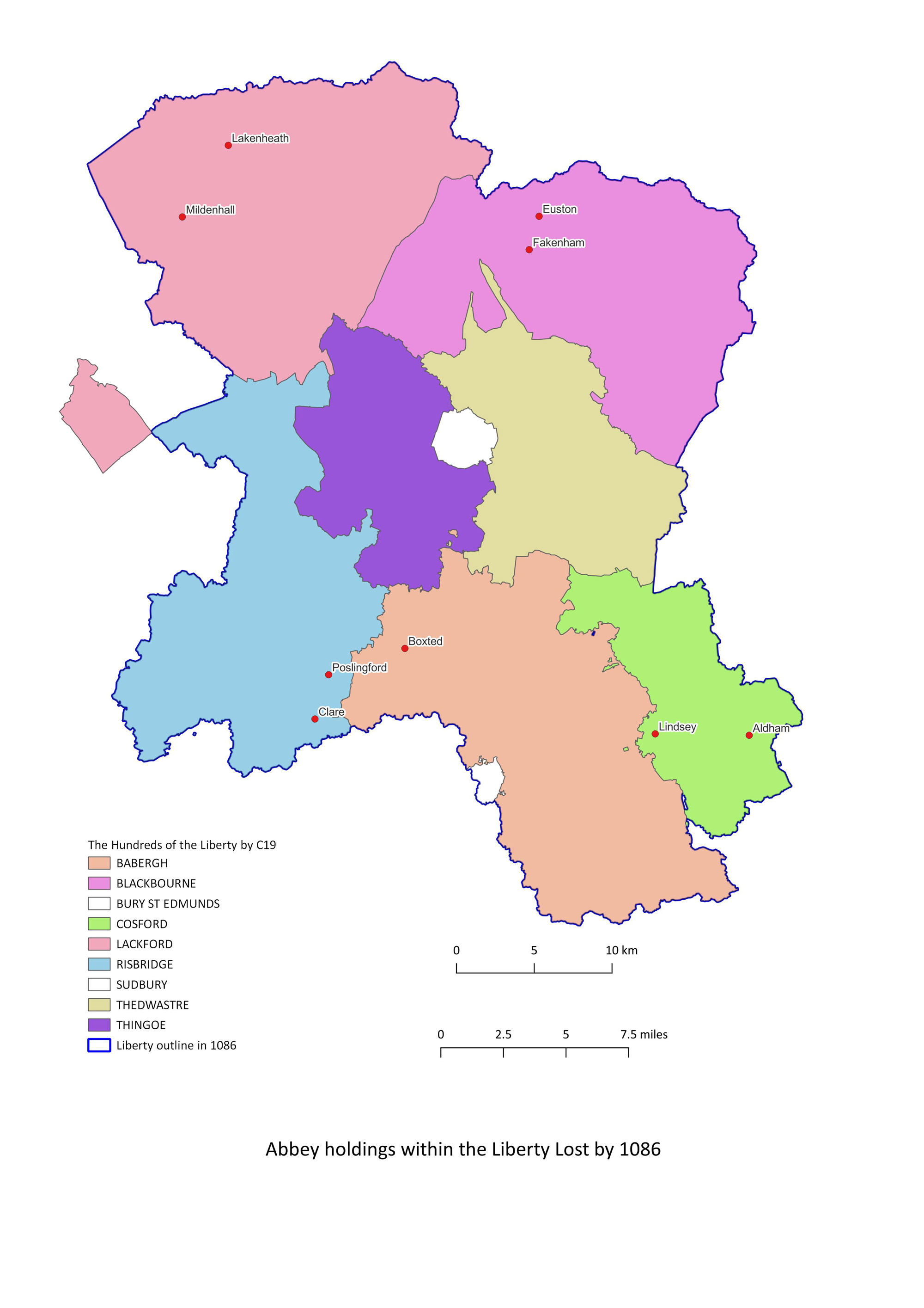 Lost by 1086 Holdings of the Abbey of St Edmund lost by 1086 - Inside the Liberty of St Edmund. This map is based upon those included in "History of the Abbey of Bury St Edmunds", by Antonia Gransden. The shaded areas are the Hundreds within the Liberty of St Edmund. One major loss was Mildenhall, a very valuable estate which had been granted to the Abbey by Edward the Confessor in 1044. Eventually, Abbot Samson would buy Mildenhall back from the Crown in 1189 by paying King Richard the sum of 1000 marks. |
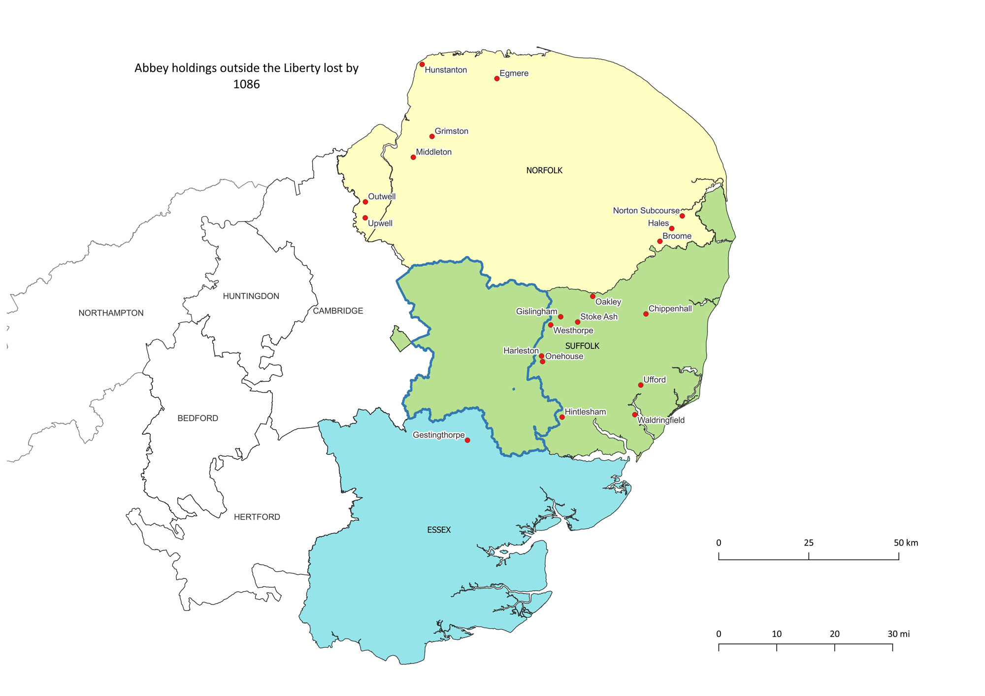 Lost by 1086 Holdings of the Abbey of St Edmund lost by 1086 - Outside the Liberty of St Edmund. This map is based upon those included in "History of the Abbey of Bury St Edmunds", by Antonia Gransden. The shaded counties are those where some holdings are located. |
 Gained by 1086 Holdings of the Abbey of St Edmund gained between 1066 and 1086 - Inside the Liberty of St Edmund. This map is based upon those included in "History of the Abbey of Bury St Edmunds", by Antonia Gransden. The shaded areas are the Hundreds within the Liberty of St Edmund. |
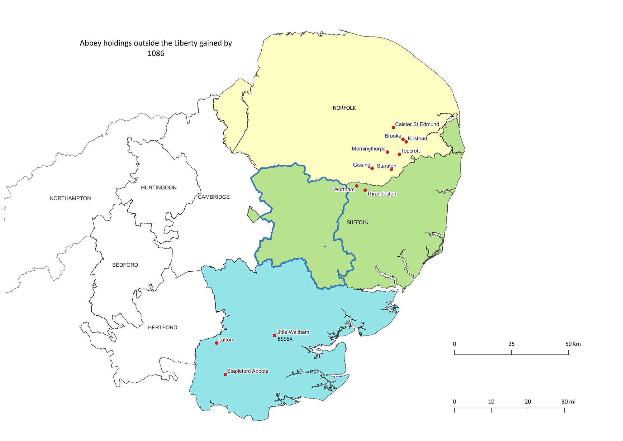 Gained by 1086 Holdings of the Abbey of St Edmund gained between 1066 and 1086 - Outside the Liberty of St Edmund. This map is based upon those included in "History of the Abbey of Bury St Edmunds", by Antonia Gransden. The shaded counties are those where some holdings are located. |
Page: 1 |
|
These maps are drawn using the Open Source mapping program called QGIS, Version 3.28
Page created by David Addy, 19th January, 2024
|
| Go to the Monastic homepage | Go to Maps Homepage | Last Updated 7th April 2024 | Go to Main Home Page |