
|
The late Twentieth Century
1946-2000
Pre
1945
|
Please click here if you want to look back to 1945 and earlier in our local history of St Edmundsbury.
|
|

Barbara Stone by Rose Mead
(1867-1946)
Quick links on this page
Mildenhall goes American 1950
London overspill official 1954
Fighters, bombers, rail cuts 1960
WSWB set up, Gas ends 1964
Flooding and Growth 1968
Pageant of St Edmund 1970
Boby's closes 1972
A45 Bury Bypass opens 1973
Local councils reorganised 1974
London overspill stalls 1979
Winter of Discontent 1980
Nowton Court purchased 1985
Western Way, the Hurricane, and Black Monday 1987
Poll Tax introduced 1990
Council Tax, Manor House 1993
Police Authorities set up 1995
Corn Market dies out 1997
Cattle Market closes 1998
Town Centre Gateways 1999
Millenium Bug? 2000
Foot of Page
|
|
1946 |
In the aftermath of war many of our buildings looked different as railing had been removed to be melted down "for the war effort". The people had changed and a way of life had disappeared. Wartime austerity, however, had not ended. Rationing continued, families were still separated in many cases, and homes were destroyed. Long term issues replaced the day to day survival of the war, and the economy was totally geared to munitions production and had to be turned around.
Redgrave Hall had been requisitioned for troops during the war, and following this period, and the massive repairs needed, it was demolished in 1946, like many other large houses of the time.
The airfields and military installations in our area naturally began to be wound down.
In 1945 307 and 85 Squadrons flew from RAF Castle Camps in Mosquitos but the station now closed down in January 1946.
Honington remained as HQ for the American VIII AF Fighter Command until 26th February 1946. This meant that of the 122 bases of the Mighty Eighth, it was the last to be vacated.
In March 1946 RAF Transport Command moved in at Honington, and the base would become crucial to the Berlin Airlift of 1948-49. RAF Honington has since seen Canberras, the Valiant V-Bomber, Buccaneers and Tornadoes.
Stirlings from RAF Shepherd's Grove continued to deliver mail and stores overseas until March 1946.
In May 1946 the station was taken over by 60 Group as a satellite of Watton Radio Warfare Establishment, and some Ansons and Lancasters were positioned here.
The RAF left Newmarket Heath in Summer 1945 but after 1946 light aircraft continued to deliver people to the races at this airstrip.
Number 622 Squadron had disbanded at RAF Mildenhall in August 1945 and been replaced by 44 (Rhodesia) Squadron, who would remain here until August 1946. The base remained active, but on 26th May, 1946, the second open day since the end of the war was held. RAF equipment was on show, together with some captured enemy ordnance, including a V-1 flying bomb. Proceeds were donated to St Dunstan's Hostel for the Blind.
On 8th August No 3 Group's Major Servicing Unit was installed at RAF Mildenhall, and the two operational squadrons were then removed to RAF Wyton.
After the war Stradishall left 3 Group and passed to 48 Group Transport Command and in August 1945 Number 51 and 158 Squadrons arrived in Stirling CV's and these flew until March 1946 when 51 Squadron received Yorks. In September 1946 Stradishall reverted to 3 Group and five squadrons of Lancasters were based here until February 1949.
In April 1946 Numbers 149 and 207 Squadrons had arrived at RAF Tuddenham, although only on half strength. The local air training squadron had its gliding school moved here from Westley, although it had been used for gliding purposes for several years as an adjunct to Westley.
Tuddenham closed for flying in November 1946, but would return to duty in 1954. The Gliding School of the ATC would move to RAF Honington.
On 6th January 1946, Arthur Boreham was posted to the 3rd Infantry Training Centre at Bury St Edmunds. In his book, "Saga of a Suffolk Soldier", he described finding the Officer Commanding to be Lt Colonel Anstee of the Beds and Herts Regiment. The old Suffolk Regiment Training Centre had been merged with the Beds and Herts ITC in July, 1942, and based in Bury. Arthur had to arrange for the reception of 180 new call-up men, despite the ending of hostilities. However, it was inevitable that cutbacks would soon take place.
The large establishment for training the recruits needed by the Third Infantry Division at Gibralter Barracks and Blenheim Camp, (West Lines), was now scaled down. It was re-designated as Number 12 Primary Training Centre under Lt Colonel Milnes, late of 1 Suffolk. Major Pereira was now left in command of the Gibralter barracks, designated as depot of the Suffolk Regiment once again. Number 12 PTC would exist for only two more years. In 1948 its training role would transfer to Colchester.
Back in Civvy Street the authorities had to cope with large numbers of men returning from the war, and houses and public utilities that had been neglected for six years.
The 1946 Housing Act greatly increased the subsidy available to local authorities, and they were allowed to borrow from the Public Works Loan Board, or PWLB, who could provide loans at below normal market rates. This was a considerable incentive for local authorities to build more houses. However, building materials and skilled labour were in short supply.
|
|
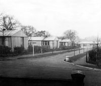
Prefabs in Queens Close
Bury St Edmunds
|
|
blank |
Work began everywhere on building new housing, and at first the emphasis was on speed. In 1944 the government had passed the Housing (Temporary Accomodation) Act which aimed to replace the war damaged housing stock and introduce returning service men to work in the construction industry. With conventional building materials and skilled labour in short supply, one solution was to turn to factory made sectional buildings which were pre-fabricated so that they could be assembled, like a kit, on site. The government paid for the buildings and the council provided the land and the roads and sewers. In Bury St Edmunds 65 such dwellings were ordered and delivered as follows:- 13 prefabricated bungalows off York Road, at York Close
- 15 prefabricated bungalows off Queens Road, at Queens Close
- 20 prefabricated bungalows off Eastgate Street at East Close
- 17 prefabricated bungalows at Perry Close on the Priors Estate.
Although their design life was just 10 years, some lasted fifty years or more. (The Queens Close prefabs shown here lasted 20 years before being demolished and replaced by elderly persons flats in 1965). Most prefabs came with built in cookers and fridges, as well as a bathroom and were considered luxurious for the time. They were specified to be 635 square feet of floor area, but could only be made 7.5 feet wide to allow for road transport from the factory. In practice they ended up costing more in total than a conventional house, and never contributed more than a fraction of the post war housing programme.
|
|

Apprentices at Acacia Avenue
|
|
blank |
On 1st March, 1946, the Bury Free Press reported on another scheme to address labour and skills shortages. It reported on the new apprentice training scheme taking place on the Mildenhall Estate, under the auspices of Harvey Frost, a local builder. Under the new scheme set up by the Ministry of Works and the Ministry of Labour, Mr Frost was designated an official "Apprentice Master". There were 32 boys who are aged between 14 and 16 years old, learning on the job in the afternoons and also attending technical classes in the mornings. Nearby, Harvey Frost's firm was building a contract of 30 new homes using normal labour.
The full text of the article may be seen by clicking on the thumbnail.
By 31st March 1946 Bury St Edmunds Borough Council had spent £30,000 on its post-war housing programme, of which £5,729 was for the siteworks and roads for these pre-fabs. Council accounts noted that, "the bungalows and their foundations provided by HM Government. Cost not known." By this date the total of £24,271 of 1946 Act expenditure on the Mildenhall Road Estate was for buying the land, associated compensation and tithe redemption payments, and for constructing the necessary roads and sewers. While £17,000 of this sum was paid to contractors for this work, £3,079 was spent on "Prisoner of War labour."
In Haverhill pre-fabricated homes were started at Burton End, just past Primrose Hill, including the ten homes of Castle Square. Huts and military buildings at Hamlet Croft were also used for temporary homes until plans for Parkway Estate could start. Some families at Sudbury were housed on the ex-American air base while waiting for housing. Make do and mend was to remain the ethos for many grey post - war years.
Between September 1945 and March 1946, Sweden exported 5,000 prefabricated houses to England. The design was adapted by the Ministry of Works from a standard Swedish kit, with the all-timber houses arriving in flat sections, and then stored at the docks for allocation, often to rural areas in support of farm workers. These were distributed in 1946 and 1947, including 14 houses to the Thingoe RDC at Smithy Close at Rougham, and 12 dwellings to the aptly named Norse Avenue in Stanningfield. (By 2013 most of these had been demolished and the sites redeveloped, but one home remains on each site.)
|
|
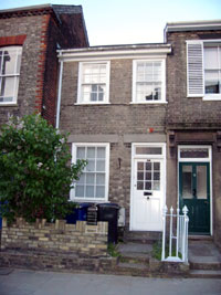
18a Crown Street in 2011
|
|
blank |
In March 1946, at the age of 78, Rose Mead, the well known Bury artist, was found dead at the foot of her stairs in her studio at 18a Crown Street, in Bury St Edmunds. By now she was actually living at St Edmunds Hotel on the Angel Hill. By the 1940's she led a secluded life, but her reputation as Bury's best loved artist has grown stronger over the rest of the century. Born in 1867, she had begun an international career in art, but family responsibilities were to tie her to Bury to nurse her mother in 1897. She never married and took up a feminist stance, often counselling female aspiring artists to seek fulfillment in a career, rather than in marriage. Many of her works were sold through Harold Jarman's photography shop at 16 Abbeygate Street, but she was also capable of falling out with him over artistic disagreements. A collection of her work is owned by the St Edmundsbury Borough Council.
|
|
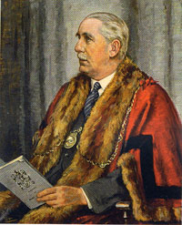
E L D Lake, "The Major"
|
|
blank |
Major E L D Lake also died in the spring of 1946. He had been Mayor of Bury for 9 terms of office, 6 of them during the War. He had run Greene King Brewery for over 25 years, and he had brought both town and brewery through the Second World War, and his death stunned the town and the firm. He was replaced at Greene King by a three man team of joint managing directors, of Colonel Oliver, the Head Brewer, Charles Wilson, Properties and Land, and John Clarke, Business manager and Accounts. Government restrictions continued, and production was curtailed until 1948.
Major Lake's twin sister, Miss Muriel Dewe Lake had stood as Mayoress to the Major, and had worked tirelessly throughout the war. In July, 1946 she was elected an Honourary Freeman of the Borough of Bury St Edmunds in recognition of her war work.
In March 1946 Winston Churchill referred to an iron curtain descending across the continent. The cold war began because of the struggle for control of the politics of the eastern european nations between the Soviet Union and the western democracies.
Westley Airfield was officially de-requisitioned in March 1946, and by May a new venture was being considered by East Anglian Flying Services to establish an air taxi business and flying school at Westley. There was local opposition and the idea fizzled out.
In August 1946 the Women's Timber Corps was finally disbanded, having kept the country's timber supplies going since 1942. Many women continued with jobs in the Forestry Commission after this time.
Many peace celebrations were held in 1946 both to give time to organise them, and to wait for the better weather. In addition it took many months for Far-East prisoners of war to return.
|
|
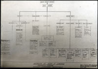
Surveyor's Department proposed staffing
|
|
blank |
In order to carry out the works required around Bury St Edmunds, the council needed sufficient qualified staff to design and manage the work. This diagram shows the new staffing structure proposed by the Borough Engineer and Surveyor.
The Education Act of 1944 did not come into force until 1946.
Thus in 1946 the Bury St Edmunds Borough Council lost its elementary education powers when the West Suffolk County Council Education Committee was established by law. On August 1st 1946 the King Edward VI Grammar School in Bury was taken into the state funded sector as a voluntary controlled school. Financial pressures had increased as demands grew ever greater for the provision of universal education, regardless of means.
The harvest of 1946 was a wet and muddy affair. Many women of the Land Army were needed to remain to help out, despite the end of hostilities.
In Britain The Save Europe Fund was set up. "What will winter be like in Europe this year?" was their slogan. Food parcels were sent to Germany including the eastern zone under the Russians. Letters and parcels ceased when the Russians clamped down.
|
|
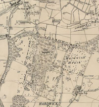
POW Camp on Hardwick Heath
|
|
blank |
By September, 1946 there were still 386,000 German POW's in the UK working on the land and on reconstruction projects. They were paid the going rate for the job. The rule was enforced of "No Fraternising" even in church. One such camp was Camp number 260 at Hardwick Heath with about 64 huts. It was said to have contained Italian prisoners at first, following the victories in north Africa. As the war progressed there were more Germans captured. Parties of prisoners were collected by local farmers to work on the land, and Borough Council accounts show that some of the roads for the new Mildenhall Road estate were built by prisoners of war. A dozen or so POWs were regularly delivered for duties at Gibralter Barracks, where they worked in the messes, cookhouse, Quartermaster's Stores, and did odd jobs such as woodcutting and gardening. There were also camps at Mildenhall, Brandon, at Acton, near Sudbury and another at Botesdale. The German prisoners at Hardwick Heath had their own newsletter called "Lagerecho", which continued to be produced up to February 1948.
As well as the German POWs, there were large numbers of foreign troops who had fought alongside British forces, and now needed to be returned home. One particular group did not wish to return, and these were people whose homes were now under Soviet occupation or control. The Polish were particularly fearful of returning, particularly as Stalin had already deported a million Poles to Siberia during the years since annexation of eastern Poland under the Ribbentrop and Molotov Pact of late 1939. In addition, there were rumours about the Katyn massacre, which was a series of mass executions of Polish nationals carried out by the People's Commissariat for Internal Affairs (NKVD), the Soviet secret police, in April and May 1940. Some 250,000 Poles therefore chose to remain in Britain and were eventually joined by their families and dependents from wherever the war had left them. The only way such numbers could be accommodated was by placing them in camps recently vacated by the British armed forces or by the Americans. A Polish Resettlement Corps (PRC) was raised in 1946 as a corps of the British Army into which Poles were enlisted for the period of their demobilization up to 1948.
Where camps were housing Polish Families they were administered by a number of organisations including the National Assistance Board, Local Authorities and the National Service Hostels Corporation. One such camp in our area was Weeting Hall, just ouside Brandon, lasting from 1949 to 1955. By 1953 there were still 47 families in residence. There is also evidence that Rougham Camp housed Polish personnel in 1947, and there may have been Polish troops at Fornham Park camp in 1946 and/or 1947. Zosia Biegus of website "www.polishresettlementcampsintheuk.co.uk," informs me that, "I believe that Rougham Camp was used as short term accommodation for Poles who had chosen to return to Poland after the war."
|
|
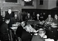
Alderman Bright on shortages
|
|
blank |
All through 1946 the Bury St Edmunds Borough Council began to build the first of many new streets of houses on the Mildenhall Road Council Estate. The layout and house types were designed by a local firm of architects called Mitchell and Weston. Despite their best efforts, by December 31st 1946 only 22 houses would be completed, and shortages of materials were part of the problem. Here is Alderman Bright standing in a council meeting in the Guildhall in late 1946, to say "We know that the shortages are very real; pipes ordered last March are now needed to complete some of our houses, but they may not be available until next March."
More photographs by the Pictorial Press of this Council Meeting in 1946 can be viewed by clicking here: Council Meeting 1946
Shortages included the ingredients for making plaster. This had the very long lasting effect that whole streets of newly built houses in Mitchell Avenue, Acacia Avenue and the other new roads of the Mildenhall Road Estate had unplastered kitchens until the very end of the 20th century. A few examples still retain this "feature" in 2012. Building the Mildenhall Road Estate would continue until 1960, when over 50 new roads, avenues, closes and streets were finished, and this estate would eventually house 4,000 people.
The winter of 1946/47 was unusually harsh, following a wet and muddy summer. It was a miserable beginning to peacetime.
In December 1946 the fraternisation ban, which had prevented local people from associating with Prisoners of War, was finally lifted. So Christmas Day for many POW's was spent in British homes. The public felt the German POW's had a raw deal and should have been sent home earlier.
The payments previously made to the Borough of Bury St Edmunds by the Guildhall Feoffment trust to reduce the rates burden on the town were ended. They had been paid since 1843, and the final payment was £7.3s.6d.
Since 1933 the library of the Suffolk Institute of Archaeology was found in the Athenaeum. In 1946 it was moved into the School of Art building in the Traverse, in the next room to the Cullum collection of books.
During 1946 the large maltings behind the railway station was sold by Gough's to Peachey, but the name Gough's Maltings lingered on.
To show that traffic was now being taken seriously, there was a one-way system set up in the town of Bury.
In the country, things were naturally slower to get started again after the war, but in 1946 rural West Suffolk had hardly any sewerage, no piped water and little electricity. The rural district councils had to take action.
Before the war there had been little enough good roads, and no industry outside Bury. By 1945, the wartime building of airfields had improved roads, and left large areas of building and hardstandings where once had been agriculture. Gradually, sites at Stanton, Rougham, Chedburgh and Barnham would become used by a variety of size and type of industry.
At Chedburgh Airfield 304 squadron had been equipped with Halifaxes in early 1946 and were used for trunk routes overseas until December, 1946. RAF Chedburgh was now closed in December, 1946. It had been home to 1,600 RAF personnel and 240 WAAFs.
While Chedburgh Airfield stood empty it seems that the buildings of the technical site of the RAF station were taken over by a small farmer called Mr Fred Blower, from Cornwall. He kept dairy cattle in some nissen huts, pigs in the MT Store, chickens in air raid shelters and Aylesbury ducks enjoyed the static water tank.
He also kept hives of bees and lived in the office of the Flare Path Party. Apparently he paid rates but no rent.
Presumably Mr Blower or Blewitt lost his home when the site was sold in 1952, and light engineering gradually moved in to the site.
British Pathe News have a short film about this farmer which can be found here:
The derelict Aerodrome Farm Chedburgh August 1950
For the moment, however, homes in the Thingoe RDC area had no refuse collection service, and less than 5% of the population had piped water. Thingoe RDC had no sewerage at all, and owned just under 400 council houses. Thingoe now bought its first medium sized refuse vehicle in 1946, and acquired offices at number 1, Northgate Street in Bury. Previously it held its council meetings in the Guildhall. Now it could hold committee and council meetings under its own roof overlooking Angel Hill.
|
|
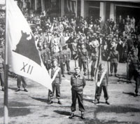
Welcome Home for 2 Suffolk
|
| 1947
|
The second battalion of the Suffolk regiment had remained in India until its partition and independence. The small cadre of the battalion returned to Bury St Edmunds in 1947 to a civic reception. The second battalion was now placed in suspended animation. In practice it was disbanded. Its remaining personnel were transferred to the first battalion and would join it in Greece in 1948.
During 1947 about 15,000 foreign POW's a month were sent home. By the end of 1947 some 24,000 German POW's had stayed on in Britain mainly because they had met local girls, or their homes were in the Soviet zone, and they feared further reprisals.
By 1947 large numbers of Polish fighting men had arrived in England from all parts of the northern hemisphere. Their homeland was under Soviet domination or occupation, and they intended to keep alive the idea of a free Poland, even if it meant living in England until this goal could be achieved. Most had no choice in the matter and became known as "Displaced Persons." Displaced people came from concentration and work camps in Germany. Others, having first been deported by the Russians to Siberia, made their way to England with General Anders’ army through the Middle East, Africa and India.
|
|
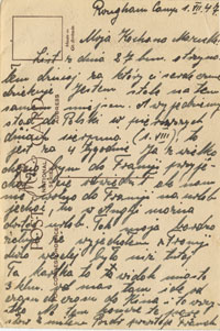
Polish soldiers at Rougham
|
|
blank |
The authorities were already short of accommodation, and groups were dispersed to whatever disused army and air force camps could be found, scattered throughout the UK. Rougham Camp, which had been the home of the 94th Bomb Group USAAF, during the war, was now being used to manage the demobilisation and discharge of Polish soldiers and airmen who wished to return to Poland. Rougham Camp held the unit officially known as the Foreign Despatch Centre. This card is written by a Pole from Rougham Camp. It is dated 1st July, 1947, and seems to confirm the conclusion of Zosia Biegus, that Rougham Camp was used as short term accommodation for Poles who had chosen to return to Poland after the war. The message on the back of the post card refers to that fact and has been kindly translated by Ms Biegus.
"The message reads;-
Rougham Camp 1.vii.47.
My beloved Marzenko!
Today I have received your letter of 8 VII for which I thank you. I am still in the same place. We shall leave here to go to Poland in the first days of August that is in four weeks time. I would love to visit you in France but we are not allowed to go on holiday to France. We can go on holiday here in England, so my dear I very much regret leaving France, life there was much more fun than here. This card is a view of a town 3 kilometres away, from time to time I go there to the cinema. That is everything for now, I end with words of good wishes,
Franek"
For those who wished to stay in the UK, there was usually the formidable issue of the need to learn English and adapt to local ways. On April 1st. 1947 the Committee for the Education of Poles in Great Britain was set up. The committee was responsible for the administration of Polish education at all levels in Great Britain. By 1949 there were 16 nursery schools and 34 primary schools with over 2000 children that resided in National Assistance Board camps and hostels scattered through out the UK. The Committee also concerned itself with adult education, teaching English language to all in the camps who wished to learn, and was active until 1954.
The website
"http://www.polishresettlementcampsintheuk.co.uk/PRC/PRC.htm" lists as many camps as are known. In the eastern region, the military units and their camps are as follows:
- SUFFOLK
- 7 Putk Utenow Lub.--- (7th Regiment of Cavalry ??) --- Livermere Camp, near Bury St Edmunds, Suffolk
- 3 Baon S.K. --- (3rd Battalion ??) --- Freckenham Camp, near Newmarket, Suffolk
- Zgrup. Pol. Ośr. Akadem.--- (Polish academy???)--- Sudbury, Suffolk
- NORFOLK
- 3 Karp. Baon C.K.M. --- (3rd Carpathian Heavy Machine Gun Battalion) --- Riddlesworth Camp & Riddlesworth Hall School nr Thetford, Norfolk
- Gimn. Rolnicze 3 D.S.K. ---(Divisional Agricultural college of 3rd Lancers) --- Bodney Airfield 129 North, Thetford, Norfolk
- Karp. P.A.L. --- (Carpathian Light artillery regiment) --- Quadrilateral Camp 109 nr Thetford, Norfolk
- 3 Karp. P.A.L. --- (3rd Carpathian Regiment of Light Artillery) --- Dixon East Camp, Thetford, Norfolk
- Gimn. i Liceum 3 D.S.K.--- (School and college of 3rd Lancers)--- Bodney Airfield North, Norfolk
- Polish School Centre --- (Same as above? ie Duplicate?)--- Bodney Airfield Camp 190, Thetford, Norfolk
- 13 Dyw. Komp. Zaop --- (13th Supply Company ) --- 21 Shakers Wood Camp, Norfolk
- 3 Karp. Baon Saperów --- (3rd Carpathian Battalion of Sappers) --- London Rd. Camp, Brandon, Norfolk
- Karp. PAL. --- (Carpathian Light Artillery)--- Dixon West Camp, Brandon, Norfolk
- 1 Kom. Sanitarna --- (1st Medical Company)--- Weeting Hall Camp, Brandon, Norfolk
- Karp. P.A.L --- (Carpathian Light Artillery) --- Weeting Hall Camp 108, Brandon, Norfolk
- CAMBRIDGESHIRE
- 2 Baon S.K --- (2nd Battalion SK ???) --- Chippenham South Camp, Cambridgeshire
- 1 Baon S.K. --- (1st Battalion SK ???) --- Chippenham North Camp, Cambridgeshire
During financial year 1946/1947 various contracts for house building were let and started on the Mildenhall Road estate in Bury St Edmunds. These were listed as -
Bury Allied Builders contractor - 30 houses in Mitchell Ave, Trent & Shelley Rds, Dovedale Wlk, Acacia Ave
- R Costain Ltd - 22 "Airey" Houses in Gloucester Road
- Bury St Edmunds Development Co - 50 houses Acacia & Anselm Ave, Bunbury, Conway & Wordsworth Rds
- H Frost by Apprentice Labour - 4 houses - two pairs in Acacia Avenue
"Airey" houses were another type of prefabricated house promoted by the government. These were unlike the earlier bungalows as they had two storeys. They were designed by Sir Edwin Airey for the Ministry of Works Emergency Factory Made housing programme. They had a frame of prefabricated concrete columns reinforced with tubing recycled from the frames of military vehicles. A series of ship-lap style concrete panels formed the outer cladding. (By 2013 half the Gloucester Road site was demolished and redeveloped, and the other half had the houses brick skinned.)
|
|
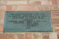
Apprentice Plaque, Acacia Avenue
|
|
blank |
Apprentice houses were erected by boys under the Apprentice Master scheme of the Building Apprenticeship and Training Council set up to promote careers in the construction industry. Harvey Frost was the Apprentice Master, but there were on site instructors to ensure the work was properly carried out. The plaque shown here was placed on numbers 9 and 11, Acacia Avenue, Bury St Edmunds, and is dated 1946, which must have been a start date rather than a finish date. The second pair were at 10 and 12 Acacia Avenue, but the plaque on that pair is dated 1948, which is probably more realistic as a finish date. By 1950 a third pair of apprentice built homes would be completed at 2 and 4 Avondale Walk, just off Acacia Avenue, in Bury St Edmunds.
In October 1947 the Bury Borough Council began to build its own first 16 houses in Mitchell Avenue by Direct Labour. The council had just set up its own Direct Labour Organisation or DLO to hasten its progress in constructing homes when contractors were in short supply, or fully occupied.
Due to its variation of design, available with a flat or pitched roof, and with variations for rural or urban sites the Airey House became one of the most prolific of the factory built permanent designs. Thingoe RDC would take Airey Houses for many of its village developments. Small numbers would be built at Depden, Poslingford, Great Barton, Risby, Bardwell, Barrow, Rede, Ixworth and Barningham, and Fornham St Genevieve. Some of these would be demolished for site redevelopment by 2013, but many have been transformed by the addition of a brick outer skin.
|
|
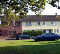
Unity houses
|
|
blank |
Like the Airey houses, another form of Pre-cast reinforced Concrete, (or PRC) dwelling was the Unity House. Unity houses were designed by Frederick Gibberd and Thingoe RDC erected 34 Unity Homes alongside its Airey homes in Fornham St Genevieve. These now have the address of Park Avenue, Fornham All Saints, and a row is shown here. The house on the left shows the effect of "brick skinning" by a private owner. Another 20 Unity homes would be built at Barningham.
Eventually 86 Unity Houses and 16 Unity flats would also be erected in Haverhill by Haverhill UDC. (These Unity homes all survive in 2013, but have all required external insulation and rendering to keep them up to standard, and prevent deterioration.)
During January, Melford Rural District Council had been given authority to take over half of Acton Place Camp for temporary accommodation. As the Germans left, their hutments were frequently to be taken over for this purpose. Nevertheless, many remained stuck in camps, as reported in this extract from the Suffolk Free Press, January 2nd, 1947:
"Prolonged applause greeted the arrival of Lavenham Salvation Army Band to the German P.O.W. camp at Acton for a musical programme which lasted two hours, a crowd of over 400 listened attentively and the singing was hearty, a cornet solo by Bandsman Bert Alderton who until recently was a P.O.W. in Japan also a flute solo by Eric Walker who is only a lad, two songs by the German P.O.W. ‘s choir was much appreciated."
Bury St Edmunds officially adopted RAF Honington in recognition of its valuable work during the war, and its close relations with the town.
The opening winter of 1947 continued to be very bad. Heavy snow blocked the roads, including the notorious Chedburgh Straight, where snow lay many feet thick through February. Electricity cuts were frequent and severe, affecting industry as well as homes. Greene King only brewed once a week in February, just to keep the yeast alive. Worse would follow when the snow melted.
|
|
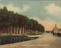
Lakenheath village pond
|
|
blank |
In March, 1947 occurred the last great flooding of the Fens. Dykes were breached all across the Fenlands from Suffolk to Lincolnshire. Some 3000 acres
of Lakenheath Fen were inundated and the floodwaters reached to the edge of the
village. The Womens Land Army was still in operation, and the Lakenheath hostel, being situated at a low point at the north end of
the High Street, was flooded - including the dormitories, the water being right
across the road. The dressing tables from the cubicles were moved out before the
water level rose but the bunks and wardrobes had to be left in. The W.L.A. girls
were evacuated to a large house at Risby and elsewhere until the floods
receded.
RAF Mildenhall was mobilised to help rescue the flood victims. The worst day was 16th March, when 110 flood victims were collected by RAF Mildenhall transport and given temporary accomodation on the base. Mobile searchlights were deployed along with wood tracking to lay on sodden earth, and teams sent out to known danger spots. On 21st March the base used an Auster aeroplne to view the flood situation from the air. Some 44 NCOs and men were then deployed to Lakenheath Lode on 22nd March to help with heavy flood relief work. On 23rd March, another party of 28 volunteers and 36 former POWs went to help at Southery Pumping Station. Flooding was less bad during April, but RAF Mildenhall continued to supply lighting equipment to allow night working to help restore the damage.
This widespread destruction led to serious discussions of how to intercept run-off from inland rivers and divert it around the Fens. The idea of a Cut-Off Channel from Barton Mills to Denver Sluice was to be the outcome of these discussions.
Other incidents reported in the Suffolk Free Press were:
March 16th - "The blizzard last week disorganised local bus services in the Sudbury district in spite of gangs of men including German P.O.W’s working on the roads. In the Hitcham district roads were blocked for several days, drifts of up to 10 feet were reported."
March 27th - "One of the worst floods in living memory cut off the Ballingdon area of Sudbury, rising water from the river Stour was the cause. "
The war had been over for nearly two years, but there were many issues still being sorted out in its aftermath. On 6 May 1947, Lieut.-Colonel Geoffrey Clifton-Brown MP, stood up in the House of Commons and asked the Secretary of State for War, "why it has become necessary to recondition and re-equip Fornham Park Camp, Bury St. Edmund's, which has stood derelict for 18 months; what will be the cost of this work; and if there is no barrack or permanent camp more suitable for peace-time military occupation."
Mr. Bellenger replied that, " Fornham Park Camp, Bury St. Edmunds is being reconditioned and re-equipped to accommodate a regiment returning from overseas. The camp was evacuated approximately six months ago by Polish Forces when it was certainly not in a derelict condition. The cost of the work being carried out is estimated at £700, and there is no more suitable barrack or permanent camp available at present for the purpose for which it is required."
Lieut.-Colonel Clifton-Brown had been the MP for Bury St Edmunds since 5th July, 1945. He did not agree with the Secretary of State's answer. "Could the Minister look again at his answer, because no Polish troops had been there until six weeks ago? In fact, Polish troops in a neighbouring camp were given permission to go and take the stuff out of this camp with the result that the camp is empty. Is it the policy of the Government to allow one part of the Service to take it somewhere else so that money has to be spent to take it back again?"
Mr. Bellenger replied, " No, Sir, we do not give that permission to the Polish troops, but, as the hon. and gallant Gentleman will know, sometimes they do not wait for permission."
Another ex-military MP joined in. Major Legge-Bourke, "Will the right hon. Gentleman bear in mind that general negligence in regard to empty camps only leads to looting and destruction of very valuable equipment?"
Mr. Bellenger replied, "No, Sir, that charge of general negligence is unfounded. The fact is that I have not the large number of troops necessary to guard these empty camps."
|
|
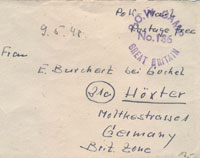
POW letter from Camp 186
|
|
blank |
In the event, it seems that the new purpose of Fornham Park was not to house a returning regiment, but it was used to hold German POWs who were awaiting repatriation to Germany. Berechurch Hall POW Camp in Colchester had been designated as Camp 186 since its opening in September, 1944 to hold prisoners taken in the Invasion of France after D-Day. During 1947, Berechurch Hall Camp was closed, and the designation of Camp 186 was transferred to the newly re-furbished Fornham Park Base Camp. It seems likely that some of the inmates of Berechurch Hall were moved to Fornham Park at this time. One piece of evidence for this is the career of the following German Officer, posted on the internet at Axis History Forum :-
"SS Hauptsturmführer Franz Schwinghammer
Born 7th March 1911 in Innsbruck, Austria, died 11th September 1986 in Innsbruck, Austria.
After the war POW in Naples, London District Cage, Berechurch Hall (Colchester) and Fornham Park (Bury St. Edmunds). POW 209166. Returned to Austria in 1948. "
|
|

POW envelope reverse
|
|
blank |
There also survive a few envelopes preserved by German POW families, which originated from Fornham Park. One was for sale on Ebay in May, 2009, dated December 1947. Another was dated in pencil 9/5/48, addressed to E Burchert Hoxter in Germany. Postmark is POW Camp No. 186 Great Britain. Inked in message is "POW Mail Postage Free".
On the back it gives a sender's address as, "Burchert 186 POW camp Fornham Park nr Bury St Edmunds Suffolk GB"
The envelope is opened but the letter is missing. This item was sold on Ebay in Feb 2009.
In addition, there is the eye-witness report of one Richard Ashton, the son of the newly appointed Camp Commandant to confirm that Fornham Park became Camp 186.
"Father's final posting was just outside Bury St. Edmunds, in the East Anglian county of Suffolk. Fornham Park was a large country house with extensive grounds, and he and mother had their quarters in a portion of the house, the rest of which was occupied with all of the offices associated with a military unit, rather like a colonial era Government House. He had the dubious honour of commanding the last prisoner of war camp in England to close, one that was high security, and which had a large garrison of soldiers to ensure the security.
Now for the conflicting info. I have seen online two different locations for 186 Base Camp.
I can assure you when dad commanded it, it was at Fornham Park, a couple of miles north of Bury St. Edmunds in Suffolk. He retired from there.
As a child I remember during school holidays (while staying there) being sneaked into the soldiers' movie theatre, run by the Army Kinema Corporation, and the film being shown was 'Of Mice and Men', hardly appropriate, but I don't remember any detail of the film. This would undoubtedly have been another Nissen Hut, and thinking back they had two projectors in a make-shift 'bio-box' like a real cinema, and were thus able to do reel changeovers on the run.
It was rumored that Rudolph Hess, one of Adolf Hitler's aides-de-camp, was detained at what was eventually father's camp at Fornham, after his capture in Scotland, and the Allies not entering into the negotiated peace he appeared to have parachuted in to arrange. Hess's whereabouts were never actually divulged, so this is all pure speculation. Father would have known if he were an inmate there, but would never have divulged it.
Interestingly, visiting the U.K. briefly during 1990, I discovered that Fornham Park appeared to be deserted, either still, or again, with no sign of habitation in the house, and the grounds apparently being vacant too. Many wartime military conversions of stately homes resulted in an enormous cost to return them to a usable condition, so perhaps Fornham had never seen civilian use since about 1948 when no.186 Base Camp closed."
|
|
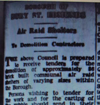
Tenders for shelter demolition 1947
|
|
blank |
In August 1947 the Bury St Edmunds Borough Council advertised for contractors to tender for the demolition of 86(?) brick built communal air raid shelters within the town. Tenders had to be approved by the Home Office before the Council could accept them.
The summer of 1947, in contrast to the floods of March, was very hot. It was also dry because restrictions by government, and shortage of supplies meant that Greene King could not produce enough beer to meet demand. Greene King pubs in Haverhill were closed for three days a week.
Despite problems with production, the new managers at Greene King knew that they had finished the war with old and outdated equipment throughout the brewery, except for their magnificent brewhouse of 1939. From 1946 to 1947 the Rink Maltings on Westgate Street was fitted with four brand new Malting Drums, designed by the brewery maltster, and built by the Bury engineering firm of Robert Boby's. The old malting floor system had needed a large input of skilled men to turn the grain, and they were no longer available.
The payment of tithe redemption instalments was still being exacted from owner occupiers of farmland, and arrears from before the war were still pursued in the courts by the Tithe Commission. Mr A G Mobbs of Beccles was in court threatened with prison at Lowestoft County Court in 1947. Although willing to go to jail, the judge sent him home, still owing the debt. He was still fighting the Tithe every year up to its abolition in 1977.
|
|
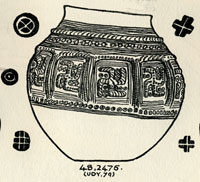
Lackford Cremation Urn & potmarks
|
|
blank |
T C Lethbridge was the Excavator for the Cambridge Antiquarian Society from 1925 to 1956, carrying out field-work and excavations in Cambridgeshire and Suffolk. In 1947 he excavated a pagan Saxon cemetery at Mill Heath, Lackford, which was in danger of further destruction from being newly ploughed. The site is above the 50 foot contour on a peninsula of land between the south bank of the River Lark and a the Cavenham mill stream. He found between 400 and 500 cremation urns, a concentration which is unusual for the Lark Valley, where earth burials, or inhumations, are more prevalent. There were swastikas present upon a number of cremation urns, and the Anglo-Saxon cemetery at Lackford has yielded some of the most exquisite designs of this image.
These urns were also important because they led in some cases to the identification of individual potters. For some years a potter identified as the Illington/Lackford potter (Myres 1977) has been known to have working during the late-sixth century somewhere along the west Norfolk/west Suffolk borders. His output was cinerary urns of a number of standard types decorated in two or three routine styles. Decoration was stamped on to the vessels while they were still damp. One of these stamps has been found and it was made out of a red-deer antler and bore a cross die. Stamps frequently used by the potter, or potters, were a cross-in-circle, a St Andrew’s cross and a concentric circle with a blob centre. Decoration in the main was restricted to pots used as cinerary urns. Distribution of the products was roughly within a radius of some thirty miles centred on Lackford with one outlying example some eighteen miles further on at Castle Acre in Norfolk.
|
|
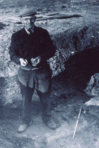 Basil Brown at West Stow 1947
 |
|
blank |
In 1947 Basil Brown returned to the site he had discovered on West Stow Heath to excavate the Romano-British pottery kilns. He was joined here by Stanley West, who was working as an assistant at Ipswich Museum, where Brown was based. This picture shows Basil Brown in 1947, in the process of excavating one of the Roman kilns that he had found here in 1940-1942.
Early Anglo-Saxon potsherds were evident in rabbit scrapes all over the knoll. At what turned out to be the north east corner of the settlement site, a sand pit was being dug for building material. This sand pit revealed sections of Anglo-Saxon buildings, and was the first evidence of the existence of a settlement here.
Meanwhile the West Stow sewage farm to the south of the site was having problems. It dealt with all the foul and waste water from Bury St Edmunds.
Consultants were asked to advise on restructuring the sewage farm as it had suffered continuously from smells and operational problems. Progress was slow and difficult. By 1951 it would be decided to abandon these works and open a new Sewage Works elsewhere.
Across the country gas works were nationalised during 1947, and the production of town gas in Haverhill was soon halted. The fuel office still operated in the Council Offices at Swan Lane, Haverhill, as petrol and paraffin was still on ration.
The West Suffolk County council now needed more office space and in 1947 acquired the Manor House on Honey Hill, built by the First Earl of Bristol in 1736-8. It had left the Hervey family in the 1780's, and it had been owned by Walter Guinness, Lord Moyne from 1908 to 1933. Now it was ignominiously turned into office space.
In September, 1947, one of Bury's more pleasant institutions first opened its doors to members. This was the Farmers' Club, located then, as now, at number 10, Northgate Street. The club had been the idea of K J Underwood, but he soon found that F W Barker, chairman of the local branch of the NFU had similar ideas, so a joint meeting had been held to sound out prospective members in May of 1947. At first it was to be called the Town and Country Club, to emphasise the links between market town and agriculture, but the current name was soon settled upon. The premises had been the Judges Residence, retained by the West Suffolk County Council for this purpose, but by this time a new Judges House was found in Great Barton. The club bought these premises for £4,500.
On 20th September, RAF Mildenhall held another Battle of Britain Memorial Open Day.
In these post war years emigration to the colonies such as Australia, New Zealand and Canada came to be increasingly attractive to many people, particularly ex-servicemen. Sybil Andrews and her husband decided that a better life could be found in Canada, and emigrated in 1947. She would never return to her home town of Bury, and had only been a visitor since 1922. Since 1951, working in Canada, she has obtained international recognition as an artist of merit. Most of her work is today in the Glenbow Museum in Calgary, Alberta, but a few pieces were donated to the Bury Museums Service.
Also in Bury a bus station was built next to Moyse's Hall, on the site of today's Macdonalds restaurant. Buses still stopped on the Cornhill for town services, opposite Market Thoroughfare.
Through 1947 the Suffolk Free Press reported various incidents involving German POWs, who were awaiting repatriation.
August - "The Suffolk Football Association have ruled that German P.O.W.’s may not play for civilian clubs in the league games but games between civilians and P.O.W.’s may take place with the consent of the camp commandant and no admission charges may be made."
October16th - "German P.O.W.’s from Halstead, Borley and Liston almost filled the public section of Sudbury Town Council on Tuesday night to watch how Local Government conducted their affairs."
During October, five German P.O.W.,s were fined 10s each for distilling spirits without a license at Tendering Hall Camp at Stoke by Nayland.
In December 1947, the Suffolk Free Press reported that, "In recognition of his bravery in rescuing a Lawshall man from an attack by a bull, a German P.O.W. Godfrey Dappert of No 260 P.O.W. Camp, Hardwick has received an illuminated address from the Carnegie Trust and a watch suitably inscribed, the presentation was made by Brigadier J.Slater O.B.E., Deputy Commander of the East Anglian District at a ceremony on Hardwick Heath."
|
|

Red Squirrel common in 1947
|
|
blank |
Up to 1947 Suffolk enjoyed a good population of red squirrels.
During 1947 the first reliable record was made of the grey squirrel arriving in Suffolk. It increased in abundance over the next five years, and by the 1970s it would become endemic and common. At the same time the red squirrel was to decrease to extinction in Suffolk by the 1990s. The grey squirrels were stronger competitors than the red, and also carried a disease which was fatal to the native red squirrel.
|
| 1948
|
The Town and Country Planning Act 1947 was one of many radical Acts of Parliament passed by the post-war Labour government. It came into effect on 1 July 1948, and was the foundation of modern town and country planning in England and Wales. The most fundamental requirement of the legislation was to establish that planning permission was required for land development; ownership alone no longer conferred the right to develop the land. To control this, the Act reorganised the planning system from the 1,400 existing planning authorities to 145, and required them all to prepare a comprehensive development plan. West Suffolk County Council was the new local planning authority, and had to submit a West Suffolk Plan by June 1951, along with town plans for Bury St Edmunds and other major towns in Suffolk.
In 1947, Bury St Edmunds was keen to redevelop the town, and it was possible that it would be designated a London overspill town. As well as developing a new council housing estate off the Mildenhall Road, there were ideas to demolish and redevelop parts of the town centre. However, the development proposals caused consternation on a national level, and the council came under pressure to commission an objective, external report on the architecture of the town, in accordance with the guidelines of the Town and Country Planning Act of 1944.
Therefore, the Bury St Edmunds Borough Council had commissioned the Society for the Protection of Ancient Buildings to make a survey of the historic buildings in the town. This was published in 1948, written by J MacGregor and M Sisson, entitled: ‘Bury St Edmunds: A report on the buildings of architectural and historical interest prepared for the corporation of Bury.’ which remains an unpublished report, but a copy is available at the Suffolk Record Office, in the Bury St Edmunds Box File. In 1952 this exercise would result in 300 buildings becoming listed for their historic importance.
Bury St Edmunds Council were pressing on with new contracts for houses on the Mildenhall Road Estate. Contracts let in 1948 were as follows: -
Harvey Frost - 2 "Apprentice" houses in Avondale Walk
- Direct Labour - 20 houses in Gloucester Rd & Baldwin Ave
- LCJ Sewell and Sons - 28 houses in Prince Charles Avenue
- Direct Labour - 8 houses in Mitchell Ave
-
Direct Labour - 4 houses in Prince Charles Ave
- Direct Labour - 8 houses in Gloucester Rd and Prince Charles Ave
- GW & HC Knights - 32 houses in Acacia & Anselm Avs, Avondale Wlk, Mitchell Ave, Waveney & Wordsworth Rds
- Direct Labour -
18 houses in Gloucester, Trent & Severn Rds
- GW & HC Knights - 36 houses in Acacia & Mitchell Avs, Bunbury & Gloucester Rds, Severn Rd
The National Health Service was created in 1948 and the resulting Ministry of Health was deemed to be too large to function efficiently. Its environmental functions were split off to form the Ministry of Housing and Local Government. In Bury, the Public Assistance Institution would become St Mary's Hospital for Geriatric Care.
Hospitals such as the West Suffolk Hospital in Hospital Road, Bury, now became taken over by the new NHS.
The LNER and all other railway companies, were nationalised to became under the British Railways Board. Rail closures had been carried out by the old companies in the 1930's as motor vehicles spread and became more popular. The war had halted these closures, and recovery needed them for a time. However, the march of the motor car would continue in the 1950's.
Similarly, on 1st April, the electricity supply industry was also taken into public ownership, following the Electricity Act of 1947. The Eastern Electricity Board took over local suppliers like the East Anglian Electric Supply Company, the Newmarket Electric Light Company, and the Ipswich Corporation electricity undertaking. The Bury St Edmunds Corporation had already sold out its own electricity business to the East Anglian Supply Company before the war.
Work was in hand to bring electricity to the countryside. Chevington got mains electricity in 1947 and 1948, making the villagers' paraffin lamps redundant. However, the electric light bulb did not give off the heat of a paraffin lamp, so some people had to spend more on heating.
In 1948, a start was made on the Parkway Estate in Haverhill, and the first twelve houses were built in Park Avenue.
At Greene King's Brewery, the new maltings had ample capacity for the brewery's needs. The barley store on Sparhawk Street was now inadequate. Farm mechanisation meant that the new combine harvesters could take the harvest within six weeks. Previously the delivery of barley had spread over a six month period when the stooks were slowly and laboriously threshed by steam threshing units. So the old Foundry Maltings were converted to a second grain store.
The Soviet Union blockaded all surface transport into West Berlin in June 1948. In July 1948 RAF Lakenheath came to life again, having been deactivated by the RAF in May 1944. The USAF flew in B29's of 2nd Bomb Group to help in the Berlin airlift, and the Americans stayed on. Transports and tankers followed and in 1951 93rd Bomb Group flew B50's from the base. Giant B36's and Globemasters followed.
RAF Honington proved vital to the Berlin airlift by supplying aircraft parts and maintenance facilities from June 1948 to the end of the blockade in September 1949. These efforts did a great deal to reconcile the RAF and USAF with the people of Western Germany who they had been bombing until 1945.
At RAF Mildenhall, the No 3 Group Major Servicing Unit was disbanded in July. The runways and perimeter tracks were resurfaced to take No 230 Operational Conversion Unit. However, the use of next door Lakenheath by heavy American bombers caused this idea to be shelved. In December the base was used as temporary accomodation for Nos 35, 115, 149 and 207 Squadrons from RAF Stradishall.
John T Appleby's book "Suffolk Summer" was published. The author gave the copyright to the Borough Council of Bury St Edmunds. All royalties would be used to maintain the Old English Rose Garden in the Abbey Gardens as a permanent memorial to those American servicemen who gave their lives in the cause of freedom. It was officially named the Appleby Rose garden, and is still maintained in good order to the south of the main central beds and the bowling green.
In 1948 there were excavations carried out in the chancel of the abbey church by the Borough Council, and a short note was published by H J M Maltby, as ‘Excavations of the Abbey Ruins’, PSIA xxiv, Part iii. The dig began on 13th December, 1948, under Mr Maltby, the Curator of Moyse's Hall Museum, and Mr Goldsmith, the Council's Borough Engineer and Surveyor. They established that the remains of the crypt were still present, and finds included some mouldings and painted plasterwork. Unfortunately the fine plasterwork and traces of original tempera wall paintings noted by Maltby, had long since vanished by 2013.
Incidentally, the 1948 edition of the Proceedings of the Suffolk Institute of Archaeology and Natural History, (PSIAA) just mentioned, was the Society's centenary issue, having been founded in 1848. It also contained a description of the Mildenhall Treasure, first made public in June, 1946.
|
|
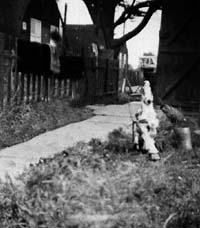
POW Camp or home?
|
|
blank |
By November 1948, the last German POW's were sent home, of those who wished to go. Some stayed because their homes were now within the Soviet bloc. Others found local jobs or local girls. The Lagerecho newsletter of the German prisoners at Hardwick Heath, had already had its final issue in February 1948.
At Hardwick Heath, the huts which had housed POW's were now pressed into service as temporary housing while families were waiting for one of the new houses on the Mildenhall Road Estate. Many of these were ex-servicemen with new wives and babies. Families who were prepared to go into the Hardwick Heath huts were given first choice of a new house on the Mildenhall Road Estate as these were slowly completed.
|
|
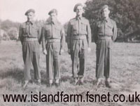
Repatriation escort party at Fornham Park May 1948
|
|
blank |
Fornham Park had been an army camp during the war, but had been abandoned in 1945. In 1947 it was refurbished as a transit camp, designated Base Camp 186, for the repatriation of Prisoners of War.
This picture, taken from www.islandfarm.fsnet.co.uk web site, shows a group of four soldiers taken at Fornham Park waiting to escort and repatriate some high ranking German prisoners back to Germany. It appears that this picture relates to a Repatriation Party of 76 German Prisoners who left Island Farm Special POW Camp 11 at Bridgend, in Wales on 12th May, 1948. They were reported to be Generals, Admirals and Luftwaffe chiefs, in the Welsh newspapers. Island Farm Camp had been a special camp for holding high ranking German Officers since 1944. This particular group of released men apparently passed through Fornham Park as their last transit camp prior to joining the SS Biarritz at Harwich for the journey home.
Fornham Park Camp closed down later in 1948. Its last commandant was Lieutenant-Colonel John Forbes Ashton, of the Border Regiment. He and his wife then retired to a cottage at Beyton.
Also closed down was the Infantry Training Centre in Bury St Edmunds, located at Blenheim Camp. The lecture hall and camp cinema had closed already, and Arthur Boreham described how the only men left were those regulars who still had time to serve out their engagements. Orders came in April 1948 for the closure. The training work of the number 12 Primary Training Centre, as it had been re-designated in 1946, was to be transferred to Colchester. Apart from three huts and the Sergeants mess the rest was closed up. The remains of the camp was now officially handed back to the Suffolk Regiment Depot at Gibralter Barracks. In 1951 infantry recruit training would be returned to the regimental depots, and Gibralter Barracks would resume its traditional role.
|
|
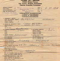
Polish demob at Rougham Camp
|
|
blank |
Many Polish soldiers, displaced persons and their families, were still living in temporary accommodation, and wondering about their future. The remainder of Polish soldiers still in uniform were demobilised in 1948. The Foreign Despatch Centre at Rougham Camp was still issuing discharge papers to enlisted Polish soldiers who, unlike many of their contemporaries, wished to return to Poland. Here we see the Honourable Discharge of Bombardier Lance Corporal Wladyslaw Blazkow on 6th October, 1948. Blazkow had survived Stalin's deportation, along with thousands of others, from Eastern Poland, ( Kresy), to Siberia. He had then enlisted in 1942, and fought for the Allies, earning the Italy Star, among others. His discharge paper lists his medals.
The Borough Council at Bury St Edmunds now decided to buy its own stock of library books instead of hiring county books. Moyse's Hall Museum acquired a copy of the Bury Chronicles from the Creation up to 1283. It was Lot 22 in Sotheby's Sale of February 9th 1948.
During 1948 there was a redistribution of Suffolk's parliamentary seats. Since 1918 the County of West Suffolk had two constituencies, called Bury St Edmunds and Sudbury, dividing West Suffolk in the middle by an east to west boundary. Despite protests, West Suffolk was abolished as a parliamentary county, and was replaced by Suffolk as a whole. Bury St Edmunds constituency was enlarged to take in about half of the old Sudbury constituency. The remainder of the old Sudbury area was merged with the Woodbridge constituency to make "Sudbury and Woodbridge".
Colonel Clifton-Brown continued to represent the enlarged Bury constituency until standing down in 1950.
|
| 1949 |
By February 1949 the four squadrons of Lancasters from Stradishall had all arrived at RAF Mildenhall. RAF Stradishall was now able to carry out major runway repairs and improvements. In August these four squadrons converted to Lincolns. However the Lincoln was already out of date and by March 1950 these squadrons would be disbanded. Personnel would be sent to RAF Marham.
In April 1949 the North Atlantic Treaty was signed which committed the USA to defend Europe against Soviet attack. This was one reason for the location of US Airforce bases on East Anglian soil in the next few years.
Gradually there was a massive build up of an airlift of supplies into Berlin through until September 1949, although the blockade was officially lifted in May 1949.
|
|
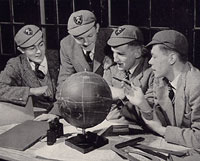
Bury Grammar School |
|
blank |
In April 1949, the American periodical "The National Geographic Magazine" was devoted to The British Way, a series of looks at life in post war Britain and the contribution of Britain to the arts, medicine and science. It included this picture of prefects at the King Edward VI Grammar School in Bury, studying a world globe. It referred to the fact that John Winthrop the younger studied at the school and was eventually to become a colonial governor of Connecticut.
From the left the boys are Terry Blumfield, Richard Burgess-Watson, Graham G Marshall, and John M Ross. The picture was taken in the upstairs dining room of the boarding house in 1948.
Elsewhere in the same article it was stated that "Though England is on a near privation diet, nothing seems to damp the spirits of the young. They even make a joke of the restrictions to show that they can 'carry on' whatever happens."
In July 1949 the RAF station at Stradishall became Number 203 Advanced Flying School for Meteors, a few Spitfires, Vampires and Harvards into the 1950's. Number 203 became redesignated 226 Operational Conversion Unit but continued to fly many types of aircraft until 1955.
Also in July 1949 the West Suffolk County Council had its Development Plan for Primary and Secondary Education approved by the Minister of Education. The Education Act of 1944 had introduced full time education for all children between five and fifteen years old. There would be an examination at age 11, called the Eleven Plus, to determine which children could go to the Grammar Schools, and who should go to the newly introduced Secondary Modern Schools. This Act came into force in Suffolk in 1946.
Under the 1944 Education Act, the town of Bury St Edmunds ceased to be the Education Authority for elementary education. Education was now to be a three tier process, namely the primary schools, the secondary schools, and the Further Education sector, all provided locally by West Suffolk County Council. The 1949 Plan provided for the closure of all the existing Infant Schools. In Bury those to close were the Eastgate Controlled Voluntary, St John's Aided Voluntary, St Mary's Controlled Voluntary and Victoria Controlled Voluntary. The Guildhall Feoffment Junior County School was also earmarked for closure.
The new list of Primary Schools in Bury was to be:
- The new Tollgate County Primary, construction ready to start.
- Eastgate Junior and Infants
- Southgate Green area proposed school
- Westgate area and Priors Estate
- St Edmundsbury Juniors
- Roman Catholic School
Secondary Education would continue to be provided by the following:
- Silver Jubilee Boys' Modern Secondary School, as modernised
- Silver Jubilee Girls' Modern Secondary School, as modernised
- King Edward VI Grammar School, enlarged to give two form entry
- Bury St Edmunds County Grammar School, to be re-organised from mixed sex to a two form entry girls' school
- Some free places to be provided at Culford School from April 1950
Further Education needs were to be met by a further report to be submitted to the Minister.
During 1949 work continued on the building of the Mildenhall Road Council Housing Estate. New contracts were approved to be built as follows:-
- Direct Labour - 12 Houses at Baldwin Avenue and Curtis Road
- Direct Labour - 20 Houses at Philip Road and Gloucester Road
- Direct labour - 24 three storey flats at Birch House, Willow House, Curtis Road
- GW & HC Knights - 10 houses at Gloucester and Severn Roads, and Acacia Avenue
The Berlin airlift ended in September 1949, and the renewed fears of war aroused by this crisis faded a little.
By 1949 over 2,000 acres of Lakenheath Fen was carrying crops of wheat, barley, potatoes, sugar beet, chicory and
market garden crops - largely thanks to the hard work of the Womens Land Army. This work was still at the mercy of floods, as had happened in 1947.
So, following the floods of 1947, there was a review of water control in the South Level of the Fens. This led to the Great Ouse River Flood Protection Act of 1949. This Act authorised extensive new works of drainage. The most significant was the plan to dig a cut-Off channel from the River Lark at Barton Mills up to the Denver Sluice. This would not be completed until 1964.
|
|
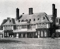
Cavenham Hall
|
|
blank |
The 59 room mansion called Cavenham Hall was demolished in 1949. Cavenham Hall had been built in 1899 as a home at which shooting was the main occupation. It was designed by A N Prentice for H E M Davies, who had grown rich from the proceeds of gold mines in South Africa. Such great houses were no longer viable to run or maintain at this time.
|
|
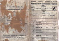
First WSGS race card
|
|
blank |
During late 1949 the brothers Joby and Dougie Dutton planned to open the West Suffolk Greyhound Stadium at the Tayfen Meadow, off Spring Lane in Bury St Edmunds.
It was not a registered dog track with the British Greyhound Racing Board, but was independent of any industry regulations. In other circles such an unlicensed operation was known as a "flapper or flapping track." This allowed any man in the street, with an unregistered greyhound, to enter it in a race and bet on the outcome. Unfortunately this lack of regulation could also lead to some sharp practice, such as entering a "ringer", a dog which was not as described on the race card.
Greyhound racing tracks had started in this country at Belle Vue, Manchester, in 1926, and soon became hugely popular, drawing large crowds. In 1920s London alone there was racing every night at White City, Harringay, Wembley, West Ham, Clapton, Wimbledon or Hackney Wick. By the end of the 1920s, annual attendances totalled 17 million. The famous track at Walthamstow was established in the 1930s, on the site of an existing flapper track. The attractions of dog racing would decline markedly by the 1970s. Even the celebrated Walthamstow stadium would be struggling in its later years, and would close in 2008.
The first race card at Tayfen meadows was run on December 1st 1949. Denny Brothers, the printers established in the adjacent Tayfen Road, were engaged to print the race cards, and continued to do so for the next twenty years. The Tayfen Meadows track finally closed in 1996.
|
|
Brandon Flintknappers |
|
blank |
At Brandon, the firm of Shell made a promotional film on Flintknapping. This was one of a series of short films to illustrate a number of old crafts and trades. There were still three full time flint knappers at work in Brandon making gun flints for muskets. Most of these were sent to West Africa, where such guns were still in use. However, there was also a trade to Ohio in the USA, where flintlock musketry was being revived as a club activity. This short film is now available to view online at the East Anglian Film Archive, by clicking here:
EAFA Crafts and Industries
At Clare the Clare Rural District Council purchased, and moved into, new headquarters at Stone Hall, Clare. The offices of Clare RDC had been located in Haverhill until this time. Stone Hall retained some medieval features, but had been modernised in 1931. It had been a private house for most of its life, but had been used as the Town Institute and Reading Rooms in former years.
Religion still seemed important to people although everybody knew that they would never return to the lives they had known before the war. At Chevington the village chapel was sold by the Congregationalists to the Methodists. The latter had been leasing it since about 1840. Within 10 years the congregation would drop to 8 people, worshipping only once a month.
|
|
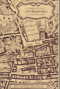
Town Plan for Bury St Edmunds
|
|
1950 |
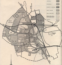
Legislation required the new Planning Authority of West Suffolk County Council to submit Development Plans for the county and for its major towns, by June 1951. This plan for Bury was first drawn up and published in October 1950. It included a survey of existing conditions in the town, together with the proposals to improve the town's infrastructure while balancing the interests of townspeople, industry and commerce.
The survey covered the geography, past history, population, industry, housing shortages, communications, utilities, special local features, openspaces, education, health and welfare. The outline plan covered road proposals, residential land, industrial land, agriculture, commerce, open spaces, and the Cathedral.
For Refuse Disposal, the survey had this to say:
"105. Domestic refuse is collected weekly with the aid of both mechanical and horse drawn transport, and a daily collection is made in the town centre.
106. Since the war there has been more refuse than can be burned in the central destructor near the cattle market and the remainder, together with the cinders from the destructor, has been disposed of by controlled tipping on the Haberden and part of Tayfen."
The electricity supply by now was imported as "Alternating Current at standard pressure and frequency." The imported bulk supply was brought by 33,000 volt overhead power lines from Stowmarket into Raingate Street, where a main transformer station had been built. From here the voltage was reduced to 11,000 volts, and distributed to various sub-stations around the Borough. The town's generating station had been shut down, but the refuse destructor was still operating in the old generating station building off Kings Road.
Most of the town's electric system was now 3 phase 240 volts lighting and 415 volts power. Single phase lines still existed in older parts of the town.
The Plan reviewed the County Council's ministry approved Education Plans for primary and secondary schools. By now the County Plan for Further Education had also received approval, and it was reported that the Bury St Edmunds Technical Institute was to be enlarged by a block of technical rooms for building apprentices, engineering apprentices and commercial day release students. It already had 690 students and 110 building trade apprentices part time.
|
|
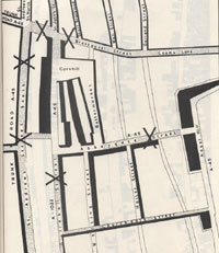
A45 in Abbeygate Street |
|
blank |
The survey described how the A45 Trunk Road at this time serving Ipswich, Bury and Newmarket ran through Bury St Edmunds. From Ipswich Road it ran up Southgate Street, up Maynewater Lane and into Westgate Street. It turned up St Andrews Street South, down Risbygate Street, and out along the Newmarket Road.
However, another through route, designated A45 (non-trunk), ran from Risbygate Street, down Brentgovel Street, across the Cornhill and down Abbeygate Street, across Angel Hill, up Crown Street, down Honey Hill into Sparhawk Street, and thence through St Mary's Square and down Southgate Street. Both routes were two way, and it was no surprise that Abbeygate Street and Brentgovel Street suffered a number of traffic accidents.
|
|
St Andrews Street South encroachment |
|
blank |
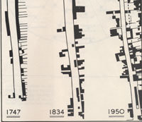
As the plan was being prepared, a new factor was thrown into the consideration when petrol rationing ended. The planners' response to this was to expect a great increase in future road traffic, and to prepare plans to cope with it. Part of this response was a plan to widen St Andrews Street South to accommodate the extra through traffic along the trunk route of the A45. The encroachment of buildings on to the street since 1747 was shown as a justification for "reclaiming" the lost carriageway. The line of dashes on the 1950 diagram shows the extent of the proposed 'reclamation'. This project would never be carried out.
Petrol rationing had been first imposed in September 1939 and its continuation five years after the war ended was a hotly debated issue, especially during the 1950 general election campaign.
The Conservative opposition had argued it was no longer necessary, but the Labour government believed that the nation had a severe dollar shortage and could not afford to buy US supplies.
After the 1950 election, in which Labour's majority was greatly reduced, the government realised the public would no longer tolerate rationing. On May 26th 1950, the government announced that petrol rationing would come to an end. Sweet rationing would continue until February 1953, and sugar rationing would not end until September. The end of all food rationing did not come until 4 July 1954, with meat and bacon the last to go.
At Tayfen Meadow "Greyhound racing has recently been established....and is well patronised by the public." The first race had been run on December 1st, 1949.
|
|
The Outline Town Plan |
|
blank |
The new outline town plan is shown here. The town was divided up into zones, where henceforward it would be difficult to obtain planning permission for functions which were not compatible with the zoning. This all seemed reasonable enough, but would cause distress in some parts of town. In particular, the area from St Johns Place, through Peckham Street, Tayfen Road and much of Long Brackland was shown with horizontal hatching which designated those streets for industrial purposes. This was mainly because of the presence of the gas works, but domestic properties in these areas now became blighted. They would become ineligible for Improvement Grants when these became available, and feared that demolition orders might be forthcoming. This industrial zoning would hang over these properties until the 1970s.
|
|
Plan for Mildenhall Road Estate |
|
blank |
By 1950 many of the contracts let on the Mildenhall Road Estate in Bury were well advanced. However, new contracts were still being let. These did not proceed street by street, but were let in blocks in various streets, so that work was not concentrated in one place, but spread over several separated sites. New contracts were still being let. During 1950 these were:--
Direct Labour - 24 three storey flats at Cedar House, and Maple House in Lake Avenue
- Direct Labour - 18 houses at Severn Road
- Bury St Edmunds Development Co Ltd - 20 Maisonettes at Derwent Road
- GW & HC Knights - 24 houses at Gloucester, Bunbury, Severn and Waveney Roads, and Lake Avenue
- Bury St Edmunds Development Co Ltd - 36 Maisonettes at Tennyson Road and Lake Avenue
- GW & HC Knights - 8 houses at Mitchell Avenue and Waveney Road
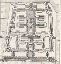
The 1950 Town Plan included this map of the Mildenhall Road Estate which fitted within the 80 acres of land purchased in 1945/1946 by Bury St Edmunds Borough Council from the Fornham Park estate. The estate ended at Baldwin Avenue, where there was room for just one side of the street to be built. This was the even numbered side of the street. Note also that there is no plan for Northumberland Avenue or Lancaster Avenue to be included at this time. These would be later additions which were to become the first stages in the development of the Howard Estate.
In 1950 the international tension leading up to the start of the Korean War in June led to European re-equipping and consideration of the deployment of tactical nuclear weapons.
In March 1950 the four squadrons of Lincoln Bombers based at RAF Mildenhall were disbanded after only a few months of existence. Personnel mostly deployed to RAF Marham for retraining on American purchased B-29 bombers, renamed the Washington bomber by the RAF. The Mildenhall base was made available to meet lend-lease obligations to the USA.
On 12th July RAF Mildenhall was re-formed under Group Captain Thomson, but his job was to hand over the base to the United States Air Force.
In mid-1950 the Americans came to Mildenhall, took it over from the RAF and high security was installed. On 12th July, American staff arrived and on 15th July one squadron of B-50s of 93rd Bomb Group arrived. They stayed until February 1951 when 509th Bomb Group replaced them. The 2nd and 22nd Bomb Group followed in succession, and both B-50s and B-29s operated from Mildenhall in 1950. July 1950 was the height of the Korean War crisis, and the largest ever USAF bomber force was operational in Britain, greater than during WW2.
A serious accident occurred at RAF Mildenhall, on October 10th, when a B-50 bomber crashed on the main runway.
On 15th November the Control Tower at Mildenhall was handed over to the USAF, but base security remained with the RAF Regiment until February 1951.
In 1950 the RAF station at Shepherd's Grove was put on a care and maintenance only footing.
At RAF Honington the 94th Maintenance Unit (MU) arrived in March. Their job was the care and maintenance of the RAF's bombs and weaponry. They were joined by the 58th MU, who recovered and repaired crashed aircraft. Honington was a maintenance facility through until 1956.
The Stanford Battle Area was a source of post-war controversy when its inhabitants were never allowed to return to live there. In 1950 its future was settled when the Ministry of Defence bought it by compulsory purchase for £25.00 an acre. The open market value was said to be £250.00 an acre. No value at all was placed upon the wooded areas because the timber had been damaged by shrapnel and military action during training there.
Another property damaged by army occupation during the war was Fornham Hall and its Park. In March, a thousand lots of the house contents were sold by auction.
|
|

Fornham Park & Estate sale 1950
|
|
blank |
On 25th October, the whole Fornham Park Estate was put up for auction by direction of Captain Duncan Macrae, the son of Lt Colonel John Macrae-Gilstrap. Captain Macrae had been the life tenant of Fornham Hall since 1939, but it had quickly been requisitioned by the army. This sale would end the Gilstrap connection with Fornham Park, which had lasted since 1862. Up for sale were the House and the 224 acres of park surrounding it. The buyer of the Park was a Mr Hurlock of Nacton, and within a year the Hall would be demolished.
In addition to Fornham Park itself, the estate included seven farms, the Old Rectory, school and school house and the Woolpack in Fornham St Martin, cottages, allotment land, meadows and the two park entrance lodges. The total acreage up for sale was 2,400 acres. Lot 42 was an arable field of 46 acres, tenanted by the farmer Mr C Stennett. Lot 41 was the 10 acre Tollgate Farm, tenanted by Mr D Boughton. Together these 56 acres of land were purchased by Bury St Edmunds Borough Council, and were earmarked to become an extension to the Mildenhall Road Council Estate, and would become known as the Howard Estate. (The first contract for 40 new houses would be let in 1952.)
Bury St Edmunds Golf Course had never been officially requisitioned during the war years, but nevertheless it had been used extensively for infantry training by the nearby barracks and West Lines camps. An assault course and rifle range and various excavations and tunnels had to be made good. The War Ministry at first offered £800 in compensation, but the club rejected this amount. In February, 1950, the revised offer of £1,028 was accepted, equivalent to more than a year's subscriptions from club members.
Local government was now starting to enforce basic hygiene requirements. Thingoe RDC surveyed the public houses in their area. In many of them there were earth closets shared by the customers and tenants, male and female. None of the 58 inns had both mains water and mains sewerage. The state of rural housing was much the same.
In 1950 the East Suffolk County Council and the West Suffolk County Council set up their own Record Offices. Martin Statham became the archivist in Bury St Edmunds, and Derek Charman was the first archivist at Ipswich. Bury St Edmunds Borough Council and West Suffolk County Council agreed to set up a joint committee to manage their archives. The specially designed Muniments Room, fireproof and secure, in the Borough Offices was already being used by both councils, so this move made sense. Better public access to records would come in 1953, when the archives were moved into Angel Corner. The joint committee would last until 1955, when responsibility for the archives was handed over completely to the West Suffolk County Council.
|
|
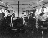
Gould's horsehair factory c1950 |
|
blank |
At Glemsford, Gould's horsehair factory was still in production. This picture from the Foxearth and District Local History Society website shows the workers producing their speciality, which was the production of violin bows.
To add to the grey conditions of life in post war England, the summers started to deteriorate as well. This cooler trend continued into the 1970's.
|
|

Festival of Britain
|
| 1951 |
The Festival of Britain was an attempt to inject optimism and hope into the country after the War and its aftermath of rationing and shortages. This programme, illustrated here, was full of coloured adverts showing the best of Britain. Officially it was to celebrate the centenary of the Great Exhibition of 1851, but unofficially it was to put the war behind us, and look forward with optimism. Local celebrations were to be held across the country. Like the Dome in the year 2000, it was also meant to be a regeneration project for a depressed part of London, in this case the derelict area of the South Bank next to County Hall in London. The main exhibitions lasted from May to September. Local arts festivals were held in Norwich in June and Cambridge in August.
|
|
East Anglia Guide |
|
blank |
The publishers, William Collins Sons and Co., published a new series of 13 regional guides to Britain, on behalf of the Festival of Britain Office. They were sponsored by the Brewers Society as their contribution to the Festival of Britain. Volume 4 of these "About Britain Guides", was entitled East Anglia, and its title page is shown here. The East Anglian farm cart shown was a horse drawn vehicle, although the guide also proudly illustrated the Fordson Tractor Works at Dagenham. It claimed that "Farming is probably nowhere more highly mechanised."
|
|
Turning Elveden heathlands to agriculture |
|
blank |
Part of this mechanisation was to allow works to be carried on at a larger scale than was feasible with man and horse. This illustration shows how much of the remaining Breckland which was still unforested, was being "reclaimed" into agriculture. Once ploughed, artificial fertilisers and artificial irrigation, were needed to keep the land in production. This picture shows heather heathland being ploughed up at a rate of 500 acres a year on the Elveden Estate.
Norwich had 120,000 people, with 60,000 in Ipswich and Cambridge. Kings Lynn, Yarmouth and Lowestoft had 40,000 inhabitants. Bury St Edmunds, despite its 20,045 residents in 1951, scarcely rated a mention in this guide, and the Gazetteer mentioned it as a place producing agricultural machinery, spending a few more lines upon its historic remains. The Guide felt that production of cheap clothing in Haverhill would help to keep agricultural workers' families in employment.
Great Yarmouth was still landing up to 400 million herrings in one season, and Scottish migrant female workers were still a feature of the fish preparation and packing industry of the time.
Rushbrook Hall seems to have been abandoned around this time. Its owner, Lord Rothschild presented some of the oak panelling in the library to Thingoe RDC for use in the Members Room. These panels have moved with the local authority, and currently grace the St Edmundsbury Borough Council Offices on Angel Hill. After standing empty for many years Rushbrook Hall finally burnt down in 1961.
|
|
Town Guide 1951, 1952 |
|
blank |
The Borough of Bury St Edmunds authorised the production of this 80 page town guide for the years 1951 and 1952. It was published by the New Centurion Publishing and Publicity Co Ltd of Derby and Cheltenham. The illustrations were supplied by G F Lambert's Photographic Studios and from the collection of H J Jarman. The "Past History" section was supplied by M P Statham, but the section of "Some Famous Inns" is anonymous. It describes the history of the Angel Hotel, and interestingly it refers to the Suffolk Hotel as located "in the Cheesemarket".
The section entitled "Bury St Edmunds of the Future", was written by the Town Clerk at the time, J W H Knight. John Knight would later enter private practice as a solicitor, become a Borough Councillor, be made Mayor in 1966 and 1980 and after a long local government service at Borough and County level, be made a Freeman of the Borough in 1991. Mr Knight, never one to under sell an idea, wrote that, "there is a well established school of thought which looks upon Bury St Edmunds as a convenient administrative centre for much of East Anglia."
Mr Knight referred to the outline Development Plan for the Borough, including the extensive road improvement works, and a population growth to 25,000. Wanting to add light industries to the town's industrial life, building work had already started on a Trading Estate near the railway line. (Although un-named by Mr Knight, this trading estate would later become known as Western Way.)
The Town Plan for Bury St Edmunds was reprinted with amendments in July, 1951. The housing shortage was thought to be so important that the number of dwellings provided in the Borough since the end of the war was listed as follows:-
- Permanent living units built including flats - 425
- Prefabricated houses - 65
- Requisitioned properties - 22
- Ex-Service hutments - 56
- Dwellings built through private enterprise - 80
- TOTAL - 648
The Town Plan predicted that 60 houses would be built in the first six months of 1951 and 40 more in the second six months, the allocation for the year being 100. It was thought unlikely that more than 500 would be built in the next 5 years, and this was thought to represent "probably less than one third of the total demand."
Slum Clearance Demolition orders in place as at July 1951 were for 15 cottages in Westgate Place and 3 cottages in Southgate Street. A further 230 properties were considered unfit for human habitation, but demolition orders would not be made in view of the acute shortage of housing. The Plan also noted that the Housing Act of 1949 had introduced government grants for repair and reinstatement of old cottage properties, and this, "may have considerable influence on any future slum clearance schemes."
At the Mildenhall Road Estate, contracts were still being let during 1951, as follows:- -
Bury St Edmunds Development Co - 26 houses at Jocelyn Close
- Direct Labour - 20 houses at Severn Road
- Direct Labour - 8 shops with maisonettes in Lake Avenue
- Direct labour - 8 houses in Bunbury Road
- Direct labour - 30 houses in Lydgate Close
The growth of building on the Mildenhall Road council estate also led to the opening of St George's Church Hall in Anselm Avenue. It would be consecrated as a parish church in 1967.
The council could not, as yet, proceed with a comprehensive scheme for reorganising the Cattle Market. However, much of the work had been completed on the largest water improvement scheme ever undertaken in the town.
|
|
New Water Tower in West Road |
|
blank |
In 1936 Bury had a population of 16,860, excluding the military, and they used about 23 gallons of water per head, per day.
By 1951 Bury's population was now 20,056, and consumption had increased to over 40 gallons, or about twice as much per head as in 1936. This was attributed to the spread of baths and water closets in older properties, as well as the better appointed new houses now being built. Clearly, a modernised water supply system was needed.
In Bury St Edmunds the council began construction work on a new one million gallon underground reservoir, together with a new water tower in West Road to supply the increasing needs of the growing town for piped water. New electric pumps and a new pumphouse were installed in Kings Road to extract more water from the underground boreholes. A new 12 inch pumping main was laid to get the extracted water to the storage systems in West Road. The new water tower would hold 100,000 gallons at a water level of 300 feet above datum. From here the whole town could be supplied by gravity. The whole new system would be completed in 1952. Nearly 5 miles of new mains were laid as well as building the 100 foot tower.
You can view more pictures of progress on the new Water Tower by clicking here, and returning by using the browser's "Back" button:
Building the Water Tower in West Road, 1951-1952
In the new Town Guide, Mr Knight also referred to "a scheme for reorganising completely the sewage disposal arrangements for the borough is also in the course of preparation". Sewage disposal was now another major problem. Bury's waste was piped to a sewage farm at West Stow, which had been plagued with problems for years. Plans to upgrade West Stow Sewage Farm were finally abandoned in 1951. It was decided that a new works was to be commissioned in Fornham Park at Fornham St Genevieve instead.
The problems of water and sewage had to be resolved in order to support the growth which the Development Plan had envisaged. New homes were being built and the council "can look with pride upon post-war results so far achieved. Not satisfied that the ambitious 80 acre project now half completed at Mildenhall road will meet the needs of the community, the Corporation have recently purchased a further 56 acres of land adjoining."
Plans were also being considered for an all-purpose public hall, modern swimming baths, library extensions and more improvements to the Abbey gardens.
Several pages of the Guide were also devoted to educational facilities. The Tollgate County Primary School had just been completed for 5 to 11 year olds on the Mildenhall Road Estate, and the Westgate County Primary School was about to be built near the hospital. At this time the West Suffolk County Grammar School was for 350 mixed boys and girls, and King Edward VI Grammar School served 170 pupils, including 50 boarders. It was intended to make the County School into a High School for girls only, moving the boys to The King Edward, and both schools would be capable of taking 350 children each. Entrance to both schools was by selection through examination in their eleventh year. A few scholarships were available to Culford School for Boys, and to the East Anglian School for girls. Modern secondary education was provided at the Silver Jubilee School for girls and the Silver Jubilee school for boys, with 500 pupils each.
|
|
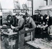
Technical Institute in Bury, c1951 |
|
blank |
The Technical Institute provided for Further Education for 700 students, located on the site of the Silver Jubilee School and the County Grammar School. Since before the war there had been evening classes run in Bury for the training needs of business. After the war classes were also arranged during daytimes for technical education to support apprentices, particularly for the building trade. In 1951, it was decided to formalise the running of these classes under a new body, to be called the West Suffolk Technical Institute. At first they occupied a few huts on the site of the Silver Jubilee School in Grove Road, today the location of the King Edward VI Comprehensive School. Evening classes were also accomodated at the County Grammar School premises in Northgate Street. Bury Technical Institute would eventually be enlarged and become the West Suffolk College of Further Education in 1960.
The Cullum Reference Library and the Free Lending Library were both located in the old School of Art building, under the control of the Bury Borough Council.
Even the countryside was now getting the benefit of piped water. Thingoe RDC had got pipes to Bradfield St George by 1951. The early 1950's also saw villages like Chevington getting mains water and kitchen taps. The fetching of water from a well or handpump was now over.
|
|
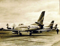
F86a Sabres at Shepherd's Grove
August 1951 |
|
blank |
In 1950 the RAF station at Shepherds Grove, near Stanton, had been put on a care and maintenance only footing.
In 1951 it was loaned to the USAF and on 27th August 1951 the 116th Squadron of the 81st Fighter Intercepter Wing brought in twenty three F86A Sabres, the first in this country. The picture shows some of the Sabre jets lined up after arriving at Shepherd’s Grove from America. These were thought to be the world's fastest jet fighters. 92nd Squadron joined soon after.
In 1952 the 116th Squadron, based at Shepherds Grove, became the 78th Fighter Squadron, and in 1954 received F84F Thunderstreaks.
In October 1951 Strategic Air Command (SAC) took over formal control of RAF Mildenhall. The final elements of the RAF had now left, but in practice the USAF had been flying from the base since July 1950. It has been a USAF airbase ever since.
Starting in 1951 the main runway of RAF Mildenhall was extended at both ends, and new taxi ways added. The area of the base was extended so that several roads had to be diverted or closed, including the Mildenhall to Littleport road.
Many American bombers were withdrawn from Britain in 1951, and Bomb Wings began to rotate in and out of Mildenhall for the next seven years.
On 29th August an American Thunderjet fighter from RAF Manston, crashed into St Johns Street in Beck Row. It had been flying at low level and had hit the tail of a parked B-50 bomber at RAF Mildenhall. The pilot died, but no civilians were hurt.
At Barnham, the Little Heath Forward Filling Depot for mustard gas still had some tons of chemical agents in store. Some pipework had been removed in 1949, but the three underground 500 ton capacity pots or tanks were still in place. In 1951 Pot A was almost fully emptied following a leak.
|
|
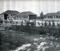
Tollgate County Primary School |
|
blank |
Tollgate County Primary School was also opened to take its first pupils on September 18th, 1951. It was the first new school to be built under the West Suffolk Local Education Authority's Development Plan. Standing in a site of 8.91 acres, it was built to provide junior and infant education primarily for children living on the borough's new housing estate. Its catchment also extended along Fornham Road as far as the railway bridge. It opened with 337 pupils on the roll, with expansion to 520 places planned by 1953. The playing field had been laid down in advance and was ready for use immediately. The shrubs around the school grounds had been planted by boys from the Silver Jubilee Modern Secondary School. The school had cost £65,000.
|
|
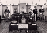
Suffolk Show - Rougham |
|
blank |
The Suffolk Show was not solely an Ipswich affair in those days, and every year it moved around the county. On the 7th and 8th of June, 1951 it was held at Rougham, just outside Bury. It was located on Rougham Estates's largest field, the 75 acre East Field and attracted 34,000 visitors. The picture shows the display mounted by the Borough of Bury St Edmunds, and the photograph was taken by Gerald Lambert who had a photographic studio in Well Street, in Bury. On the left stands Macebearer Harry Meakins, on the right is Charles Bye, and between them stands the Mayor's Officer, Robert Dorling.
|
|
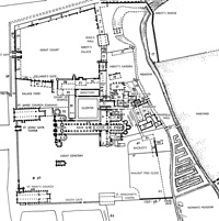
Bury Abbey at its height
A B Whittingham |
|
blank |
One of the most comprehensive archaeological assessments of the site of the abbey ruins in Bury is that of A. Whittingham, published in 1952 as A B Whittingham, ‘Bury St Edmunds Abbey’, in the Archaeological Journal volume cviii, 1951, p186. The Journal was for the year 1951, but was not actually printed until 1952. This report would be the basis of the Guide Book to the ruins published in 1971.
However, although Whittingham is always quoted as the main authority on the Abbey and its layout, many of his conclusions must be considered conjectural, and are based on other sources. He does not seem to have excavated in the Abbey Grounds himself, but used all the written evidence he could find to draw up his plans. Please click on the thumbnail to view the whole 1800 pixel wide plan.
|
|
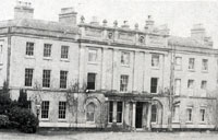
Fornham Hall |
|
blank |
Fornham Hall in Fornham Park, at Fornham St Genevieve, had been neglected and stood empty since the war. It had originally been built by built by James Wyatt in 1782-1785 for Sir Charles Kent. The park had been used by the military during the war, and was still graced with the remains of Nissen huts and slit trenches used for exercises. Attempts were made to find a use for it after the War, but at this time, property values were so low that it was not viable to bring it back into use.
By mid 1951, despite public misgivings, the demolition of Fornham Hall was approved. In September work began and the salvage operation yielded 20,000 feet of timber alone. All the doors and windows and fittings that could be extracted were also sold off. Even the bricks and rubble found a ready market. Only the stable block and estate cottages survived. Some of the stables were converted into dwellings and put up for sale as recently as 2009.
Wizard Fireworks began manufacturing fireworks in 1951 at Chedburgh.
Greene King had suffered many restrictions since 1945, both in terms of raw materials, and government regulations. It had enjoyed a boom in bottled beers, but draught beer had contracted badly. Since 1948 they had tried out some new recipes. Suffolk Ale was strong and took a long time to produce, but proved a popular buy in bottles. In 1951 they tried out a higher quality draught beer. This was called Abbot Ale and was first released in 1951. It would become one of their best known beers in the future.
In 1951 Haverhill had a declining population of about 4,000. The Urban District Council negotiated with the Government and promoted the idea of town expansion. Haverhill was thus a pioneer of town expansion.
|
|
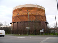
Gasholder completed 1952
|
| 1952 |
In the winter of 1951-1952, a new gasholder was built on the north side of Tayfen Road. This was to meet the urgent need for more gas storage capacity, and could hold 750,000 cubic feet of gas. Hitherto, the existing three gas holders could store just 280,000 cu ft, which was only enough to meet 4 hours supply at peak demand.
Just next door to the new gasholder there still remained a remnant of medieval times. In January, 1952, osier beds were still being cropped to make willow baskets. One basket maker, Sidney Craggs, had been working on the osier beds in Tayfen Meadows, when he was fatally run down by a tractor as he returned to his home in Blomfield Street.
On 8th February 1952, Queen Elizabeth II came to the throne following the death of her father, King George VI. Her coronation would not take place until 2nd June, 1953.
The Americans made Lakenheath airbase secure as part of its cold war preparations. High security arrived in 1952 with a high wire fence so that B47's could arrive in 1953 together with other "secret" planes including the U2 high flying spy plane.
Halifaxes had flown from Chedburgh in 1946 for 301 and 304 Squadrons of the RAF, and were used on trunk routes overseas until December 1946. The site of Chedburgh Airfield was sold in 1952 and is now a light industrial estate where use can be made of buildings and hardstandings. The remainder is agricultural once again.
|
|
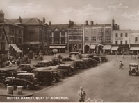
Card showing Buttermarket
posted 1952 |
|
blank |
The Town Development Act 1952 started a move to relocate people out of London, not by the use of new towns as hitherto, but by developing existing communities. Haverhill had already announced that it was prepared to expand to between 8,000 and 10,000 population. Before the war the population of Bury had been around 16,000 since about 1880. It was now about 20,000, and the Borough Council at first aimed for 25,000.
During 1952 the Bury St Edmunds Borough Council was committing itself to extend the Mildenhall Road Estate. During financial year 1951/1952 It had bought new land south west of Baldwin Avenue, and paid off the necessary tithe redemption lump sum. During financial year 1952/1953 it was ready to let its first contract of 40 houses, to be developed by the Bury Development Company.
This newly planned development was not given its new name until November, 1953. But this was the birth of the Howard Estate, and the first contract was for 40 houses in Baldwin Avenue. The even numbers were already under construction as part of the Mildenhall Road development. The odd numbers would now be built as the first stage of the yet to be named Howard estate development. This is why it has been said that one side of Baldwin Avenue marks the end of the Mildenhall Estate, and the other marks the start of the Howard Estate. The Howard Estate would now be gradually developed and expanded over the following decades.
In 1895 Hengrave Hall had been bought by Sir John Wood, and from 1896, much of Hengrave was restored to its former splendour when Sir John renovated the great Banqueting Hall, the chapel, the gallery and its summer parlour. He also built an annexe to replace the infamous ‘de Hemegrave wing’ that was demolished in 1775. This annexe later served as a hospital during the First World War.
After his death at age 93 in 1951, the Hall was sold to the Religious Order of Nuns of the Assumption, who would run a convent school here until 1974. When Hengrave Hall became the property of the Assumption Nuns, they moved their girls' boarding school here from Kensington Square. Some of the contents of Hengrave Hall had recently been sold off, and the Bury St Edmunds Borough Council acquired two portraits by Mary Beale, a 17th century artist who was born at Barrow. These could be seen in the Manor House Museum in Bury St Edmunds until 2006, having previously been on display in the Clock Museum when it was located at 8 Angel Hill.
|
|
Life at Hardwick Heath |
|
blank |
By now most of the families at Hardwick Heath, living in the old POW camp, had been rehoused on the Mildenhall Road Estate. The little boy in this picture is Brian Hoddy.
The Womens Land Army was not disbanded until 1952. The following year the Lakenheath hostel
was converted into 17 'family units' which were rented to homeless couples. This accomodation survived until 1965, when it was demolished and replaced by sheltered housing. The timber camp at Wordwell was also abandoned.
|
|
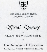
Tollgate School Official Opening |
|
blank |
On 30th September, 1952, the one year old Tollgate County Primary School had its official opening by Florence Horsebrugh, who was the Minister of Education at the time. The programme of events noted that the dining hall could seat 250 pupils at a sitting, while the kitchen had capacity to serve 500 meals a day to pupils and staff. Attention was also drawn to the colour scheme, and the excellent condition of the decorations after a year of occupation.
It was hoped to build two more classrooms during the coming school year.
|
|
Silk on bobbins at Glemsford |
|
blank |
During November, 1952, it was reported that the rich silk velvet for the approaching coronation of Queen Elizabeth II was being woven at a silk factory at Braintree. This was for the Robe of State of Crimson Velvet, which was attached to the shoulders of the coronation gown. The raw silk came from a silk farm at Lullingstone Castle in Kent, and the first stage of preparation was called "throwing", which produced the silk yarn. This took place at the Glemsford Silk Throwing mill in south Suffolk. It then went to be dyed in Warner's own dye house at Braintree, after which it was sent to the Braintree mill to be woven. In fact there were two identical pieces woven by two different women in case of mishaps. Each piece was woven in 21 inch wide lengths, and was 21 yards long. Weaving would take two months to complete. The woven fabric would be made into the finished article by Messrs. Ede and Ravenscroft of Chancery Lane, London.
The Robe of Purple Velvet to be worn by the Queen as she left the abbey after her coronation was also hand woven by Warners at Braintree, from silk "thrown" at Glemsford Mill.
Silk for the coronation coach and other robes was meanwhile being woven at the Sudbury Silk Mills of the Walters family. This raw silk also passed through the Glemsford throwing process, where the silk ended up wound on to bobbins.
Identity cards were finally withdrawn in 1952. When war came the National Registration Scheme required all civilians to carry the cards at all times. Although people had more or less got used to them, in 1951, a Mr Willcock was prosecuted for refusing on principle to produce his card for a motoring offence. The case ended in the High Court in 1952, when his conviction was upheld, but the Lord Chief Justice openly criticised the continuance of the scheme.
Woolworth's came to Bury in 1952, on their present site, although the shop was rebuilt and extended in the 1960's.
|
|
Removing wood blocks |
|
blank |
In Bury, Abbeygate Street was closed in order to resurface it with tarmac. Being a premier street in the town it had previously been laid with wooden blocks. The blocks were initially thought to have been made of cedar wood, soaked in tar, and were about the size of a brick. Further research suggest that the blocks were Jarrah wood (Eucalyptus Marginata) not cedar wood. They were laid edge up, and tarred over. These helped to deaden the sounds of the milkman's horse, and other tradesmen in the early hours. By now they were worn out and probably unsuitable for heavy motor vehicles.
In 1947 the Bury St Edmunds Borough Council had commissioned the Society for the Protection of Ancient Buildings to make a survey of the historic buildings in the town. This survey was produced to the Council in 1948, and, as a result, some 300 properties in Bury St Edmunds were listed under the terms of the Town and Country Planning Act of 1944, because of their architectural or historical importance. Such "listed buildings" were still under legislative protection by 2010.
|
|

Bury Abbey at its height
A B Whittingham |
|
blank |
Meanwhile, the Archaeological Journal for 1951 was published, which contained a plan of Bury St Edmunds Abbey by A B Whittingham, dated 1952, facing page 192. This plan would remain the definitive outline of the Abbey buildings into the 21st century, and a simplified version was later included in the Ministry of Works Guidebook to the site.
|
|
Bury station's old goodsshed |
|
blank |
The Eastern Counties Railway, the principal constituent of the GER, favoured
clapboarded timber goods sheds and many examples of these, built in the
1840s, survived well into the post-war period. Even such major traffic centres
as Bury St Edmunds, Stowmarket and Thetford had timber sheds, the former
lasting until 1954 when it was in a state of considerable disrepair.
The sheer decrepitude into which
some goods facilities had fallen by the 1950s is
demonstrated by the 1840s shed at Bury St Edmunds,
which had been condemned in 1913 but is seen here on
27 March 1952. Its timber construction was typical of
many early sheds built by the GER’s constituents. Its
replacement was completed in 1953.
|
|
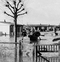
East coast floods
|
| 1953 |
During the night of January 31st and February 1st the east coast was devastated by severe flooding from inundation by the sea. Spring high tide was reinforced by strong onshore winds, and sea defences were breached all along the Suffolk coast from Lowestoft to Felixstowe. Some 400 houses were flooded at Lowestoft, but it would have been much worse except for the new sea wall just built. Things were much worse at Felixstowe where 40 people died when a wall of water swept through caravans and houses. Some of the pre-fabs shown here were swept off their foundations and floated for several hundred yards. In places the sea penetrated three or four miles inland, and reached ten feet deep.
|
|
Borough Guide 1953, 1954
|
|
blank |
In 1953 a new Official Guide book to Bury St Edmunds was produced by H J M Maltby, by authority of the Borough Council. The previous guide covered 1951 and 1952, and had thus rendered itself apparently out of date by 1953. Maltby's publication was designated as the Guide for 1953 and 1954. Photographs were supplied by Bury photographers G F Lambert and H I Jarman and also by the British Travel and Holiday Association. Although it was supported by the advertising of many local businesses, very little was made of the trade or industry of the town.The introduction included the following statements:
"Its modern industries are those natural to an agricultural centre. Engineering works, and those for the manufacture of framing implements, the brewery, the timber yards, and more recently, the beet sugar factory, have risen on the borders of the old town and outside its limits. The west end of the town has been developed as a residential area, by private enterprise, and a fine new housing estate, of about 134 acres, acquired by the corporation on the Mildenhall Road, north of the town, is growing. The layout will include shopping and communal centres and open spaces, and, when completed, will be one of the finest and best planned estates among the smaller towns in the country."
Not mentioned in the new guidebook was the fact that since the war Bury St Edmunds Borough Council had completed 661 new houses with another 149 under construction.
Also not mentioned was the fact that the Bury St Edmunds Borough Council finally bought the Abbey Gardens and West Front, with its sitting tenants, from the Bristol family for £7,814. The council had held the Abbey Grounds on lease since 1912, but their future for public access was now assured.
|
|
Bury St Edmunds market in 1953
|
|
blank |
This remarkable picture was captured on Kodachrome slide film in a Leica wielded by Michael Leonard's father. Michael3900, a small boy at the time, posted this on Tumblr. It seems that his father, Max Gene Leonard, was an American working at RAF Upper Heyford where he was a schoolmaster for the children of the American servicemen posted there. He lived at Winslow at this time, where his son Michael was born.
|
|
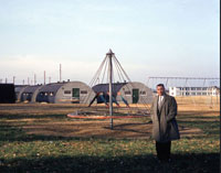
Lakenheath airbase in 1953
|
|
blank |
Max Leonard worked at other American bases in Europe, taking photographs wherever he went. He was also school principal at Lakenheath airbase for a time. This picture is also thought to be some time in 1953.
|
|
Coronation Carnival Procession
|
|
blank |
From 30th May to 7th June, 1953 was the official week of celebrations of the coronation of Queen Elizabeth II. The Borough of Bury St Edmunds issued its own programme of events, and a Carnival was arranged to parade all manner of floats around the town. This picture shows the Carnival in Mustow Street passing Burrell's Garage, and was taken by Clifford King's father, and posted by Clifford on the Facebook page "Old Bury St Edmunds."
In May, 1953, a remarkable event occurred when the Augustinian order of Friars moved back to Clare Priory, having been absent since 1538. The Priory was a gift to them from the daughters of Lady May, who had wished to see the Friars return to Clare.
|
|
The Clock Museum in 1988
|
|
blank |
The Bury Borough Council was left a notable collection of clocks and watches in memory of John Gershom-Parkington, (1920-1941), who was killed during the war. The collection was bequeathed by his father, Frederic Gershom Parkington, who had died on 23rd January 1952, in Jersey. The Gershom Parkington String Quintette used to be a household name, playing light classical music on the wireless in the years after 1925. Frederic, its founder and leader, was one of the Parkington family who ran a successful tailoring business in Bury St Edmunds for generations. Messrs T W Parkington and Son, Ltd, of 29 Abbeygate Street, were still advertising in the Bury Guide of 1953-1954, as military tailors and breeches makers, and ladies' taylors, but the new guidebook was produced before this bequest was proved.
The Jersey Heritage Trust has summarised the provisions of his will as follows: " Will and Testament of Frederic Gershom Parkington, known as Frederic Gershom-Parkington, of 5, Douro Terrace, St Helier. Desires to be cremated and have his ashes buried with his wife. Bequeaths to his late violinist, Tom Jones, his music and quintette arrangements; to the town of Bury St Edmonds, all time pieces and books relating to the measurement of time in memory of his son John Gershom Parkington who was killed in the last war. Dated 22/12/1951."
The London Gazette of 13th March, 1953 publicised the existence of the will, and asked for claims against it to be made by 15th May, 1953. Once the council of Bury St Edmunds was made aware of the bequest, it had to consider if it would accept it, and how to make arrangements to house and display it.
By agreement with the National Trust the collection was to be installed in the Queen Ann house at 8 Angel Hill, next to the Borough Offices and now known as Angel Corner. It seems to have not been officially given the name of Angel Corner until 1956.
|
|
Search Room, Angel Corner 1953
|
|
blank |
In 1950 the Bury Borough Council and West Suffolk County Council set up a Joint Committee to manage their archives. By now the Muniments Room in the Borough Offices was used by both councils, so this move made sense. In order to allow the public access to these records, and to provide more working space, it was decided to move the Archive material into the National Trust building as well.
So the clocks were joined at the Angel Corner building by what would in 1955 become called the Bury St Edmunds and West Suffolk Records Office. The records were held there until 1973, the clock collection until 1993.
Myxamatosis first arrived in Britain in Kent in 1953 and within 5 years 96% of Britain's rabbits were dead. This was of particular importance in the Breckland, where rabbit grazing had largely determined the shape of the landscape. Many open heaths would now become invaded by scrub.
The parish of All Saints was created in 1953 to serve the growing population of Bury St Edmunds as the town spread westwards. The original All Saints church building was a multi-purpose Hall Church, which
was set up at the corner of Park Road and Highbury Road to serve the Priors and Horringer Court areas in Bury. This building would become the church hall in 1963 when a new church was consecrated adjacent to it.
|
|
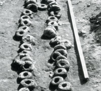
Loom Weights at Pakenham
|
|
blank |
In 1953 the Anglo-Saxon settlement at Grimstone End at Pakenham was excavated by Basil Brown and a team from the Ipswich Museum. This settlement was dated to the Sixth Century, and was built over a Bronze Age burial mound. A particular discovery was that some houses contained looms, where the weft was kept under tension by loom weights made of clay. These loom weights are typical of Anglo Saxon settlements excavated, and are often preserved by fires destroying the homes in which they stood. In later years such loom weights were also found at West Stow.
The Ipswich Museum curator, Norman Smedley, along with Harold Spencer and Stanley West lifted the eight foot long row of loom weights found at Pakenham, and shown here. At the time it was believed that these were laid out for firing, because the idea of such a wide loom was dismissed. However in 1964, Marta Hoffman would conclude that this was evidence of one of the largest known Anglo-Saxon looms in North Western Europe. By 1999 Steven Plunkett had concluded that, "This Suffolk discovery was, in fact, one of international significance." (SIAH, 1999)
On 19th September, 1953, the 358th (Suffolk Yeomanry) Medium Regiment, RA (TA), was granted the Freedom of the Borough of Bury St Edmunds.
The Cold War being under way, the Royal Observer Corps were once again activated. At Bury St Edmunds one of the new standard 10 ft by 8 ft observation platforms was erected above the ground near the edge of the old Westley Airfield. The site is now part of the Westley Middle School off Oliver Road. This post was designated as Post 7/B2, reporting to the Training Centre set up in the Bury St Edmunds Guildhall, and thence to 7 Group HQ at Colchester. A more elaborate underground system would be installed on this site by the 1960's.
|
|
The last Thetford passengers at Barnham |
|
blank |
This view illustrates the end of passenger services from Bury St Edmunds to Thetford, and was taken at Barnham Station on Saturday 6th June 1953. This was the actual day of the last trains. Closures are quoted as a 'from date' on which no trains will run and tend to be a Monday, such as Monday, 8th of June, that is given as the closure date for this passenger service.
The Thetford to Bury railway line had seen much traffic during the war, both for munitions going to and from the Barnham bomb dump, and for troops travelling to Barnham Camp and the many other military posts along the line. After the war its use had fallen away, and in 1953, on June 8th, passenger traffic on the line ended. At Bury the last trip of the Thetford Flier was accompanied by a mock funeral party, wreaths and an old fire engine to add to the spectacle. The line would now carry only freight traffic until its demise in 1960.
|
|
BFP pictures of funeral for Thetford Flyer |
|
blank |
The Bury Free Press of 12th June, 1953 carried an extensive report of the last run of the Thetford Flyer, mainly because of the spectacle created by local rail enthusiasts who arranged a mock funeral procession and events at each station along the route. The back page carried a number of pictures of these events.
|
|
Mock Funeral for Thetford Flyer |
|
blank |
In February, 2021, Tom Epton emailed me, attaching this photograph of the mock funeral. He writes:
"(I) attach my photo of the mock Funeral Cortege for the Closing of the Railway passenger traffic service line from Bury to Thetford. I think the Banner Bearer was Oliver Goldsmith the .... local Accountant . Smiling behind him with the Shovel is Walter? Leeson, the Chemist whose shop "Leesons" was at the bottom of Abbeygate Street, on the right, at the corner with Angel Hill. I had the photo developed by his Shop, with copies for himself. He charged me 1/6d for my Print...!
The wording on the Banner, said:
"Here lies the Body of The Thetford Flyer,
Whose running costs grew higher and higher:
Torn from its Rails to its Heavenly Station,
It died at the Hands of Nationalisation.
RIP"
|
|
Junction showing branches to Thetford & Sudbury
|
|
blank |
This picture, from "Transport Treasury", shows Bury St Edmunds Junction signal box looking Eastwards towards the Hollow Road bridge in August, 1959.
The Thetford branch goes off to the left, and the Long Melford and Sudbury branch to the right. These are the final days of a faltering rail service, neglected through the war, and running obsolete rolling stock. Unprofitable lines were closed in an attempt to keep the rest of the network viable.
|
|

Bury station's new goods shed
|
|
blank |
The new goods shed at Bury St Edmunds is shown here, photographed
on 27 August 1953, soon after completion. The concrete framed structure with extensive glazing is a far cry
from its decrepit predecessor, although the
open side for vehicular access and large end opening
must have made it a draughty place to work.
World War II wrought tremendous destruction of railway goods facilities, particularly
those in London. Reconstruction in many cases
consisted simply of patching up the bomb-damaged structures. Otherwise, rebuilding was confined to the very
worst examples, such as at Bury St Edmunds, where an old timber shed that
had been condemned in 1913 was replaced in 1954 with this concrete-framed
structure. (To be converted in future years to Rollerbury).
|
|

Theatre as Barrel Store
|
|
blank |
Another structure in dire need of restoration was the old Theatre Royal building in Westgate Street. Despite its condition it was declared as a Grade 1 listed building. The roof was no longer watertight and it had been largely forgotten during the quarter century it had been used as a barrel and equipment store by its owners, the Greene King brewery.
The decision was taken in 1953 to decontaminate the mustard gas sites at Barnham and redevelop them.
The Barnham Mustard Gas depot was finally emptied of the last of Pot A in October, the gas being sent back to ICI in Cheshire. During 1954 Pots B and C were also emptied and sent by rail to ICI. Here it was used to fill new bombs during 1954 and 1955.
On 4th November 1953, a Canberra bomber from RAF Bassingbourne crashed on the edge of RAF Mildenhall. The crash demolished the scullery of a nearby house occupied by Mr E J Lockwood. The pilot was killed and the navigator seriously injured.
John Saunders has recorded that, "Interestingly, the origin of the name of Howard Estate is not clearly documented but the Bury Free Press of 6 November 1953 had revealed that Bury Town Council would the following week consider the names of the streets on Mildenhall Road Estate and naming the new Estate after a former well-known landowner. The following week’s edition of the newspaper reported that the names of the latest streets on the Mildenhall Road Estate were to be selected from the names of English Counties and that the extension of the Mildenhall Road Estate adjoining Baldwin Avenue was to be known as Howard’s (sic) Estate."
The derivation of the name 'Howard Estate' remains somewhat obscure. However, it perhaps reflected a feeling that 'Mildenhall Road estate extension' was not the best of names to give it. It was too late to rename the Mildenhall Estate, as it was more commonly called by now, and perhaps considered a bit misleading to outsiders. The land covered by both estates had once been part of the Fornham Park Estate of Captain Macrae, a descendant of Sir William Gilstrap, who had bought it in 1862 from Lord Manners. From 1789 to 1843, it had been owned by Bernard Edward Howard, who became the 12th Duke of Norfolk. Perhaps it was the same urge for historical respectability that would lead the public house built to serve the new housing to be called 'The Greengage'. This reference was to the Gage family who had owned this land at an even earlier period, from 1540 to the 18th century.
(It is interesting to note that, by the 1980s the Howard Estate would be extended to cover a large area stretching down to the A14, and by that time Baldwin Avenue, Lancaster Avenue and Northumberland Avenue etc would become regarded as part of the Mildenhall Road Estate, not the Howard.)
In 1953 local builder, Leonard Sewell, purchased the Hardwick Manor House and grounds. The original owner had been a Mr Halford Hewett. The Hardwick Manor was not an ancient site, as it was, in fact, a greatly enlarged and remodelled estate cottage following the demolition of Hardwick House in 1927. For many years afterwards Mr Sewell would host an annual Hardwick Fete in his grounds.
|
|
 Boby's Engineering Workshop
|
|
1954 |
Robert Boby Ltd was still a major employer in the area in 1954. This picture of one of its workshops was included in the Town Guide for 1953-1954. Although the firm had traded as Robert Boby since 1856, it had been a division of Vickers for many years. The factory was called St Andrews Works, and its main office stood in St Andrews Street, South. However, the works covered a large area between St Andrews Street and Kings Road. They advertised their seed and grain cleaning machinery, malting and brewing machinery, pneumatic intake plants, mechanical handling equipment, and general engineering.
Several towns in East Anglia had expressed a wish to expand and in January 1954 came the earliest official announcement from the London County Council of the towns they were considering for the reception of an overspill population. The towns named were Haverhill, Sudbury, Bury St Edmunds and Thetford. These towns, the LCC stated, have signified their agreement, in principle, to a policy of expansion and now experts are scrutinising the extent of population that each can take.
By now Westley airstrip had largely reverted to agricultural use, but was still owned by the Borough Council. The farmer on the land Mr Lawson, also purchased the redundant hanger, and it was taken down and re-erected at his Bridge Farm, in Ixworth. As the housing shortage continued, and in view of town expansion thoughts, the Council planned to build a new housing estate on the land. It was intended that the frontage on to Newmarket Road would be private homes, and during 1954 the first of these were built.
In September 1954, the total number of pupils on the roll at Tollgate School was 577, or 57 more than its initial planned capacity when completed in 1951. Numbers would continue to grow throughout the 1950s.
|
|
Fornham Road Fire Station |
|
blank |
At Bury, the Fire Brigade was removed from its town centre cramped location in the Shambles, where it had been since 1899. This site was now totally inadequate for the growing town, and was often hemmed in by traffic congestion. The Fire Station moved out to Fornham Road, where there was land for a training tower, extra garaging, and usually a quicker response to calls. The site was almost opposite the lower end of Avenue Approach. Unfortunately it was built on unstable land very close to the river Lark, and would be replaced by the Parkway site in 1987.
In 1954 the Suffolk Show was held at Lark Hall at Cavenham.
|
|
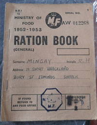
Rations for 1952/1953 |
|
blank |
After 14 years, food rationing ended at midnight on 4th July 1954. The process had begun in 1948 but had made slow progress until 1953 when the then Food Minister Gwilym Lloyd-George made it a priority for his department.
The ration card shown here had entries for meat, eggs, fats, cheese, bacon, sugar and a spare line in case of emergency requirements.
Sweets and chocolate had come off ration in April, 1953, but sugar remained rationed until September 1953. Clothes rationing ended in May, 1949. Petrol ended in May, 1950.
Meat and bacon was the last item to be taken off ration. The final day saw celebrations across the country.
Greene King bought the Wines and Spirits business of Cawdrons of Fakenham and Wells in Norfolk. It was merged with Peatlings, bought 20 years earlier, to form Peatling and Cawdrons, which still trades in Bury today.
At Ixworth, the Thingoe RDC modernised its 1893 houses in Stow Road. They were given bathroom extensions and both hot and cold water systems. Thingoe RDC regained the spirit which had built these innovative homes in the first place, and in the next 20 years would build about 1,200 dwellings, with model sheltered housing schemes and extensive schemes of rural sewerage.
Greene King took over the Simpson's Brewery at Baldock. Its owners were threatened by the trend to amalgamation, but favoured a merger with Greene King to ensure that the Brewery stayed open. This brewery did well later in the decade because of the growth around London.
|
|
Blue Danube Atom Bomb |
|
blank |
In 1952 Britain had test fired its first atom bomb codenamed Hurricane. The government intended to produce a nuclear bomber force, and a free falling bomb making programme was launched called Blue Danube. Two sites were selected for the storage of Blue Danube once delivered to the RAF, and these were at Faldingworth in Lincolnshire and Barnham in Suffolk.
With the 94th Maintenance Unit based at nearby RAF Honington, Barnham Camp was designated a Special Weapons Storage Area in June of 1954. The existing area was modified to store High Explosives, but a separate secure location was needed for atomic material.
In September 1954 the new site at Barnham was taken over. Its location is easily seen today as it is now the Gorse Industrial Estate. Armed guards were easily supplied by a track from the rear of RAF Barnham Camp. Construction took place through 1955 and 1956 in conditions of secrecy. Although this was to be a massive installation it was not shown on any Ordnance Survey maps for many years.
By the end of 1954 large areas of Barnham Heath were declared free of Chemical Warfare agents following decontamination by deep application of bleach. The empty underground storage pots were sealed. The RAF held the site until 1963.
In December 1954 the moth balled base at RAF Tuddenham transferred to the USAF as a sub-station of Pickenham.
The Camden Society had been publishing historical documents since 1838. Volume 84 was produced in 1954 for the Royal Historical Society, and was "The Kalendar of Abbot Samson of Bury St Edmunds, and related documents." It is a general inventory of the revenues due from the Hundreds of the Liberty of St Edmund to the Abbot, and was drawn up some time around 1190.
|
|
 New Stowmarket Congregational Church
|
| 1955 |
During 1955 the new Congregational Church at Stowmarket was finally finished, on the site of the old church destroyed by German bombs in January, 1941. It was built by Sadlers of Ipswich, and was considered the epitome of modern ecclesistical architecture. Today it has become known as the United Reform Church.
|
|
Clare Secondary School |
|
blank |
January 1955 saw the opening of a new secondary school at Clare, just north of the Cavendish Road. The school enjoyed extensive facilities including large playing fields and a house for the Headmaster. Further temporary buildings would be added in 1961 and the school would take 400 pupils, both boys and girls, taught by 23 teachers.
The London County Council was promoting the idea of moving to expanding towns at the British Industries Fair in May 1955. Industries were shown the advantages of moving out of London.
|
|
Guide Book 1955-1956 |
|
blank |
Two years after the last Guide to Bury St Edmunds was produced, this new edition was produced. Details of the Gershom Parkington collection of clocks was now included. Much of the historical information was retained from the 1953-4 edition, but now the Introduction included the following:-
"Some 32 acres have been acquired by the Corporation off Newmarket Road (A.45) for development as a Municipal Trading Estate, which will adjoin the Cambridge/Ipswich branch line of British Railways."
|
|
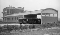
Co-operative bakery |
|
blank |
The Western Trading Estate was established on these 32 acres by Bury Borough Council to encourage industrial development. This Bakery building of the Bakery Division, Co-operative Wholesale Society Ltd, was part of the new development of the Western Trading Estate in the late 1950s. This building survived life as a supermarket before being demolished in 2008.
Today the area is called the Western Way Industrial Estate. It was to be the first of several such ventures by the council around the town. The rates income expected from this 32 acre venture was needed to pay for new sewerage and other worn out infrastructure for the town. Unemployment was low in the town so the Council was careful in its selection of industries. Plans were now in train to bring Bury's population up to 40,000, based on London "Overspill" of 10,000 people.
|
|
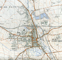
Bury St Edmunds by 1955 |
|
blank |
Soon the 40 acre Eastern Way Trading Estate was also started, and during 1955, Bury signed the Town Expansion Agreement with the London County Council, or LCC.
This 2.5 inch to the mile (1:25000) map of Bury St Edmunds dated 1955, still fails to show the Western Way industrial estate or the Eastern Way estate. The golf course club house is visible in Out Risbygate Street. It shows the Mildenhall Road housing estate in the course of construction, together with new development at Perry barn.
|
|
Willow Cottages - OS 1884 |
|
blank |
In 1955 subsidence occurred at number 4 Willow Cottages in Bury St Edmunds, which was to live on in Bury folklore for decades. Willow Cottages were a row of 14 properties running off Mill Road. These houses had outside privies at this time, and a plumbers mate, employed by plumber Percy Cook, fell 15 metres down a cavity that opened up when he pulled the chain. Luckily he was recovered and the cavity was filled, but the story lived on. This illustrated the fact that there was a web of underground tunnels which had arisen from 19th century chalk workings to feed Lime Kilns in Mill Road. One such was Bullen's Lime Kiln. Lime Kiln Cottages still survive in Mill Road, although Willow Cottages seem to have been demolished in the late 1960s to early 1970s. In twenty years time a new development nearby, called Jacqueline Close, would become nationally known for subsidence of a much more serious nature. Click on the thumbnail for a wider view, including the site where Jacqueline Close would be built on the opposite side of Mill Road.
The Playhouse Cinema in Bury converted to show films in Cinemascope, but post war austerity had dried up the film studios, and television was becoming widespread.
Many people will remember the excitement of going for shoes at Quants in Abbeygate Street, because in 1955 they installed a refurbished X-Ray machine. The shop had already had an X-Ray "Ped-o-scope", as far back as 1931. The idea was that the shop assistant could tell if the shoes properly fitted on young feet by viewing them through the machine. No doubt today this would be seen as a hazard to health, but then the kids loved it.
Milk Bars for tea, coffee and milk shakes were in fashion and at this time Bury had a Milk Bar on the Cornhill where Dixons stood until the internet undermined high street electronics shops. By 2006 the wheel had turned again and specialist coffee bars returned, and Starbucks opened in this location.
A qualified librarian was first appointed by Bury Borough Council.
The Archivist service which managed the records held at Angel Corner in the Records Office, now came under the control of West Suffolk County Council. The service had previously been managed by a Joint Committee of the County Council and the Bury St Edmunds Borough Council. It continued to be called the Bury St Edmunds and West Suffolk Record Office until 1974.
In 1955 the area of Bury St Edmunds's abbey ruins was placed into the guardianship of the Ministry of Public Buildings and Works. Today, (2013) the MPBW is known as English Heritage, via various name changes along the way. This effectively meant that Ministry permission was required for any further work to be carried out within the designated area of the Abbey Gardens.
The County Grammar School in Northgate Street now became an exclusively girls school, under a plan approved by the Ministry of Education in 1949. In July 1955, all the boys from the County Grammar had to say goodbye to staff for the last time. Their new term would begin in September at the King Edward VI Grammar School in the Vinefields.
|
|
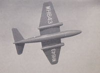
English Electric Canberra |
|
blank |
The English Electric Canberra bomber began to be deployed at RAF Honington during 1955. Following some years without aircraft being resident, flying had once again returned to Honington. The Canberra was one of the first successful jet bombers produced in the UK. Some Canberras are still in service, mainly in training and electronic warfare roles. Production began in 1949 and continued until 1961. Its prime function was as a nuclear bomber and photo-reconnaissance aircraft. It was to be used as a second strike bomber and to determine those areas untouched by the first wave of atomic warheads so that the second wave could finish the job. The Canberra flew at Honington from 1955 to 1957.
Meanwhile, the West Suffolk County Council had opened the first Country Park in Britain at Knettishall Heath in 1955.
|
|
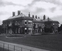
Ousden Hall from the garden
|
|
blank |
Ousden Hall and its vast estate had been owned by the Mackworth-Praed family since 1863. In 1913, Sir Herbert Mackworth-Praed sold the property to his youngest half-brother, Algernon Mackworth-Praed for £41,965.
Algernon Mackworth-Praed had bought Ousden Hall in order to live there, and he engaged Arthur Blomfield to make alterations and additions for his comfort. Improvements included a new water installation, a new dining room and full rewiring and redecoration, and in all he spent another £4,000. Algernon lived at the house until the start of World War II, when it was requisitioned by the army. After use as a POW camp, it was returned to his possession, but when Algernon died in 1952, the contents of the Hall were sold off. In 1954 the heir to the estate, Cyril Mackworth-Praed, sold the 2,593 acre estate with the Hall, to Lady Shelley-Rolls. She decided that the hall was past economic restoration, and so, like many large old houses at this time, Ousden Hall was demolished in 1955. The stable block has survived, remodelled in the 1990s into a substantial country house. The turret clock from the Hall's clocktower was eventually moved to Moyse's Hall Museum in Bury St Edmunds.
|
|
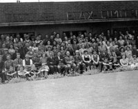
Glemsford Flax Workers |
|
blank |
Glemsford had enjoyed employment in the flax processing industry for many years. This picture shows the English Flax Ltd employees at Glemsford during the 1950s. The factory shown here was at Lower Road, Glemsford. An earlier flax factory had been located at The Croft in Flax Lane Glemsford. During the Second World War the factory labour was supplemented by volunteers from the Women's Land Army.
|
|
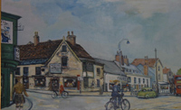 St Andrews Street and Risbygate Street
|
| 1956 |
Click on this picture to see how a Dutch visitor interpreted this Bury St Edmunds street scene, in painting, in 1956. It shows the junction of St Andrews Street with Risbygate Street. The newsagents "Stones" stands on the facing corner. This was eventually demolished to improve the junction, and replaced by a furniture store.
In Haverhill, the Council acquired land to the south of the town for industrial development in readiness for a town development scheme with the London County Council for the transfer of 5,000 people.
During 1956 building of the first new factories started at Haverhill, and Polak and Schwarz said that they hoped to start production in September in their new premises off Duddery Hill. This was the beginning of what is today the vast Haverhill complex of IFF.
The Great Ouse River Board continued to rebuild the crumbling locks along the River Lark where these were becoming a problem for the flow of the river. The lock at Fullers Mill was rebuilt in 1956, but no lock gates were installed. Gradually such repairs and rebuilds changed the nature of the river's locks and staunches into weirs and sluices to control the flow of water to remove risks of flooding. The needs of navigation were now mostly ignored.
In 1955 Canberra bombers of XV, 44 and 57 Squadrons had arrived at RAF Honington. By 1956 they were joined by 10 Squadron. On 6th September, the base was visited by the Commander in Chief of Soviet Forces, Marshall P F Zhigarev.
In 1956 these Canberra units based at Honington bombed Egypt during the Suez crisis.
In October 1956 7 Squadron was formed in order to fly the new Victor Valiant bomber from here. The Valiants could carry the massive atom bombs being built at this time.
The V-Force was rapidly becoming more powerful, and on 11th October 1956, a major change in the RAF's power came about. The Blue Danube atomic bomb was dropped by a Valiant in a successful test in Australia.
Although the public had a strong suspicion about the dangers of nuclear weapons, most specific details were kept secret, and were either never revealed,or came to light only years later. On 27th July, 1956, such a dangerous incident occurred at RAF Lakenheath, which was in reality a USAF base. On that day a USAF B-47 Stratojet was practising take-offs and landings, when a wheel burst and the wingtip scraped the ground resulting in a crash that ripped the roof off one of the "igloos" which stored nuclear materials, drenching the building in jet fuel. The four crew of the B-47 perished in the blaze. Firefighters managed to extinguish the fires at great risk to themselves as a major explosion was highly probable. The military fire fighters were joined by men of the Brandon Fire Brigade who poured water on to the bomb store until they were sure that the danger was over. Brandon's Sub Officer Frank Kybird led Leading firemen Ernest Norton and Ben Willet, Firemen Jack Riley and Bill Inns on their fire tender, driving through the perimeter fence, and on to the bomb storage area to save the whole area from possible devastation.
|
|

Barnham Atomic Bomb Store |
|
blank |
By 1956 the Nuclear Bomb store at Barnham had been completed. It had the capacity to handle the giant Blue Danube bombs which were 24 feet long, (7.3m) and 5 feet in diameter, and weighed 10,000 pounds. The site covered 23 acres in the shape of a pentagon, with the entrance at its apex, with huge electric gates. There were three giant blockhouse buildings with gantry facilities at their entrances for the reception of the non-nuclear parts of Blue Danube. The plutonium cores were stored in 55 individual secure hutches about the size of a small garden shed. Cores would be taken to the large blockhouse only to be installed when the bomb was to be armed for use.
The job of 94 Maintenance Unit was to store the material safely and keep it ready for action, and fully tested. The installation was intended to support bomber squadrons at Honington, Marham, Watton, Wyton, Upwood and Bassingbourn.
As far as is known the Blue Danube was effectively obsolete technology by the time it was built and only about 20 were ever made, ending in 1958. A large part of the military thinking behind the deterrent was to convince the enemy that any attack could be met by overwhelming retaliation. Thus Barnham also existed to convince the Soviets that Britain had many more atomic bombs than was, in fact, the case. It probably never held more than a handful of weapons of mass destruction, although it had the capacity to hold over 50 bombs.
Theodora, Marchioness of Bristol of the Hervey family died and caused Ickworth House to be presented to the National Trust in lieu of death duties. The family were able to lease back the east wing to live in. The public got access to the Park with its lake, and also to part of the house.
During 1956 the West Suffolk Constabulary installed VHF wireless in its control room, giving communications with patrol cars and motor cycles. A dog handling section was also set up.
Petrol was in short supply after Egypt's President Gamal Abdul Nasser took over the running of the Suez Canal from a Franco-British company in July 1956. He had been refused funds to build the Aswan High Dam because of his links with the USSR and he nationalised the canal as a sign of Arab defiance against western powers.
Petrol Rationing was brought in on December 17th, 1956 and rationing would continue until May, 1957.
|
|
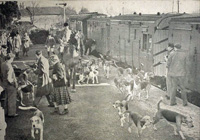
The Hunt arrives by train |
| 1957 |
The year opened with petrol rationing in full swing. The general population found that in many cases other supplies which needed to be moved by road were also affected.
In many cases alternative means of carrying on regardless were employed. This picture shows the East Suffolk Hunt hiring a special train to take them from Bury St Edmunds to Mellis for a Meet in February.
Petrol rationing, following the Suez Crisis, was not finally ended until after five months of restricted supplies on 14th May, 1957.
One hundred and eight dwellings were to be erected at Burton End, Haverhill for men with families moving with a new factory from London. This would be the first stage of the LCC part of the Parkway Estate. In the early days this was also known as the London Estate.
In Bury in June, May Gurney began the site works on 54 acres of the old Westley Airfield site to start the Westley Estate.
The main trunk sewer through Buy St Edmunds was also upgraded at this time.
The Treaty of Rome set up the European Economic Community. Britain did not join in.
The Magna Carta Trust was formed under the patronage of distinguished leaders of Church and State. Today, the Mayor of St Edmundsbury remains one of the Trustees.
In 1957 the Suffolk Records Society had its first beginnings. A provisional committee met on New Year's Day 1957, in Ipswich, to attract funds in order to begin the publication of Suffolk documents on an annual basis. The first of these volumes would be presented to members at an Inaugural Meeting in October 1958. The provisional committee included Martin P Statham, the Archivist for Bury and West Suffolk.
|
|
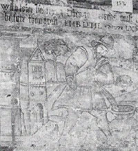
Mural at the Elite |
|
blank |
The East Anglian magazine of February 1957 published an article describing two murals dating from the 17th century. The article began by describing recent alterations to the Elite Restaurant on the Cornhill in Bury St Edmunds, owned by the Co-Operative Wholesale Society. The murals were uncovered by building work, and were described as 10 feet by 3 feet, one in a better state than the other. The picture shown here illustrates a man pouring water from a bucket into an urn, but the caption reads, "With some light thing when thou needs most, Trie thou thy friend before thou trust" followed by "Embleme LXXIII". Embleme refers to so-called Emblem Books, which had pictures with moral captions, published in the late 16th and in the 17th centuries. The murals could not be left in situ but were removed and hung in the restaurant on public view. Their present whereabouts are unknown. The Elite Restaurant was between Quality House (which was itself the former Playhouse theatre) and Marks and Spencers and possibly next to Lindsey’s department store.
Work began on excavating the Abbey site by the Ministry of Works and would continue for seven years. From 1957 the Ministry undertook a series of clearances of areas within the Guardianship land, in order to facilitate excavations and stabilisation of the remaining ruins. This work would continue until 1964. This included excavations of the transepts, crossing, eastern chapels and crypt of the church by the Ministry of Public Buildings and Works (R Gilyard-Beer, ‘The Eastern Arm of the Abbey Church at Bury St Edmunds’, PSIA xxxi, 1969, p256-262).
Many of the finds from the excavations were removed to their headquarters in Saffron Walden.
The West Front ruins themselves, together with the inserted dwellings, were still owned by the Bristol family. In 1957 they were sold to the Bury St Edmunds Borough Council, except for a small office retained by the Estate. There were ideas to turn the area into a Cathedral Close, and many people wanted to unpick the ruins and reveal the view to the site of the old High Altar.
|
|
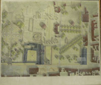
Dykes Bower Masterplan |
|
blank |
One of the main proponents of this idea to unpick the abbey ruins was Stephen Dykes Bower, the Cathedral Architect, appointed in 1943. He produced a Master Plan for the Cathedral Close or Cathedral Precinct, as shown here. The plan envisaged the removal of the homes from the Abbey Ruins to provide views right through the ruins of the Abbey Church, together with a new access road into the Churchyard further up Crown Street. Dwellings on Crown Street, but obstructing the great vision, were to be demolished to make way for the new road. At this time vehicles had access to the Churchyard, and Bower's plan would have allowed for pedestrianisation of the access to the Cathedral south side. Another new parallel footpath would be built on the south side of the Norman Tower, through the site of the old Penny Bank building, which was another of the casualties of the scheme. The Masonic Hall, built opposite the Cathedral's West Front, was also to be removed in order to enlarge Chequers Square into a fitting plaza in front of a Cathedral. Although this was a bold vision, it failed to take account of the enormous cost or the many interests involved in bringing it to reality.
New housing continued to be built in Bury. On May 9th, the Mayor opened the 1,000th house built on the Mildenhall Road Housing Estate. The Northumberland Avenue Methodist temporary hall and the Plymouth Brethren's Lancaster Hall were both opened to serve the expanding area. The Lancaster Hall was actually located on Tollgate Lane.
Another new building on Tollgate Lane built to serve the new estates was the Greengage Public House. The land was once part of the Hengrave Estate, home of the Gage family, who were said to have introduced a French green plum called "Reine Claude" to Hengrave, which became called the Green Gage in English. The new pub name reflected this local story.
|
|
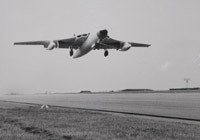
Vickers Valiant |
|
blank |
During 1957 the country was building up its nuclear deterrent capability. A strong force of Valiants was operational at RAF Honington. Number 7 Squadron were already operational. In January 1957 90 Squadron became operational and in May were joined by 199 Squadron. Squadrons of Vickers Valiants would operate at Honington until 1965.
|
| 1958 |
By the late 1950's the Bury Round Table had established an annual Whit Monday Fete at Hardwick Park. The centrepiece in 1958 was the "launching" of the Russian Sputnik. Each year a celebrity was also in attendance, and the aim was to raise funds for good causes.
In July 1958, a start was made 'on the ground' to put into effect an agreement with the London County Council to expand Haverhill under the Town Development Act to 10,000 people. The "London estate", extension to Parkway, was begun.
|
|
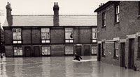
PC Saunders |
|
blank |
1958 is the year a lot of Haverhill people remember as the year of the first great flood. In fact there had been an equally big flood in 1903, but few people remembered it. After a terrible storm in June most of the High Street and Queen Street area of the town, including the Pightle, was flooded. Unfortunately it would be only ten years before the next occasion like it.
|
|
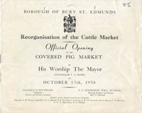
Cattle Market Reorganised |
|
blank |
In Bury, the Cattle Market was moved westwards, away from the St Andrews Street frontage to provide car parking for the town centre. New covered pig pens were provided together with a new lorrywash. You can view the information leaflet by clicking on the thumbnail. This remained the site of the livestock market until its closure in December 1998. In 1958 and into the early 1960's, it was still usual for some of the animals to be herded on foot up Risbygate Street to and from market.
|
|
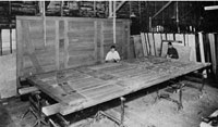
Whitmore's make doors for Old Bailey
|
|
blank |
In 1958, Whitmore's timber yard was long established adjacent to the railway line in Out Northgate. They were widely known for the supply of well seasoned timber, sometimes of exceptional size. This picture comes from the firm's website. Its description is as follows: "Having been laying maturing for 8 years, Whitmore's supply Oak for The Old Bailey doors." This was a massive project for the firm, carrying with it the prestige associated with the main law court in the land.
|
|
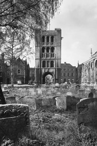
Gravestones cleared in 1958 |
|
blank |
The great churchyard was felt to need tidying up as part of the conversion of the area to a Cathedral Close. The gravestones and monuments by the Cathedral, between the West Front and the Norman Tower, were all cleared away, the railings having already gone to the war effort.
During the construction of Barons Road for a new private housing development, three Anglo-Saxon males were discovered buried just off Hardwick Lane in Bury. Finds included spearheads, a shield boss and a knife.
|
|
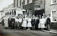
Buffaloes outing to Lowestoft
|
|
blank |
Friendly Societies and Christmas Clubs were still popular in 1958. With the formation of the National Health Service and Welfare State, some of the welfare functions of the Friendly Societies were becoming less necessary in many cases. The Royal and Ancient Order of Buffaloes and the Oddfellows were examples of these societies. Club outings to the seaside were popular, as were competitions between public house teams for darts, skittles and cribbage.
Here we see the RAOB outing to Lowestoft from the Cricketers pub in Kings Road, on June 29th, 1958. This picture is stamped "Alan Arthur, 21 Hatter Street, Bury St Edmunds", on the reverse.
|
|
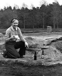
Digging at West Stow
|
|
blank |
From 1958 to 1961 the Anglo-Saxon village site at West Stow was excavated by Miss (later Professor) Vera Evison, on behalf of the Ministry of Works. She had been alerted to the site by Stanley West, who pointed out that the settlement was threatened by the sandpit which was still being quarried at the north-east corner of the site. As with so many important finds in East Anglia, the West Stow village site had been discovered by Basil Brown in 1947.
|
|

Souvenir Honington 1958 |
|
blank |
On Saturday 20th September, 1958, RAF Honington opened its gates to the public, by holding an "At Home" air show and static displays. It was described as coming, "on the 18th anniversary of the Battle of Britain". The Station Commander, Group Captain A D Frank, DSO, DFC, wrote, "At Honington you will see something of the organisation needed to keep three Squadrons of Valiant bombers in fighting trim. These fine aircraft are the successors of the Wellingtons and Lancasters of the last war. Flying faster, higher and further than was dreamt of then, they have the terrible hitting power conferred by nuclear weapons. It is our hope and belief that mere possession of this power will render unnecessary any future Battles of Britain."
RAF Honington had opened in 1937, was transferred to the USAF in September 1942, and returned to the Royal Air Force in 1946. The Valiant Squadrons began to form in 1956 to replace the Canberra bombers previously stationed there. In 1958 it was home to No 7 Squadron, No 90 Squadron and No 199 Squadron. The Vickers Valiant was the first of the three "V" bombers to enter service. The Valiant, Victor and Vulcan bombers could all be seen, with others, in a static display at the Open Day. Flying displays featured throughout the afternoon.
You can read the whole programme for this event here:
RAF Honington At Home 1958
On 7th October 1958, the Suffolk Records Society held its Inaugural meeting at County Hall, in Ipswich. Members, who had been recruited through 1957 and early 1958, and paid their subscription, were presented with the first volume to be produced by the Society. It was a collection of documents concerned with agriculture in the period between the Napoleonic Wars and the First World War, entitled "Suffolk Farming in the Nineteenth Century". There were 219 members at this time.
This first volume was dedicated to the memory of Vincent Redstone and his daughter, Lilian Redstone, who had pioneered archive management in Suffolk.
By 2007, the Suffolk Records Society would have completed 50 such volumes, a steady output of one volume each year.
Thingoe RDC gained a grant of arms, with the motto "Attingo Rura", when the chairman at the time, Mr Nigel Whitwell of Pakenham, bore the cost to mark his term of office.
|
|
Beevers' catalogue of 1958 |
|
blank |
The Connoisseur Year Book for 1958 included a catalogue of the John Gershom Parkington Memorial Collection of Time measurement Instruments at Bury St Edmunds. It was compiled by S Benson Beevers and it was reprinted as a catalogue to be sold to visitors to the collection in its home at Angel Corner in Bury St Edmunds. The catalogue grouped the items under the major headings of "Mechanical", such as clocks and watches, and "Non-Mechanical", such as Quadrants, Sundials and Nocturnals.
In 1958 the Thor intermediate range missile first arrived in the UK.
Greene King closed their Panton Brewery in Cambridge, which they had acquired in 1925.
Greene King also took over the small Sudbury Brewery of Mauldon's, with 22 public houses on the Essex border. This brewery was old, and it was agreed to close it down, and supply the pubs from Bury.
Typically for the times, the last four horses owned by Greene King for deliveries, were put down in 1958. Horsepower everywhere was dwindling away. The odd milkman, rag and bone merchant, and individual greengrocer still toured the town on horse drawn carts, but as each horse reached the end of its working life it was not being replaced.
|
|

Son et Lumiere 1959
|
| 1959 |
A grand 10 day pageant of 'son et lumiere' was held in the Abbey Gardens to commemorate the death of St Edmund and other historical events such as the town's links to Magna Carta. The pageant marked the first celebrations of the newly formed Magna Carta Trust.
The Mayor, Monty Banks, officially launched the great scheme to extend St James's church to make it more suitable for its role as a cathedral for the Diocese. This work had been envisaged since 1914, but two world wars and economic depression had always held things back. As it was, this major phase of work would not be finished until 1970.
The cinema trade was beginning to decline, and this year the Playhouse Cinema closed down. Its site became a large Co-op General Store, called Quality House. The Playhouse Bar, however continued to serve the drinking public for several more years until 1975.
The Odeon Cinema carried on until 1982, but by 2001 only the old Central Cinema in Hatter Street survives, having changed its name first to the Abbeygate on November 19th, 1959, and then to Studio One and Two in 1971.
|
|
Henshall's, Cornhill
|
|
blank |
Bury town centre lost one of its landmark shops when Henshall's Ironmongers closed its doors on the Cornhill. Woolworths was looking to expand, and Henshall's was right next door, as shown in this Francis Frith postcard from the 1950s.
|
|
W Plumpton and Son
|
|
blank |
In 1959 the well known drapery store known as W Plumpton, was acquired by Palmers of Great Yarmouth. Palmers continued to trade on the Buttermarket and Abbeygate Street corner as W Plumpton until 1961.
William Prince Plumpton started his draper's shop and sold carpets by 1851. In that census he was recorded as a draper and lived at 7 Abbeygate Street. In 1861, he is resident at 36 Buttermarket and was described as a draper employing 14 hands. In 1871 he was employing 21 hands. In 1881 and 1891, he was living at 87 Guildhall Street, draper. He died in 1898 and the drapery business passed on to his sons William and Richard Plumpton.
William Plumpton junior died in 1917, and Richard Plumpton died in 1933. The shop continued to trade as W Plumpton until 1961, when the name was changed to Palmers.
Bury's population was estimated at 20,800 in 1959, but plans were afoot to drastically increase this number.
In London, the LCC, (London County Council), were continuing to promote the idea of moving to expanding towns. In May 1959 the customary hoardings went up around Eros to prevent vandalism on Cup Final Day and on the hoardings were posters which read:
"There is space for growing industry in expanding towns, Bletchley, Swindon, Aylesbury, Haverhill, Bury St Edmunds and Thetford. Ample labour is assured. Financial assistance possible, Modern homes for work people."
At Bury, work began on the Pigeon Lane pumping station and the Fornham Park treatment works to replace the West Stow works. Plans had been drawn up, amended and discussed for sewerage improvements since 1947.
Sainsbury's built a poultry processing and packing factory in Mildenhall Road, which would employ 100 people.
|
|
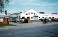
Van Melle sweet factory
|
|
blank |
In 1958 and 1959 the Dutch company Van Melle built this factory on a spur road off the Newmarket Road. Nowadays it is known as Western Way, but at first it was just called the new Industrial Estate, as it was the first of its kind in Bury St Edmunds. At this time the road was a cul de sac. The company made its fruit flavoured Fruitella chews, and it exported to the middle east and far east, where this confectionary was very popular. By 1983 it would employ 200 people, but by 1990 falling demand meant some 152 became suddenly redundant, followed by a sale of the factory in 1992.
The West Suffolk Technical Institute moved from its site at the Silver Jubilee School on to its present site in Out Risbygate.
On 29th August 1959 the First Battalion Suffolk Regiment amalgamated with the First Battalion Royal Norfolk Regiment to form the First Battalion, the First East Anglian Regiment (Norfolk, Suffolk and Cambridgeshire).
|
|
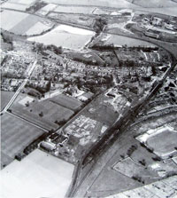
Northgate Area April 1959
|
|
blank |
This aerial view of the Northgate area of Bury St Edmunds shows the sweep of the railway line to Thetford at the top of the picture, together with the sugar beet factory and its settling ponds. Fornham Road and its housing runs across the picture, and it is possible to make out the fire station and its training tower along that road. Avenue Approach and its continuation into the Klondyke can also be seen. The picture is dated 13th April, 1959 and was sold on Ebay in December, 2017.
The East Anglian School for girls makes up the large cluster of buildings at centre left, together with its playing fields. The buildings shown below the school in the picture are the Boby's Northgate Foundry, together with allotments visible alongside the railway line to Cambridge. This area was known locally as 'The Chalks'. Across the railway line at the lower right can be seen the Greyhound Track, which was reached off Spring Lane, but that access is just out of the picture.
(This view would change completely in the next 13 years when the A45 Bury bypass would cut a swathe through this landscape, coming in from the top right to swing parallel to the railway line.)
|
|
View showing Whitmore's Timber Yard
|
|
blank |
Modernisation of the railways from steam to diesel power meant that some old facilities were no longer required. Bury St Edmunds railway engine shed (code 31E) closed at the beginning of 1959, by which time local passenger services had been taken over by new diesel multiple units serviced at Cambridge and Norwich. The turntable at Bury remained in use for visiting steam locomotives.
Brand new diesel locomotives were now to be seen entering service in the area. By early 1960 Ipswich engine shed was the first all-diesel depot in the country. As the number of new diesels built up, steam locomotive numbers rapidly declined, but continued to ply their trade until the last departed from Norfolk and Suffolk in mid 1962. These were the first counties in the country to be fully converted to diesel power.
In the picture ex-Great Eastern locomotive 65561 is seen approaching Bury St Edmunds Junction with the return of the daily Bury to Watton pick up freight on 7th August 1959, passing the store yard of Whitmores timber business on the right. The Ipswich based loco is probably three quarters of the way through a long day working return pick-up freights between Ipswich and Bury, with the same between Bury and Watton in between. It was withdrawn from service by the end of the year.
Some industries still relied upon the railways for their transport requirements, especially where bulk volumes made road transport problematic.
The second and third wagons contain large tree trunks, which may be destined for Whitmore's timber yard seen to the right (now occupied largely by a Tesco supermarket). Whitmore’s timber company still exists in Leicestershire. Their website says they moved from Bury St Edmunds in 1972, when the land was bought by the Department of Transport for the A45 by-pass.
Also visible is the loading shelter for traffic for the maltings adjacent to the Fornham Road railway bridge.
|
|

Junction showing branches to Sudbury & Thetford
|
|
blank |
The sugar factory also relied upon the railways for the delivery of coal. The sugar factory had its own dedicated internal rail network, with a siding attached to the main line.
Details of this A E Bennet photograph, sourced from Transport Treasury, are supplied by Gerald Brown, "This view of Bury St Edmunds Junction signal box is looking Eastwards over its domain towards the Hollow Road bridge, seen on 7th August 1959. The Thetford branch is to the left, while the Long Melford and Sudbury branch to the right. The picture also shows a huge coal stack at the sugar beet factory (left rear) ready for the campaign, and before the building of the large ABM maltings."
|
|
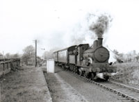
Heading to Melford
|
|
blank |
This photograph, supplied by the website Transport Treasury, shows the last surviving E4 62785 hustling a Long Melford bound early afternoon train through the remains of Bury St Edmunds Eastgate station on 31st October, 1959. The loco was withdrawn in December 1959.
The train has just passed over the Eastgate Street bridge, which can be discerned in the background. Eastgate bridge is just beyond the signal. The remains of Eastgate Station is on the left, closed in 1909, demolished in 1924.
In 1961 the line would close to passengers, and in 1965 to freight as well. Today the A14 traffic occupies the former railway land.
This type of 2-4-0 Holden E4 locomotive was designed in 1891 to meet the Great Eastern Railway's (GER) need for a mixed traffic locomotive. It was intended to haul the increasing agricultural traffic and it also had to haul cross-country and slow main line passenger services. They were slowly withdrawn over a period of decades, with the diesel railcars finishing them off after 1954. One surviving example still survives in the National Collection. In 1997 it worked as a tourist attraction on the North Norfolk Railway, and has also been an exhibit at Bressingham Steam Museum. It has been restored to its pre-British Railways livery and its original number of No. 490.
In 1959 the American occupied RAF Mildenhall airbase became a transport centre and the C124's arrived and Mildenhall became the home of the 322nd Air Division. Later the controlling unit became 513th Tactical Airlift Wing.
Mildenhall was to become the USAF's "Gateway to Europe" as a staging post for flights from the USA. Galaxies, Starlifters and C130 Hercules all flew through Mildenhall.
The American 78th Squadron had moved its F84F Thunderstreaks from Shepherd's Grove to Woodbridge in December 1958.
|
|
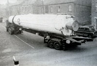
Thor missile in transit
|
|
blank |
In 1959 Shepherds' Grove became a Thor Missile Base and a flight of 82 Squadron operated them until their removal in 1963.
RAF Tuddenham also became a Thor Missile base in July 1959 when the Americans formed 107 Squadron . This sinister period lasted until July 1963, when the base at Tuddenham was sold off.
Thor missiles were made in the USA by the Douglas Aircraft Company, and flown in to Britain at Lakenheath airbase. As they were 65 feet long and 8 feet in diameter special 90 foot long vehicles were needed with steerable rear axles to carry them to their bases. In some places the road had to be widened to take the size. Three Thor missiles were delivered to each site, and periodically rotated back to USA for routine maintenance in the reverse direction.
In 1959 the Blue Danube atom bomb was no longer made, and was replaced by a smaller device. However, the Nuclear Bomb store at Barnham was upgraded by new Watch Towers at every corner and new workshops. A second fence to create a secure enclosed perimeter where RAF dogs could run freely also seems to date from 1959 improvements. The British deterrent was now codenamed Redbeard, and was a lot smaller than Blue Danube. Some of these new bombs may have been stored at Barnham. The new American Thor Missiles were stored at their own operational bases, and do not seem to have been placed at Barnham, where the facilities were presumably not suitable.
|
|
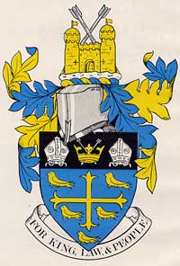
Arms of West Suffolk CC
|
|
blank |
During 1959 the West Suffolk County Council received its grant of arms. The cross and martlets, (house martins), derive from the arms of Edward the Confessor, to commemorate the grant of west Suffolk to the abbey. The mitres represent the abbey at Bury, and the crown and arrows represent St Edmund.
|
|
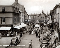
Traffic on market day
|
|
1960 |
This view of the Buttermarket shows Cullens outfitters on the Cornhill on the left of the picture. On the right the nearest shop is Plumptons which still exists in 2011. Next is the Suffolk Hotel, with its distinctive awning and its AA sign. Moyse's Hall museum is visible in the distance, but the real interest in this view is the fact that traffic is still being allowed access to the Cornhill during market days. Not only that, but vehicles could park, and a lorry is seen moving towards the camera, and edging past parked cars. Buses leaving the bus station could also leave the town through the market if necessary, and sometimes the awning of the Suffolk Hotel came to grief during such manoeuvres.
|
|
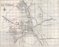
Bury Street Plan in 1960
|
|
1961 |
Central Bury St Edmunds at the beginning of 1960 was still much as it had been since the coming of the railways in the 19th century. It still had railway lines to Thetford in the north and Sudbury in the south. The Mildenhall Road estate was finished, and it was thought that 4,000 people now lived there. The Howard Estate at this time consisted of the roads between Baldwin Avenue and Northumberland Avenue, including Lancaster Avenue, Suffolk Road, Bedford Road, Devon Close and Hertford Close.
The Westley Estate had been started by the Borough Council and there was some private development in the Minden Drive and Gainsborough Road area.
These new estates catered mainly for local families, but the town's infrastructure had changed little to reflect this.
The main A45 from Ipswich passed up Southgate Street, and went on to Cambridge via Risbygate Street, although by now through traffic was diverted away from Abbeygate Street, and bypassed the town centre by way of Westgate Street and St Andrews Street South. Vehicles wishing to reach the Cornhill and Buttermarket could do so with ease, with travel in both directions even on market days. The attached street map shows the layout of Bury on the cusp of the great changes which would take place to the shape of the town over the coming fifteen years. The Western Way industrial estate was just being laid out, but an influx of factories had yet to take place.
West Suffolk County Council had been discussing improvements to its accommodation at the Shire Hall since a new complex of offices was proposed in 1954. By 1960 a competitive proces between eight architects led to the appointment of Donald Hank McMorran being appointed to draw up a preliminary report on the provision of a council chamber and office accommodation, including a library. In 1960, the scheme was revised to provide a police station (built in 1962-4), a library (built in 1963-5), and a scaled-down version of the council offices (built in 1966-8). The buildings were to be developed piecemeal as the sites became available, and site clearance began in August 1962 for the police headquarters.
The West Suffolk Greyhound Stadium at Tayfen Meadows is not shown on the map, but its location alongside the Tayfen Brook on low lying ground meant that heavy rains could flood it. Such a flood occurred in Autumn 1960 when the greyhound circuit was turned into a lake by rising waters, with the track, spectator areas and equipment submerged. Thankfully the weather spared a trio of greyhounds housed on site. A BBC Look East television news report from the time concluded with a shot of a car driving through the shallow floodwaters which still covered some roads. This can be viewed here: East Anglian Film Archive
RAF Lakenheath became home to the USAFE 48th Fighter Wing who are still there today. In 1960 the Americans removed their nuclear capable fighters out of France and the 48th Wing moved into Lakenheath from Chaumont with F100 Super Sabres, and were reassigned from the 17th Air Force to the 3rd Air Force. Both Mildenhall and Lakenheath became Strategic Air Command bases with this move.
At Honington the Valiant squadrons were joined by a new bomber, the Handley Page Victor. These were operated by 55 squadron and 57 squadron from 1960 to 1965. The Victor was introduced to carry the Blue Steel missile, but eventually these planes were converted to mid air refuelling tankers. These planes were known as "V Bombers", along with the Avro Vulcan.
The London County Council had continued to relocate people outside London and Bury St Edmunds Borough Council now signed up to take 10,000 so-called "overspill" population. The Eastern Way Industrial Estate was being set up on 40 acres, beginning with ABM's silos and malt-houses.
John Saunders has noted that, "On 9 September 1960 the local press reported that Barber, Greene and Olding, a firm of world-wide connection and repute, was to establish its European headquarters in Bury St Edmunds bringing with it the first batch of workers and their families from the London area under the town’s council link with London County Council’s industrial selection scheme. The scheme involved the purchase of 18.95 acres of land on the Council’s Western Industrial Estate along Newmarket Road. The firm also entered two further contracts:
‘To purchase from the Bury Rugby Club their ground extending over some three acres abutting Beeton’s footpath and also with Mr F H Fenner to purchase a portion of backland extending approximately 2¾ acres adjoining the south western extremity of the land’".
The old Technical college in Bury was absorbed into the new West Suffolk College of Further Education, which opened in 1960 and could offer day release and full time courses.
|
|
Last 'passenger' train from Thetford
|
|
blank |
To commemorate the final closing of the line from Thetford to Bury St Edmunds the Railway Society hired a steam engine and special rolling stock for the occasion. Regular passenger services had ceased in 1953, but freight still ran until 1960. Gerald Brown's description of this picture is as follows:
"65469 poses in the platform at Bury St Edmunds shortly after working the last "passenger" train from Thetford on 11th June 1960.
The stock of the Railway Society special can be seen adjacent the signal box in the background - 5 brake vans! Note also the North British and Brush diesel locomotives stabled in the former shed area and the decapitation of the shed building - possibly to save paying rates?
I wonder what traffic was conveyed in the large wicker basket marked Return to French Drove."
(Details are only visible by clicking on thumbnail)
|
|
Thetford Bridge Station
|
|
blank |
By the end of June, 1960 the railway goods link from Bury to Thetford had finally been cut. Passenger traffic to Thetford had already ceased in 1953. The last freight train finally left Bury for Thetford on 27th June 1960, and there was no big send off. Only one man turned up at Bury for the send-off. This was William F White, the Borough Treasurer of Bury St Edmunds, and amateur rail enthusiast. Together with a local reporter he rode the last train to Thetford, where they were met by just one 14 year old train spotter. More cuts were to follow to the railway network.
In Haverhill the town centre was by-passed by the completion of the Inner Relief Road, now called Ehringshausen Way.
At the beginning of 1960 another part of old Haverhill went into decline. In January of that year it was stated that the use of the cattle market was declining. For the first time ever there was no fat stock sale at Christmas. The market was officially closed in February 1960.
|
|
Glemsford silk mill
|
|
1961 |
At Glemsford the old Silk Mill, situated on the River Glem was largely demolished. It had been built in 1824 by Alexander Duff, and, at first the machinery was powered by a water wheel. Later this was changed to steam power.
Throughout the 1960's about 2,000 new homes were built each year in West Suffolk. Slum Clearance was the term under which whole streets were demolished and replaced by modern homes, but most new houses were on what we now call "Greenfield" sites around the edges of towns.
Between 1955 and 1961 the Bury St Edmunds Borough Council had demolished 267 unfit properties. Closing Orders and Demolition Orders had been placed upon a further 237 properties.
By now the farm horse had more or less disappeared from the countryside.
|
|
Queen's visit July 1961
|
| 1961
|
In July, the Queen, Elizabeth II, visited Suffolk. The Royal Yacht Britannia sailed into Harwich harbour, so that the royal party could watch a parade at HMS Ganges, the naval training base at Shotley. The royal motorcade proceeded to events in Ipswich, and then on to Bury St Edmunds. Crowds lined the Angel Hill to see her. Note that the Angel Hill is clear of of all the improvements now deemed necessary to control the added traffic flows by the 1990's.
In August 1961 the Berlin Wall was built and stood for 28 years.
Buses leaving the Bus Station in Bury St Edmunds were finally banned from driving through the Buttermarket on market days, to avoid further damage to the portico of the Suffolk Hotel.
|
|
Bury's Northgate Station
|
|
1961 |
Bury's rail link to Sudbury was closed down to passenger traffic in April 1961. This was the result of the closure to all traffic of the section of line from Lavenham to Long Melford. Previously the line had run from Bury St Edmunds to Welnetham, then Cockfield, Lavenham, Long Melford and Sudbury. Freight traffic continued as far as Lavenham until 1965.
Gerald Brown informs me that, "A final passenger train – a ramblers special - ran between Liverpool Street and Lavenham via Long Melford in June 1961 and an enterprising gentleman hired the train to run a last publically available passenger train to Bury and back while it would have otherwise stood at Lavenham.
A further private and last passenger train is believed to have run between Bury and Lavenham in connection with a wedding."
Road haulage had destroyed railway traffic as the road network was improved. As a final insult to rail, the line of the cuttings for the Sudbury railway track where it entered Bury would be used to provide part of a new trunk road and bypass for Bury, opened in 1973.
The two County Territorial Army Units were merged to form the 308 (Suffolk and Norfolk Yeomanry) Field Regiment, Royal Artillery, (TA).
A new porch was completed on the Cathedral of St James, at its west end, but on the north side.
Early in 1961 the Greene King brewery acquired Wells and Winch at Biggleswade. With its 287 pubs, it was the biggest acquisition ever made by the firm. The Redman family wanted this brewery to remain open, and Greene King wanted to be big enough to remain independent. This deal gave them access to Bedford, Luton, and Watford, and a total of 900 tied houses.
|
|

Old barrel store
|
|
1961 |
In 1961 Greene King also decided to lease the old Theatre Royal barrel store, at a peppercorn rent, to the newly formed Theatre Royal Trust, with a view to restoring the Theatre to working condition.
Numerous events were held to raise funds for the restoration of the theatre, from coffee mornings to jumble sales. In 1961 Benjamin Britten held a fundraising concert at Ickworth House in aid of the theatre, issuing unique invitations in the shape of a fan which opened up to form the shape of Ickworth’s famous circular rotunda. Britten was one of several famous cultural figures who lent his name to the restoration advisory panel chaired by the Duke of Grafton. Other panel members included poet and architectural critic John Betjeman; theatre designer Oliver Messel; actress Gwen Ffrangcon-Davies; architect Hugh Casson; pianist Kathleen Long and director Peter Hall.
|
|
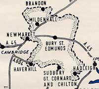
West Suffolk's Expanding Towns
|
|
1961 |
By 1961 it was general policy in West Suffolk to use London overspill and town expansion to revitalise the local infrastructure. From 1961 to 1971 West Suffolk became one of the fastest growing areas of the country. Haverhill and Bury were to grow by 10,000 each but lesser town expansion was planned for Mildenhall, Brandon, Newmarket, Sudbury and Hadleigh. New factories were backed up by large scale council house building projects. This would stimulate private house building and renovations of older properties. Ipswich and East Suffolk near the coast hardly grew at all during the 1960's.
Meanwhile, the Howard estate would continue to be expanded.
|
|
Barber Greene 1962
|
|
1961 |
At Western Way industrial area in Bury, the foundation stone was laid at the Barber Green factory. This would become the European Headquarters of the international firm of Barber-Greene Olding Limited. The building contained offices at the front and a factory at the rear with substantial outdoor hardstandings. This manufacturer of road building machines was to become a major industry in the town for the next two decades.
This firm dated back to 1916 and had premises in Hatfield after merging with Oldfields of Hatfield. Needing to expand they acquired a greenfield site at the end of Western Way. Here the firm would become one of the largest in Suffolk, employing 600 people. Massive downturns in road construction in the UK and upheavals in the Middle East would result in an eventual move off the site in 1985.
|
|
W Vinten Limited
|
|
1961 |
Just over the road from the Barber Greene factory, the premises of W Vinten were also under construction. These were offices as well as a factory for television studio mountings and aerial photographic reconnaisance equipment. Vinten's had been founded in Cricklewood in 1910 and eventually supplied studio equipment to 35 countries, and aerial equipment for the RAF, NATO, and free world airforces.
Needing to expand the business, W C Vinten, the owner, investigated several sites before buying 6 acres on this expanding industrial site in Bury St Edmunds. Staff had a two year period to adjust and by 1964 132 staff had relocated to Bury, with Bury St Edmunds Borough Council providing 100 "keyworker" council houses to aid the move. By 1970 the firm would expand to employ nearly 600 people.
However, farming was still the largest single economic unit in Suffolk in 1961. By 1981 it would be smaller than other sectors of employment.
|
|
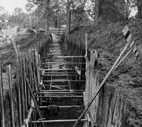
Main Sewer - Abbey Gardens
|
|
blank |
In Bury a major project was taking place to replace the main sewerage system for the town. Trunk sewers up to 4 feet in diameter were installed through the town and out to Fornham Park. As they worked by gravity they tended to follow the bottom of the river valleys of the Linnet and Lark as far as was practical. The main sewer entered the Abbey Gardens along the back edge of the tennis courts and exposed the remains of the walls of Bradfield Hall.
|
|
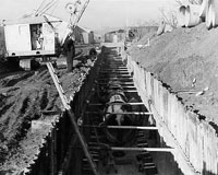
Main Sewer - Cotton Lane Allotments
|
|
blank |
The new sewer pipes went through the Abbey Gardens, through the allotments behind Cotton Lane and along Fornham Road, and the pipes were often set into deep trenches, depending upon the lie of the land.
Even at this late date there was an outbreak of measles in Bury St Edmunds, with 634 cases being recorded. One death resulted, but others may have suffered some degree of eyesight and hearing loss. Medical treatment was much improved since 1931, when there were 4 deaths from measles and the infant mortality rate in Bury was 46.61 per 1000 live births. By 1961 infant mortality had fallen to 13.4 per 1000 live births. However, for both years the infant death rate in Bury St Edmunds was well below the national average, which was 66 per 1000 in 1931 and 21.4 in 1961.
The 4th Suffolk (TA) unit was amalgamated with 1st Cambridgeshire to become 1st Battalion the Suffolk and Cambridgeshire Regiment. This regiment only lasted until it was disbanded in 1967. The 358th Suffolk Yeomanry was amalgamated with the Norfolk Yeomanry to form 308 (Suffolk and Norfolk Yeomanry) Field Regiment, RA (TA). Along with the regular army, the TA was being cut back.
In Haverhill the town centre improvements got under way when much of Peas Hill was demolished, the 1,000th tenants were given keys to their new homes and the population was 5,200.
At RAF Stradishall Javelin 2's and 6's had been flown by 89 and 85 Squadron up to 1959. In 1958 Hunter 6's arrived with Number 1 and Number 54 Squadron and these planes stayed until 1961.
In December 1961 Stradishall became a Training Command with Number 1 Air Navigation School with Varsities and Meteors, then Dominies until August 1970.
|
|
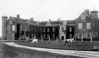
Rushbrooke Hall 1909
|
|
blank |
During 1961 one of the once finest local houses was lost to fire. Rushbrooke Hall had been a magnificent three winged Elizabethan mansion, started by the Jermyn family in about 1500, and extended fifty years later. Just before the Second World War it had been bought by Lord Rothschild in 1938 and massively refurbished and modernised. However, with the coming of war, in 1941 the house was taken over as a Red Cross Convalescent Home for wounded servicemen. After the war the Rothschild family never returned to live there. There were attempts to find an institutional use for the property, but these all failed , and for several years the house had stood empty and abandoned. It was said that it needed five tons of coal a day to heat it, and by 1961 it was full of dry rot.
In 1961 demolition was begun, and some pieces were recycled. Some of the oak panelling was given to Thingoe RDC for the Council Chamber. This was later moved to the Borough Offices on Angel Hill in 1974. The chimneypiece from the hall and two large doorcases went to the Roman Catholic Church in Westgate Street. Further salvage work was thwarted when the house caught fire and burnt down. "Undoubtedly its destruction was amongst the greatest losses in the history of Suffolk houses", wrote W M Roberts.
The spire which topped out Westley parish church's tower was removed, as it was thought to be unsafe.
In June 1961 the Village Chapel at Chevington was demolished. Its Methodist congregation had fallen to only eight by 1959, and it was sold to Thingoe Rural District Council in 1960, who would use the site for housing.
|
|
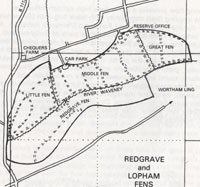
Redgrave and Lopham Fen by 1983
|
|
blank |
During 1961, after long delays and discussions, the Suffolk Trust for Nature Conservation was formed. The immediate reason was to save Redgrave Fen from further drying out, because of its importance as a surviving lowland valley fen. It was situated at the source of the River Waveney, and lay along the Suffolk border with Norfolk.
In the late 1950's, David Bellamy had studied the fen and found a diverse and fascinating mosaic of fen communities, rich in rare species of both acid and alkali loving plants. This richness was a result of the fen's unique water regime, complex geology and soil structure and the traditional management practices of local people as a Poor's Fen over many years. In 1954, Redgrave and Lopham Fen was designated a Site of Special Scientific Interest (SSSI) in recognition of its outstanding conservation interest.
By 1960 the fen was in grave danger. Scrub was rapidly encroaching as the fen dried out, caused by river dredging and a local water borehole, extracting the precious water. Something had to be done.
The major impetus for these efforts to safeguard Redgrave's future came from core members of The Suffolk Naturalists' Society and for a short period this organisation effectively took over the management of the fen. However, it was felt that another specialist organisation, whose main objective was primarily to manage nature reserves, should be set up to look after Redgrave Fen. In 1961 the Suffolk Trust for Nature Conservation, later to become The Suffolk Wildlife Trust, was formed and Redgrave Fen became its first wildlife reserve.
Having taken on the management of Redgrave Fen, the much larger area of Lopham Fen would eventually also be taken into Suffolk Trust management, despite the anachronism that Lopham Fen lay in Norfolk.
|
|
Bury Guide 1962
|
| 1962 |
In 1962 a new Guide Book was produced by a Cheltenham publishing company under the authority of the Bury St Edmunds Borough Council. The cover picture was painted by Ernest Payne of Bury St Edmunds. It had soft covers, and was the first guide to include more than just historical interest. It included an article on "Bury as an agricultural centre", and another entitled "From an industrial point of view". Western Way industrial estate had attracted a number of new industries in the 8 years of its existence. Since then another 40 acres had been added to the council's industrial land portfolio. A decision on becoming an expanding town in partnership with the London County Council was expected soon. Barber Green, Olding had moved its road making machine business from Hatfield to Bury St Edmunds. The West Suffolk College of Further Education had been inaugurated to to provide facilities for the proper training of craftsmen and technicians.
|
|
All Saints Foundation Stone
|
|
blank |
This foundation stone for the new All Saints Church in Park Road, Bury St Edmunds, was laid by the Bishop of St Edmundsbury and Ipswich on 21st January, 1962. The new church was being built next to the existing All Saints church hall, and would be consecrated early in 1963.
John Saunders has pointed out that, "On 30 March 1962 the front page of the Bury Free Press confirmed that in less than an hour that week Bury St Edmunds Town Council had decided to embark on the biggest land deal in its history. They had agreed to buy Mr Boughton’s 57 acres (off Beetons footpath) at a cost of £140,000 or almost £2,500 per acre, he having previously been refused planning permission to develop it himself as it was owned for residential purposes. It would be used to build an extension to the Howard Estate.
Also in the month of March 1962 five London families had moved to Hooper Square on the Westley Estate in Bury St Edmunds under the London overspill scheme."
|
|
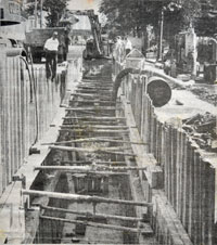
New sewer in Fornham Road
|
|
blank |
While the new sewage works at Fornham Park was being built, work was under way to replace the old sewers from the town to West Stow. The new 51 inch sewers had been laid through the Abbey gardens and Cotton Lane Allotments and thence along Fornham Road, ultimately to terminate at the new pumping station in Pigeon Lane.
This picture was published in The Bury Free Press but supplied by Michael Smith who had worked for T C Stewart, the contractors. Unsurprisingly the disruption to traffic and to residents of Fornham Road was considerable as well as confusing. For part of the way traffic could be diverted around Northgate Avenue, which at this time joined Fornham Road at both ends. But for weeks the inhabitants were hemmed in by giant machinery and stockpiles of 4 foot diameter concrete pipes.
|
|
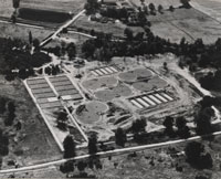
Fornham Sewage Treatment Works
|
|
blank |
The Fornham Park sewage treatment works was opened in May, 1962, and the West Stow sewage farm was de-commissioned. A pumping station was installed in Pigeon Lane to terminate the sewer and pump waste up to the new works. You can view the plans and information about the new Sewage Works by clicking here:
Official opening of Fornham Park Sewage Works, 1962
The old settling beds at West Stow were to become used as a landfill site for rubbish from Bury St Edmunds to replace tipping at the Haberden and Mount Road. By 1962 most West Suffolk villages had piped water, and many parishes had mains drainage. Work continued throughout the 1960s.
In Haverhill the Colne Valley Railway Line was finally closed down for goods traffic, leaving the Stour Valley line to continue until 1967. Haverhill South had not seen passenger traffic since 1924.
It was the height of the Cold War, and the Cuban Missile Crisis of 1962 was probably the height of this period of fearfulness of Nuclear War. West Suffolk people knew that Honington had its giant V-Bombers, and that the Americans had nuclear weapons at Lakenheath. It was always felt that our area would be hit first, in the event of Foreign attack.
|
|

F-100D Super Sabre
|
|
blank |
On 22nd August 1962 an American aircraft known as a F-100D Super Sabre 55-2784 crashed into base housing
(known as the Tobacco Houses) at RAF Shepherds Grove which was being used by personnel from other USAF
bases nearby. USAAF flyers had left Shepherds Grove in 1959, but 82 Squadron replaced them to convert the station to a Thor Missile Base. John Stynes of St Petersburg in Florida, then aged 19 and a member of 82 Squadron missile crew stationed at Shepherds Grove was accommodated with many others in the fire station building adjacent to the old air traffic control building. In March 2012 he wrote his recollection of this crash.
"They had just reached the secure site area and were walking across the main runway to the Dining Room when they were suddenly aware of a very low flying F100 aircraft circling above. They were surprised and then startled as they became aware of what they believed was gunfire behind them and could then see a large plume of smoke in the direction of the tobacco houses. (They subsequently discovered that the ‘gunfire’ was the ammunition exploding in the crashed aircraft) The F100 after making several passes above their heads eventually left and they continued over to the missile site.
When they arrived, they were told that there had been a major incident and that an aircraft had crashed into the tobacco houses. All those that were not needed at work were then put into vehicles and taken to the quarters to assist until the USAF could arrive with their own personnel.....
We were then approached by one of our Launch Control Officers (Flt Lt Stubbs) to assist him with checking the runway to ensure it was clear and we went in his car, stopping to remove any small items from the surface that we thought may constitute a hazard to aircraft. Eventually, a C47 Dakota aircraft fitted out for casualty evacuations landed and taxied up to us, inside was a medical crew including a doctor who we took back to the incident site.
By this time, the fire was out and the aircraft could be approached. Concern was then expressed about the disappearance of Peter Hammond, who most of us knew as he had recently worked at the missile site. The doctor suggested that we should form search parties and look for him, as it was possible that he was in shock and had run away. This was done, but to no avail. We were later told that Peter was eventually found beneath the aircraft. We were also told that Peter had been outside the front of the building (up a ladder?) and had seen the aircraft coming towards him over the top of the house, he had time to enter through the front door and warn the occupants who went out of the back. Unfortunately, Peter went back out the front and was hit by the aircraft that had hit at the rear of the house, skipped over it and landed in the road."
Peter Hammond was one of several men repainting the bungalows. According to the Times newspaper report, he was 19 years old and lived at nearby Hepworth. Three bungalows were destroyed by the crash, although one was unoccupied. An officer's wife and infant son escaped from one bungalow, while another Officer's wife and three children also escaped unharmed. The pilot had already bailed out.
The statement above comes from http://www.airfieldinformationexchange.org. The site of the crash at Shepherd's Grove is nowadays next to a children's play area.
|
|
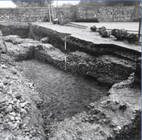
Bradfield Hall remains
|
|
blank |
When the new sewer was installed in 1961 the trench through the abbey gardens exposed some ruined walls along the line of the tennis courts. In November 1962 Martin Biddle excavated this area for the Ministry of Public Buildings and Works, and found evidence of Bradfield Hall or the Infirmary, which is shown here.
By April a new and much more sophisticated Observation Post was completed to replace the 1950's platform used by the Royal Observer Corps at the edge of the old Westley Airfield. It was opened as Nuclear reporting Cell 4/17 in October 1962. These nuclear bunkers were completely underground, constructed of reinforced concrete. The top was 7.5 inches thick, with a 3 inch covering of grassed over soil. The hatch covered a 15 ft long ladder down to two small but self contained rooms, with kitchen and toilet facilities as well as the trappings of a nuclear observation post. Equipped with a weeks supplies this was one of a network reporting to 4 Group HQ at Colchester. Westley had phone links also to the Bacton (4/15) and Beyton (4/16) Bunkers.
By 1968 this tension was thought to have eased and the Royal Observer Corps (ROC) was halved in numbers and the Guildhall base would be closed down, although Westley Bunker was kept in a care and maintenance state for some years more. It was to become part of the grounds of Westley Middle School and was sealed off and levelled in the 1980's. The ROC and its Bury Group members were stood down finally on 30th July 1991. Officially there were 11 still active members of Post 4/17 at Bury at this time.
|
|
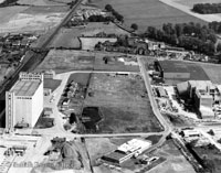
ABM new maltings
|
|
blank |
ABM finished building their new Maltings at Eastern Way. This aerial photograph shows the silo of Associated British Maltsters Ltd and Eastern Way industrial estate. The maltings sat conveniently on the railway line for ease of distribution.
Already well established by the 17th century, brewing has always been an important industry in Suffolk, with its ready supply of locally grown barley. Maltings are common in the Suffolk landscape, although by the twentieth century they were on a larger scale.
In 1968 the well known Pathe News filmed the ABM factory, and declared it the largest malting factory in Europe. This clip can be viewed on their website here:-
www.britishpathe.com/
On the Cornhill in Bury St Edmunds, Smith's Furniture Stores closed down, having traded here since 1866. It was located next to the Castle Inn, on its western side.
In 1962 local author Norah Lofts published the last book in what came to be regarded as her classic work.
The 'Suffolk Trilogy' (The Town House, of 1959, The House at Old Vine, of 1961 and The House at Sunset in 1962) spans 600 years in the history of a house, from its beginnings as the h ome of a medieval wool-merchant to the present day. The model for this house is said to be Sun Court in Hadleigh High Street.
Norah Lofts had lived in Bury for most of her life, and had become a best selling author of historical novels, often with a Suffolk background. She died in 1983.
|
|

All Saints spire
|
|
blank |
All Saints parish and its original hall had been set up in Bury St Edmunds in 1953. The site was in Park Road, and during 1962 a new church was built next to the original church hall. This view shows the spire being added to the church in December, 1962. It would be consecrated in 1963. It was a light, airy building that was much bigger inside than it seemed from the outside.
Winter 1962 saw a Big Freeze which lasted for months. The weather had been getting worse since about 1950, and the winter of 1962/63 turned into the coldest since 1740. Although never so bad, this cooler time lasted into the 1970's.
The really bad big freeze began on Boxing Day, 1962, and extended well into 1963.
|
|
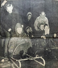
Livermere Lake frozen over
|
| 1963 |
The biggest freeze up for many years continued after Boxing Day of 1962, and through January and February 1963. Villagers remember snow piled up as far as bedroom windows, and roads were frequently blocked.
Great Livermere lake froze over and the Mildenhall Round Table club challenged Bury St Edmunds, Thetford and Newmarket tablers to a skating tournament all under flood lights. Children were shown in this picture from the Bury Free Press having fun on toboggans.
February 1963 was the coldest February for 82 years. Standing water was frozen for some 10 weeks, and the populations of Herons, Bitterns and Kingfishers were severely affected.
|
|
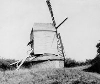
Post Mill at Woolpit
|
|
blank |
Following years of neglect the post mill at Woolpit finally collapsed. Such events led to other mills being "saved" by local enthusiasts. There had been a mill in Woolpit in 1577, but this mill was probably built in 1675 according to Robert Halliday.
In his booklet, "Ahead of its Time," John Saunders noted that, "In March 1963 Bury St Edmunds Town Council Housing Committee decided to select the names of 16 roads on the Howard Estate from the names of mayors dating from 1836 onwards. The Committee decided that they should recommend to the Council the name of St Olave as the name of the main road to run between the Mildenhall and Howard Estates because it would be named after the St Olave’s Trust from which the Council purchased the land where the road would run."
James Oakes' diaries had been sold to a dealer in 1955, following its discovery in the library at Nowton Court, the family home. The diaries came on the market in 1963, and the Borough Archivist, Martin Statham, urged the Bury St Edmunds Borough Council to buy them, which they did. These turned out to contain a massive amount of detail of life in Bury from 1778 to 1827, and were eventually published in 1990.
The old industrial regime in Bury was changing. At Greene King the annual ton of coal delivered to each married employee was ended. Not only was the Welfare State providing for the working classes, but the company was under pressure from the Stock Market to show a modern face, and improve efficiency. Paternalism was not thought good business any more.
The Angel Hotel in Bury was expanded when it took over the adjacent St Edmund's Hotel. The Midland Bank took over Whipps Fishmongers who were next door at the top of Abbeygate Street.
|
|
 Laying up the colours
|
|
blank |
In 1963 the First East Anglian Regiment was granted the Honorary Freedom of the Borough of Bury St Edmunds. Its successor is the Royal Anglian Regiment, and the First (Royal Norfolk and Suffolk) Battalion retains this honour today.
On 30th November the colours of the 1st Battalion and the 4th Battalion of the Suffolk Regiment were laid up at St Mary's Church in Bury by colour parties of the 1st East Anglian and the Suffolk and Cambridgeshire Regiment.
Thingoe RDC's water undertaking had by now supplied piped water into all of its parishes since the war, and was making bulk supplies to five neighbouring authorities. On November 1st, the whole lot was transferred to the West Suffolk Water Board.
Only two packs of Stag Hounds survived the Second World War, the Mid-Kent and the Norwich Stag Hounds. the Norwich Stag Hounds frequently hunted in Suffolk as well as Norfolk, but they disbanded in 1963. (The Mid-Kent Hunt had disbanded a year before.)
By now, Red Deer were a noticeable feature of the Thetford and King's Forest plantations of coniferous trees, owned by the Forestry Commission, situated to the north of Bury St Edmunds. The large Red Deer are not native to the area.
They carry impressive heads, for they are some of the biggest and best-fed reds in the country. Most are thought to be descended from deer that eluded the Norwich Staghounds, a pack that hunted carted deer in the area until 1963. The deer was taken to the meet in a cart (or box), released and given some law (time before the hounds were released). The hunted beast would generally give the hounds a good run before standing to bay. The hounds were then whipped off and the deer put back in its box and taken home.
In latter years the Norwich only hunted hinds and haviers (castrated stags), but some of the hinds eluded the hounds. As they were usually pregnant they were the founders of the current East Anglian herd, members of which can now be found throughout Norfolk and Suffolk. The Norwich Staghounds obtained their deer from the famous herd in Warnham Park in Sussex. According to the authoritative G.Kenneth Whitehead, “on several occasions the Norwich failed to recapture their deer, and as a result, the Warnham strain has been responsible for the fine quality of the feral red deer now in the Thetford forest area.” After 1963 the herds became entirely self supporting, growing only from their own reproduction in the wild.
During 1963, the town map of Bury St Edmunds was being reviewed. One proposal was for the Mount, an area between Shakers lane and Rougham Hill, would be used for industrial development. This alarmed local activists, such as Dr Marcus Bird, and his response was to propose that this area should be turned instead into a new golf course. The existing golf course, he proposed, should be sold for a mixture of new housing to extend the Howard Estate, and light industry to provide adjacent employment. The Golf Club had become well aware that the Howard Estate had been extended right up to their eastern boundary, and that the 90 or so acres of golf club land had now become valuable potential development space. However, the club would soon hear of further threats to their existing location.
At Haverhill, town expansion was well under way.
In March the roads and services were being constructed for the Clements Estate in Haverhill and the tender was awarded for the first 142 houses. At Little Wratting, Blunts Hall was demolished by Sainsbury's to make way for the expansion of the thriving Haverhill Meat Products factory complex. The old peoples' bungalows were completed in Withersfield Road, Haverhill, by April that year.
In May 1963, the new Haverhill sewage works was opened by Louis Goodman, Assistant Secretary at the Ministry of Housing and Local Government. It was built with expansion in mind and could be extended to cope with a population of 17,500.
|
|
Published 1963 by J & E Brooke
|
|
blank |
Well known local farmer, Justin Brooke, died in 1963, and, unhappily, did not live to see his latest book in print.
In 1928 Justin Brooke and his wife Edith had bought Clopton Hall and its 150 acre farm in the parish of Wickhambrook. The land cost £5 per acre, and the farm was largely uncultivated because the agricultural slump had broken the farmer. They bought another farm of 172 acres adjacent to the first for a similar cost per acre, eventually building up to a total of nearly 2,000 acres. In 1963 the couple published a book called "Suffolk Prospect", which vividly described the rural conditions of pre-war agricultural Suffolk. Their business plan was to abandon the mixed farming typical of this boulder clay area, and to concentrate upon growing fruit. Brooke had published books on growing peaches and other stone fruit in England. In this latest book he did not confine himself to the pre- war days, but also described the improvements in life brought after the war, as well as the many bureaucratic restrictions and muddles which he saw around him.
Brooke also described some customs which he claimed still flourished in 1963. "Certainly I know today where I can obtain the services of a local black witch, should I so desire."
The Beeching report on the railway network was published in March 1963. The report, called 'The Reshaping of British Railways' recognised the falling demand for passenger traffic and the growth of the road freight network. The report listed hundreds of railway stations across the country that were considered uneconomic to run in present conditions.
The stations of the Stour Valley line (Chappel & Wakes Colne, Bures, Sudbury, Long Melford, Glemsford, Cavendish, Clare, Stoke, Sturmer, Haverhill, Linton, Bartlow and Pampisford) were all listed and recommended for closure.
Many rail line closures would follow in an attempt to keep a viable network going. However, passenger traffic had already ceased at Mildenhall, Thetford, and stops along the Thetford line like Ingham and Barnham, Haverhill's Colne Valley stations, as well as Welnetham, Cockfield, and Lavenham. Haverhill's Stour Valley line from Cambridge to Long Melford and Sudbury would survive until 1967.
After the Cuban Missile Crisis of 1962 international relations improved considerably.
The Thor missile base at Shepherd's Grove was closed down in 1963. The site then changed to agriculture with an industrial estate and extensive use for housing. Similarly the missile base at Tuddenham was closed in July and sold off.
After 1963 the main UK nuclear bomb was called Type WE 177, based on an American design. These would be stored at the nuclear capable bases themselves. This would include RAF Honington.
So by April 1963 the nuclear weapons at the Barnham bomb store of RAF Barnham were removed and the site closed down. It would be sold off in 1965.
West Suffolk Police first began to use Traffic Wardens in 1963.
|
|
Guidebook of 1964
|
|
1964 |
In Bury St Edmunds the Borough Council relinquished one of its most important functions when, on 1st April, 1964, all of its Water Supply Undertaking was transferred to the West Suffolk Water Board. This included the Water Pumping Station and borehole in Kings Road, the West Road Watertower, and all the associated staff. It retained its sewerage function until 1974.
In 1964 the Publicity Committee of the Bury St Edmunds Borough Council published its own guide to Bury St Edmunds for the first time. Hitherto any guides had been produced by private enterprise. The new guide was a handsome hardback production, with many black and white photographs and just one or two coloured illustrations. It was followed by new Guides to Bury St Edmunds in 1966, 1970 and 1973.
|
|
 New industry in 1964
|
|
blank |
Barber-Greene Olding and Co was now well established with its European Headquarters in Western Way, employing over 200 people engaged in building diggers, asphalt machines and road laying equipment for sending to road building projects worldwide.
Associated British Maltsters boasted the largest maltings in Britain, which stood dominating the Eastern Way Trading Estate, as well as the skyline of the town. Nearby on Eastern Way was the butter packing factory of Lovell and Christmas. Just up the hill on Hollow Road stood the Bury Sugar Beet processing factory. It had just finished a three year programme of reconstruction, and was the biggest Beet Factory in Britain.
The Cooperative Wholesale Society had its Bakery at Western Way, as did the printing works of Lamson Paragon.
The Town Clerk advertised in the new guide that two industrial estates were now fully occupied, but attractive sites were available on other estates. The population was 22,000 and was increasing to 40,000 wrote the Town Clerk.
The new guide contained an excellent 26 pages called "The Life of Bury", with a full history from Anglo Saxon times to the present day, written by Norman Scarfe. It is interesting to note that Norman Scarfe ended his final perambulation just past Barn Lane in Eastgate Street, as follows:- "Beyond the railway bridge, Out Eastgate climbs out past the ancient hospital of St Nicholas to Barton and the fields and farmhouses of Suffolk."
Norman Scarfe himself wrote that "There are at present 6,500 houses. A total of 13,800 will be required by 1981. Of these, 7,490 will have to be built on new land.....this would involve building on 750 acres of the Borough's available land."
By the year 1974 the railway bridge over Eastgate Street would have been been replaced by a road bridge for the A14 Trunk Road and, within another 25 years, new housing at Moreton Hall would reach out into the "fields and farmhouses" as far as the Flying Fortress public house, on the edge of the Rougham Estate.
|
|
 An Opportunity for Industry
|
|
blank |
This illustration is of a folded leaflet sent out in answer to enquiries from London based industry who wished to expand to larger sites outside the metropolis. The full leaflet may be seen by clicking on the thumbnail illustration. If the enquiry was sent to the Town Clerk, he would reply by sending this leaflet together with a map of the borough, a short guide to places of interest, and a typed list of local auctioneers and estate agents. The main leaflet showed the location of Bury St Edmunds, a note on factory sites available and factory units built by the council for rent. Existing industries were listed, as were local communications, population figures, new local housing available for workforce, and educational and leisure facilities available.
|
|
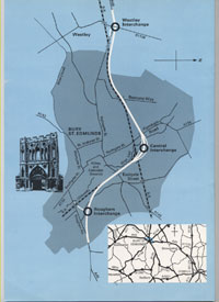 Proposed Bury By-Pass
|
|
blank |
As part of all this new development it had become clear that the transport infrastructure in Suffolk needed to be upgraded, and that there was a pressing need to reduce the amount of traffic passing through Bury St Edmunds. During 1964 the West Suffolk County Council laid down a line for the proposed by-pass of Bury St Edmunds. This would be part of the upgrading of the A45 trunk road which linked the fast-growing container port at Felixstowe with the Midlands. This line was included as an amendment to the Bury Town map, which was an important statutory Planning Document, and the line would be upheld in the subsequent Public Enquiry in July 1965. Planning decisions from 1965 until the road's completion in 1973 would now need to take these proposals into account.
The Bury Golf Club now learned that the line of the new road was highly likely to cut through the existing golf course. There was a proposal to follow the line of the railway, which would place a permanent barrier between the clubhouse and the course, as well as disrupt the existing greens and fairways. This line was confirmed in 1965.
|
|
 Gasworks in 1963
|
|
blank |
Bury's Gasworks in Tayfen Road would close down production in 1964, but the gasholders remained as part of the national grid network. Town gas had been generated here by the process of heating coal to drive off the gas, which was collected in three huge gasometers. Coke was the by-product from this process. By 1960 the cost of gas manufacture became too expensive and a grid main was laid and gas was imported from North Africa via Canvey Island. The Bury St Edmunds Gasworks finally closed on April 11th 1964. Coal gas was now supplied from outside the area. Natural Gas from the North Sea would arrive in Bury in 1971.
In technological contrast IBM released its System 360 commercial range of computers including innovations such as upgradeability and magnetic tape drives.
In May 1964 a by-election followed the demise of W T Aitken, who had been Bury's MP since 1950. Another Conservative was duly elected to represent the town. He was Eldon Griffiths, who was to be the town's MP until his retirement as Sir Eldon, in April 1992.
Early in 1964 the Haverhill Urban District Council took a special census which showed that Haverhill's population was then 7,239. By March 1964, 575 houses had been erected and there were a further 238 under construction. Some 26 new factories had also been built under the town expansion scheme.
The Thingoe Rural District Council showed that it continued to be at the forefront of managing rural development by buying up the major part of Hall Park at Great Barton. A master plan was drawn up for private residential development, the council installing roads and sewers, and laying out extensive green amenity areas. Some 113 individual plots of land were to be sold off for "executive" type private houses.
In Westgate Street a long running public battle to raise interest and funds was won when the Theatre Royal was triumphantly re-opened as a living theatre. Eleven years later the brewery would lease it to the National Trust on a 999 year lease. Seating was now halved to only 350 to comply with modern requirements, but this has made it hard to remain financially viable at all times.
The County Grammar School had stood in Northgate Street since 1907, when it was considered the most up to date in West Suffolk. It had served both boys and girls until 1955, when it became a Girls Grammar School. In September, 1964, the County Grammar School for Girls now moved to brand new premises in Beetons Way. For many years the girls had walked to this new site to make use of the playing fields which the education authority had acquired there. These long walks now became unnecessary.
|
|
 Beetons Way 1964
|
|
blank
|
On the opposite side of Beetons Way from the new school, the Howard Council housing estate was rapidly being expanded. In the summer of 1964 people were moved into new houses while the pavements were still under construction. This rather unsharp photograph shows the Hisscott brothers helping dad to wash the car outside number 48 Beetons Way. The paved garden path ends at the unfinished pavement, while across the road there is wasteland with Boby Engineering's Northgate Foundry visible in the background. Picture contributed to Facebook, 'We love Bury St Edmunds' by Carol Monro.
The old County school premises in Northgate Street gradually became used as an annexe to the West Suffolk College until 1988.
The Public Libraries and Museums Act required libraries to each certain standards. Pictures, records and films could be lent. These standards were laid down by a Libraries Working Party and included one member of staff for every 2,500 population and the purchase of 7,200 books each year as a minimum.
On 1st September 1964, the East Anglian Regiment became the Royal Anglian Regiment, and the Suffolks made up the 1st Battalion. The Depot remained at Bury, but cutbacks were the order of the day.
In September 1964 a major scheme of flood protection for the Great Ouse was completed. This consisted of a Cut-Off channel from the River Lark at Barton Mills down to Denver Sluice. The aim was that when flood water came down the Lark from the Bury St Edmunds direction, it would flow down the Cut-Off channel to below Denver Sluice. Thus it would avoid the risk of flooding Mildenhall and the washlands around the Great Ouse. It should also have allowed the Lark to be less likely to overflow as it had a second outlet to take water away more quickly.
This flood relief scheme also came to serve to keep Essex supplied with water. From 1966, water was taken over 140 kilometers from Denver Sluice to Abberton Reservoir and Hanningfield Reservoir via a system of tunnels and rivers.
|
|
 New Police Headquarters
|
|
blank
|
West Suffolk County Police Joint Committee built new headquarters in Raingate Street in Bury, as part of the County building complex on that site. Site clearance had begun in August, 1962, the first moves to a comprehensive redevelopment of West Suffolk County Council headquarters in the Raingate Street area. The police HQ would become ready for full use in 1966, although the official opening was on 9th October, 1964. A special leaflet was produced to mark the opening and can be viewed here:-
New Police Headquarters
The old Police Station in St John's Street would remain in use until around 1969, when it became available for redevelopment.
|
|
 Sexton's shop in 1906
|
|
blank
|
In October 1964, the landmark shop in the Buttermarket known as Sexton's the Tobacconists was to close. The Bury Free Press newspaper for 9th October, 1964 revealed that Mr Dick Baker intended to retire having become proprietor of the business upon the death of his father in 1947.
Mr William Watling Sexton had started this shop at 26, Buttermarket in 1858 as a dyer and scourer, tea dealer and tobacconist, having moved his shop here from 27 Abbeygate Street, and his dye works from the Abbey Ruins in the churchyard. By 1885 Mr Sexton had died and the business was in the hands of his widow, Mrs Harriet Sexton. By 1892 their two daughters, called Miss Anne Sexton and Miss Rosina Watling Sexton, were running the shop.
In their later years, a sedan chair was used to take the two ladies to Sunday services at the cathedral, and this chair can still be seen in Moyse's Hall Museum. Miss Ann died, aged 84, in 1914, and Miss Rosina died at the age of 92 in 1925. After they retired from direct involvement in the shop, it was managed by Dick Baker's father. After 1925 Mr Baker senior bought the shop, abandoned the dying and cleaning part of the business, and changed it to an exclusively tobacconist's business. It was normal for this type of business to also sell walking sticks and other "tobacconists fancy goods." The Bury Free Press commented that with the retirement of Dick Baker came the closure of one of the few remaining pure tobacconist's shops in Suffolk. A feature of the shop was that its interior had remained largely the same since its opening in 1858. The distinctive tobacconist's sign showing a kilted highlander taking snuff, known as a Phineas, had already been donated to Moyse's Hall Museum. Dick Baker lived in Felixstowe, and had commuted to Bury every day by bus and train. He told the newspaper that he sold 2 cwt of snuff each year, but now the shop would be sold to Sketchley's cleaners. By 2010 the shop would be occupied by "Shoe Zone".
|
|
 Bury Chronicle 1212-1301
|
|
blank
|
During 1964, the publisher Thomas Nelson's imprint called Nelson's Medieval Texts produced the Chronicle of Bury St Edmunds 1212 - 1301, edited by Antonia Gransden. It contained both the latin text and an English translation.
During the Mid 1960's Bury's Northern Way Industrial Estate was laid out on 30 acres of land in the area of Thingoe RDC.
On the Mildenhall Road Estate the Methodists' temporary chapel in Northumberland Avenue was replaced by a permanent brick built church.
By 1964 the extensive excavations of the Abbey of St Edmund were brought to a close. The undergrowth had been removed, the ruins stabilised and the area re-displayed to the public. The future of the dwellings built into the West Front remains continued to be the subject of hot debate. Many academics wanted these houses unpicked to reveal the medieval remains, but several families still lived there as tenants of the council.
|
|
 Foundation Stone
|
|
blank
|
In 1914 it had been decided to create St James' Church in Bury St Edmunds to be the Cathedral church for the new diocese of St Edmundsbury and Ipswich. It would require a considerable extension of the church to make it fit for its new central role. However the intervention of the First World War and subsequent reconstruction followed by agricultural depression and the Second World War meant that no such work could be in contemplation. Not until the mid 1950s could ideas of an extension to the cathedral come to the fore once again.
In 1954, Stephen Dykes-Bower, Surveyor of the Fabric of Westminster Abbey was commissioned to produce plans for a suitable extension. An appeal for £275,000 was launched in 1956, and although barely half the target had been raised, work began on the porch and library in 1959. In 1962 the first eight bays of the cloister were built.
Here in 1964 the Archbishops of Canterbury and York finally laid the foundation stones for the biggest phase of the planned work, namely the Choir, Lady Chapel and the Chapel of St Edmund. These works would finally be completed and Consecrated in 1970.
|
|
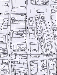
Central Bury 1965
|
| 1965 |
On 1st April, 1965, the London County Council ceased to exist and was replaced by the Greater London Council under the terms of the London Government Act of 1963. All the LCC town development agreements were taken over by the GLC.
In Bury the Corn Exchange was operating as a corn market every Wednesday, and as a public hall for the remainder of the week. There was an annual Trade Fair and Chrysanthemum Show, and wrestling and roller skating were popular.
The Borough Council applied to the Department of Education and Science for the right to keep its library powers. It reasoned that it provided a better service than the County library and it needed to spend less to reach the standards of the Libraries Working Party. Also the Ministry of Housing and Local Government had agreed to the growth of the town to 40,000 within 10 years, and permission was being sought to reach 60,000 under the London overspill arrangements. At this time the Borough Librarian also ran the Citizens Advice Bureau, and the estimated population of Bury St Edmunds was 22,270.
The Borough Library was north of the Corn Exchange, with its lending section on the ground floor, and a reference section based upon the Cullum Bequest of books, upstairs. The staircase was dominated by the portrait of Sidney Milner Gibson. The rear of the building held public toilets entered in the Traverse.
Further north again stood the Town Hall, the main offices of the Bury St Edmunds Borough Council.
|
|
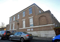 County Library building
|
|
blank
|
Meanwhile the West Suffolk County Council was pressing ahead with its own office redevelopments in Raingate Street, including a new Library. (There was already a library in the town run by the borough council.) The new library building was to be a headquarters for the county service, with a public library, large reserve book store, a council chamber, and garaging for mobile vans. Delays were occasioned from the first by the difficulty the council experienced in securing a government loan for its offices, and the library was not designed until 1960. As the future of the authority as an independent county came increasingly into question, a smaller scheme was prepared without the council chamber intended at the west end. Work began in 1963 and the building opened in May 1965. This building would become the County Record Office in 1974.
As local railway links were gradually extinguished, land became available for further road building.
On the Bury to Sudbury rail line the section between Lavenham and Long Melford had closed to all traffic in April 1961. Freight traffic continued from Bury St Edmunds as far as Lavenham until 1965. The one daily train was a source of excitement for schoolboys as it ran in the cutting at the top of King Edward VI Grammar School playing field. The planned bypass for the town would follow this same route.
In July, 1965, there was a Public Enquiry held into the proposal to build a by-pass to take the A45 Trunk Road away from Bury St Edmunds town centre. Everybody supported the aims of the new road, but the line of the road became controversial as it had a large impact upon the Bury Golf Course, as well as upon other property owners along the proposed line. However, the Enquiry confirmed the new proposals and planning decisions from 1965 until the road's completion in 1973 would now need to take these proposals into account. Talks between the Golf Club and the Council soon revealed that the Council also wanted to extend the Howard Estate on to land containing the 7th to 10th holes of the golf course. The combination of road and housing plans meant that a major change was needed to the Golf Course.
Further traffic measures were under way within the town centre. Looms Lane had been a traffic bottleneck for years, being extremely narrow. Properties from Blomfield House all along the south side of Looms Lane all the way to Northgate Street were demolished. The road was successfully widened up to the junction with Lower Baxter Street, and Blomfield House was replaced by a white tiled health centre offering maternity, dental and school health services. Unfortunately this merely shifted the bottleneck to Brentgovel Street, which remained so narrow that only single lane traffic could traverse it. The other issue about this scheme was the tiled exterior of the health centre, which John Betjeman called "lavatorial splendour." In 1987 the white tiles would be replaced by a red brick facade.
In 1965 Robert Boby Engineering spent £100,000 to improve the throughput of the St Andrews Works. The existing stores block would be demolished to allow an extension to the Fitting Shop. A new stores would be built to the south west of existing buildings.
|
|
 Theatre restored interior
|
|
blank
|
The Theatre Royal officially re-opened on 1st April, 1965, after having been fully restored from its sad fate as a barrel store since 1925.
In fact there had been a run of the play "Blithe Spirit" during May, 1964, but much finishing work was still needed at that time backstage.
|
|
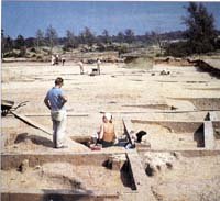
West Stow Dig
|
|
blank |
Dr Stanley West was contracted for three months a year to undertake excavations at West Stow on behalf of, and funded by the Ministry of Public Buildings and Works. These continued in the summers up to 1972. It was in this period that the major part of the settlement was explored.
A large number of coins and two revolvers were stolen from the Moyse's Hall Museum. The £880 insurance money was used to buy replacements. The collection now had one coin from every reign from Edward the Confessor (1042) to Queen Elizabeth II except three unobtainable at the time.
By this time the building of the Westley Estate was well under way and contractors began work on the Westley Community Centre, to serve the estate.
|
|
 Tom Jones 1965 Fete
|
|
blank
|
At this time there was a fete held every year in the grounds of Hardwick Manor. Every year a popular celebrity would attend, and in 1965 Tom Jones, the singer, was welcomed. He remains a popular singer in 2002.
Father Bryan Houghton of St Edmunds Catholic Church in Bury kindled a renewal of interest in the relics at Arundel, which he believed were the remains of St Edmund. He tried to have the remains returned to Bury St Edmunds. He did receive three teeth from the Basilica of St Sernin in Toulouse, but never succeeded in establishing widespread acceptance of his claims in Bury, and so the remains rest at Arundel. In 1970 he published a book about his attempts to prove his theories.
|
|
 Giffords early 1900s
|
|
blank
|
Giffords bakery had stood at 97 Risbygate Street since about 1896. Ethel and James William Gifford had married at Cheveley in 1896. Ethel's father was a master baker called William Collen. The couple had four sons, but only James Gifford took up the baker's trade. He ran the bakery here until 1965. At first the shop sold sweets as well as bakery, as it was opposite the St James's Schools for boys and girls until they were closed in 1937.
Greene King closed down its brewery at Baldock. This had once been Simpson's Brewery, and was now sold off for housing. Once Greene King had taken over Wells and Winch, at Biggleswade in 1961, closure at Baldock became inevitable.
|
|
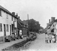 Stanton's Groop c1903
|
|
blank
|
In Medieval times the streets of Bury St Edmunds were drained by open ditches which would eventually empty into the river. In 1965 most of our rural villages still retained such features. This postcard view is thought to date from about 1903, and shows the Street at Stanton, with its drain, known as the Groop. Here at Stanton, in 1965, the Thingoe Rural District Council replaced the Groop by a culvert, which was then paved over. Some smaller villages would retain their open ditch drainage for many more years.
|
|
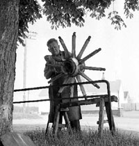 Flempton's blacksmith 1965
|
|
blank
|
Some old trades still lingered on in 1965, such as this village blacksmith at Flempton, pictured by the East Anglian Daily Times on 13th May 1965. The smithy can still be seen on the green at Flempton, although it no longer supports a smith.
Previously Honington had been an important V-bomber base occupied by Squadrons with Victors, Valiants and Canberras equipped for electronic warfare. Numbers 55 and 57 Squadrons were formed after 1959 to fly the newer Victors, but left for Marham in 1965. The era of the 'V - Bomber' was now coming to a close.
From 1965 the British nuclear deterrent was switched to the Navy with its submarine force. From 1966 to 1968 RAF Honington was put on a Care and Maintenance basis.
The high security store and maintenance facility for older types of atom bombs at Barnham had shut down in 1963, and in 1965 it was sold off. Like other former military bases its best new use was as an industrial estate, and the Gorse Industrial Estate thus came into being with a variety of small tenants engaged in a wide variety of engineering and other small businesses.
|
|
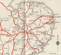
'The Hub of East Anglia'
|
| 1966 |
On 3rd January 1966 the Soviet spacecraft Luna IX made the first controlled landing on the Moon by a man-made object and sent back the first television pictures from the Moon's surface.
During 1966 the Bury St Edmunds Borough Council produced its second self-published Town Guide, within dark blue hard covers. A couple of new colour plates were also added to the production. Dr H Marcus Bird wrote a comprehensive History of Bury St Edmunds for the Guide to replace the version by Norman Scarfe in the 1964 Guide. The new guide included this map of the region showing Bury as the Hub of East Anglia. In 1964 this map had been monochrome, so attempts were being made to add colour where possible. This map would be used to promote Bury St Edmunds as a centre for many years to come. Apart from this map there was very little said about industry in Bury. There was one page of factory photographs at the back of the guide together with a page proclaiming that, "Special Industrial Leaflet on Request". The photos showed the premises of the Silo block for ABM maltsters, Lamson Paragon's Printing Works, The CWS Bakery, Barber Greene Olding and the butter packing factory of Lovell and Christmas. (This merely repeated the pictures in the council's Industrial leaflet from 1964 - see above.) Although attractive industrial sites were advertised as available, "two Estates now fully occupied."
|
|
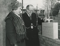
Borough Offices Extension Foundation Stone |
|
blank |
The Borough Council was also expanding, and wanted to consolidate the use of its various locations about the town. Work had begun on extending the Borough Offices on Angel Hill by an extension to the rear of the building opening on to Lower Baxter Street. Here we see the Mayor, Councillor Eric Steele, and the Mayoress, placing the foundation stone on the new building. As well as more office space, the extension included a new council chamber, which would replace the old chamber in the Guildhall. The old Town Hall in the centre of the town, which had contained a number of offices, would be put to other uses. Scattered offices in use by the council around the Angel Hill would also be replaced by the new extension.
The Chalkstone Housing Estate at Haverhill was started by the GLC. All of the town development houses in Haverhill before 1974 were designed, financed and built directly by the London County Council and then by the Greater London Council after 1965. The population of Haverhill in 1966 was estimated at 9,000, a growth of 2,000 in two years.
|
|
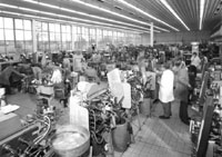
Inside Vitality Bulbs new factory |
|
blank |
Vitality Bulbs relocated from Wood Green, in London, to its new purpose built lamp manufacturing facility in Bury St Edmunds. This new factory was located in Anglian Lane, just off Beetons Way, just a stones throw from Boby's Northgate foundry, which was now on its last legs. Lighting systems would be manufactured here under a number of names until 2010.
|
|
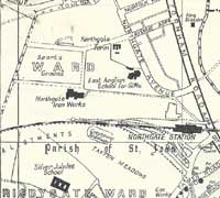
Foundry location 1960s |
|
blank |
Boby's Northgate Foundry, located in the Chalks area of Bury St Edmunds, was closed down in 1966. The footpaths crossing this area were known to locals as "the chalks", because of the chalk deposits often exposed on the surface here. The Northgate Foundry had been producing grey cast iron and bronze castings since 1900 for use in Boby's Iron works and for sale to third parties. By the 1960s the call for cast iron products was declining. Their place was taken by alloy castings and mild steel fabrications, which Northgate foundry could not make economically. Most of the workers were redeployed to the St Andrews Works in St Andrews Street, but the old moulding and casting skills would now be lost forever.
The foundry was left empty and soon became derelict. It was not demolished until 1972 to make way for the A45 bypass. Raynham Road was developed for housing from about 1975, and this linked Anglian Lane to Northgate Avenue.
The site is today the home of the Anglian Lane Trading Estate, and the only sign of the old ironworks is some iron slag which was used as ballast on the footpath approach from Northgate Avenue, at the end of Maltings Bridge.
By 1966 the Bury Golf Club had realised that it could turn the proposals for the A45 by-pass and town expansion to its own advantage. At the AGM the club resolved to seek planning permission to build houses on the land holding the existing 7th, 8th, 9th, 10th and 18th holes. They also aimed to seek an option to purchase 45 acres of farming land to the west of the course, and to open negotiations for the sale of the development land to the Borough Council. The new land and its reconstruction as a golf course and clubhouse was estimated at £68,100, according to the Club's official history, and the development land could be sold for £88,000. Over the next 9 months these proposals would be put into action.
|
|
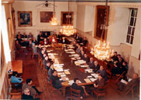
The last Council in the Guildhall |
|
blank |
In December the Bury St Edmunds Council met for the last time in the Guildhall. It had been used for meetings of the Corporation since 1606. The offices in the Town Hall were also now vacant, and plans were laid to make it into an art gallery.
|
|
Borough Offices Extension |
|
blank |
All this was made possible because the Borough Offices extension was opened and it included a new Council Chamber and three floors of offices, including a flat for the resident caretaker. The commemorative stone had been laid by the Mayor, Cllr Eric Steele, in February 1966, and was finished during the year. It was a typical example of the architecture of the 1960's, and by the 1990's, was considered hideous.
|
|
Clare Station closes
|
| 1967 |
The Stour Valley line of the Great Eastern Railway, but now part of British Railways, was closed down on the first Saturday in March, 1967. The last train had left Haverhill forever, along with its stations at Clare, Cavendish, Glemsford and Long Melford. In the other direction, the link through Bartlow to Cambridge had also ended, but various moves would be made unsuccessfully in the 1990's to reinstate this link. Clare station would become part of a future Clare Country Park.
The line to Sudbury from Marks Tey remained in operation. That line was originally opened on July 11, 1849. The section from Shelford to Haverhill was opened on June 1, 1865. The final section, bridging the gap and making Haverhill accessible from either direction, was completed on August 9, 1865. Haverhill's hundred years of railway communications was now over.
The Borough Offices Extension was not officially opened until January, 1967, although it had been in use for several weeks. You can view the plans and information about the new extension by clicking here:
Official opening of Borough Offices extension, 1967
West Suffolk County Council's new Howard Primary School opened in January 1967 to serve the growing Howard estate built by the Borough Council.
Another new secondary school was opened in 1967, this time under the auspices of the Roman Catholic diocese. It was named St Benedict's School and was located alongside the County Upper School in Beetons Way. The original preferred site of Fr Houghton and school managers for St Benedict’s was on the Howard Estate but the Education Authority decreed that it should be constructed at Beeton’s Footpath (later to become known as Beetons Way).
The Ipswich Borough Police Force and the East Suffolk force were merged with the West Suffolk Police Force to form the Suffolk Constabulary on 1st April 1967. The new west Suffolk headquarters was now finished at Raingate Street, but the police station in St Johns Street remained in use for another three years.
When the new amalgamated Suffolk Constabulary came into being the split between east and west Suffolk policing ended. It had broken apart in 1899.
West Suffolk County Council set up a farm training centre at the independent Chadacre Agricultural Institute to centralise its agricultural training in one place. East Suffolk had already established its own centre at Witnesham in 1960.
During 1967 the Bury St Edmunds Golf Course sold off 20 acres of land on the edge of Bury St Edmunds for further housing development, and to enable a new road to be built as a by-pass for Bury. This would become the A45, later known as the A14, and new houses would become part of Bury's Howard Estate. As the new A45 would bisect the old golf course and cut off the Newmarket Road clubhouse from the remaining golf course land, a wholesale re-design of the Golf Course became necessary.
|
|
Aerial view showing Jacqueline Close |
|
blank |
One of the most traumatic incidents to happen in Bury St Edmunds since the war had its first manifestations in July, 1967.
During the 19th century chalk was mined from beneath a quarry in the south west of Bury St Edmunds, known as Bullen's Lime Kilns. The earliest ordnance survey maps of the area (1886) and the later 1904 edition both show an air shaft associated with the mine. The mine was in operation until the beginning of the first world war, after this it became disused and any previous surface indications of mining in the area virtually disappeared. The presence of a shaft or any other indication of mine workings was not present on subsequent ordnance survey maps. However its existence remained in the minds of some of the older residents. Developers bought the site and boreholes down to 6 metres found no problems with ground conditions. Two terraces of houses were erected and were called Jacqueline Close, located off Mill Road. The aerial photograph from 1969 clearly shows the south terrace in the top right hand corner.
The first subsidence occurred after heavy rain on 25th July 1967 and involved the collapse of a road and a rear garden at the southern end of the site. The subsequent crown-hole was 8,1 m deep. Soon after this the council became involved and commissioned a geologist to investigate the site and the event. Excavation and drilling revealed a network of tunnels in which broken material occurred, probably the result of roof spalling. It was recommended that the crown-hole should be back filled and a drainage system installed to convey water away from the site.
Further subsidence occurred on 12th December 1967, this was associated with a soak-away under a road. The subsequent collapse was filled with concrete on 27th December, but worse was to follow.
The Museum of East Anglian Life opened in 1967 on 70 acres of ex-farmland on the edge of Stowmarket. The land was originally part of the home farm for the Abbots Hall estate. The estate's history dated from Medieval times when it was an outlying manor for St Osyth’s Priory in Essex. It passed through numerous owners until it was taken on by the Longe family in 1904.Huge changes in the 1950s and ’60s meant England was in danger of losing long established skills, equipment and buildings if something was not done to rescue them. Individual collectors and the Suffolk Local History Council worked to conserve and display local agricultural and industrial materials. After several years of temporary exhibitions across the county, the Misses Vera & Ena Longe placed 70 acres of Stowmarket's farming land, along with Abbot’s Hall itself, in trust to be used as a Museum.
|
|
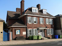
Thingoe House
|
|
1968 |
Thingoe Rural District Council, (RDC) moved its offices from 1, Northgate Street, to 118a Northgate Street, where it had meeting rooms, offices, council chamber and car parking. The extended building was renamed Thingoe House. The RDC's functions had expanded out of all recognition since the war, and its programme of sewerage and housing was proceeding apace.
|
|
New Shire Hall
|
|
blank |
The West Suffolk County Council was also needing more office space as work had expanded. Plans had first been considered in 1954, and the architect Donald McMorran of McMorran and Whitby, had been appointed in 1962. Working drawings finally began to be prepared for the council office block in June 1963, and a revised scheme was called for in June 1964. McMorran died in 1965, and following a series of revisions, the work was brought to completion by his partner George Whitby in February 1968.
This major extension, now called the New Shire Hall, was opened in 1968, in Raingate Street, in Bury St Edmunds.
In Bury St Edmunds, new market bye-laws were introduced.
Since 1939 the agricultural industry in Suffolk had got more prosperous. Cheap food was heavily subsidised by the state, and the industry became increasingly profitable by mechanisation and economies of scale. Small farms were dying out. Arable farming replaced animal rearing. Horses had virtually disappeared in the 1960's, replaced by tractors. In 1958 there had still been 4000 working horses in Suffolk, but in 10 years they were all gone.
In May, 1968, operations closed down at the USAF Mildenhall airbase, while new one thousand feet concrete over-runs were constructed on the runways. Additional airfield lighting was installed. The heavy jets from Mildenhall now operated from Lakenheath airfield until Mildenhall runways were completed in February, 1969.
|
|
Oliver Cromwell at Bressingham
|
|
blank |
In August 1968 the last steam train ran on British Railways tracks. It was pulled by the loco "Oliver Cromwell", and travelled incongruously from Carlisle, via Norwich, to Diss station. However, it was bound for retirement at Bressingham Steam Museum, run by Allen Bloom. Steam traction on British Rail was now dead, having been slowly replaced by Diesel Engined locomotives.
In August 1968 the Warsaw Pact countries, mainly the USSR, invaded Czechoslovakia.
RAF Honington had been put on a Care and Maintenance basis from 1966 to 1968, and in the Summer of 1968 the Daily Express held a series of World Motorbike Speed Record attempts here. Eventually on September 23rd a Mr Hagon achieved 206 mph, but the record was disallowed because of strong following winds.
|
|
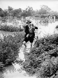
Rescue at Cotton Lane
|
|
blank |
Bury had last had severe flooding in 1947, but in September 1968, there was a storm of tropical intensity. Some 2.7 inches of rain fell in the 24 hours of Sunday 15th September, and much of Southern Britain was under water by Monday morning. Surrey was worst hit, and this was probably the most severe inland flood to hit the Home Counties in the last 100 years.
At Bury St Edmunds, Grenville Wilson, of 19 Eastgate Street, had just started work at the Sun Alliance Company in the town, and as he left for work on Monday morning the street drains were starting to overflow. When he returned home the river had risen to the level of the retaining wall by the Abbot's Bridge. The water level in the river was well above the level of Eastgate Street and part of this wall collapsed just as he was passing the Fox public house. The force of water swept him into the side entrance of the Fox, which luckily saved him from being swept any further.
Floods overwhelmed the Butts and Friary Lane, and water ran down Raingate Street. Peak loads of 30 tons of water per second were measured at Bury St Edmunds, some 600 times greater than normal. The council had to send out office workers to help rescue stranded livestock from flooded fields. Residents in Eastgate Street were soon stranded, and the army brought in amphibious vehicles to help police and firemen to rescue them. Boats, dinghies and rafts replaced cars on many flooded streets. Water lay along Etna Road and flooded Mulley's coach garage. The Dovecote in the Abbey Gardens was under water, as was practically everwhere along the River Lark through the town. Out of town, Sicklesmere was under water and only the tallest lorries could get through the flood. In Bury itself, some 270 properties were flooded to a depth of up to three feet. You can view more pictures of the flooding by clicking here:
The floods of September, 1968
After this the authorities knew that something had to be done. It was thought that demolition of Eastgate Bridge, and its replacement by one which allowed flood water to pass more easily, was the best approach.
|
|
July 1967 collapse
|
|
blank |
However, such precautions would never have been of help at Jacqueline Close, off Mill Road, in Bury St Edmunds. Built over 19th century chalk workings, surface water run-off into soakaways had already resulted in pathway collapses in July 1967. After this period of heavy rain and flooding nothing appeared to happen there for three months that was visible above ground. However, below ground, the surface water soak-aways funnelled the run-off into the already saturated ground, and percolated down about 40 feet to old mine workings. Gradually the roofs of tunnels and cavities were eroded, and fell into the voids. Thus the roofs of these tunnels quietly moved upwards as the collapses continued, until they reached the surface in December of 1968. On December 13th the walls of two houses began to sag. On December 21st a major collapse occurred on the estate, causing the front path, patio and a large part of the foundation of number 9 Jacqueline Close to subside into a shaft 6 metres in diameter and 9 metres deep. After this major collapse the site was declared unsafe by the borough council and it suggested that the residents should relocate. Some did, but others formed a residents association in protest, and looked for compensation.
Ten years after the great Haverhill floods of 1958, despite new drainage levies, floods also occurred there again in mid-September 1968. They were just as bad here as in Bury, and in many ways the effects were greater, and more widespread, because of the nature of the town at the foot of the Stourbrook valley.
In 1968 work began on the Horringer Court Estate along a road to become called Glastonbury Road. This was a private residential estate which was outside the Bury St Edmunds Borough boundary, situated within the Thingoe Rural District Council's area. Building would continue in this area for another decade.
|
|
Quality Castings (Slough) Ltd
|
|
blank |
Just as demand was falling off for the ferrous castings produced by Boby's and Cornish and Lloyds, a new foundry moved into Bury St Edmunds. In 1968, Quality Castings (Slough) Ltd moved into a site on the Fornham Road which would grow into the Northern Way Industrial Estate. Quality Castings were the first firm to occupy a location on Northern Way when its owner, Ron Tarrant brought 12 employees from his old Nissen hut at Slough where he had started the business in 1957. QC could undertake the aluminium and alloy castings that Boby's could not economically produce. These non-ferrous sand and gravity die castings were now in demand, and once established in Bury the firm would grow to over 40 employees.
|
|

Norfolk 1945
A R Blundell
|
|
blank |
During 1968, Alfred Blundell, the well known local artist, died. Since 1920 he had lived at Cavenham Mill.
Alfred Richard Blundell was born at Bury St Edmunds on December 24, 1883. From 1898 to 1900 he worked as an auctioneer’s clerk, after which he became a railway clerk, initially at Bury St Edmunds station, later at Woodbridge. In 1912, Blundell resigned to become a full time artist.
He set up a studio in Bury and subsequently went to London where he sold enough work to be able to study at the Slade School. From 1913, Blundell studied at the Slade. His first acceptance by the RA in 1915 was for a drypoint of St Paul’s, London.
Blundell moved to Old Hall, Hawstead, Suffolk in 1915. In 1920, he purchased Cavenham Mill, which had a first floor studio with huge windows. In 1933 he took an East Anglian school appointment and taught at three Bury St Edmunds Schools, including Culford. He continued to live at Cavenham Mill until his death in 1968.
Farm mechanisation had picked up again after the war, and with it a reduction in the labour force required. By 1968 Suffolk had 3,000 combined harvesters, compared to 12 in 1938. This represents 6 combines to every parish. These harvesters demanded larger fields, so hedges were removed and ditches filled in to accomodate them. One or two drivers could reap a whole harvest faster than the teams of men, women and boys who turned out to gather in the harvest before the war. Average field size in the 1930's was around 8 acres. By this time it was common for fields to be 40 acres, and as much as 90 acres in some places. The hundred acre farm of pre war days has failed to be viable, and 700 acres or more is now typical. There were drastic consequences for wildlife. Habitat loss was made worse by the use of chemicals like DDT. The Sparrow Hawk was virtually unknown in Suffolk by the end of the 1960's.
At West Stow and Lackford, along the River Lark valley, large deposits of sand and gravel had long been exploited in a minor way. In 1968 a major gravel extraction programme was begun by Amey Roadstone Corporation. Royalties were paid to the landowners. This campaign would continue for 20 years, and as each pit was finished, work began on a new section. Deposits would be extracted on both sides of the river in due course.
|
|
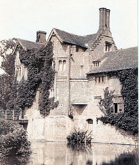
Gedding Hall early 1900s
|
|
blank |
The Rolling Stones were an internationally known music group in the 1960s, and would continue to perform into the 21st century. The bass player in the group at this time was Bill Wyman, who gained a connection with Suffolk when he bought Gedding Hall in August, 1968. The previous owner was a Mr Geoffrey Allen, who was said to have had wide underworld connections, including with the gangsters Reggie and Ronnie Kray. After Mr Wyman undertook some research into previous inhabitants of Gedding Hall he told a national newspaper that Ronnie and Reggie Kray fled to the hall after killing Jack 'the Hat' McVitie on October 28th/29th 1967. They were meant to have stayed up until 3am deciding what to do before returning to London.
It has been said that in 1196 Adam De Geddynge was Lord of the Manor of Geddynge and Thurmstone and the family hall was built in 1273. The hall has probably been rebuilt and modernised several times since then. Its current appearance points to a date originally in the 16th century, but there was a major overhaul and rebuild in 1897. Mr Wyman believes that the house dates back to the 1480s, and that he has located a nearby 15th century brick kiln site where many of the bricks in the hall were made.
|
|
Building railway underpass Beetons Way 1968
|
|
blank |
Since the public enquiry in 1965 it was known that a new bypass for the town was to be built. The line of the new road meant that a bridge would be needed over Fornham Road, and that the road would also need to cross Beetons Footpath. Part of the old Beetons footpath had already been converted into a roadway to serve the County Grammar School for Girls which had moved to Beetons Way in 1964. It was extended also to serve the new Howard Estate council housing along Beetons Way on the opposite side of the road to the school. It was the Council's intention to further extend Beetons Way to link up with the new industrial development at Western Way. So not only was it necessary to replace the existing footpath level crossing by an underpass, but the underpass would also eventually have to be traversed by the new bypass when it arrived. The first step was obviously to build an 'underbridge' to carry the railway line, and this picture shows the first excavations under way to achieve this through the summer. The Howard estate can be seen on the left of Beetons Way, and the County Grammar School for Girls in the background, on the right. The gateway for the old footpath level crossing is visible on the extreme right.
|
|

Beetons Way by November, 1968
|
|
blank |
This second picture was taken on 2nd November 1968 from the footpath that ran from Beeton's Way past the Northgate Iron Works. This is now Anglian Lane. The photographer's back is to the County Grammar School looking up towards Western Way. The site immediately in front of him would today be Ridgeon's builders merchants. The train is heading towards Cambridge, and is about to cross Beetons Way/footpath. The orange structure is the new bridge under construction over the footpath. The old footpath route can be seen to the left of the bridge, rising up the railway embankment to the old level crossing.
Over the next five years the new bypass would be built immediately adjacent to the railway line, between it and the photographer, opening in 1973. It would also require its own bridge over Beetons Way, which would be built in 1972.
|
|
Rougham Hill
|
| 1969 |
The main trunk road from Ipswich to the midlands still ran through central Bury St Edmunds at this time. This view down Rougham Hill shows the entry point to the town from the Ipswich direction. The Sudbury railway line had closed in 1965, and the rail bridge over the road seems to have been removed in this picture, perhaps making it a year or two later than 1969. The A45 (Trunk) road, as today's A14 was called, ran up Southgate Street to Maynewater Lane, into Westgate Street, and then up St Andrews Street South, exiting the town along Risbygate Street. There was also a road designated as A45 (non-trunk), which ran up Southgate Street into St Mary's Square and along thence along to the Angel Hill, to access the town centre via Abbeygate Street or Looms Lane.
The building visible on the right was the engineering firm of S H Jenkins, which stood on the corner of Shakers Lane. Shakers Lane ran from here all the way to the Eastgate Street/Hollow Road junction at this time. Nowadays the engineering works remains, but Shakers Lane has been truncated by the by-pass. Rougham Hill is now a cul-de-sac accessible only from a roundabout at the junction with Rushbrooke Lane.
|
|
Golf clubhouse of 1969
|
|
blank |
On 31st May, 1969, the newly redeveloped Bury St Edmunds Golf Course was formally opened. However, for a time the club used temporary score cards, as not all of the new holes were fully ready. The 11th and 12th holes were opened on June 1st, but the new 18th and 9th were not ready until 1971.
A wholesale redesign of the course (by noted golf architect Frank Pennick) and a new clubhouse became necessary in 1967 because of the proposed construction of the A45 Bury St Edmunds by-pass, and expansion of the Howard Estate. Five new holes were built on 44 new acres of farmland, and some of the original ones were renumbered - what was the first is now the sixth, for example, and the old sixth now the fourteenth - and many greens became multi-tiered. The old clubhouse on Newmarket Road was replaced by a new centre off Tut Hill.
The old holes, which had been sold to the council for development, were now excluded from the perimeter fence, and became open to the public. Some of the turf from the greens became re-used on local lawns, and boys ran impromptu golf games for a time.
On 21st July, 1969, Neil Armstrong became the first man to walk on the surface of the Moon.
W John Bridge became Managing Director of Greene King's brewery in Bury. He was the Great Grandson of Fred King, who was the "King" of the merger between Greene's brewery and King's Brewery in 1887.
In August there was a high level conference held at the USAF Mildenhall base, when President Nixon flew in to meet Prime Minister Harold Wilson. A crowd of up to 10,000 people gathered to watch their arrival and departures.
|
|
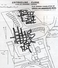
Extent of mine workings
|
|
blank |
Through the winter of 1968 and throughout 1969 the owners of homes in Jacqueline Close, Bury St Edmunds, had a wretched existence. Their terraced properties and the surrounding land had been declared unsafe. Following several more collapses the Chelsea Speleological Society offered their services to the residents association. Members visited the site on several occasions and gained access to the workings via the subsidence locations. On inspection they found a series of intersecting tunnels some of which were 4-5 m high. In places the mine roof domed suggesting failure was imminent and piles of debris lined the floor indicating that collapses had already occurred.
The older part of the mine was found to have been worked at two levels. This just happened to be below Jacqueline Close. Not only was Jacqueline Close found to be undermined but so was the hospital site adjacent to the laundry that was scheduled for re-development.
These plans were scrapped and the workings beneath the hospital site were filled with fly ash. The extensive undermining of the Jacqueline Close site proved too expensive for the residents association and the council to remedy.
Bury St Edmunds Borough Council installed its first computer, an NCR 500 based on punched paper tape input and magnetic stripe ledger cards as backing store. The ledger cards were simultaneously updated electronically and information printed on the front of the card. This system, known as a "visible records" computer, mirrored the use of accounting machines and had 400 words of magnetic core memory. This machine was used for the financial records of the council. It would be extended in use to payroll, the rates system, and to the accounting for council house rents over the next few years. It was programmed by members of the Borough Treasurer's Department in Machine Code, where hardware instructions were represented by a three digit code, and memory was addressed in four planes of 100 words each.
The Depot of the Royal Anglian Regiment in Risbygate Street, Bury St Edmunds, finally closed when its depot functions under Lt Colonel Deller were moved to Bassingbourn in Cambridgeshire. By now all but the Keep and front walls had been demolished.
Also to close was the Police Station in St Johns Street in Bury. A fine new Police HQ was opened in Raingate Street, next to the Shire Hall.
|
|
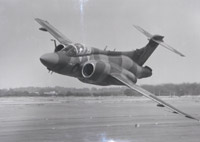
Blackburn Buccaneer
|
|
blank |
From 1966 to 1968, RAF Honington had been mothballed on a Care and Maintenance basis.
In January 1969 the RAF base at Honington was reactivated for flying and was updated to fly the Blackburn Buccaneer attack Squadrons of Strike Command. On 1st October the first Buccaneers arrived with 12 Squadron, the first to be deployed by the RAF. Previously the Buccaneer had been a carrier based plane used by the Navy and the Navy's 809 Squadron would also now use Honington. Number 12 Squadron were here until 1980.
|
|
Underpass at Beetons Way
|
|
1970 |
On 15th January, 1970, another part of Bury's rural past disappeared when the road known as Western Way was joined to Tollgate Lane by way of a new stretch of road which was officially opened to replace the old Beetons footpath level crossing. The blue official opening plaque can be seen on the left hand wall. This new 'underbridge' had to be built to carry the existing railway line. For the first time, vehicles could traverse under the railway line, linking the factories in Western Way with the new Howard Estate, without needing to go a very long way round. Only ten years before, the walk from the Greengage pub to the Barracks had been along a dusty country lane called Beetons Footpath, flanked by blackberry bushes and wheat fields, and small boys had thrilled to the sight of trains running over their pennies placed on the line at the level crossing.
(A much larger adjacent structure would be built in 1972 to carry the new A45 Bypass over Beetons Way, ready for the new A45 bypass opening in December 1973.)
|
|
 Bradfield Woods saved
|
|
blank
|
A few miles away, at Bradfield St George, Gedding, and Felsham, the future of a different relic of the past was also under grave threat. The ancient woodlands known as Monks Park Wood and the adjacent Felsham Hall Wood had survived intact from medieval times up to the 1960s. Since 1934, 300 acres of Felsham Hall Wood had been owned by the rake factory at Great Welnetham, and managed as a coppice woodland for the production of poles for a variety of wooden products, agricultural rakes in particular. The business had already been leasing those woods since 1912. By the 1960's a decline in trade had set in which caused John George & Sons Ltd. to place their Welnetham operations in liquidation in 1967. However in 1970 the Welnetham business was purchased by the Litchfield family, the firm now trading as Welnetham Woodwork Ltd., but the Felsham Hall woods were made available for sale on the open market.
In the 1960s agriculture had been grubbing out large parts of Monks Park Wood to turn it over to arable production. Local people had appealed for help from various conservation bodies without success. The Suffolk Trust for Nature Conservation had been formed in 1961 to save Redgrave Fen, but it felt that the financial commitment was too great to take on the purchase of Bradfield Woods. Undaunted a group of people began their own local appeal for funds. Eventually they were supported by the Society for the Preservation of Nature Reserves, (now called the Royal Society for Nature Conservation,) who were able to acquire the remnants of Monks Park wood, together with Felsham Hall Wood, and to preserve them as a nature reserve. In 1983 the Suffolk Trust for Nature Conservation would finally take the woods on a 50 year lease. The national importance of this old established woodland, with its unique flora, would be recognised in 1994, when the area was declared a National Nature Reserve.
|
|
 Bury St Edmunds Conservation Area
|
|
blank
|
The first urban conservation areas were designated in 1967 and by 2010 there would be over 8,000 conservation areas in England. They were to be designated by the local planning authority for their special architectural and historic interest.
This plan, taken from East Anglian Archaeology, Report Number 1, published in 1975, shows the Bury St Edmunds Conservation Area. This area was designated in 1970, and although it would limit development within its boundaries, there was still plenty of scope for the destruction of important archaeological evidence within the rules.
During 1970 there was a Public Enquiry into the new line proposed for the Bury By-Pass. It was basically the same as agreed in 1965, but with a few improvements to bring it up to "Roads in Rural Areas" standards. The road was approved, and the necessary Section 7 and 9 Traffic Orders would be made in April 1971.
|
|
 Corner of Southgate St. & Maynewater Lane
|
|
blank
|
With the A45 still running through the town, there were traffic bottlenecks in several places. One of these was on the corner of Southgate Street and Maynewater Lane, where the lane was extremely narrow. In order to widen this approach, Southbridge House, at number 82 Southgate Street, had to be demolished in 1970. This house had been home to the National Assistance Office from 1948 to 1964, and had been used by the Royal Corps of Signals during the war.
In February a C-141 Starlifter made an emergency landing at USAF Mildenhall. As there was a suspected gas leakage from a rocket engine on board, homes and factories within 2,000 feet of the plane were evacuated. Some 200 people were evacuated to Mildenhall Town Hall, but were soon allowed to return, following what proved to be a false alarm.
At the College in Bury, the new Engineering Training Centre was set up.
|
|
 Bury St Edmunds Guide 1970
|
|
blank
|
In 1970 the Bury St Edmunds Borough Council produced another new official guide to the town. It had hard covers, as it had been for some years, but now contained more colour pictures, as well as many in black and white. it was published to coincide with the commemoration of the 1,100th anniversary of the death of King Edmund of East Anglia. It was supported by a message from Lord Stradbroke, the Lord Lieutenant of Suffolk. In his introduction to the guidebook, "Exploring Bury St Edmunds", Councillor Harry Marsh made this note about St Johns Street, "The right side of the street and beyond is scheduled for redevelopment, when the economic position permits." The exploration was otherwise dedicated to the history of many streets and their buildings, both real and imagined.
James Gorst, the West Suffolk Planning Officer wrote a piece about Bury, in which he said, "Bury St Edmunds claims to be the birthplace of English town planning, as it was the first new town built after the Norman Conquest in 1066."
Town Clerk at this time was Richard R Hiles, who wrote a piece in the new guidebook entitled "A Progressive and Expanding Town." At this time, "The pig market is one of the busiest in the country, attracting buyers from an area stretching from south of the Thames to north of the Humber, and almost to the borders of Wales." "The Wednesday Corn Market, held in the Corn Exchange in the town centre, is rated by the corn trade to be among the country's four leading markets." "The Wednesday and Saturday market of stalls......is now a traffic-free zone on market days." Bury, with its 25,000 inhabitants is the shopping, business and social centre for 80,000 people. "The Council ..has an approved scheme for the redevelopment of an area adjoining the present shopping centre for additional carefully designed shops and a modern bus station." This latter note referred to the plans for St Johns Street, which became hotly contested, and ultimately abandoned.
As for industry, Greene King were malting their own East Anglian barley at their Westgate Brewery. Robert Boby Engineers, part of the Vickers Group, manufactured malting machinery for brewers and distillers throughout the world. The Bury St Edmunds sugar factory held the European record for the highest tonnage of beet processed in a single season. Four new Industrial Estates now supported thirty new industries. "Factory sites, fully serviced, are available for sale or letting to suitable industries and the Borough Council offers all possible assistance to the newcomers and their work-people."
The four new industrial sites referred to included the Western Way and Eastern Way Industrial estates, which had been the first and second respectively, to be set up. With the Town Map review these were not enough, and and as an interim measure the Northern Way Industrial site was set up. This consisted of 30 acres in the parish of Fornham All Saints, in the Thingoe Rural District Council area. The site was on the northern edge of the Bury Borough Council's Mildenhall Road Estate. Within the Borough boundaries, a fourth, much smaller, site had been identified off Beetons Way, served by a new road to become called Anglian Lane. Vitality Bulbs had moved here in 1966.
The council provided modern houses on well planned estates for staff and employees of factories moving out of London, and for people leaving London who subsequently joined one of these businesses. GLC and Government grants helped to keep the rents at a low level.
The population was planned to grow from 25,000 to 40,000 by the early 1980s. A new hospital was planned to open in 1972, Bury having been selected as the site for one of two new-type hospitals by the Ministry of Health.
|
|
 Railway goods received 1970
|
|
blank
|
Although in decline by 1970 the railways were still a major influence on Bury St Edmunds and area life. As well as the passenger services the station handled 57,297 outgoing and 162,175 incoming parcels, 90,420 tons of incoming goods and 59,966 tonnes of outgoing goods. The area of operations from Bury for its delivery and collection fleet of vehicles extended from East Harling to Brandon in the north and from Haverhill to Sudbury in the south. The old stables building to the north of Platform 2 was used to maintain the road vehicle fleet.
|
|
 Railway goods dispatched 1970
|
|
blank
|
A breakdown of goods received and dispatched are in the charts shown here. Thurston goods were trip worked to and from Bury by the local shunting engine. Goods from Kennett were handled by the weekdays Cambridge to Bury goods train service.
Bury had its own dedicated railway carriage for its newspapers detached from the 02.45 Liverpool Street to Yarmouth newspaper train at Ipswich and due in Bury at 05.17. The carriage was worked back empty to London every day.
The railways were also still an important player in moving mail around the country, particularly on the Sundays excepted train to and from Manchester. Bury was also a stop in the wee small hours for a mail train running between Peterborough and Liverpool Street and vice versa on which sorting of the mail was carried out. For the hardy, limited passenger accommodation was available on these such that with an 01.01 departure one could be in London by 03.55. For late night revellers in the capital the return train left Liverpool Street at 23.00 for an 01.32 arrival at Bury.
The BR Staff Association still occupied their social club with its bowling green and cricket pitch off Tayfen Road.
Greene King, the Bury Brewers firm, employed a firm of London Marketing Consultants to devise a proper coordinated marketing strategy for the firm. For the first time they were faced with their odd-man-out position in the modern brewing world by consultants. They gave away as much in donations and charitable subscriptions as they spent on advertising at this time. Many of their established ideas were challenged. This was the beginning of the company's rise from successful local brewer to being a national player, which it would be by the end of the century. By 1972 they began advertising on Anglia Television, which mirrored its own distribution network.
The architect Stephen Dykes Bower completed work on a new choir for the Cathedral church of St James for the new diocese of St Edmundsbury and Ipswich. The Quire and Crossing were consecrated in September, and as the project had been started in 1959, and ran through a period of inflation, it left the cathedral in debt. There was not enough money to build a tower, but provision was made for one to be added later.
Work was completed on converting the Bury Corn Exchange into a two storey building. Owned by the Bury Borough Council, the running costs of the building as a Corn Exchange on Wednesdays and a public hall for the rest of the week, far outstretched the income that it generated. The solution was to put in shops on the newly created ground floor and run the Corn Market and dances and events upstairs. The shop rents would offset most of the the losses on the public part of the premises.
|
|
 Pageant 1970
|
|
blank
|
In July 1970, the Pageant entitled "Edmund of Anglia" was presented in the Abbey Gardens from the 6th to the 25th of that month. It was written by Olga ironside Wood to celebrate the 1100th anniversary the death of St Edmund in 870. Some £6,000 was given by the Borough Council, and another £4,000 raised from commercial and personal sponsorship.
|
|
 Father Houghton's book
|
|
blank
|
In the same year Father Bryan Houghton produced his book entitled "Saint Edmund - King and Martyr". His book revolved around the thesis that the remains of St Edmund had been taken to France in July 1217, and had ended up in the Basilica of St Sernin at Toulouse. In 1901 these relics were brought to England, but rejected as authentic, and were lodged at Arundel. In 1964 and 1965 Father Houghton had tried to again have them authenticated and brought to Bury St Edmunds. The book records how he failed to convince others that this should be done.
Homes built at Jacqueline Close, off Mill Road in Bury St Edmunds had been undermined by subsidence, which had got steadily worse since 1967, and accelerated by the floods of 1968. The area was unsafe, and the residents had gradually moved out, losing homes and suffering considerable financial hardship and stress.
In 1970, an equipotential resistivity survey suggested the presence of further mines in the north east of the site. By 1976 the Borough council would decide to buy and clear the site. It would be stripped down to the chalk then geotextile put in place and covered with soil. The site would then become a recreational ground and was monitored for further ground movement.
|
|
 Stradishall Memorial plate
|
|
blank
|
In August, 1970, the RAF training base at Stradishall, for Air Navigation, was closed down. It had been in service since 1938 and had been a home for RAF bombers throughout the war. Over 30 units had been stationed there, with over 30 different types of aircraft. In 1993/94 the RAF Stradishall memorial Trust issued 100 commemorative plate and mug sets in honour of the defunct base.
From October 1970 to January 1971 The Buccaneers of XV Squadron were at Honington. The Buccaneers of 12 Squadron were still in residence there.
|
|
 Cathedral Extension
|
|
blank
|
The new Choir and Crossing at St Edmundsbury Cathedral was consecrated on 29th September, 1970. An appeal for £275,000 was launched in 1956, and in 1959 work began on the porch and library despite the fact that not half of the target had been raised. This phase was dedicated in 1961. In 1962 the first eight bays of the cloisters were begun. Not until 1964 were the foundation stones laid for the Choir, Lady Chapel and Chapel of St Edmund. By now the total project cost was estimated to have doubled. The Tower remained to be built; the Cloister and north transept had only been started and these ambitions needed to wait for better times.
|
|
Burning off coalgas
|
| 1971 |
Bury St Edmunds had enjoyed a coal gas supply since 1834. The town's own gasworks had closed in 1964, and coal gas was then piped in by a national network, or grid, of pipelines. Following the discovery of vast reserves of natural gas under the North Sea, it was decided to replace gas made from coal by this vast natural resource. Unfortunately every gas burning appliance needed to be converted to run on the new fuel, and there had to be a coordinated changeover, area by area.
During 1971 Gascol converted Bury St Edmunds to run on natural gas. This photograph shows the last of the coal gas being burnt off before the new gas could be turned on.
St Alban’s Voluntary Aided Primary School opened in Beard Road, on the Howard Estate, on 6th January 1971 as part of the three-tier Catholic comprehensive system of the Deanery. It had been agreed that all Catholic children over the full primary age range from the north of the railway line should transfer to St Alban’s that month, meaning that it would open with around 70 on roll. Children south of the railway line would attend St Edmund’s School but the transfer of children from that School would reduce its roll by 72. Unfortunately this agreement would not last and St Alban's would suffer a loss of numbers over the next three decades, finally closing in July, 2000.
In January 1971 the Ram Inn in Eastgate Street was demolished to make way for an office of the Inland Revenue. The Ram dated back to the 17th century, and had been one of Joseph Maulkin's inns in the 19th century. Only the name of the nearby Ram Meadow Carpark commemorates that inn today.
In February decimal coinage was introduced to Britain, replacing pounds, shillings and pence. For those of you not around in the days of LSD, there were 12 pennies in a shilling, and 20 shillings in a pound. One pound was therefore made up of 240 pence, and so the conversion rate to decimal was that one new penny equalled 2.4 old pence. A guinea was one pound and one shilling, but was by now unused except to buy expensive race horses or suits from up market tailors. There was no coin or note for a guinea. A crown was 5 shillings and half a crown was 2 shillings and sixpence. The old florin was worth two shillings, and strangely enough had been introduced in Victorian times as the beginnings of a changeover to decimal currency. At one - tenth of a pound, this coin survived as the ten pence piece after 1971.
|
|
DoE Guide to the Abbey ruins |
|
blank |
The Department of the Environment was set up in 1971 by merging the Ministry of Housing and Local Government and two other Ministries, one being the Ministry of Public Buildings and Works. The new Department quickly published this guidebook to the Abbey ruins at Bury St Edmunds, based upon the 1951 article by A B Whittingham. It was on sale for 15 pence. By 1976 a third impression was on sale for 40 pence, and it is still in print today.
The new Department of the Environment also continued to finance part of the excavation costs at West Stow Anglo-Saxon village.
With Stanley West's excavations drawing to a close, in 1971 the West Suffolk County Planning Officer proposed the idea of a Country Park at West Stow under the 1968 Countryside Act. Both sides of the river were considered and at the time there were a variety of uses being carried out here. Gravel was being extracted at Lackford, south of the river and lakes were expected to result. Gravel beds were also identified on the West Stow side of the river. Refuse tipping was in full swing east of the village site, and one of the three dwellings known as Wideham Cottages was occupied by a tip worker, the other two being vacant and in disrepair. The river had fishing rights let, and there were shooting rights owned by the Council. The area west of the site was used for motor cycle scrambling events, and this was served by car parking in a field west of Wideham Cottages. All these issues needed to be taken into account.
|
|
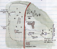
Brickworks at Hoxne
|
|
blank |
In March, 1971, John Wymer drew this sketch of Banham's Brickworks at Hoxne. This site was first noted in 1797 by John Frere for the number of ancient flint tools that workmen were finding in the diggings. Frere was the first person to recognise that these flints, and their stratified location, were good evidence for the great antiquity of man. He suggested that they came from a world far older than the reckoning accepted by scholars of the day. It was many years before archaeological excavations were mounted here, but these would confirm Frere's ideas. In 1971 Wymer was to lead the major excavation at this site which would cover the next five years, and lead to a major book entitled "The Lower Paleolithic Site at Hoxne, England", published in 1993.
County Councils had to set up a Social Services Department in 1971. Work was taken from the old Health and Welfare Department and the Children's Department of West Suffolk County Council.
At Bury the population was now 26,000 and its target of 40,000 was now looking unlikely. Nevertheless, the census confirmed that in percentage terms, West Suffolk was the fastest growing county in the country at this time.
|
|
Fornham Road demolition
|
|
blank |
In April of 1971 the final Traffic Orders for the new A45 Bury St Edmunds By-Pass were made at last. It had been approved in principle since 1964, when the line was first agreed. Work could now begin on the By-Pass with its revolutionary concrete grooved surface, its three new interchanges, and several new bridges. The programme was put on an accelerated basis, and the new road would be opened in December 1973.
One of the new road bridges was planned to cross the Fornham Road. Later in the year we see the demolition of several homes in Fornham Road to make way for the bridge construction.
In April, 1971, 204 Squadron was reformed at RAF Honington flying the Shackleton MR2 for marine surveillance, and early warning. In 1972 they would be replaced by the Navy's 809 Squadron.
Number 41 Cornhill was bought by Bury Borough Council as an extension to Moyse's Hall Museum for £20,000. Completion of the contract was due in March 1972.
|
|
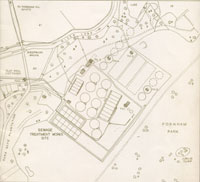
Sewage Works extension
|
|
blank |
In July, 1971, the Fornham Park sewage treatment works extension was officially inaugurated. In 1962 the Fornham Park works had been opened to replace the old West Stow sewage farm to receive and treat the waste from Bury St Edmunds. Since 1962 the flow of sewage had increased, but the dilution factor given by the river Lark had remained small, particularly in dry weather. The river authority now required a higher standard of purity to be reached in the final outflow liquid in return for licensing a larger final discharge into the river. The sewage works thus had to be extended to meet the higher daily load, and an effluent "polishing" plant was installed to further clean up the outfall into the river. This would be the last sewage works improvement to be financed by the borough council. In 1974 the responsibility for sewage disposal, along with the provision of water supplies, would pass out of the hands of locally elected councillors. You can view the plans and information about the new extension by clicking here: Official opening of Sewage Works extension, 1971
|
|
 Closure of Boby Engineering
|
|
blank
|
Bury's engineering heritage took a severe blow in 1971 when the Robert Boby works in St Andrews Street was closed down. It had been owned by Vickers since 1927, and was still the biggest factory in Bury. Some 270 men were put out of work, but many Bury people still remember friends or relatives who worked there. Many local men did engineering apprenticeships at Boby's, even if they now live far away.
Some design staff were retained for a further year or more.
|
|
 R C Treatt factory
|
|
blank
|
R C Treatt & Co Ltd had been located in London for 85 years. Richard Treatt began trading in essential oils in 1886 and moved into manufacturing and like many other London businesses needed to expand. After looking at 15 possible locations, Bury St Edmunds was selected, and about 16 personnel moved to the town. The Northern Way premises would expand to 5 acres with 180 staff, 40 of whom would be laborotory chemists, specialising in the production of a wide range of citrus ingredients. In the next century the company would continue to expand and would need further space, which luckily could be found at Moreton Hall in Bury St Edmunds.
Since March 1970 the F-100 fighter planes from USAF Lakenheath had been stationed at Mildenhall. Lakenheath was closed for runway improvements to be carried out. They were due to return to Lakenheath by the end of August 1971, but the following accident was to spoil their stay.
During that August an F-100 Supersabre crashed just off the main runway at USAF Mildenhall. It smashed a corner off a cottage at West Row, and ploughed 200 yards through a field. It demolished part of the perimeter fence and burst into flames on top of a 50,000 gallon fuel tank. The pilot walked out of the wreckage.
The Abbeygate Cinema in Hatter Street changed its name to Studio One and Two, showing two programmes simultaneously to the smaller audiences that the cinema was now attracting.
Comprehensive education arrived in Bury with the abolition of the King Edward VI Grammar School and the Silver Jubilee Secondary Modern Schools. The Vinefields premises of the Grammar School became the St James Middle School, and the King Edward VI Upper School was set up as a co-educational establishment on the site of the Jubilee Schools. Because of the new three tier system, new middle schools were needed. The County Grammar School for Girls became the co-educational County Upper School. The old single sex grammar school system, which divided children by ability was now dead.
In September 1971 the brand new Westley Middle School was opened for 9 to 13 year old as part of the new Comprehensive System. The site of the school had been acquired by West Suffolk County Council in 1967 for use as a secondary modern school, but the new legislation changed this plan. The site still included the Royal Observer Corps Observation Post 4/17.
St Louis Convent School became a state run Catholic School.
The oldest and most rare of the Grammar School's books and records were now deposited in the Cambridge University Library, including the Psalter which had survived from the Abbey of St Edmund.
|
|
 Northgate Avenue A45 construction
|
|
blank
|
As well as the houses that were removed on Fornham Road before the bypass could be built, the A45 would cut a swathe through Northgate Avenue and part of the grounds of the East Anglian School for Girls. The caretaker's house and gardens were demolished and the family were rehoused on the Howard Estate. The houses seen in this picture were now cut off from the rest of Northgate Avenue by the new road, and became renamed as Thingoe Hill.
Despite all this change John Betjeman called Bury "The most perfect and least spoiled English town."
Nevertheless, a group of concerned citizens decided to set up the Bury Society, to act as a watchdog over any possible excessive zeal in redevelopment of the old features of the town. Their immediate aim was to stop the proposed redevelopment of St Johns Street, and the associated demolition of all the buildings on the east side of that street. Plans had been drawn up in May, and bids invited for the work. A public meeting held on 22nd June had condemned the plans and it was felt that there must be some sort of mechanism developed to avoid the need for such "eleventh hour rescue dramas" as a member of the public put it.
Thus in October, 1971, the inaugural meeting of the Bury Society was held at the Corn Exchange. Local Historian David Dymond became the society's first chairman. There had been 8 years of discussing the future of St John's Street, resulting in considerable deterioration of the street scene due to the "Planning Blight" that inevitably followed the threat of extensive redevelopment. Finally, after this massive display of public displeasure, at the end of November 1971 the Council abandoned the plans for redevelopment of St Johns Street.
When the West Suffolk County Council approved the ultimate expansion of Haverhill from 18,500 to 30,000 they - with the full approval of the Haverhill Council - commissioned the eminent architect and planner, Sir Frederick Gibberd, to prepare a master plan, and this was published in 1971.
At Haverhill the West Suffolk County Council opened an indoor sports centre.
During 1971 the West Suffolk County Council acquired the freehold title of some significant land in the town of Clare. Titles
transferred were the Clare Castle on 25/03/71 and the old Clare railway Station on 09/08/71. The aim was to set up the area as a Country Park, albeit within the boundaries of the town. The original conveyance document for land
covering Clare Castle between John Antony Lester de Fonblanque and the West Suffolk County Council dated 09/08/1971 included restrictive covenants which would keep the land used for a country park without any further development. It was planned to open the park to the public during 1972.
Very soon the new 20 acre Country Park at Clare won a silver medal for safeguarding the Clare Castle ruins and adapting the old railway station. Further land would be acquired in future to add to the area of the park. These were the ex-railway land along the old line in 1973, further ex-railway
land on 01/06/90; and land south of the river during 2000. By this time all but 4% of Suffolk homes had mains drainage and almost all had piped water. About 11% still had no hot water system.
|
|
Richard Humphries
Ashburton Lodge 1972
|
|
1972 |
In the mid 1960s Warners of Braintree had been Britain's leading silk weaving company. Based in Braintree the company had 85 hand and 60 power looms, but believing that man-made fibres would before long completely replace silk, they had just three handloom weavers by 1966. Five years later, in 1971, the entire weaving department of Warners closed down altogether. An employee of the company called Richard Humphries raised what capital he could and managed to save a few hand looms, some Jacquard cards and the Jacquard card punching machine to create new designs. By 1972 premises were found at Ashburton Lodge, Sudbury, Suffolk and Humphries installed his looms and equipment, creating custom window blinds and textured furnishings. Ashburton Lodge was immediately adjacent to the existing Stephen Walters Silk Mill on the Cornard Road in Sudbury. In 1975 Humphries would move the business to Castle Hedingham, before returning to Sudbury in 2004.
In January the Haverhill Echo reported that Clare Market was in difficulties. After 13 weeks, the man who revived it, Mr Glazer of Brockley was losing money and was withdrawing. Clare Parish Council were considering whether to take it over.
In April 1972 the Clare Castle Country Park was officially opened to the public by the West Suffolk County Council. It was to be managed by the County Planning Department. The land had been acquired during 1971.
In May the Eastern Road Construction Unit started work on the construction of the Bury St Edmunds By-Pass. Since 1969 it had taken over the design work from the county council once the Trunk Road A45 had been designated a Strategy Route by the Department of the Environment.
|
|

Whitmore's Timber Yard seen in 1959
|
|
blank |
One of the casualties of the work was Whitmore's timber yard, which had stood alongside the railway line, on a site now occupied by Tesco's Supermarket. Whitmore's website declares, "1972 – Whitmores Timbers site in Bury St Edmunds was bought by the Ministry of Transport, so the company relocated to its current site in Leicestershire." Whitmore's still thrives today at Claybrook Magna in Leicestershire.
By some failure in planning, Bury St Edmunds Borough Council were building houses at Creed Walk, Robinson Walk and Bullock Walk at the southern edge of the Howard Estate. A row of partly built houses now had to be demolished to make way for the final route of the A45 Bury Bypass. Creed Walk houses had reached the stage of the roofing joists when they were taken down. The remaining part of Creed Walk was left facing on to the new bypass.
|
|
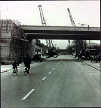
A45 bridge over Fornham Road 1972
|
|
blank |
Similarly it was rumoured that the route now cut through Northgate Avenue 30 feet further north than expected. This turned Northgate Avenue into a cul de sac, instead of retaining vehicular access to Fornham Road. The new road had to cross over the Fornham Road, and this bridge was also being built in 1972. This picture was supplied by Rosie Cook to Facebook page 'We love Bury St Edmunds'. Ms Cook is the small girl shown here on her cycle with her father.
Another road bridge had to be built to cross over Beetons Way, and this was constructed just on the north side of the railway underbridge which the Council had already completed in 1970.
|
|
Landscapes & Documents Conference
|
|
blank |
In May 1972 a conference of adult education tutors was held in Bury St Edmunds. This was the first joint meeting of tutors in local history with tutors in archaeology. The aim was to encourage joint working on projects in order to bring the greatest variety of evidence to any excavation or investigation. The seven papers were published in 1974 in this booklet entitled "Landscapes and Documents", edited by Alan Rogers and Trevor Rowley.
In the City, the FT 30 share index reached 543, the highest it had ever been, following a two year boom in share prices. Following the peaks of May, Stock markets experienced a decline throughout the rest of the year, which would continue into 1974.
The excavations were wound up at West Stow in the summer, but Stanley West had the idea of launching a practical archaeology project based upon actually rebuilding some of the dwellings. His idea for a "living, experimental reconstruction of the past" was supported by the County Planner, and would fit in well with proposals to create a Country Park here.
The West Suffolk County Council opened the Brandon Country Park during 1972. (In 1984 it would receive a Visitor Centre as well.) The WSCC had opened the first Country Park in Britain at Knettishall Heath in 1955. So the proposals for West Stow were well founded.
From the beginning, the West Stow site owners, Bury St Edmunds Borough Council, also supported the project in association with Dr West. However, the passing of the Local Government Act of 1972 meant that on 1st April 1974 the old Borough Council was to be replaced by a new District Council amalgamating the towns of Bury St Edmunds and Haverhill with the surrounding Rural Districts of Thingoe and Clare. The West Suffolk County Council was also to merge with East Suffolk to produce Suffolk County Council. The Local Government Bill had also included plans to move Haverhill, the Thurlows, Bradleys, Wrattings, Kedington, Barnardiston and Withersfield into Cambridgeshire. The Local Government Act which finally emerged in 1972 left them in Suffolk.
Clearly, this was an anxious time for local government in Suffolk, and for the forward projects which each council had hoped to undertake. In order to safeguard the West Stow site against the uncertainties surrounding the transfer of ownership under Local Government reorganisation, various ideas were considered over the next two years.
|
|
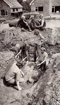
Westgarth Gardens
|
|
blank |
In the same year a new development of homes at Westgarth Gardens in Bury revealed a major early pagan Anglo-Saxon cemetery of 67 graves. In July, building work was well under way, when a human skull and a shield boss were dug up in a new gas trench. Throughout August and September there were some exciting finds, including a German made glass beaker of fine quality, and a 4th or 5th century pale green glass bucket. The grave goods were later dated from the mid 5th to the 7th century. The adjacent estate road was soon named Saxon Way, but the excavation was not published until 1988 in East Anglian Archaeology Report 38.
At the Old Town Hall in Bury St Edmunds the conversion work from council offices was completed. During 1971 it had been decided to revert its name to the Market Cross. The ground floor was turned into the offices of a Building Society and the first floor became an Art Gallery run by the Bury St Edmunds Art Gallery Trust.
In Bury St John's Church School closed in St Johns Street, and the building became a Church Hall.
Planning permission was sought to turn the old RAF Stradishall base into a prison for 500 men and detention centre for 200 youths. However, in September the site was taken over for use as a Resettlement Centre for Asian refugees who had been expelled from Uganda by its ruler, Idi Amin. A total of 3,169 refugees passed through Stradishall in the seven months it served as a Resettlement Centre. This emergency was largely borne by local authority health staff, many of whom sometimes had to work round the clock.
RAF Honington received the Freedom of the Borough of Bury St Edmunds in 1972 recognising and fostering the close associations with the town since 1937 which had been first recognised when the town "adopted" the station in 1947.
Plans for a 2,000 acre reservoir at Great Bradley were being considered.
The old tradition of free school milk ended in 1972, except for infants.
More serious was the conversion of schooling into a new three tier system. Grammar Schools and Secondary Modern Schools were abolished, to be replaced by Upper Schools. Middle Schools were introduced for the 11-13 year olds. This new Comprehensive School system, as it was called, did away with the Eleven Plus examination, which had hitherto decided where Bury's Primary School children would go on to the Silver Jubilee Secondary Modern School for Girls or for Boys, or to the King Edward VI Grammar School for Boys or the County Grammar School for Girls.
|
|
Bury St Edmunds Guide 1973
|
|
1973 |
The Town Guide for 1973 was the last one to be produced by Bury St Edmunds Borough Council. Harry Marsh, the editor for several editions past, headed his introduction, "Foreword Quo Vadis?", with the optimististic comment that joining with three adjacent councils was "yet another milestone in our long history."
A long historical introduction went uncredited, but was probably based upon Dr Marcus Bird's work. Margaret Statham wrote a piece on the life of St Edmund with rather more historical rigour than the Guides had enjoyed in the past. Stanley West wrote about "Early Saxon Settlements", and suggested that the valley of the Lark was extensively settled in the 5th and 6th centuries, with a string of villages spread out about a mile apart from Barton Mills to Barons Road in Bury. He suggested that a village like that at West Stow could have been established before 400AD, associated with the Romano-British town of Icklingham. He also wrote about the Anglo-Saxon cemetery discovered at Westgarth gardens in 1972.
|
|
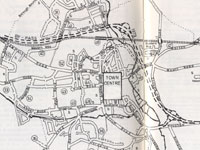
Bury St Edmunds Bypass line
|
|
blank |
Much other material was naturally repeated from earlier guides, but there were additional colour plates, and a note by the Borough Surveyor, George Standley, entited, "Expanding our Historic Town." By 1973 the Cullum Road, which linked Southgate Green with Westgate Corner, was completed and was in full use, as shown on the street map shown here. However, other plans were also underway.
To deal with part of the traffic problem ,"the most important road proposal now in hand is the replacement of the trunk road A45 which, running through the heart of the town, suffers a continual stream of very heavy container traffic making for or returning from the east coast ports. The new road runs from the east to the west of the town, either alongside the railway line or in place of those sections of line which became disused under the Beeching scheme. Graded interchanges will allow for the linking up with the town roads." The by-pass would open in December, 1973.
The plan shows the line of the new by-pass road, and also shows a proposed link road from the Northgate interchange to Eastgate Street. Although the link from the A45 to a new Northgate Roundabout was constructed, the road from the roundabout to Eastgate Street was never to be built.
|
|
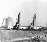
Rail bridge steel beam
|
|
blank |
Attached is a photograph taken on 18th February, 1973, of the installation of the two beams to form the railway bridge over the new by-pass. The beams weighed 98 tons and were 156 feet long and 10 feet 6 inches deep, supplied by Redpath Dorman Long, of Scunthorpe. They were installed by British Rail on behalf of the main contractors A Monk and Co..
In the background the first of the sugar silos at the beet factory is being “slip formed” at the same time. Slip forming is where the builder sets up formwork for concreting, casts a ring, waits for it to go “off” enough and then slides the formwork up using the previously cast section as support. A cylindrical silo is an ideal “subject” for that process.
During 1973 the Bury Sugar Beet Factory became the largest in Europe when two new silos were built. By 1975 it would be processing 6,600 tons of beet every day from late September to the end of January.
With the Town Map amendments now approved, the way was clear for an expansion to 40,000 population. "Much of the land for this purpose lies to the east of the town in what is known as the Moreton Hall site, where, of some 400 acres, about 140 acres have been set aside for housing and about 160 acres for industry." Landscaping was thought to be very important, and so 144 acres were reserved for tree belts, open areas, and the retention of existing woodland belts and coverts.
In other areas of the Borough the town had already outreached its administrative boundary. The Northern Way industrial estate had already had to built within the area of the Thingoe RDC, and was by now well established. New private housing on the south western edge of town, at Horringer Court, was similarly being built just outside the Borough's own boundary. The Horringer Court estate would remain within the parish of Horringer well into the late 1970s.
Britain joined the EEC, some sixteen years after it was set up.
Inflation continued to climb in these first years of the 70's fuelled by international oil price rises. This led to higher wage demands and higher interest rates. During August, rates for money borrowed by local authorities for short term purposes reached 17%. By December even long term rates had peaked at 13% a year.
The Resettlement of Ugandan Asians project at Stradishall was successfully closed down in March 1973, after seven short but hectic months. Over 3,000 people were re-located.
In April, Purchase Tax and Selective Employment Taxes were abolished, but the Value Added Tax was brought in to the consternation of many businesses which had to act as unpaid tax accountants to collect it.
In 1973, the Yom Kippur war added to world uncertainties, and put further stress on oil supplies. Oil prices had quadrupled, industrial unrest was widespread, and confidence was falling. Share prices continued to decline.
|
|
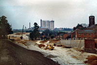
A45 construction Thingoe Hill
|
|
blank |
This is another photograph of works for the A45 construction. It shows the sugar silos now completed and looks from a similar viewpoint to the previous photo of this area but from a few yards further south. The Thingoe Hill dwellings and a factory building are visible, as is Gough's maltings behind them. This picture by Robert Robinson is from Facebook page, 'Old Bury St Edmunds.'
A unique programme of reconstructions of Anglo Saxon dwellings was started at West Stow with the aid of a group of Cambridge students enrolled and directed by Stanley West. They called themselves the West Stow Environmental Archaeology Group. The aim was to explore the techniques of building and woodworking thought to have been used by the early Anglo-Saxons. In August 1973 it was suggested that the best body to oversee the village project would be a trust formed from members of the Borough Council, the County Council and outside experts. It would be called the West Stow Saxon Village Trust.
The Bury and West Suffolk Records Office moved out of Angel Corner and into a fine new building opposite the Shire Hall in Bury.
|
|
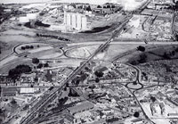
Bypass central interchange 1976
|
|
blank |
The Bury St Edmunds bypass, with its new dual carriageways, was opened as part of the A45 improvements, (now known as the A14), on 7th December 1973. It was designed with three access points close to the town to serve as relief from traffic for the historic core. You can view the plans and information about the new Bypass by clicking here: Official opening of Bury St Edmunds A45 bypass, 1973
Meanwhile West Suffolk County Council was building a link road from a roundabout on Northgate Street to join the A45. This was finished in 1974.
The picture shows the central interchange which joins the new roundabout in Northgate Street on the site of the old North Gate. At Tollgate Lane the new A45 road crossed over it at the same point as the recently built underpass to the railway line. The link from Northgate roundabout to the By pass was built by the County Council as Phase two of the scheme to relieve the town centre of cross town traffic.
|
|
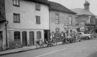
Northgate shops in 1960
|
|
blank |
The building of the Northgate Roundabout swept away many old properties and shops, including Haywards motor cycle shop, shown in this picture. Across Etna Road stood Booty's shop still trading in 2005 on the corner of Etna Road, and now right on the roundabout. Booty's can be seen in the picture, as can a car emerging from Etna Road. Out of the picture, but on the other side of Booty's, stood a shop then trading in the premises of the former Three Horseshoes inn, which closed in 1934. Hobson's Greengrocers' and Game Dealers shop stood at number 55 Northgate Street, and was also lost, as was a fish and chip shop, a newsagents and post office.
|
|
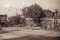
Taylors' Northgate Maltings
|
|
blank |
H & D Taylor's Northgate Maltings ceased trading during 1973. Malting had been an industrial mainstay of Bury St Edmunds for two centuries. In 1844 there were 12 separate maltsters recorded in the town. They all used the traditional malting method of spreading dampened barley on to a malting floor and employed teams of men to turn the barley over regularly until it had just sprouted. Time, temperature and humidity were vital ingredients of the task. However, like many trades, the technology of the task changed, so that modern malting involved an enclosed revolving drum; a process needing much less space and far fewer employees. In addition maltsters tended to amalgamate to obtain economies of scale, and brewers like Greene King gradually developed their own maltings.
Robert Boby's engineering works had laid off its production workforce in 1971. A few design staff were kept on at Bury through 1972. Finally it closed its office doors as well at the end of June, 1973, when the remaining design staff were let go. A very few people were transferred with the business to Vickers Engineering, South Marston, near Swindon.
The complete story of Robert Boby Engineering from its beginnings in the early 19th century to its demise can be read here:
The story of Robert Boby Engineering
|
|
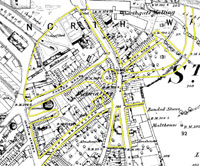
Northgate Roundabout footprint
|
|
blank |
This diagram shows the footprint of the new roundabout in Northgate Street, together with the widening of Tayfen Road. The background map shows the streetscene from 1888, largely unchanged until this scheme. The yellow lines outline the new roads. The roundabout still includes a walnut tree that was originally within the garden of one of the demolished properties.
The Royal Oak in Tayfen Road was another casualty of these closures as its business dwindled with the redevelopment all around it.
|
|
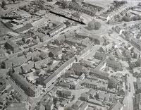
Northgate Roundabout from the air
|
|
blank |
The changes made by the Northgate Roundabout construction can be seen on this aerial photograph.
Meanwhile, across town Phase one of this urban Principal Road scheme came to be called Cullum Road. It crossed the Butts, which were water meadows, and linked Southgate Green to the Butts corner on Westgate Street.
Plans were also being made for the development of the Moreton Hall area with 140 acres of housing, 116 acres for industry and 144 acres of landscaping. At first, much of the housing was designated as Council Houses, but this was never to materialise as circumstances would change so much in the following decade. London was no longer to continue exporting its population, and the finances of council housing would become less economic without the associated government grant aid.
In the Autumn the college of further education at Bury opened its Motor Vehicle Training Centre. The Priory School was opened in Bury for 100 children with special needs.
The Playhouse Bar finally closed, having survived the closure of the Playhouse cinema by some years. This bar had an even longer record as a remarkable survivor. It had been the tap room of the Half Moon inn long before the Playhouse was built, dating back into the days of the coaching inns.
In the early 1970's slum clearance was still council policy. The modern idea of rehabilitating old properties was unheard of. Financial considerations were the main cause of this. At this time it was not possible to refurbish a property and recover the cost in the house's resale value. Also it was felt that most people had had enough of the old, cramped streets and properties, and wanted new, modern places. One side of Long Brackland was now completely swept away, as was most of Chalk Road. The King William pub in Long Brackland was swept away with it.
|
|
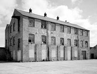
Lingwood's Brandon Rabbit Fur Factory closed 1973
|
|
blank |
In Brandon the rabbit fur industry had been a traditional occupation for a hundred years or more. One major factory for preparing rabbit skins and making fur products, particularly hats, had been S and P Lingwood's works on the London Road. This large three storey factory had been built in 1909, and bought by S & P Lingwood Ltd, Hatters, Furriers and Skin Merchants, in 1919. This business now closed down in 1973, and the factory was turned to other uses. By 1996 it stood derelict and was later demolished.
At West Row, near Mildenhall, a group of enthusiasts started to turn potato fields into the Mildenhall Speedway Circuit. By 1975 proper licensed speedway events would be under way. The local team took the name "The Fen Tigers". Despite some setbacks from 1990 to 1994, the team and the Stadium survive into 2005. Greyhound Races became a valuable additional use for the track.
|
|
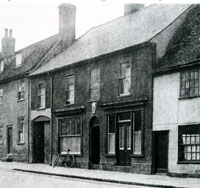
The Chequers, closed for Parkway Road
|
|
1974 |
In January it looked like a full scale miners strike was coming and the FT 30 index was down to 301, from its May 1972 height of 534.
The Chequers pub in Risbygate Street closed in January so that it could be demolished to make way for the Parkway Road. The Chequers originated in the 1820's. This new road would link Westgate Street and the newly finished Cullum Road to Risbygate Street and on to Tayfen Road. Meanwhile, in Kings Road, the Cricketers Inn was closed and demolished as part of the Kings Road/ Parkway roundabout. The Cricketers had been home to the Bury Folk Club through most of the 1960's. The Playfields which had seen cricket,football and swimming over its life was dissected by this new road.
In Risbygate Street there were further demolitions to make way for the new Parkway Road.
Green King now built a new 50,000 square feet wines and spirits store on water meadows behind the Theatre Royal, almost down to the River Linnet. This would win a design award for the use of structural steel in 1975.
In the opening three months of the year Haverhill UDC let its last housing contract to build 306 dwellings on the Chalkstone Estate. All the streets were named after birds. The Council also let a contract for a new swimming pool to be added to the existing indoor sports centre built by West Suffolk County Council. All of these projects would be taken over and completed by St Edmundsbury Borough Council on 1st April to be finished off over the next three years.
Other councils committed projects in their dying days as well. In March 1974 the Borough of Bury St Edmunds entered into a deed of covenant committing its successors to lease the Anglo-Saxon village site to trustees and to allocate the project the sum of £10,000, subject to the setting up of a Trust. The money was to be earmarked from the proceeds of new gravel workings on land it owned, adjacent to the site. It also leased the gravel rights to Amy Roadstone Corporation. In this way the future of the Anglo-Saxon Village reconstruction project was safeguarded, whatever the views of the new councils might be.
In March a Labour government came to power, just as the economy was drastically slowing down.
|
|
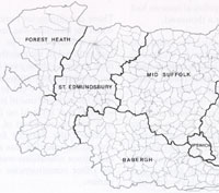
Suffolk local government 1974
|
|
blank |
Under the Local Government Act of 1972 all existing principal local authorities, including West Suffolk County Council, Bury St Edmunds Borough Council, Haverhill UDC, Thingoe RDC and Clare RDC, were swept away on April 1st, 1974.
In Norfolk, six villages were added from neighbouring Suffolk and the rural district of Lothingland was abolished. Overnight, Bradwell, Belton, Burgh Castle, Fritton, St Olaves and Hopton were all transferred to Norfolk, boosting population numbers for Great Yarmouth's parliamentary constituency, while bringing income into the town, as villagers' local rates went into Yarmouth's coffers rather than Suffolk's. Among the changes were that local policemen saw themselves switch from the Suffolk force to the Norfolk one.
The political change was drastic historically as it removed one-third of the settlements in the Lothingland Half-hundred which was an ancient Suffolk administrative unit dating back to the late Anglo-Saxon period.
For one of the six villages, it gained a new name as well as a new county under the changes.
Hopton became Hopton-on-Sea for the first time in its history after the village was given a thin strip of coastal Corton – the remains of the former parish of Newton mostly destroyed by erosion in the 16th century – which ran up to the boundary with Gorleston.
The changes meant the border moved away from the traditional boundary between the two counties, the River Waveney.
But it was not the first time it had shifted.
Previous border changes in the mid-1830s also saw Gorleston leaving Suffolk and being incorporated into Yarmouth borough.
The Borough of Bury St Edmunds, its Mayor and Corporation and the office of Recorder of Bury St Edmunds, were all abolished. It was replaced by St Edmundsbury District Council which was made up of the areas of the Borough of Bury St Edmunds, the Urban District of Haverhill, and the two Rural Districts of Clare and Thingoe. There were to be 44 elected Councillors and the unelected post of Alderman was abolished. The town of Bury St Edmunds was divided into 9 wards with 17 Councillors. Haverhill was divided into 5 wards with 8 Councillors, and 19 rural wards were set up with 1 Councillor to each ward. Only the parish councils continued to exist in their old form.
On 15th May the Queen granted a Charter bestowing Borough status on the new district of St Edmundsbury. This status did not include any additional executive powers, but it allowed the office of Mayor, and the ceremonial associated with it, to continue. This status perpetuated the right to have a sword and maces and to appoint "local officers of dignity" - ie sword and mace bearers, and the mayoral traditions continue to this day throughout the enlarged Borough of St Edmundsbury. The Council now needed a coat of arms, and a petition was sent to the Garter King of Arms to obtain approval and a design.
The new St Edmundsbury Borough Council took over responsibility for the Bury markets, and the provision market held in Haverhill on a Friday and Saturday. There was a market held in Clare, but this was run by the Parish Council, and continues to be under their control today. St Edmundsbury lost the power to run a library and this was transferred to the County Council. It also no longer met the expenses of the Coroner's Court.
Under the Water Act 1973, the towns also lost control of the sewage works they owned. The expensive new works at Fornham Park, serving the people of Bury St Edmunds, was transferred to the Anglian Water Authority, together with the outstanding loan debt and all liabilities and assets.
Haverhill's sewage works off Coupals Road was also transferred to the Anglian Water Authority.
The West Suffolk Water Board was also abolished and its water works in Kings Road and the water tower in West Road, all passed to Anglian Water.
The West Suffolk Burial Board was abolished and the powers and duties of burial and cremation passed to the new district and borough councils. The maintenance and upkeep of the Kings Road cemetery in Bury passed to St Edmundsbury Council. At Haverhill, the Urban District Council already ran its own cemetery.
Refuse collection remained a district council function, but disposal of it was removed from them and given to County Councils. This put the future of the West Stow refuse disposal tip and adjacent Anglo-Saxon reconstructions into doubt.
For the first time the eastern boundary of the old Liberty of St Edmund was abandoned. St Edmundsbury was detached from Long Melford and Sudbury which went to Babergh District Council and Thedwastre went to Mid Suffolk D C.
Suffolk County Council was also created on 1st April by the merging of East Suffolk and West Suffolk County Councils. One consequence of this was the establishment of the Suffolk Archaeological Unit with Stanley West in charge. Raingate Street had held the County Library until 1974, but this building was now used for the new Bury Branch of the Suffolk County Records Office, the Borough having now lost any involvement in the archives. The Borough Library in the Cornhill now became the County Library, for town and surrounds, as the Borough also lost the its library powers. The library would stay here until 1983.
|
|
St Edmund by E Frink
|
|
blank |
The West Suffolk County Council would not go down without leaving its own memorial. In town it had Elisabeth Frink design and cast a statue of St Edmund which stands in the churchyard by the Cathedral. At first it was despised, when erected in 1976, but is now popular with the town and tourists alike.
Dame Elisabeth Frink was born in Little Thurlow in Suffolk, in 1930. The Frinks were a military family, but had lived at the Limes and the Grange, in Little Thurlow, for many years. Although Elisabeth was brought up in Suffolk, she attended boarding schools in Devon. Holidays, however, were at the Thurlows. Later she studied at Guildford School of Art (1947-49) and Chelsea School of Art, London (1949-53).
As a student, she received a grant from West Suffolk County Council to support her in her studies. She was soon recognised and won a prize in the ICA's International 'The Unknown Political Prisoner' Sculpture Competition in 1952. Her work was bought by the Tate and by the Arts Council in 1953. Frink taught sculpture at Chelsea, St Martin's and the Royal College of Art. Out of sympathy with abstraction she moved to France in 1967. On her return she became a Trustee of the British Museum in 1974 and a Royal Academician in 1977. Her first major commission was for the Eagle lectern of Coventry Cathedral in 1962. A cast of the Eagle is on the J.F.Kennedy Memorial in Dallas, Texas (1964). Tribute was made for Amnesty International in 1975. Her last commission was for the Risen Christ for the Anglican Cathedral, Liverpool (1993).
|
|
Elisabeth Frink
|
|
blank |
As one of Britain's leading sculptors, Elisabeth Frink was awarded Honorary Doctorates by the University of Surrey (1977), Open University (1983), University of Warwick (1983), University of Cambridge (1988), University of Exeter (1988), University of Oxford (1989) and University of Keele (1989). She also received official recognition, being awarded the CBE in 1969, and in 1982 she was created Dame of the British Empire. She died in 1993.
On Barton Hill the WSCC purchased land and planted an oak grove.
The Suffolk Area Health Authority also came into being on 1st April, 1974, and all the work of the West Suffolk and East Suffolk Health Departments was transferred to it, together with six other authorities with former health powers.
|
|
West Suffolk Hospital
|
|
blank |
Also in 1974 the new West Suffolk Hospital was opened in Hardwick Lane, Bury St Edmunds, and an extension was completed at Moyse's Hall Museum. The old hospital in Hospital Road was soon abandoned, and its patients moved to the modern splendour of Hardwick. Hospital Road retained its name despite the lack of the hospital. It had previously been called the Chevington Road, which was itself an old name from a previous time when it led along the River Linnet as the Chevington Way, in the days before Lord Bristol had enclosed Ickworth Park.
Benwell Fireworks took over the Wizard fireworks factory at Chedburgh.
Despite all the administrative change, Bury's growth was still driven forward by building on the Nowton Estate. The Southgate Church and Community Centre were set up in joint premises. The church was run on ecumenical lines. Just out of town, the girls school at Hengrave Hall closed and the estate was converted into an Ecumenical Retreat and Conference Centre.
In September 1974 the local planespotters were excited to see a Lockheed SR-71A Blackbird reconaissance aircraft fly into the USAF base at Mildenhall. This all black aircraft had flown non-stop from New york, a distance of 3,490 miles, in 1 hour 55 minutes, breaking the previous record by three hours. This gave it an average speed of 1,817 mph. It stayed at Mildenhall for 10 days then flew to Los Angeles in 3 hours 47 minutes, a distance of 5,645 miles.
|
|
208 Sqn Buccaneer at Glencoe
|
|
blank |
In October No 208 Squadron reformed at RAF Honington as part of the Buccaneer force. They joined the Buccaneers of 12 Squadron.
Excavations had been taking place at Icklingham, and important evidence was found for early Christianity. The foundations of a flint church were found near a Christian cemetery dating back to Roman times.Three large lead tubs or cisterns were discovered with the chi-rho mark of Christ.
|
|
Suffolk Clocks by Haggar & Miller
|
|
1974 |
During 1974 the London based Antiquarian Horological Society published a book entitled "Suffolk Clocks and Clockmakers". This book was written by Arthur L Haggar and Leonard F Miller. They attempted to list every person recorded in Suffolk's local directories and newspapers as being a clock or watch maker or seller up to 1870. After that date it is very unlikely that any clock was actually made locally, as factory made clocks were sold exclusively after this time. Some clock dealers continued to 'brand' bought in clocks by adding their business names to blank dials or faces. Even before 1870 many clocks and watches were factory produced and only sold by local 'clockmakers', but it is often very difficult to identify these.
There was only a single edition produced of this book, and it is very scarce in 2007, usually fetching between £125 and £250 a copy.
Because research would reveal further examples of local clockmakers, the authors would publish a Supplement to the book in 1979.
|
|
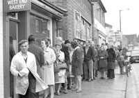
West End Bakers bread queues
|
|
blank |
Strikes were common place in the 1970s. In December 1974, the nation’s bakers decided to put down their oven gloves and stop producing the daily loaf. Small independent bakers might continue to produce bread, but obviously could not match the output of the larger industrial producers. Bread could be obtained from the West End Bakery, but obviously supplies were limited to what a relatively small bakery could produce.
By June, the FT 30 index had fallen 53% since May 1972, further even than the London Stock Market had fallen from 1929 to 1932. By August the Bear Market had dropped to below 200, and still things got worse. Another General Election in October confirmed the Labour Party in office.
From 1972 to 1974 world stock markets had also been in decline. Wall Street lost 48% of its value over 21 months. In January 1973 the Dow Jones index reached 1052, falling to 578 by December 6th 1974. Prices did not regain old levels for another ten years. There was also an oil crisis as oil producing countries cut production to force up prices. There was a surge in inflation and very high interest rates. Long bond yields reached 17%. Secondary banks were reaching a financial crisis in some cases where injudicious loans had been made.
|
| 1975 |
In January the London Stock market's FT 30 index reached rock bottom at 146. Things now got no worse, but it would take 10 years for shares to regain their 1972 price levels. The year 1974 had been worse for shares than 1929, but government's now knew rather better than in the 1930's how to respond to depressed stock markets, so the economic and social aftermath was nowhere near as bad.
|
|
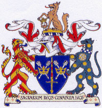
St Edmundsbury Borough Arms
|
|
1974 |
A new coat of arms was approved for St Edmundsbury following the grant of the right to Borough status under the 1972 Act. The Borough Council of St Edmundsbury had to petition for a Grant of Armorial Bearings. The Arms were designed by the College of Arms and approved by the Council, and with effect from 13th February 1975, were reserved to the Borough Council. Letters patent by which a right to Arms is established, were granted by the Garter, Clarenceux and Norry and Ulster Kings of Arms on 21st June 1977.
An explanation of the Coat of Arms can be seen by clicking here: The Council's Coat of Arms
The Bury St Edmunds Sports and Leisure Centre was opened in Beetons Way by Sir Alf Ramsey. It had been commissioned by the old Borough council on land owned by the county council, and both councils had worked together to achieve it. Upon opening it was managed by the new St Edmundsbury Borough Council. Its heated indoor swimming pool replaced the old open air pool off Prospect Row, behind Kings Road in the old Playfields, and this was then demolished. In those heady days of expansion, the town maps of Bury and Haverhill were committed to grow to 40,000 and 30,000 respectively, but the crash would soon make itself felt.
The Borough Council purchased the remainder of the Victory Ground sports field from Greene King to avoid it being sold off for housing. They had to agree to keep it as a high class sports ground, and allow existing users to continue.
|
|
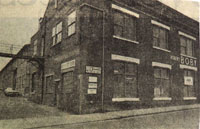
Boby's Offices back in use |
|
1974 |
For three years after St Andrews Ironworks closed down in 1971 the site had stood derelict and unused. By 1974 Anglia Commercial Developments had decided to let small units or offices within the site for short term leases until it had completed commercial negotiations over its future. By 1975 the East Anglian Daily Times described how a "mixed bag of small firms had revitalised the old buildings into a thriving hub of industry." By 17th February 1975 about 20 firms were in place, including small engineers, a transcendental meditation centre, car renovations, a seating firm and a 24 hour taxi service.
Some of the businesses displayed signs at the entrance.
Despite the severity of the 1968 floods, it took a long time to decide upon the best course of remedial action. There was a public outcry against the idea of demolishing Eastgate Bridge and replacing it with a modern bridge which did less to hold up the river's flow.
By 1975 the banks of the Linnet were strengthened behind Winthrop Road, and large parts of the Lark were dredged out downstream of Eastgate Bridge. In strategic places the banks were lined with concrete to aid water flow out of Bury. A weir was installed just downstream of Eastgate Bridge.
Marlows Builders Merchants finally gave up their premises in Churchgate Street, which they had occupied since 1925. The business moved out to fine new premises in Hollow Road.
The Playhouse Bar, the only remnant of the old cinema of the same name in Bury, finally closed. The Odeon Cinema was renamed as the Focus Cinema, but cinema-going was falling in popularity at this time.
Large old rambling properties were not economical to run and were passing out of owner occupation at this time. One such was the Fornham Priory, home of the late Alderman R A C Olle. It was sold at auction for £34,000 and became refitted as a hotel.
|
|
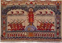
Banner of St Edmund
|
|
blank |
In 1975, the Bury born artist Sybil Andrews, now living in Canada, completed her great work, The Banner of St Edmund. It is hand embroidered in silks on linen, and was first conceived in 1930. Today this banner hangs in the Treasury of the St James Cathedral in Bury.
|
|
Oswald Jarman retires
|
|
blank |
During 1975 the well known local photographer, Oswald Jarman, retired from his photographic business in Abbeygate Street. William Spanton had established his 'Repository of Arts and West Suffolk Photographic establishment' at 16 Abbeygate Street by 1864. His son, William Silas Spanton, ran the business successfully from 1870 until his retirement in 1901. Harry Isaac Jarman then took over Spanton's business, having learnt his trade with another photographer, John Palmer Clarke, whose studio was on the Angel Hill. In 1903, JP Clarke moved to Cambridge and Mr Jarman bought the extensive collection of negatives of local views which had been created by the Clarkes.
Harry Jarman's son, Oswald, eventually joined him in the business and carried on after Harry's death in 1971. On Oswald Jarman's retirement in 1975 a large number of the early glass negatives were deposited with the Suffolk record office, and were stored in environmentally controlled conditions in the Bury St Edmunds office.
The collection consists of 4000 negatives, and includes the work of Harry and Oswald Jarman, along with photographs taken by William Spanton and his son W S Spanton, and those purchased from John Palmer Clarke. They give a glimpse into life in Bury St Edmunds and a number of smaller towns and villages across the county from the 1860s to the outbreak of WW2.
(Oswald Jarman died in February, 1993, and in 1997 his son donated the negative collection to the Bury St Edmunds Past and Present Society. The Society successfully bid for lottery funding to clean and repackage the collection, and began a programme to digitise and publish the images online.) You can see this collection here:
WWW.burypastandpresent.org.uk
The newly established County Councils were keen to set up archaeology units, and the archaeologists realised that cross-county co-operation would be to their mutual benefit. The Suffolk Archaeological Unit, the Norwich Survey and the Norfolk Archaeological Unit agreed to set up a new joint publication, to be called "East Anglian Archaeology", which would publish periodic reports of the results of excavations and fieldwork. Report Number 1 was published in 1975, and included nine reports and articles on Suffolk. Two reports by R D Carr were on the problem of redundant Suffolk churches, and the archaeological potential of Bury St Edmunds.
By 1975 there were about 2,100 horses in Suffolk, very few of which would be working the land. Even 20 years after tractors became accepted, there were still 26,300 working horses by 1939.
During 1975 the Greene King brewery were still freeholders of the Theatre Royal, while it was run by the Theatre Royal Trust. In 1975 the National Trust were granted a 999 lease of the building.
In 1975 there was stagflation and a shortage of oil, but the stock market rebounded 73% in a period of 25 days, following a falling, or Bear , market lasting 3 years.
The weather was extremely dry in 1975, and, in fact, this would herald a severe two year drought.
The MITS Altair computer was launched, arguably the first personal computer. It ran on the Intel 8080 micro-processor.
|
|
St Edmundsbury Borough Guide 1976
|
| 1976 |
With the formation of the new St Edmundsbury Borough Council in 1974, it was felt useful to publish a new Guide to the whole area of the new Borough. As it covered the areas of Bury St Edmunds, Haverhill and the old rural areas of Thingoe and Clare, it was partly an amalgamation of the various guides produced in earlier years by those councils. However, it has to be said that the bulk of the material relied upon the historical information previously published by the Borough of Bury St Edmunds. One notable addition from the old Thingoe area was a picture and diagram of the nine parishes which met at Rymer Point, near Honington.
In his foreword, the chairman of the editorial committee, Harry Marsh, wrote that, (the former councils) "have been united in a Borough covering 162,301 acres with 80,000 inhabitants who, in this progressive age have been left with only one railway station and that under threat of extinction."
Elisabeth Soulsby contributed "A Glance Back at Clare", and W Rayner wrote on the rural areas of Thingoe and rural Clare. Haverhill and District Local History Group gave a piece on that town's past, while William Blake gave the story of Haverhill from 1946 to date.
During 1976 Elizabeth Frink's statue of St Edmund was erected in the Great Churchyard on the green before the West Front ruins.
During 1976 and 1978 there were excavations in the Abbey Gardens at Bury St Edmunds to examine the Queen’s Chamber undercroft by English Heritage which provided evidence of Saxon settlement.
The West Stow Anglo-Saxon Village Trust was formally established to manage the reconstruction site and employ the necessary staff. The Trust inherited three completed huts and a start on the first hall. Up to this date the Council had managed the financing of the archaeology group through a holding account. The Trust now formally controlled its own finances and it was set up with £10,000 from St Edmundsbury Borough Council, £1,000 from Suffolk County Council and £25 from Breckland District Council.
Refuse tipping had virtually ceased by now at West Stow. A new Refuse Disposal site had been developed at Lackford by the new Suffolk County Council.
|
|
Bury Market 1976
|
|
blank |
Haverhill Golf Course was opened as a nine hole municipal course.
On 30th April, 1976, Bury Town Football Club played its last match at the Kings Road Ground. The result was a two all draw against West Ham United XI. The crowd was put at 1,750. The new Parkway Road would be built across the pitch, and the Parkway car park would be constructed. Bury Town would move to Ram Meadow as tenants of the St Edmundsbury Borough Council.
In Bury the Kings Head public house , on the corner of Brentgovel Street and St Johns Street, closed its doors for the last time. It had been an inn since at least the 18th century. In the 1820's it had been one of the Carriers house of Bury, from which wagons left for London on a twice weekly schedule, stopping overnight along the way. In 1976 the yard still existed, but its main use now was as a home for market traders to store their stalls between market days. Its closure meant that some traders had to make other arrangements to bring stalls in to the market on lorries or vans. A younger clientele was served, however, when the pub was demolished to make way for a branch of Mothercare, providing families with babies and toddlers requirements.
In July the USAF at Mildenhall held their first Open Day Air Show, to mark the year of the American bi-centennial celebrations. It was a tremendous success, with over 100,000 people attending. There was traffic chaos for mile around. Lancasters made a guest fly past, as did the RAF Red Arrows display team. Other foreign airforces were represented and the USAF showed off its latest aircraft. This event marked the beginning of an annual Open Day and airshow, which became a two day event in 1978.
|
|

Drought of 1976
|
|
blank |
After the dry year of 1975, Summer 1976 had a heatwave and drought lasting for over 3 months with temperatures around 35°C. It was the hottest summer for 300 years, and one million people were put on standpipes. Fires in crops caused losses of £500 million.
In the remarkable ‘long hot summer’ of 1976, Britain briefly experienced a Mediterranean-style climate, some places ran out of water, many more nearly did, and ladybirds abounded. In 1976 the jetstream moved near Iceland – about as far north as it can go. All Western Europe was affected by drought. The BBC Countryfile website reported that, "The drought itself developed over a period of many months, for the summer of 1975 was warm, dry and sunny, particularly from late July. It led into a relatively dry autumn and a mild and rainless winter. At winter’s end, most reservoirs in England and Wales were scarcely half full, one in Northamptonshire was almost empty. The preceding 11 months had been the driest on record. Then the spring rains failed to materialise.
By the start of July, water rationing became inevitable and an emergency powers bill was announced on 3 July 1976. The resultant Drought Act came into force on 6 August. Besides banning hosepipes, the Act had serious emergency powers to reduce or turn off domestic and industrial supplies. In East Anglia, and locally elsewhere, fields became so arid that the topsoil blew away on stiff easterly winds. Then, to add insult to injury, the autumn became so wet that much of the potato crop had to be left in the ground.
This was the summer of the great ladybird invasion. 1976 was a year of extremes. But, most remarkable of all, no one mentioned the term climate change; it hadn’t been invented."
|
|
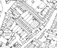
St Edmunds Place- 1884 OS map
|
|
blank |
On 30th September, 1976, the sheltered accomodation known as St Edmund's Place, was officially opened by the Mayor, Councillor Steven Davies. The original St Edmunds Place had been two rows of cottages, 24 in all, which surrounded a cul-de-sac extending from Church Row almost to St Johns Street. These had been swept away as part of the recent slum clearance programme in the area. At the far end of the cul-de-sac, facing back down the street was a wall upon which had been fixed a war memorial dating to 1918 commemorating the men of the Place who had died during the Great War. This wall and its memorial was preserved and is the last remnant of the original St Edmunds Place.
By 1976 the sorry story of the collapse of houses in Jacqueline Close, Bury St Edmunds, had left behind a fenced off area of dereliction. In 1970, a resistivity survey suggested the presence of further mines in the north east of the site. In 1976 the Borough council had decided to buy and clear the site. It would be stripped down to the chalk then geotextile put in place and covered with soil. The site would then become a recreational area and would be periodically monitored for further ground movement.
In 1976 KC135 Tanker operations moved to Mildenhall from Torrejon in Spain.
Continued high inflation led the government to call for restraint in wage demands. In 1976 Stage one of the government's restrictions were imposed. Workers could only have a £6 a week increase.
The Apple computer was launched based on a totally different, but much cheaper microprocessor than the Altair, the MOS Technologies 6502. These two different processors led to two separate strands of development of desktop computers.
|
| 1977 |
The agricultural tithe payers were finally relieved of any further payments in 1977. Without this Act they would have continued until 1996. A G Mobbs of Beccles had continued to fight the tithe in the courts since the 1930's. In 1971, a bailiff took his two guns and his silver cup for winning the Best Friesian Bull before the war, and he again made the national daily papers. Not until the Finance Act of 1977 (S. 45) was agricultural Tithe payment ended after being paid in one form or another since Saxon times. Every other European country had abandoned the practice long ago, such as France in 1789, Ireland in 1869, Denmark in 1903 and even the Isle of Man in 1945. Even at home Henry VIII had abolished the tithe in Scotland in 1547 when he took it from the Roman Catholic church and gave it to the Church of England.
|
|

Foxgloves in Kings Forest
|
|
blank |
In his book entitled "A Scratch in the Soil" published in 2017, Bernard Tickner reported that from 1977 a certain Mrs Alice Ramsay of West Stow took to scattering foxglove seeds throughout the forest around the village. She wanted to liven up the scenery despite the fact that the thin sandy soil was inappropriate for them. In some years they dwindle away, but with rainfall at the right time they can make a considerable display. Although by no means a Breckland plant, they persist in the area to this day.
In Haverhill, the Sainsbury's store was opened at Jubilee Walk together with the bus station and Brook Service Road car park. The Sainsbury's store is now occupied by Leo's.
A Council contract for 264 dwellings at Chimswell Estate was substantially completed having taken about 3 years, as was a contract for 306 dwellings at Chalkstone. Wratting Road acquired its footbridge overhead.
The old RAF base at Stradishall had attained some fame during 1972 as a transit camp for Ugandan Asians expelled by Idi Amin. In July 1977 Stradishall base became Highpoint Prison and it has been extended and improved as a prison ever since.
But town expansion plans had already begun to falter. Many newly built Council houses in Bury and Haverhill could not find tenants.
At Bury, Tim Brinton's opened at Moreton Hall, one of the first businesses to move into the new commercial area there. Roads and sewers were now being laid prior to the housing developers moving in.
In the older part of the town of Bury St Edmunds, the site of the redundant hospital in Hospital Road was sold to the Royal Masonic Benevolent Association. The old Bristol Annexe, which had been built in 1938, was to be converted to a 50 bed home for old people. St Mary's Hospital was closed down. It had originally been a workhouse, but by this time had become a Geriatric Hospital.
The year 1977 proved to be highly significant for the Bury St Edmunds printing firm of Denny Brothers. During the 1970s Denny Bros Printing was asked by crop science specialist Bayer if it could develop an information leaflet to place on the outside of a product bag, rather than placing it loose inside. The printing firm developed and patented the idea in 1977 and Fix-a-Form was born.
By 2012 the UK’s leading brand of multi-page leaflet-labels, Fix-a-Form, would be responsible for employing close to 100 people at Denny Brothers £8 million flagship site in Kempson Way, Bury.
Stage two of the government's wages policy was in force for 5% or £208, whichever was the lowest. Not surprisingly this was only really enforceable in the public sector, where the government had control of the purse strings.
|
|
Crystal Palace
|
| 1978 |
During 1978 the town saw a brand new private dwelling being built of a revolutionary design. It became known as the Crystal Palace, and its outer "Walls" were of glass, as were many of the internal walls. It stood within a private plot off Friars lane, overlooking the Butts meadows. The architect was Michael Hopkins. The interior would change over the years and would be remodelled in 2013-2014 by Project Orange architects.
The Bury Town Football Club had been removed from the playfields off Kings Road to the Ram Meadow site in 1976 to allow the new Parkway road to be built to link Cullum Road to Risbygate Street. By 1978 the Parkway was completed, but it lacked a pedestrian walkway on the stretch from Cullum Road to Kings Road.
The Traverse, in Bury, was repaved, and trees planted to improve it. The work took two years and it was officially opened to commemorate the Queen's Silver Jubilee.
|
|

Dismantling 100 ft workshop |
|
blank |
Some of the buildings on the Robert Boby site were being sold off in 1978, and one was dismantled carefully this year. This building dated back to the 1870s, probably one of the new buildings erected after the fire of 1877. It was 100 feet long by 40 feet wide, with its original beams and trusses. The windows were of cast iron. Hundreds of pieces were individually numbered in order that it could be rebuilt elsewhere. It would eventually find its way to the Rural Life Museum at Stowmarket in 1982, and in 1984, it was rebuilt there to house a display of rural industry and crafts.
By contrast the brewer, Greene King was expanding on its limited sites in Westgate Street. In 1978 it built a Draught Beer Store on the water meadows behind the Theatre Royal. This building was south of the 1974 Wines and Spirit Store, just across the River Linnet.
Westbourne Court sheltered accommodation was completed on Wratting Road but only sporadic new council house building would take place after this date in Haverhill until a final contract was let in 1990. The Council sold 5 acres of land at Chalkstone Estate to the Jephson Housing Association to build 96 homes.
At the USAF base at Mildenhall, it was discovered that 10,000 gallons of aviation kerosene had leaked out of an underground pipeline. The fuel was found to be spreading through a layer of porous limestone towards the public water aquifer. About 40,000 people were served by the Beck Row pumping station, and they were warned that they might need to be cut off from the mains supply. Anglian Water Authority quickly laid a new emergency water main. Bore holes were drilled to locate the fuel, and it was eventually pumped out and carried by temporary pipeline three quarters of a mile away to Mildenhall Sewage Works.
Local Government pay was increased by 9.9%, a massive increase by the standards of 2002, but nowhere near enough to compensate for high inflation and the falling behind of public sector pay following the Pay Restraint policy of the last two years.
|
|
1979 |
In February a contract to modify 150 council houses to be suitable for letting to USAFE service personnel was almost complete. These were part of the excess homes built for town development purposes which had not been let. They would be leased on annual terms to the USAFE, who required a fully installed kitchen with cookers and fridges sized to suit American standards.
In 1979 work began upon the refurbishment of the run down Priors Estate off West Road in Bury St Edmunds. By now it was more financially advantageous to improve existing dwellings rather than demolish and rebuild. Downstairs bathrooms were moved upstairs, replacing one bedroom in most cases. Lounges and kitchens could be enlarged. Originally built from 1928 to 1935 for the needs of large families, by 1979 family sizes were much reduced. Also reflecting this social trend was the decision to build 43 new small flats on the Priors Estate. By 1981 this would require a new street layout which was reflected in a change of names. Perry Road now became known as Ashwell Road, while Perry Close became Beaumont Close. Priors Road became Brocklesbury Walk, while Priors Avenue retained its old name.
Mains water finally arrived at Cattishall hamlet when the council requisitioned the water main from Anglian Water to serve 5 properties. The local well water had become unfit for further use. Cattishall had been well known in medieval times as the site of the King's court outside the Banleuca of the abbey at Bury.
The defunct rubbish tip at West Stow was landscaped and West Stow Country Park was opened to the public in June, 1979. The derelict and dangerous River House had been demolished and the shooting rights were extinguished. The licence to the Motor Cycling Club to run scrambling events had been ended in December 1978. The car park was given a hard surface and the toilet block erected with grant aid from the Countryside Commission.
Margaret Thatcher became Britain's first woman Prime Minister.
During 1979 a large hole opened up in Chalk Road, Bury St Edmunds. It was 15 feet wide and 42 feet deep. It was believed to have resulted from the collapse of old chalk workings in the area. Chalk had been dug in this vicinity since the 18th century, and burnt in local lime kilns for building purposes.
|
|
Oswyn Close 1979
|
|
blank |
St Edmundsbury Borough Council was starting to sell off much of its land at Moreton Hall for private development. The land had been acquired under Town Development powers and by agreement with the GLC. It received Expanding Towns subsidy on the debt charges for ten years on any houses built and let under this agreement. It had become evident that the supply of new people sent from London under the agreement had dried up. By September the council learned that it was now official GLC policy that no further nominations would be made by the GLC to Bury St Edmunds. The council cancelled its own plans for a contract to build 74 council dwellings at Moreton Hall. It decided to lay out the roads and sewers and to sell off the fully serviced parcels of land to developers. There would be no council housing ever built at Moreton Hall.
One of the last major greenfield council house building projects was completed in Bury, with 57 new dwellings erected on the Howard Estate at Wollaston Close. The distinctive 'Coppertop' houses in parts of the Mildenhall and Howard estates were re-roofed using conventional tiling.
|
|
Site of Hayward's Pickle Factory
|
|
blank |
This picture shows the view towards Fornham St Martin seen from Mitchell Avenue in the early 1970s, taken by Stephen Addy. During 1979 the Haywards Pickle Factory was built on this site along the Mildenhall Road. It could provide some 280 jobs. It was built on land which had been damp grazing for cattle. The lapwings, occasional snipe and frogs were displaced by commerce, and that's not to mention my dad's sorely missed mushroom pickings. Clicking on the thumbnail will also reveal inspection hatches for the 1961/62 installed sewer pipes to the Fornham All Saints processing works. These are on the left of the picture.
In July the USAF at Mildenhall continued their successful Open Days and airshow, begun in 1976. It was now a two day event, but this year it was struck by tragedy. An Italian display team were flying a formation of eight Fiat G-91 fighters, when one aircraft hit a tree and burst into flames. It was only 200 yards from a crowded residential caravan site. This was out of site of the crowds, and the team landed with no announcement of the disaster.
Also in July, the Buccaneers of 216 squadron were based at Honington, but would be disbanded in just under a year.
The old Territorial Army Depot in Kings Road was bought by the Council and by 1983 opened as the Council's vehicle maintenance depot.
Most of St Mary's Geriatric Hospital was demolished in 1979. Its inhabitants had been moved to the new West Suffolk Hospital off Hardwick Lane in 1977. St Mary's had been the old Thingoe Workhouse, and was still remembered as the workhouse, or "The Spike", by the older generation. Much of the old hospital site now became housing.
|
|
Gershom Parkington Catalogue
|
|
1979 |
During 1979, Captain Richard Meyrick published his new version of the Gershom Parkington Collection of Time Measurement Instruments. In true military style, Captain Meyrick called it Catalogue Mark III 1979, but it is not clear if there ever was a published Mark I and II. Meyrick noted in the catalogue, not only all the clocks and watches, but also the pictures and prints, which were part of the collection at the time. These included a photograph of the late Lt.- Col. Malcolm Ashton, OBE, (1895-1978). Meyrick noted that "Colonel Ashton was the first curator of the Clock Museum and under his direction the museum became known throughout the world."
|
|
Supplement to Suffolk Clocks
|
|
1979 |
In late 1979, determined to keep their book on Clocks and Clockmakers of Suffolk as definitive as possible, Haggar and Miller published their "Supplement to Suffolk Clocks and Clockmakers". The original work had been published in 1974. This new supplement added additional details on existing makers, as well as listing those names which had escaped notice in the earlier work. Unfortunately Leonard Miller had died after preparing the text, and the illustrations were provided by John Shallcross. Miller had been working on a similar book for Norfolk, but this never came to fruition.
The Bank of England's minimum lending rate rose from 14% to 17%, and mortgage rates rose from 12.5% to 15%. High inflation caused high pay demands to continue. Local Government workers won a 9.4% pay rise in July, together with a promise to refer their case to a Comparability Study, following several years of pay restraint in the public sector. The winter of 1979 was to become known as the Winter of Discontent as public sector workers protested against government wage restraint, and the slowness of the enquiry into their pay. Prime Minister Callaghan had tried to again restrict pay increases to 5% in the public Sector.
By the end of this year it was estimated that 29.5 million days had been lost to industrial action during the year.
In 1979, the world's first spreadsheet, called VISICALC, was launched on the Apple II. Suddenly the PC acquired a business raison d'être.
In December 1979 Russia invaded Afghanistan leading to further NATO modernisation.
|
|
The Lark Navigation
|
| 1980 |
In 1980 D E Weston published his 20 page book or booklet entitled "The Lark Navigation". This described the length of the River Lark from Bury St Edmunds to the Great Ouse in terms of every lock, staunch and bridge. Every landmark was given its historical background. Unfortunately, copies of this booklet are very hard to find in 2008, but Mr Weston had already written a much fuller and complete account of the Lark Navigation which he placed on deposit at the West Suffolk Record Office during 1980.
In January, 1980, the public service workers of the water industry, ambulance service, sewerage workers, and refuse collectors were on strike nationwide. The winter of discontent was becoming serious. Eventually a Comparability Study resulted in special increases of 14% backdated to 1st January, 1980. In July the pay wrangles continued and local government pay was taken to arbitration resulting in another award of 13% as from that date.
The year began with the Bank of England's minimum lending rate at 17%. In July, it was cut to 16% and by December to 14%. Things had improved, but these levels were still prohibitive.
|
|
Arson at the Sports Centre
|
|
blank |
On March 19th, at 4 am on a Thursday morning, the Bury St Edmunds Sports and Leisure Centre burnt down. The £1 million pound building was completely destroyed, as gusts of wind fanned the flames. Some 70 firemen with 14 firetenders fought the blaze, but the building was lost. The five year old building would cost at least four times its original price to replace, and meanwhile 28 clubs and numerous individuals would suffer the loss of its facilities. A public appeal was launched to cover any uninsured losses arising from the rebuild.
Arson was suspected, but not proved until further incidents put the situation in a new light.
Within days of the sports centre fire the Howard Middle School also suffered a fire, which luckily was not so serious.
|
|
Arson at Bury Free Press
|
|
blank |
In April, a week after the school fire, the offices of the Bury Free Press in Kings Road, in Bury St Edmunds, were also attacked and this time the buildings burnt down. The cause was undoubtedly arson, as three separate fires had been set in various parts of the building. Many of the newspaper's archives and files were lost, and the office did not re-open until October 1982. Nevertheless the paper came out on time after the fire, printed in Kings Lynn.
Four weeks later, B & G Audio also suffered an arson attack.
|
|
Victorian Bury St Edmunds
|
|
blank |
In 1980 the Suffolk Record Office published this ground breaking booklet of photographs from Victorian Bury St Edmunds compiled by Margaret Statham and William Serjeant. It was priced at £1.20, with 40 pages and an introduction by Oswald G Jarman, himself a photographer of note. The cover picture shows a photograph of Robert Cook, Town Crier, by W S Spanton, from around 1885.
The Joiners Arms in Garland Street, Bury St Edmunds, was closed down in October. Its origin was as a Victorian beerhouse. The "Joiners" also had the distinction that since William Frost was landlord in 1868, his descendants ran it up to its demise. It had been well known as home from home for the Home Guard Company who met in the Garland Street Hall during the war.
|
|
The Bushel early C20
|
|
blank |
This picture shows the Bushel inn, probably around the time of the Great War, but the archway through to the back is clearly visible, and was a feature up to 1980.
The Bushel in St Johns Street was considerably enlarged in 1980. To enlarge the lounge and bar area, the archway to the inn yard was bricked over and enclosed. The handy short cut from St Andrews Street into St Johns Street now disappeared. In the 18th century the Bushel had been called The Rose up to about 1791. The 19th century Bushel had stabling, enough to employ two ostlers, a brewery until the 1860's and a skittle ground. The last pub to survive in St Johns Street, it still thrives in 2005.
Thirty eight new flats were built at the Northgate Lodge sheltered accommodation.
The number 12 Buccaneer Squadron had been based at RAF Honington since 1969. By December they had left for RAF Lossiemouth. In July 1979 the Buccaneers of 216 Squadron had been at Honington, but were disbanded in August of 1980. They were to be replaced by the new Panavia Tornados of 45 squadron and IX squadron.
|
|
New Lark Navigation book
|
| 1981 |
During 1981, D E Weston published his rather oddly entitled book, called "Lord Bristol's Amazing Steam Venture." In fact, it described in detail the conception and building of a new River Lark Navigation scheme, which opened a new wharf at Bury St Edmunds in 1892. The book also described the rapid failure of the venture, with bankruptcy following in 1901. The "steam" in the title refers to the steam tugs which the new company hoped to use instead of horses on the more favourable parts of the river.
During 1981, some important documents relating to the Bury St Edmunds Feoffee's Accounts were discovered by relations turning out a granparents attic in Hampshire. These papers were known to Samuel Tymms in his 1854 History of St Mary's Church, but were unknown to Lilian Redstone in the early 20th century. Somehow they had moved to Hampshire, where they lay unknown for 3 generations. In 2003 these accounts of the Feoffees for the years from 1569 to 1622 would be edited by Margaret Statham for publication by the Suffolk Records Society.
Lands Removals and Furnishings left their Churchgate Street premises in 1981, which they occupied since 1905.
Gravel extraction ceased within the West Stow Country Park area, but continued across the river in the water meadows of Lackford and Flempton. The resulting hole in the ground at West Stow was profiled and landscaped to provide a fishing lake within the country park. On September 21st the Bury Sports Centre was reopened on the same site following the fire eighteen months before.
Forty one smaller council dwellings were built at Beaumont Close, on the Priors Estate to replace the old pre-fabs of Perry Road and Close. Priors Road was renamed Ashwell Road.
The Housing Act of 1980, coming into force in 1981, gave secure tenants with three years in situ, the right to buy their council house at a one third discount. This legislation was controversial at the time but would lead to a large number of public sector houses moving into the private sector over many years. Over the years the discounts would made more attractive, and it became government policy to encourage private ownership of housing.
Cornwallis Court was opened on the old hospital site in Hospital Road.
The first F16's arrived in Britain in 1981 and Ground Launched Cruise Missiles (GLCMs) were deployed throughout the 1980's to counter the Soviet SS20 missile with its 3,000 mile range.
|
|

Panavia Tornado
|
|
blank |
45 Squadron (TWCU) flew the Tornado GR1a at Honington from 1981. This 'shadow' unit of the Tornado Weapons Conversion Unit (TWCU) was based at RAF Honington when the first Tornado aircraft arrived during July 1981. The prime purpose of the unit was to introduce crews to the weapons and operational delivery techniques with regard to Royal Air Force operations. No 45 Squadron did not officially get Reserve operational status until 1983.
|
|
Chicory at Lakenheath
|
|
blank |
Chicory production ceased in 1981 at Lakenheath and the factory was then converted to a carrot washing, grading and packing plant. The factory for "Home Grown Chicory" had been in production since 1936, and was at its peak in the mid 1960's when Camp Coffee was most popular. There was only one other factory in Britain at St.Ives in Huntingdonshire, and this closed a little before the Lakenheath factory. Powdered instant coffee was now more popular than the liquid essence of Camp. However, the factories were old and made inefficient use of the increasingly costly oil needed to heat the process. Production moved abroad.
The Wheatsheaf, one of the old Bury beerhouses, closed down in 1981. It dated from the late 1850's and was built to serve the new homes being built at that time in the Chalk Lane area of Cemetery Road, or Kings Road as we know it now. It did not get a license to serve any alcohol except beer until 1961.
|
|
Gravel Pit to become Sailing Lake
|
|
blank |
At Lackford, in the area known today as Lackford Lakes, gravel extraction was drawing to a close. One of the resulting flooded gravel pits would be earmarked as a sailing lake. This picture by Mike Steele was posted on the Facebook page, "We love Bury St Edmunds" in May, 2018. Gravel and sand grading machinery can be seen in the distance in the area which would later become part of the Lackford Lakes Wildfowl Reserve.
|
|
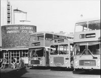
Bus Station c1981
|
|
blank |
In 1981 the Bus Station was still operating in Brentgovel Street. This site was very popular with customers as the marketplace was only a few steps away from alighting off a country bus. However, the site was too cramped for the number of buses using it and passengers sometimes had to squeeze between vehicles to get on or off the bus.
The Focus Cinema is visible across the narrow street from the Bus Station. It would close down in 1982.
|
|
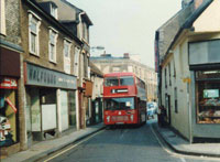
Bus in Brentgovel Street 1981
|
|
blank |
Not only were passenger conditions cramped at the Bus Station, the orientation of it meant that buses could enter only from Looms Lane and exit only up Brentgovel Street. Looms Lane had been widened as part of an earlier plan to divert the A45, but Brentgovel Street remained perilously narrow. This picture shows the difficulty a bus had in negotiating this street.
Plans were afoot to make improvements to these issues, but there was considerable disagreement over the best way forward, with many competing land owners and planning issues to address.
Nearly the whole of December saw thick snow over Suffolk. The road from Haverhill to Bury was sometimes impassable.
By the end of 1981 the minimum lending rate had climbed to 15.5%, been renamed as the Base Rate and reduced again to 14.5%. Mortgage rates were 15% but over the next few years they would slowly fall from these levels.
In late 1981 the BBC micro-computer was launched. It included a built in Basic interpreter, and was aimed at the educational market. Unfortunately the initial demand outstripped supply and there were long delays in delivery. However its various models were very successful in the UK.
IBM announced that it was launching a personal computer using an Intel 8088 processor running at 4.77MHz and 16K RAM for £786. The hardware and its MS-DOS operating system were largely out dated even by the standards of 1981 but the sheer size and reputation of IBM ensured that this rapidly became a world wide standard.
|
|
Simpson's Flora
|
| 1982 |
In 1982 the Suffolk Naturalists Society published "Simpson's Flora of Suffolk". Francis Simpson was born in 1912, and from 1930 to 1977 was the Keeper of the Natural History Department of Ipswich Museum. After retiring in 1977, Simpson was out on his bicycle almost every day exploring the county and making new records well into his 80s.
By the time Simpson's Flora of Suffolk was published, Simpson knew Suffolk and its plants as few have ever done before or since. The work of half a century of patient recording, it drew on other surveys and recorders, but was mainly Simpson's own work, a fact recognised by the Suffolk Naturalists' Society who published the work and insisted it be called Simpson's Flora.
The Flora included 285 of the author's own colour photographs of flowers in their natural setting, included at Simpson's insistence, and for which he re-mortgaged his house to cover the extra costs.
His obituary by Martin Sanford, published in the Guardian in 2003, described him thus: "Dressed in woolly hat, thick tweeds and a plastic raincoat, he was sometimes taken for a tramp. He was arrested and locked up several times while investigating botanical habitats behind MoD fences. Opinionated, stubborn, cantankerous and loveable, he became a treasured Suffolk institution.
Simpson's Flora Of Suffolk, published in 1982, is a classic of its kind, with excellent photographs and an elegant text, in which the drastic changes seen in the countryside during its author's lifetime are described. In 1996, he was made an MBE for services to nature conservation.
Francis Simpson died in 2003, aged 91, and was, for more than 60 years, the chronicler of the countryside and wild flowers of his native Suffolk. He was a conservationist long before the word was invented."
|
|

Gottfried on Bury
|
|
blank |
This new book, entitled "Bury St Edmunds and the Urban Crisis, 1290 - 1539", written by Robert S Gottfried, was published by Princeton University Press, New Jersey, during 1982. It describes how Bury transformed itself from a town dependent upon its abbey into a town based upon its wool trade and its merchants. It challenges the old view that towns declined for two centuries after the Black Death, and describes Bury as a booming town throughout the Middle Ages into the Tudor period. Computerised and analysed, the book relied upon "the first large scale statistical analysis of a medieval urban centre." Robert Gottfried was Associate Professor of History at Rutgers University. In later years some doubts were cast upon the methods and conclusions arrived at in this book. One critic noted that, "There is more rhetoric than convincing argument."
In January it snowed again in Suffolk but the two weeks it lasted was much less trouble than the previous December.
In Bury the old Odeon Cinema, called the Focus in 1975, was finally closed for good. Its fate would be to suffer demolition in 1983 to make way for the Cornhill Walk shopping centre. Bury now had only one cinema left, and that was in Hatter Street.
|
|
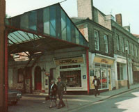
Langton Parking Garage 1983
|
|
blank |
Another site was the Langton Garage in Hatter Street. This old steel framed shed attracted the hopes of local developers, and ideas were discussed to create shops and housing on the site. The garage was owned by the Todd family, and its main use by this time was to accommodate 100 parked cars under cover, right in the town centre. In 1982 the garage was sold, and together with number 7, Whiting Street, plans were under way to create Langton Place. This would become a throughway shopping area, with flats above, linking Hatter Street with Whiting Street, which would open in 1987.
Rollerbury was opened on the Station Hill as the National Roller Skate home. At first wildly popular, it would last just under 20 years.
The Register Office in Bury was moved out of Abbeygate Street, from the premises of Gross and Co., to the Shire Hall.
The Council's collection of films, some in a dangerous state, were sent to the East Anglian Film Archive in Norwich.
|
|
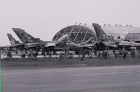
Nine Squadron
|
|
blank |
No. IX or 9 squadron has the distinction of being the first operational Tornado squadron in the world. A Vulcan Squadron from 1962 to 1982, the squadron re-formed on 1 June of 1982 at RAF Honington with the Panavia Tornado. On 1 October 1986 the unit moved to RAF Bruggen in the strike/attack role.
|
|
SESCA's first clubhouse
|
|
blank |
By 1982 the St Edmundsbury Sailing & Canoeing Association at Lackford Lake had been set up and would lease the Sailing Lake at Lackford from St Edmundsbury Borough Council. This picture from Club archives shows the first clubhouse, donated by Culford School. Volunteers also built the first jetty and seeded the dinghy park during 1982. These pictures were originally sent in to Facebook page "We love Bury St Edmunds", by Mike Steele.
In October of 1982 the Griffin inn finally closed. It stood on the Cornhill corner overlooking the Brentgovel Street junction with St Johns Street. In Bailey's Directory of 1784 it had been one of the four main Bury inns. Pigot's Directory of 1839 put it as one of six major Bury licensed establishments. Like the White Lion nearby it had not been a coaching inn, but was a major Carrier's House because it was next to the Great Market.
In November the council's building DLO had to let 30% of its work by Compulsory Competitive Tendering. This CCT regime as it was called would be continually tightened up and extended into all areas of council work for the next 20 years until it was replaced in 2001 by the Best Value regime.
The Orwell bridge was opened in December 1982 at Wherstead, demonstrating the importance of Suffolk ports as a gateway to Europe by this date. Ipswich could now be by - passed by commercial vehicles as well as private cars to reach Felixstowe and Harwich. The bridge was started in 1979 and was 1.3 kilometres long, with a clearance for shipping up the Orwell of 126 feet. The carriageway was two lanes in either direction.
Britain went to war over the Falkland Islands following their invasion by Argentina.
In May 1982, public limited companies changed their designation from the old "and Co Ltd" to the new "PLC".
In 1982 the first of two SR71 Blackbird reconnaissance aircraft was permanently stationed at Mildenhall.
|
| 1983 |
On 1st April 1983 the Town Development Agreement with the GLC officially ended. In practice, development had halted some years before, but the various subsidies and allowances now ended. St Edmundsbury Borough Council purchased the remaining undeveloped GLC landholdings at outstanding debt levels. These were in Haverhill, where the GLC had managed Town Development directly itself. In Bury the council had owned the land and let and managed all contracts by agreement.
In 1983 St Edmundsbury changed its external audit from the District Auditor to a firm called Deloittes.
|
|
 New library August 1983
|
|
blank |
Bury got a new central library in 1983, built in St Andrews Street (North) behind the old Police Station. The pedestrian access from St Johns Street was named Sergeants Walk. It would not be ready to be opened to the public until 1985. The old county (formerly Borough) lending library in the School of Art building on Cornhill, was closed down, allowing the premises to be redeveloped for shopping purposes.
|
|
 The Focus Cinema
|
|
blank |
More change came when the old Odeon Cinema, called the Focus since 1975, was demolished. It had been closed down in 1982. Also knocked down were the White Lion pub, and a barbers shop, to soon be replaced by the Cornhill Walk Shopping Arcade.
The Odeon was opened in 1937, in the art deco style of the time, boasting 1,300 seats and the new sound arrangements for 'talkies'. It had a stage as well as a screen, with provision for an orchestra. By 1973 watching television at home had largely replaced cinema going as a leisure activity. It would be 20 years before a new interest in the cinema arose.
|
|
Brentgovel Street clearances
|
|
blank |
Also marked for development were the premises of auctioneers Chevell Lawrence, the barber shop of Ethelbert Taylor, and the White Lion public house which stood on the corner with Short Brackland. The White Lion had been a carriers' inn, and in later years market traders had used the yard to store their stalls. In 1900 it was recorded that up to 16 carriers pulled into White Lion yard for a Saturday market day.
Norah Lofts died in Bury in September 1983. Living in Northgate House in Northgate Street, she was a best-selling British author. She wrote over fifty books specialising in historical fiction, but she also wrote non-fiction and short stories. Many of her novels had a Suffolk background and follow the history of a specific house, and the residents that lived in it.
She was born Norah Robinson in Shipdham, in Norfolk, but the family moved to Bury when she was a girl, living in Northgate Street, near Cadney Lane. She became a teacher at the Feoffment Girls' School in Well Street until her marriage to Mr Lofts, a builder. They lived at 8 Southgate Street. She published her first book, called I met a Gipsy, in 1935, and produced one or two books a year until she died.
After Mr Lofts died she married Robert Jorisch, who had come to England in the late 1920's to be manager of the new sugar beet factory in Bury. They lived in Northgate House in Bury.
Norah Lofts also wrote under the pen name Peter Curtis and Juliet Ashley. Several of her novels were turned into films: Jassy was filmed as 'Jassy' in 1947 starring Margaret Lockwood and Dennis Price. You're Best Alone was filmed as 'Guilt is My Shadow' in 1950. The Devil's Own (also known as The Little Wax Doll and Catch As Catch Can) was filmed as 'The Witches' in 1966.
The Bury firm of Marlow and co was severely hit by a television programme called World in Action, which detailed problems with system built timber framed houses, due to alleged on site erection errors. Marlow's had built up a massive production line for Marlow Frames over the past two years, which they had to abandon by the end of the year. The firm survived and expanded its merchanting network and continued to produce its popular roof truss business.
|
|
Celebrating Greene King's Brewery
|
|
blank |
A book entitled "Greene King, A Business and Family History", was published by R G Wilson. It chronicled the major industry in Bury St Edmunds from the time of Benjamin Greene's arrival in Bury around 1799, up to 1982. This highly detailed history throws light on Bury society through this time as well as chronicling the rise of this national brewer. By 1980 there were only 80 breweries left in the UK compared to the 800 odd before the Second World War. The book attempted to show why Greene King was one of them.
At Beetons Lodge sixty sheltered units were completed and opened by the Mayor, Mrs Barbara Jennings. Fifty five new council dwellings were completed at Ashwell Road.
By 1980 the otter had become a rarity in Suffolk to such an extent that its demise seemed imminent. This decline had been in marked contrast to the position before the Second World War. In 1932 C Ticehurst had noted that "there is hardly a suitable stream and certainly no broad in the County that lacks otter."
The Otter Trust was a registered charity and was founded by Philip and Jeanne Wayre in 1971. In 1975 they purchased River Farm at Earsham near Bungay and set up the Trust's headquarters. In 1983 the Otter Trust in co-operation with the Nature Conservancy Council (now called English Nature) began a reintroduction programme in order to save the otter from extinction in Eastern England and the Midlands. This programme was to prove highly successful and by 1999 the Trust had bred and released almost 120 otters. This programme would save the otter from extinction in lowland England.
The Apple LISA computer was launched, the first commercial machine to us a Graphical User Interface (GUI). At the time it was known as WIMP programming "Windows, Icons, Mouse and Pointer." Before this point computers had been given instructions in the form of typed-in text, or by pressing buttons with a pre-programmed function.
|
|
Bury's Bus Station
|
| 1984 |
This picture shows the Bury Bus Station by 1984. It stood alongside the very narrow Brentgovel Street, although it was very convenient for passengers who were dropped off right next to the Buttermarket. At this time, buses entered the bus station from Looms Lane, and departed up Brentgovel Street. Both manoevres required considerable skill to undertake. In former times some buses had departed into the Cornhill itself, but there was often a problem with vehicles hitting overhanging shop or hotel blinds. Note the cleared site visible behind the bus station by 1984. This would later become the location of the Cornhill Walk Shopping development. The bus station itself eventually became a McDonald's Restaurant.
The Council leased land at Moreton Hall to Sainsbury's for 125 years for a premium of £3.5 million. This was a revival in the Council's finances.
|
|
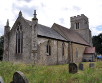
St Mary's Depden
|
|
blank |
On the night of 23rd of June 1984, the church of St Mary, at Depden, was largely gutted by fire. This church stood about a third of a mile from the road, hidden amongst trees, and was only approached by a track across fields. The nearest building is Depden Hall (now a bed and breakfast), which is some 400 yards away and itself includes fabric reputed to date from the 14th century. The village itself has fragmented into settlements at Depden Green to the North and along the A143 to the East of the church and hall. Within three weeks the debris was cleared by volunteers, and a service was held in the roofless remains, albeit within the Sanctuary only. An insurance claim of £100,000, and a local appeal of £10,000, allowed the roof to be replaced, and the church was back in action by October, 1985.
Another disastrous fire happened in December, this time in Bury St Edmunds. The Howard Middle School was completely destroyed by a fire overnight, which investigators later found had been caused by a faulty spin drier and a build up of fluff from drying laundry. The school's pupils had to be dispersed to other schools, and eventually the school would be rebuilt and opened within two years. Howard Middle School was first opened in 1972, and after this 1984 fire would reopen in 1986.
Agricultural yields in Suffolk reached a new peak. In the 19th century one acre could grow 16 cwt of wheat. By 1948 this figure had risen to 20 cwt, then rose 50% by 1962 to 30 cwt. This increase took only 14 years, but in only 22 more years it doubled to 60 cwt an acre in 1984. Better strains of wheat, chemical sprays and chemical fertilizers were responsible, but the natural world of birds and insects paid a heavy price. Manpower had been reduced drastically as mechanisation occurred. Only 3% of the workforce was engaged in farming in 1981 compared to 24% in 1901.
This vast over production would lead to the "food mountains" of the European Community and the introduction of set aside land and reduced subsidies on production.
The IBM PC standard was firmly set with the launch of the 16 bit PC AT using an Intel 80286 processor running MS-DOS at 6MHz with 256K RAM, and 1.2Mb 5.25 inch floppy disc. By the year 2000 this architecture remained world standard although it had evolved through many generations. The terms "IBM-compatible" or "IBM clone" were used to describe copies produced by other manufacturers.
The Apple Macintosh was launched on the Motorola 68000 processor at 8MHz and included its revolutionary Graphical User Interface, but it was more expensive than an IBM clone.
|
|
Nowton Park c. 2002
|
|
1985 |
In September, St Edmundsbury Borough Council acquired the headlease of Nowton Court Estate from Morgan Grenfell. The council had bought this estate on the outskirts of Bury as an opportunity purchase for the future. It would not turn it into a country park until a few years later.
On 30 October 1985, St Edmundsbury bought the old Barber Greene factory site at Western Way. Barber Greene had downsized its manufacturing of heavy road building equipment, and moved to a smaller factory at the Saxham Industrial Estate. The Borough Council wanted to avoid the inevitable future increases in its lease at St Edmunds House in Lower Baxter Street, and hoped to move all its staff out to Western Way. In the event, it would prove impossible to fit everyone into the available space but in 1987 all the depot operations, vehicle workshops and outside staff would be accomodated, together with the departments of Technical Services, Planning, Housing and Finance.
|
|
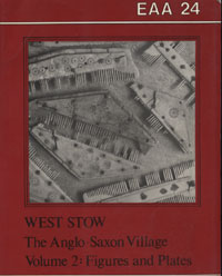
EAA Report 24, volume 2
|
|
blank |
Suffolk County Council published Volume 24 of "East Anglian Archaeology" entitled "West Stow, the Anglo-Saxon Village". This was the full account of the excavation campaign at West Stow for professional consumption. It was divided into two volumes, the first being 'the text', and the second, 'the figures and plates'. It had taken 13 years to organise the material to a point suitable for publication. This remains the major work on the excavations and finds at the Anglo-Saxon village site at West Stow.
Suffolk County Council had put the Manor House on Honey Hill, Bury, up for auction. It had been used for offices by the council since 1947. St Edmundsbury Borough Council had considered buying it for museum purposes, but the current Lord Bristol wished to take the house back into the Hervey family hands. Bristol estates thus purchased the property, built by the First Earl of Bristol around 1737, but out of Hervey hands since the 1780's. There was an informal arrangement that the Earl would refurbish the building and then it might become available to the Borough Council for lease as a museum.
On Bury's Cornhill, the Castle Inn, next door to Moyse's Hall, closed its doors. The premises are now called Superdrug, but the Castle had, at one time, included part of Moyse's Hall as an inn, and apparently dated back to the 15th century.
|
|
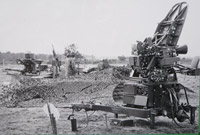
Rapier Missiles
|
|
blank |
At Honington the Rapier anti aircraft batteries of 20 Squadron took up residence on June 3rd. The rapier missile squadron would remain active here until the next century.
Microsoft Windows was launched as the latest operating system for micro-computers, as they were called at the time. The aim was to replace the older DOS operating system, and although it was hopelessly inferior to Apple's OS, it enjoyed success, and soon turned a generic term, Windows, into a commercial trade-name.
|
|
Risbygate Street May 1986
|
| 1986 |
This picture shows part of Risbygate Street in May, 1986. The photographer is unknown as the picture was sold by a dealer on EBay in 2016 for £3 from an old family album. The shrubs on the left concealed the Risbygate Street carpark and its public toilet. On the right is a row of boarded up houses awaiting refurbishment.
By March, interest rates were low by the standards of the past few years. Money could be borrowed by Local Authorities from the Public Works Loans Board at just under 9% for 25 years.
Local government in London was radically changed when the Greater London Council was abolished. Ken Livingstone had been its leader since 1981 and in 1987 he became MP for Brent East.
On 15th April 1986, 18 USAFE F111F fighter bombers flew from Lakenheath to join 15 A6 and A7 attack planes from the USS America and USS Coral Sea in the Mediterranean to bomb terrorist-related targets in Tripoli and Benghazi. One F111 and its crew of two did not return.
On 1 October 1986 the Tornados of IX Squadron left RAF Honington and moved to RAF Bruggen in the strike/attack role.
|
|
Fornham Road fire station 1986
|
|
blank |
By 1986 the fire station on Fornham Road was showing its limitations. There were stories of cracks caused by subsidence below the training tower which was built on marshy land by the River Lark. It was also limited by its accommodation which was built to house just three fire engines. A new, larger design was needed and a site on the new Parkway Road was under development to replace it. The new fire station would open in 1987. The Fornham Road site was sold for housing and would become Mermaid Close.
The Borough Council first introduced market regulations. The regulations governed stall location and market discipline and very importantly by this time, controlled the sale of the goodwill of sites.
The growth of rival markets, usually disguised as car boot sales, was met by adopting Section 37 of the Local Government (Miscellaneous Provisions) Act 1982 requiring prior notice of such events.
The council's car parks in Bury St Edmunds moved over from barrier control to pay and display to alleviate the troublesome queuing of cars on the roads waiting to get in. The robbery of money from a car park attendant in November also proved the value of the use of machines to collect the cash.
The Bury Society decided to promote the idea of the town being entered for the national "In Bloom" competitions, to promote the use and display of flowers more widely in the town.
In Prospect Row the Duke of Wellington pub, built in the 1840's, closed down. Duke of Wellington and Lord Nelson were at one time the two most popular names for licensed premises. The Iron Duke not only won the Battle of Waterloo, but as Prime Minister in 1830, he abolished the duty on beer, and passed the Beerhouses Act, resulting in many new beerhouses being set up without controls. In Prospect Row the old Duke of Wellington became a Day Centre, and then the home of a mental health charity until it was demolished as part of the Arc shopping centre redevelopment in February, 2007.
Eleven more dwellings were built by the Council at Ashwell Road, in Bury.
In August five pictures were unscrewed from the walls of the Athenaeum and stolen. The thieves were soon caught and the pictures recovered. By chance, they were of little value, but resulted in their replacement by copies.
Intel's 80386 32 bit processor was launched.
|
|
Cornhill Walk Mall
|
|
1987 |
In Bury, Sainsbury's supermarket moved from the Cornhill to Moreton Hall on the edge of town. The new land had been acquired in 1984 causing the future of the town centre to come into question.
The Cornhill Walk Shopping Arcade was opened on the site of the old Odeon Cinema. This consisted of a number of shops along a central arcade with a covered in roof. At this time it was still flanked by the Bus Station.
|
|
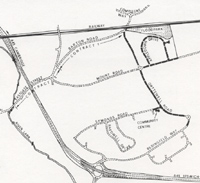
Orttewell Road
|
|
blank |
On April 9th the St Edmundsbury Borough Council officially opened Orttewell Road in Bury St Edmunds, which linked Compiegne Way to Bedingfield Way on the Moreton Hall estate. This series of contracts for roads and sewers would open up more land for development at Moreton Hall, and was intended to be the last link in the town's major highway network. This contract included the construction of roads and sewers at Appledown Drive, the next phase of house building planned for the area.
You can view the plans and information about the new Orttewell Road by clicking here: Official opening of Orttewell Road, 1987
To link Moreton Hall estate to Bury town centre by foot, a steel footbridge was built over the main A45 road, and an existing old footpath from Shakers Lane was once again linked to town. The old path was upgraded to help cyclists and walkers to gain access through the Vinefields down the school boundary to cross the River Lark into the Abbey Gardens.
Also in April, number 6 Angel Hill, formerly a doctor's house and surgery, was reopened by the Borough Council as its Tourist Information Office. It replaced various temporary solutions such as a portacabin inside the Abbey Gate, and could now be open comfortably all the year round.
In 1987 and 1988 there was an excavation of the area beneath the proposed cathedral extension at Bury St Edmunds carried out by Suffolk County Council Archaeological Unit. This showed that a Saxon road probably ran right through the original abbey precinct linking Northgate Street to Sparhawk Street and thence to Southgate Street. This missing road had long been conjectured by authorities such as Margaret Statham.
In August, Bury won the "England in Bloom" competition for large towns, as joint winner with Crewe. The official launch of Bury in Bloom had only taken place a year ago, sponsored by the Bury St Edmunds Society. This early success would be followed by further triumphs in future years.
The Chestnut Court sheltered units were completed at Prince Charles Avenue, on the Mildenhall Road Estate, with thirty five flats and a Warden's house. Eleven new council flats were built on the Howard estate.
|
|
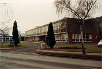
St Edmundsbury House
|
|
blank |
The Council's new offices at Western Way, Bury opened in March, 1987, and was soon to be named St Edmundsbury House. The Western Way site had been acquired from Barber Greene Olding when they wished to relocate to smaller premises following the reduction in road building worldwide. The Finance Department who had been in the Borough Offices now moved to Western Way. The Planning, Architectural and Surveying staff who had been in St Edmunds House, also moved to Western Way. More importantly for the future development of the town, the town depot moved out of its old Playfields site off Prospect Row, and into a site at Western Way.
Gradually the Playfields site would be cleared of now redundant buildings, and given over to car parking. The largest building was the old electricity power station, built to supply Bury in 1900. Before its demolition in 1987 it had been used as the Council stores.
The Borough offices were now closed for refurbishment. While the Borough Offices was closed, the remaining staff moved into St Edmunds House in Lower Baxter Street. The Mayor's Parlour was located in 8 Angel Hill, also known as Angel Corner. The Mayor shared the premises with the Gershom Parkington clock collection.
Just a few yards from the rear of the Borough Offices, on the corner of Looms Lane, stood the white tiled, and widely despised, Blomfield Health Centre building. Built in 1965, the tiles needed remedial work, and it was decided to replace them by a red brick facade. Blomfield House immediately ceased to be a target for architectural disputes.
|
|
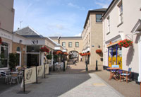
Langton Place shops in July 2009
|
|
blank |
In June, 1987, the Langton Place shopping precinct was opened having cost £1.5 million to develop on the site of the old Langton parking garage and number 7 Whiting Street. It provided a pedestrian link from Hatter Street to Whiting Street along with a selection of shops and business offices, with flats and apartments over.
Factories were now built on land outside the town along the Mildenhall Road. Denny Brothers new printing works was opened in 1987. Within 15 years they would outgrow these premises, and move to Moreton Hall. The firm was no ordinary printers, as they had invented Fix-a-Form labels for a wide range of products which needed complex instructions or details attached.
|
|
Barber Greene's last SA41
|
|
blank |
The firm of Barber Greene's who had been in Bury since 1961 announced that they were in difficulties. The firm made road making equipment and the market had all but dried up for this. In 1985 they had to move to smaller premises, firstly on the old Boby's site, and later at Great Saxham, just off the A 14, selling their long established site at Western Way to the Borough Council. The picture shows the last of their SA-41 asphalt laying track pavers ever built by the firm at Great Saxham Industrial Estate. They would close down in 1988.
During the summer the Council agreed a fifteen point plan for the development of services. This became known as Paper B13A, and was still being referred to fifteen years later as being a significant statement of intent for future council initiatives.
The government announced its intention to replace rates by the Community Charge.
|
|
Parkway Fire Station |
|
blank |
A new Fire Station was opened at Bury on the Parkway Road North by the Duke of Gloucester in September. The premises on Fornham Road had experienced problems and the land was sold for housing. The new station had room for four fire appliances instead of the three formerly stationed at Fornham Road.
At Lackford, gravel extraction had ceased in some areas, leaving large areas of potentially derelict land behind. One major pit was to become the Sailing lake, leased to St Edmundsbury Borough Council, who in turn sub-let to the St Edmundsbury Sailing and Canoeing Club. An adjacent area which was much shallower, having been used to collect outfall from the gravel washing plant, was acquired by the Suffolk Wildlife Trust. This area became known as the Slough and it was now taken under management as a Reserve for Wildfowl. It would open to the public in 1988.
In May 1987 the railway line from London's Liverpool Street Station to Norwich was electrified. The line passed through Ipswich and Stowmarket and Stowmarket suddenly became within easy commuting distance of London. Stowmarket received an economic boost from this improved link, as did Diss which was also on this line.
In August 1987, British Rail decided to sell the land on which the Railway Mission Hall stood in Fornham Road, Bury St Edmunds. As landlords they also claimed the right to sell the buildings which stood on the site. The Mission Hall had been erected by subscription in 1900, and to secure its future the congregation was now being asked to buy back what it had itself provided. At the auction in November, British Rail were forced to withdraw the mission hall itself from the sale, because it was proved to be a temporary structure, being what is known as a "tin tabernacle", with a corrugated iron roof and cladding. The Church still had to buy the land upon which the Mission Hall stood for £29,000. Most of this price had to be raised by an appeal. After this a new church was formed and in 1990 it would become called the Fornham Road Free Church.
|
|
Elsie McCutcheon's book
|
|
blank |
In 1987 the Alistair Press at 2 Hatter Street, home of the Suffolk Bookshop, published this book by Elsie McCutcheon on Bury St Edmunds. It was not a history of the town, but contained a series of chapters which highlighted an historical incident or an interesting aspect of old Bury St Edmunds. Mrs McCutcheon lived in Horringer and had a journalistic background. Chapters included "Royal Visitors", "Fair Days", Jankyn's Gift", "The Churchyard", "Bombardment", along with a host of other topics.
In 1987 Ronald Reagan and Mikhail Gorbachov signed a treaty to eliminate intermediate range nuclear forces and from 1988 to 1991 all the Cruise Missile wings were inactivated.
The year 1987 was momentous in many ways. On 16th October 1987 a hurricane struck South-Eastern England and millions of trees were destroyed as well as power lines brought down and property seriously damaged.
On the 19th October the Stock Market fell 25% following a similar fall in the USA and the event became known as Black Monday. Wall Street fell 32% in just two months, but the October high would be regained within two years. Although not appreciated at the time, this would lead to falls in other asset prices over the next few years, notably in the price of houses and building land.
Windows 2 was launched, as was the Excel spreadsheet by Microsoft. In the UK, Acorn Computers of Cambridge launched its Archimedes computer, based on a RISC processor and an advanced Graphical User Interface, or GUI. The GUI used Windows, Icons, Mouse and Pointers, known also as WIMP. This computer built on the success of the earlier BBC micro-computer built by the same firm.Although faster, technically superior and easier to use than IBM clones, it could not compete with the size of the installed IBM base.
|
|
Margaret Statham's Book of Bury
|
| 1988 |
In 1988, Margaret Statham published her book entitled "The Book of Bury St Edmunds". It was a comprehensive history of Bury in a way that had not been attempted before, and took advantage of modern printing methods to include a host of illustrations, photographs and maps. It would be reprinted and updated in 1996. It was also unusual in bringing the story right up to the present year, and remains in 2002, the only publication on Bury truly worthy of its name. Margaret Statham followed this by "Around Bury St Edmunds in Camera" in 1990, and "Yesterday's Town" in 1992.
|
|
Westgarth Gardens Report EAA38
|
|
blank |
The Suffolk Archaeology Unit finally published its report on the excavations of an Anglo-Saxon cemetery at Westgarth Gardens in Bury, carried out in 1972. This important discovery was dated from the mid 5th century to the 7th century, and was probably a much more extensive burial ground than than the 67 or so graves excavated. The newly developed residential street adjacent to the finds was named Saxon Way in its honour. The settlement associated with the burials remains unknown, as do the other early settlements around Bury St Edmunds, with the notable exception of the village at West Stow.
Arising from purchases for Town Development, the Council still owned 165 acres of development land and there were indications that it would be directed to dispose of it by the government. In order to avoid such a forced sale, in March 1988 the Council set up the Buryhill Land Company in partnership with a merchant bank called Morgan Grenfell. The company would purchase the land, let contracts to build the infrastructure, and sell it to the private sector in line with its business plan. By June 1988 Base Rates had fallen to 7.5 % and mortgages were at 9.75%. The company's business plan looked secure. It would pay the Council £25.5 million in five annual instalments, in return for 22 acres north of Mount Road and 78 acres south of Mount Road in Bury, 41 acres at Chalkstone Way, Haverhill and 24 acres at Parkway in Haverhill.
This plan was part of the paper B13A proposals agreed in 1987. It provoked a formal objection to the Council's accounts for 1987/88. Although the objection was rejected, a number of recommendations were forthcoming when the report came out in 1989. Mostly these related to the amount of information to be included in reports, and after this date, Council reports became longer and more comprehensive.
|
|
Manor House refurbishment plans
|
|
blank |
One of these B13A proposals was to create a new museum. Lord Bristol had bought the Manor House in 1985, and had intended to refurbish it. However, by now his expenditure was far exceeding his income and he decided that he could no longer carry out his aims, and so The Manor House on Honey Hill was bought by the Borough Council from Bristol Estates in 1988. It had previously been used for a variety of uses, but its most recent had been as offices for the County Council. It was intended to bring it back into a representation of its original form and layout, albeit containing museum attractions. It needed considerable restoration and removal of the office partitions and wiring. This took until 1993.
St Edmundsbury Borough Council approved plans for a major expansion to the Moreton Hall estate of private housing. A further 277 acres would be released in phases so that this estate alone would eventually hold a total of 7,000 souls. In addition another 125 acres of industrial land was earmarked to provide an estimated 1,000 new jobs.
|
|
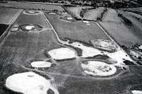
New 9 hole golf course
under construction
|
|
blank |
Meanwhile, others were also involved in profitable land deals. Bury St Edmunds Golf Club had acquired the disused Heath Farm buildings and an acre of ground adjacent to its Tut Hill Headquarters, in 1972, for £2,897. By 1988 these buildings were dilapidated, but the land had planning permission for four houses. In June, 1988, a sealed bid of £275,492 was accepted by the club, and the land sold. This money would be used to completely refurbish the clubhouse, and to buy 33 more acres of farmland upon which a 9 hole course could be laid out, and this would be ready in 1991.
The first Visitor Centre was opened at West Stow Country Park and the Anglo-Saxon reconstructions. It immediately attracted a large increase in visitors to the Country Park and the Anglo-Saxon re-constructions. It was operated to serve both the Country Park and the village site.
|
|

Bill Oddie at Lackford
|
|
blank |
Just across the river from the country park lay the gravel pits excavated by Amey Roadstone. Part of the now defunct excavations were now opened to the public as a nature reserve. It was managed by volunteers from the Suffolk Wildlife Trust, and was known as Lackford Wildfowl Reserve, as the flooded pits were suitable for ducks, geese and waders. The official opening was undertaken by Bill Oddie in November, 1988, and commemorated by a plaque on the small wooden hut that constituted the wardens' hut at the time.
The refurbished Borough Offices re-opened on June 17th 1988. All the staff in the rented offices at St Edmund's House in Lower Baxter Street now moved back in. Staff also transferred in from the old premises of the Thingoe Rural District Council, called Thingoe House, in Northgate Street. These offices were then sold off, and the lease given up on St Edmunds House.
Wollaston Close on the Howard Estate was extended by 23 new council flats, but elsewhere the demise of council housing was starting to be mapped out.
The end of Council housing began when Chiltern Borough Council transferred all of its housing stock to a new Housing Association, set up to borrow the money to buy them, and subsequently rent them to the sitting tenants. This trend continued elsewhere throughout the 1990s.
Councils wound up their building programmes and concentrated upon improving their existing stocks of houses. St Edmundsbury Borough Council agreed to start Phase 1 of the refurbishment of the Clements Estate, including considerable environmental enhancements. Other phases would follow this and continue throughout the 1990s.
|
|
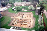
Cathedral Yard excavations
|
|
blank |
At the St James Cathedral plans were under way to provide a Cathedral Centre with a cafeteria, lecture rooms and offices. During 1988 and into 1989 excavations were carried on by Suffolk County Council's archaeologists, under David Gill, within the Cathedral Precinct Yard in advance of construction work. These revealed evidence of an early road forming part of the planned town grid pattern. Also found along the roadway was a succession of timber buildings from the late Saxon period to stone built conventual buildings of medieval date.
The firm of Barber Greene's who had been in Bury since 1961 announced that they would close within two weeks. The firm made road making eqipment and the market had all but dried up for this. In 1987 they had had to move to smaller premises, firstly on the old Boby's site, and then at Great Saxham industrial estate, leaving their long established site at Western Way.
|
|
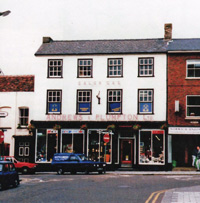
Andrews and Plumpton to move
|
|
blank |
The old established ironmongers shop of Andrews and Plumpton had stood facing down Abbeygate Street since at least 1862. Competition from the new Do-it-Yourself superstores had reduced their business considerably. Determined to continue, the family decided to move to smaller premises in St Andrews Street, (South), actually just across the road from the rear entrance to their existing shop. Sadly this old family firm would close completely in March, 2000.
In Haverhill, the Cangle School closed, although its replacement had been planned since 1972.
In December it was announced that Bury had won the Britain in Bloom category for large towns.
Following several years of house price inflation, a final burst of price rises occurred after the Chancellor of the Exchequer announced the abolition of multiple tax relief on mortgage interest repayments. This inflationary boom caused him to increase interest rates sharply, resulting in many repossessions as higher repayments could no longer be afforded. Base Rates were increased from 7.5% to 13% by December, and mortgage rates increased to 12.75%.
|
| 1989 |
Haverhill Town Council was formed following extensive local consultations and a public enquiry, to better represent the views of the people of Haverhill and promote the town and activities in it.
In Bury, serious consideration was given to relocating the Livestock Market to allow for retail redevelopment, and a Cattle Market Redevelopment Working Party was set up. By September it was agreed to build a multi-storey carpark to serve the new development by the process of "Design and Build", and a design competition was launched.
Redwood Gardens were built with 22 sheltered units in Cotton Lane at Bury.
St Andrews Castle in Bury ceased its association with the Roman Catholic School on the site when it was converted into an Active Business Centre. The school moved to modern buildings nearby.
With the Berlin Wall opened in November 1989, the cold war rapidly drew to a close. Haverhill town centre became pedestrianised, and the West Suffolk Crematorium opened at Risby, both being part of the 1987 plan, outlined in Paper B13A.
The objections to the Council's accounts were dismissed by the audit commission, but several recommendations were made. These resulted in reports containing more detail, alternative options, and committee minutes recording any additional oral explanations made at meetings. The paperwork load on councillors was increased by this ruling.
|
|
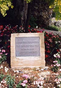
Success in Europe 1989
|
|
blank |
Bury became declared Britain's Floral Town when it won the Florale Internationale for smaller towns and was runner up for the Grand Prix d'excellence.
In July 1988 mortgage interest rates were 9.75%, but by January 1989 they had risen to 13.5%, and in October they rose to 14.5%.
House prices began to fall as repossessed properties flooded on to the market. Other home owners who could still meet higher repayments found that the value of their homes was now less than their mortgage making them unable to move house. The term "negative equity" was coined to describe this financial situation.
The Stock Market fell on 16th October and on 26th October Nigel Lawson resigned as Chancellor of the Exchequer to be replaced by John Major.
The Intel 80486 processor was launched. Tim Berners-Lee proposed a method of using hypertext and assigning such documents a unique identifier so that network accessible information could be easily transferred. This was the start of the World Wide Web. He used existing technologies, but by establishing standards such as the Hyper Text Transfer Protocol (HTTP), it was possible to achieve a fast implementation, and widespread acceptance in the academic community. At first it was the universities that had pioneered the networking together of separate computers.
|
|
In Camera by Margaret Statham
|
|
1990 |
"Around Bury St Edmunds in Camera" was published in 1990. It was Margaret Statham's second book on Bury St Edmunds, and used photographs and old postcards to illustrate aspects of the town's history. The pictures included some villages around Bury, and were mainly from around 1900 to to the late 1920s. Many of the pictures were from the archives of Joe Wakerley, a local farmer, who had opened the Bury Bookshop at 28a Hatter Street after his farm was sold to allow the extension of the Moreton Hall estate. Such 'picture books' would become commonplace in the next two decades, particularly in the use of old postcards to illustrate bygone days.
In January 1990 the Suffolk Hunt inn closed in Eastgate Street. It was a Victorian Beerhouse from the mid 19th century.
|
|
Poll Tax protest
|
|
blank |
On 1st April the old Rating system was abolished. It was replaced by a National Non Domestic Rate to cover business and commercial premises, and by the Community Charge to replace domestic rates. The Community Charge or Poll Tax was levied on every person over 18 living in the collection area. At the same time, the maximum rebate that could be paid was cut from 100% to 80%, to ensure that everybody paid something for local services, whatever their ability to pay. In St Edmundsbury the Borough Community Charge was £71.27 per head for 1990/91.
The Poll Tax was very unpopular in many circles because of the principal that a manual worker in a council house would pay the same tax as a Duke living in a mansion. The ability to pay was to be tempered by a rebate system, which would push thousands more people into a reliance upon benefits. The new system would prove expensive, bureaucratic and error prone. Resistance would increase over time and result in slogans like this one shown here, painted at great risk, on a local gas holder in Tayfen Road, Bury St Edmunds. (Please click on the thumbnail to see the slogan.)
The Local Government and Housing Act 1990 was also to have a major impact on the capital spending of local authorities
and on their Housing Revenue accounts. In the first year, St Edmundsbury began transferring money from the Housing account into the General fund because of the rules of negative housing subsidy. At the same time the Council could spend only 25% of housing capital receipts and 50% of general fund receipts. Capital programmes were soon cut back across the country.
In 1990 the last of the new houses built by St Edmundsbury Borough Council were planned. A contract for 41 dwellings at Chalkstone Way, Haverhill, was arranged by way of a Deferred Purchase agreement with a Merchant Bank, Messrs Morgan Grenfell. Government restrictions on new building and the new housing subsidy arrangements had ended the era of new Council house building. All new social housing after this time would be provided by Housing Associations.
At the same time that Council house building was coming to a stop in April, mortgage interest rates rose from 14.5% to nearly 15.5% and house prices continued to fall through the year.
The Environmental Protection Act of 1990 introduced onerous new duties on local authorities. Highway cleaning was transferred from County Councils to District Councils and the public were given rights to complain about litter and to have a response within a set timescale.
The old TA Centre in Kings Road was converted from being the Council's vehicle depot into 20 flats known as Yeomanry Yard. Four more had a King's Road address.
|
|
EAA Report 48
|
|
blank |
Two scholarly reports were published about West Stow in 1990. East Anglian Archaeology Report 47 was entitled "West Stow, Early Anglo-Saxon Husbandry", by Professor Pam Crabtree. Report 48 was "West Stow, the Prehistoric and Roman British Occupation", by Stanley West.
In August 1990 Iraq invaded Kuwait threatening the West's access to vital oil supplies. In response in August 1990 18 of Lakenheath's F111s are deployed to Saudi Arabia as part of Desert Shield. 14 more go in September, 20 in November and 12 in December. Desert Storm began on 16th January 1991.
On August 31st, 1990 the old established printing firm of F G Pawsey closed down after trading for 101 years in Hatter Street, Bury St Edmunds. The Managing Director, Ben Theobald, was now aged 83 and naturally wished to retire. He had worked for 67 years at Pawsey's and was well known to all those in the town who had needed printing or bookbinding carried out. Pawsey's had never adopted the new offset-litho printing machines which newer firms were now offering.
|
|
Noel Cullum - rake maker
|
|
blank |
Another old business which closed down in 1990 was the Rake Factory at Little Welnetham. The Tool and Trades History Society newsletter 37 for Spring, 1992 carried an article outlining the history of this unusual rural industry. Wooden rakes, scythe handles (or snaithes), hurdles and the like had been made for centuries, and one such business was run by the Last family of Lawshall by the end of the 19th century. Metal fittings for some of these items came from John George and Sons, a large firm of ironmongers, trading throughout the south-east. It was John George who took over Last's business and set up the Rake Factory at Welnetham in 1912, in order to mechanise some of the basic activities of the craft. The location was in the yard of the Welnetham railway station, allowing fast and easy access for materials inwards and goods outwards. George also purchased a lease on Felsham Hall wood and Monks Park wood at Bradfield to secure a supply of ash poles for handles, but also for access to elm, oak, lime, birch, sallow, hazel, maple and hawthorn, each of which had a specialised usage. The woods were subsequently purchased in 1934.
By 1967 the rake business was bankrupt, and Bradfield Woods were gradually being grubbed up for arable farming. The business and the remaining woodlands were purchased in 1970 by Dr and Mrs J W Litchfield, and the woods passed to the Society for the Promotion of Nature Reserves. The factory was run by the Litchfields for another 5 years, then passing to a Mr Ron Hack, and traded as Whelnetham Woodwork. It was subsequently acquired by a furniture maker, Neville Graydon of Stowmarket, but eventually the factory had to close.
Nowton Park was opened to the public by the Council.
The cathedral of St James opened its new facilities for meetings and conferences, as another step forward in making it fit for the headquarters of the diocese. Called the cathedral centre, it included the Refectory.
By 1990 there was the possibility of using non-invasive Geo-physical techniques to identify sub surface features without any disturbance. This seemed to offer an exciting opportunity for research into the protected areas of the abbey ruins at Bury St Edmunds. A resistivity survey was carried out by English Heritage in the areas of the Infirmary, Abbot’s Garden, Dovecote and the supposed site of a watermill. This plotted traces of walling and other underground features, but was largely disappointing. (English Heritage, Ancient Monuments Laboratory Report 100/1990, Author, Payne A W).
The English Heritage summary is as follows:
"This report describes a resistivity survey which was conducted in the grounds of Bury St. Edmunds Abbey in the areas of the Infirmary, Abbot's Garden, the Dovecot and the reputed site of a mill. The findings indicate that extensive buried foundations of walls and buildings are likely to be present in many of the areas investigated. Although the geophysical response was good, the definition of precise structural patterns was not particularly clear."
Through the summer, the rains kept away, and 1990 became another year of drought, something which would typify the most of the coming decade.
In October, Britain joined the European Exchange Rate mechanism at 2.95 deutsche marks to the pound. The rate of inflation was 10.9%, and the Chancellor of the Exchequer was Mr John Major. At the time, this was thought a bold and decisive move to help the economy converge with those of Europe. The exchange rate then had to remain within 6% of the average of all the EEC currencies, known as the Snake. The Base Rate was immediately brought down from 15% to 14%.
Mrs Thatcher resigned as Prime Minister in November 1990.
In December the rate of inflation was 9.7% as John Major became Prime Minister. This was also the year when the Japanese economic miracle began to fail. Over the next twelve years the Nikkei Index would fall 76%, and much of Japan's economic performance for many decades was shown to have structural weaknesses.
Windows 3 was launched by Microsoft for personal computers.
|
|
Sybil Andrews Exhibition
|
| 1991 |
In 1990 Sybil Andrews had donated 7 linocuts and 8 watercolours and drawings together with 2 drawings by Cyril Power to the Museums collection of St Edmundsbury Borough Council, (Now the West Suffolk Council). The major part of her work was donated to the Glenbow Museum of Calgary, Alberta.
In 1991 the St Edmundsbury Museum service prepared an exhibition of the work of Sybil Andrews. She was born in Bury in 1898 above Andrews and Plumpton's hardware shop at the top of Abbeygate Street. In 1922 she went to London, and in 1947 had emigrated to Canada. Christopher Reeve, the council's Fine Art Curator, wrote the accompanying commentary to the exhibition, called "Something to Splash About." Some of her pictures and Lino-cuts were displayed at Angel Corner, the council's clock museum at the time. Sybil Andrews wrote the introduction, sending a letter from her home in Canada. She died there in December, 1992, aged 94.
Operation Desert Shield became Desert Storm, the start of the Gulf War, on 16th January 1991. F111F's of 48th Tactical Fighter Wing from Lakenheath destroyed dozens of hardened shelters and tanks before the ceasefire on 28th February 1991.
Following continued public disquiet over the Community Charge the budget included provision to cut £140 from each bill. This was paid for by an increase in VAT from 15% to 17.5%. It was also announced that the Community Charge would be abolished and replaced by the Council Tax. Mortgage interest relief was also restricted to the basic rate of tax and tax was increased on lease cars by 20%. Inflation fell to 8.9% in February and interest rates were also cut. Base Rate was 14% in January and fell to 10.5% by December.
Bury's population recorded in the census for this year was now 32,774, an increase of 12,718 or 63% since 1951.
In January, 1991, St Edmundsbury Borough Council accepted a proposal by local people for the conversion of the derelict allotment gardens at Spring Lane, Bury St Edmunds, into a local nature reserve. Volunteers would clear the site of brambles, rabbit netting, fencing and old metalwork. The Spring Lane Wildlife Trust was duly established in February to allow four Trustees to hold the lease of the land. British gas would later make a grant to enable some contract work to be undertaken.
In April 1991, the British Trust for Ornithology (BTO) moved its national headquarters from Tring in Hertfordshire to The Nunnery at Thetford. The BTO had existed since 1932, aiming to carry out scientific research into the birdlife of Britain. The freehold of the old nunnery, together with 10 acres of lawns and woodland had been donated to them by Mr John Rudrum of Australia. The property had been a farm for many years, as the nunnery closed by 1539. It is located on the banks of the River Little Ouse at Three Nuns Bridges. Parts of the medieval Benedictine Nunnery of St George still survived on this site, although a massive £1.5 million programme of refurbishment was needed to convert the property into suitable offices, while retaining its historic features.
The Norman Tower and Abbey Gate were cleaned of centuries of grime and dirt to reveal details new to late 20th century eyes. Abbeygate Street was closed to traffic on market days (Wednesday and Saturday) from 6am to 6pm. These were all part of the 1987 fifteen point plan made by the Council. Alwyne House was opened as a Tea room in the Abbey Gardens at Bury. In May, the first Milk Race was held in Bury for international cyclists.
In Churchgate Street the refurbishment and conversion of the Unitarian Chapel was completed. It could now be let out for public functions as well as continuing as a place of worship.
In Kings Road the Butchers Arms closed in August. This pub had been built in 1839, when Kings Road was called Field Lane, and it was practically a country inn. It was a favourite place for Boby's workers to drink when that great engineering works was in full swing.
In October the "Twizzler" in Raingate Street also called time for the final occasion. Properly called the "Rutland Arms", this inn had been called the Globe up to 1878, when it enjoyed a spinning globe as its sign. Curiously the old name had hung on in local usage up to the present time.
Bury opened its multi-storey car park on Parkway in October 1991. The charge was 40p for a day's parking. It was located east of the Parkway Road in order to retain the cattle market site for possible retail development. The idea was that it would then serve the new shops. Because the development did not happen, the multi deck never achieved its full potential, only filling up on the most busy days of the year, such as half term holiday Wednesdays. Its charges would remain low to make it attractive, as the existing parking was to remain, and be increased over the next dozen years.
On 6th October, 1991, Bury St Edmunds Golf Club officially opened their new 9 hole course. This had been financed by the sale of Heath Farm buildings, and begun in 1988. The dry summer had delayed its opening until the Autumn. This course would become very successful for beginners, and those who wished to avoid the very busy main 18 hole course.
The Warsaw pact disbanded in July 1991 and the Soviet Union itself dissolved five months later.
Civil War began in Yugoslavia. In December, John Major signed the Maastricht agreement on European political and economic union. Inflation had fallen to 4.3% by November.
|
|
Yesterday's Town by Margaret Statham
|
| 1992 |
During 1992 "Yesterday's Town: Bury St Edmunds" was published by Margaret Statham. This book followed up her successful book of 1988 and contained many further pictures and research on the history of that town. It was financed by subscription, in the same way that many of the old 19th century publications on the town had been. This book is thus hard to find in 2006.
In January the Bury Leisure Centre was re-opened with a new leisure pool, flumes, fitness suite and sauna rooms.
At Hardwick Heath a block of changing rooms were built for the use of local football teams playing on the Heath pitches.
In West Road, the Plymouth Brethren re-opened their modernised and enlarged church.
In February 1992 the 100th Air Refuelling Wing was set up at Mildenhall made up of the 513th TAW merged with SAC's 306th Strategic Wing which was deactivated.
Still known as RAF Mildenhall, this base covers over 1,000 acres and the main runway is over 3,000 yards long.
The F111's were to leave the 48th Fighter Wing at Lakenheath during 1992 and the last one left in December 1992.
Lakenheath now flies the F15E fighter planes with the distinctive twin tails. The first F15E in Europe come to Lakenheath in February 1992. 48 in total were delivered up to May 1994 to the 48th Fighter Wing.
At RAF Honington the Tornados of 45 Squadron left. The squadron converted to Jetstreams based at RAF Cranwell. This was the end of routine flying from Honington. It would become the home of the RAF Regiment in 1994.
|
|
Waitrose under construction
|
|
blank |
During 1992 the new Waitrose Supermarket was under construction on the site of the old and defunct Robert Boby Engineering works. We are looking up the line of the as yet unmade Robert Boby Way with our backs to St Andrews Street South. This picture was taken by Mike Peyton from upstairs at his home at 39 St Andrews Street South.
In April, 1992, the Conservatives won the General Election, against all earlier predictions. Mr Richard Spring was elected MP for Bury St Edmunds, replacing Sir Eldon Griffiths, who retired following 28 years as Bury's MP. Base Rates had fallen to 10.5%, and were cut to 10% in May. By July the Retail Prices index was only 3.9%. The Local Government pay award was 4%, a level not exceeded for the next decade.
By this date electric power supplies were made available to all of Bury's market stalls which needed it to comply with legislation. The market was extended into the Traverse under its Business Plan.
|
|
Community Charge incentive scheme
|
|
blank |
In January 1992, the St Edmundsbury Borough Treasurer, Mr L G Lockey, retired, having been appointed in 1969, and was replaced by Mr Alan Johnson, lately the Treasurer of Runnymede District Council. The Community Charge, or Poll Tax, as it continued to be popularly known, had proved difficult and expensive to administer and collect. In order to give people an incentive to pay it off in one instalment by May, the Three Wishes Incentive Scheme was devised by the Borough Treasurer.
In June 1992 the Borough council repaid all its remaining borrowings of £11.3 millions to obtain debt free status. It had been reducing debt for the last decade by a steady annual process, which speeded up in more recent times. This final move was to avoid Government rules to set aside half the proceeds of all sales of property, rather than re-invest it all in new infrastructure as the Council desired. The repayment of relatively cheap loans allowed the council to receive a discount of nearly £600,000 on the deal.
In June the government announced a rolling review of the organisation of local authorities, with a presumption towards unitary, or all-purpose, councils being set up. There were to be 5 tranches, with Suffolk in Tranche 4. The review was to be finished by 1996, and the new councils all in place by 1998.
The Buryhill Land Company ceased trading. This company had been set up by St Edmundsbury Borough Council in 1988 to buy all the Council's undeveloped land. The continued depressed prices for housing land following a slump in house prices made the company's future untenable. Because the council had repaid all of its loan debt, to obtain debt free status, this allowed it to buy back the remaining land holdings of the company. In Haverhill, the Council re-acquired 28.6 acres at Chalkstone and 22.15 acres at Parkway. In Bury there were 38.7 acres south of Mount Road, and 0.64 acres north of that road.
In May, 1992, St Edmund's Place sheltered Accomodation was enlarged by the opening of a new extension.
|
|
The Magi by Sybil Andrews
|
|
blank |
On December 21st, 1992, the Bury born artist, Sybil Andrews, died. She had been born in Bury St Edmunds above the Andrews and Plumpton ironmongers, in 1898, but moved to London in 1922. After this she became known for her modernistic lino-cut prints. In 1947 she and her husband emigrated to Canada, but she was quickly appreciated there for her artistic talents. Suffolk continued to influence her works throughout her life, despite a prolonged absence from the County. Even in Canada she continued to produce some work which reflected Suffolk life as she remembered it. Her linocuts and watercolours are now collected and exhibited internationally, and some are included in the collection at the Manor House Museum. One or two of her prints were found when the strongrooms at the Borough Offices were cleared prior to the move to Western Way by some Council departments in 1987.
If you are interested in the full story of Sybil Andrews you can view a comprehensive summary of her life and work here:-
Shortcut to Sybil Andrews Page
In Haverhill the East Town Park was opened and the Sports Centre got two giant water slides.
In Bury St Edmunds, there was controversy over plans by Bloor Homes to build on 67 acres of land at Tayfen, off Spring Lane on land partly occupied by the former Greyhound Racing Stadium. Local residents objected to the scale of the proposals, and wanted the council's allotment land to be converted into a local nature reserve. The development plans were blocked by the Environment Secretary, but an informal start was made on managing the old allotments as a nature reserve. This became the Spring Lane Wildlife Area which was managed by the Spring Lane
Wildlife Trust on the basis of a “Tenancy at Will”. Bloor Homes would make a new application for housing within a few years time.
The economy broke out of recession but things remained difficult for many individuals and families. Negative equity following a fall in house prices continued to hold things back. Many individuals had their homes repossessed, when the value of them had fallen to less than the mortgage owed on them.
In 1990 Chancellor of the Exchequer, John Major, had joined the European Exchange Rate Mechanism at what came to be regarded as too high a rate for the pound. Disaster struck on 16th September, 1992, when international traders started to sell pounds. The lower level against the DM within the Snake was DM2.778. Market forces were pushing it towards 2.40. Interest rates were raised twice in one day from 10% to 15% until UK membership of the ERM was suspended at 7.30 pm that night, and the base rate cut back again to 10%. This became known as Black Wednesday. The currency speculator George Soros is said to have profited by $1 billion by betting against the pound.
Despite this crisis, the rate of inflation had fallen from 10.9% in October 1990 to 3.6% in September 1992.
In the next three months interest rates were cut three times to end the year at 7%. This experience would sour the British view of possible European Monetary Union for a decade.
In October the Parkway Car park was closed when a clock box was seen in a paper bag under a car near where RAF personnel were parked. The Colchester bomb squad damaged the car when a controlled explosion was set off to make safe the suspect package.
Also in October, the St Edmundsbury Borough Treasurer was suspended from office, and later dismissed.
The 27th February, 1992 was the date that Barry Clutterham, aged 47, was shot by the police in Pigeon Lane at Fornham All Saints. A policeman had been shot, and there had been a car chase ending in the lane. Locally known as Crusher Clutterham, a correspondent wrote, "having become known as a loveable rogue with "form" over the whole of his life from a dreadful and disturbed childhood, he was shot and killed by the Police after firing at Police Officers with a sawn off shotgun."
A fuller report is as follows:
" An incident occurred in the Bury St Edmunds area on 27th February 1992 when a local villain, Barry Clutterham, described by some as a ‘likeable rogue’ but nicknamed ‘Crusher’, had an altercation after his relationship came to a bitter end. A police car was attending the latest round of a long standing dispute with another man when Clutterham took his sawn off shotgun, smashed the window of the police car and shot PC Keith Bottomley in the chest and arm. He then hijacked a driving instructor but was cornered by a police firearms team. Despite warnings, Clutterham fired at PC Derek Pooley narrowly missing his head. Two police officers shot and killed Clutterham – the first man to be shot by police in Suffolk. Exonerated by the Police Complaints committee Derek Pooley went on to become Inspector with responsibility for the firearms team. He was lucky to be alive."
|
|
New village footpath entrance
|
|
blank |
In May, 1991, work had begun on a significant project to benefit Fornham St Martin, carried out by Fitzpatrick Civil Engineering for Suffolk County Council at a contract value of £2.6 million.
The A134 road through Fornham St Martin was diverted to a village bypass, and was opened in 1992. This new road connected Compiegne Way to the Thetford Road, and gave the A134 a much easier access to the A14 via the St Saviours interchange. HGV vehicles could now be restricted through the village resulting in a significant reduction in heavy goods traffic in the Street at Fornham St Martin. This bypass left outlying properties like Hall Farm, down the Drift, connected to the village only by a bridge over the new road. It also resulted in the closure of the road now cut off by the bypass, which became a gated footpath, and eventually a convenient site for the village sign.
Windows 3.1 was launched. Finally, Windows had a reasonably stable bug-free system, but it was still markedly inferior to the Apple or even the Cambridge based Acorn systems. Only the weight of mass-support and the business acumen of Microsoft kept it afloat.
|
|
The Culford Estate by Clive Paine
|
|
1993 |
Backed up by the research done by the Ingham Local History Group, Clive Paine edited and produced "The Culford Estate 1780 - 1935". This was a detailed study of one of the great estates around Bury St Edmunds which arose out of a 3 year course in local history, sponsored by the University of Cambridge Board of Extra Mural Studies. It covered five parishes, and was a massive and detailed exercise. The Culford Hall and Park survive today as the home of Culford School.
On 1st April the Community Charge was abolished following various campaigns including public disorder. The Poll Tax, as it was universally called, had only lasted for three years from 1st April, 1990 to 31st March, 1993. It was replaced by the Council Tax based upon bands of property values, paid by the householder. Unlike the Community Charge, people on low incomes could qualify for 100% relief, owing nothing at all. Property Bands went from A to H, the top band being for properties over £320,000 in value. This band was not included in the original plan, but was added following protests that band G for properties over £160,000, was not a fair upper limit. However, the system of a nationally set Business Rate was to continue, and local councils were permanently deprived of a direct financial link to the success of local business.
During May, the Bury Free Press began to use colour pictures regularly as a feature of its front page. Provincial newspapers were ahead of the national papers in their innovative use of colour photography.
In March the post of Borough Treasurer at St Edmundsbury was redesignated Director of Finance and put out to national advertisment. The author of this chronicle was appointed to this post on 1st June, having been Acting Borough Treasurer since January.
Big changes were happening in the world of further education. The West Suffolk Technical Institute was removed from the control of the Local Education Authority, the Suffolk County Council, and became a self governing Trust. It changed its name to the West Suffolk College.
Simpson's cattle market site was sold to the Council, who leased it to Lacy Scott, the last remaining livestock auctioneer in Bury.
|
|
The Manor House Museum
|
|
blank |
The Manor House Museum was opened in the Honey Hill building which had been originally built as the town house of Lord Bristol and the Hervey family of Ickworth in 1738. It was refurbished particularly as a secure home for the Borough Council's collection of time recording instruments, bequeathed to the town by Frederic Gershom-Parkington, in memory of his son, John, killed in 1941 in the war. The clocks had been previously on display in a somewhat restricted, but well loved, manner in the Clock Museum housed at Angel Corner. Several break-ins and thefts had made a more secure relocation a necessity.
|
|
 The Mabilla Group
|
|
blank
|
The new museum also displayed the borough's collection of textiles and clothing. The collection was enhanced by the Irene Barnes Collection of women's beaded and sequinned costumes from the period of 1919 to 1939. Manor House became the home of the Mabilla Group, dedicated to the conservation of the collection, and the maintenance of the needlework skills necessary. The collection continued to grow based on this strong beginning.
|
|
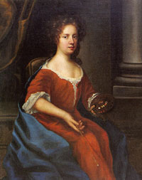
Mary Beale in 1675
|
|
blank |
The museum also housed most of the Borough Council's collection of pictures and prints, many of which had been bequests to the town. Since about 1987 the Borough had also had an active collecting policy of artists and scenes of local interest. The council already had two pictures by the Barrow born artist Mary Beale, acquired another in 1987 and a self portrait in 1989. In 1993 Mr Richard Jeffree died. He had been a follower of Mrs Beales' work, and left his collection of 14 portraits by her to the Manor House Museum, with a request that they be on permanent display.
Angel Corner, or to use its postal address, number 8 Angel Hill, now became the offices supporting the Mayor, including the Mayor's Parlour. Other space was also used as offices by the Borough Council, but this use on upper floors became much restricted by Fire Regulations.
At Lackford the Suffolk Wildlife Trust opened a major eastwards extension of its Lackford Wildfowl Reserve. Flooded gravel pits had been acquired from the mineral extraction company, Amey Roadstone, and the company had landscaped and profiled the pits to assist their rehabilitation. The SWT had been working in the area with volunteer work parties for two or three years already to get the area ready for the public to visit.
|
|
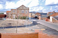
Robert Boby Way junction
with St Andrews Street South
|
|
blank |
In July, 1993, Waitrose opened their new store on part of the former Robert Boby Engineering site, in Bury St Edmunds. It included a carpark at the front, and an access road called Robert Boby Way, which linked the Parkway with St Andrews Street South. This picture by Mike Peyton shows the junction with St Andrews Street south nearly completed around June, 1993. The old offices of Robert Boby Ltd are seen end-on from this angle.
Waitrose quickly became a popular store, and would be extended in seven years time.
After years of campaigning, Haverhill's new southern bypass was started in August. The work revealed 1st century Roman brooches and some iron age finds. There was flooding in October and, more significantly, a complete renovation programme was started on the Town Hall. Haverhill Sports Centre was refurbished with health and fitness areas and a soft play zone.
In September, the St Edmundsbury council's Transport and Works Committee agreed to build a new bus station to serve the town. Following the deregulation of buses, the old bus station by Moyse's Hall had been sold for redevelopment. Bus companies were now under no obligation to provide facilities for passengers to be picked up, and so the council decided to step in.
In November St Edmundsbury decided that it would ask the Local Government Commission to support a West Suffolk Unitary Authority in our area. Suffolk County Council supported the status quo of a two tier county.
By December the retail prices index had fallen to only 1.9%, an incredibly low level compared to three years earlier.
In 1993 the twin bases at RAF Woodbridge and Bentwaters were returned to the British.
The Intel Pentium processor was announced and Microsoft announced Windows NT, a system meant to improve upon the unreliable and insecure Windows OS for business use. Students in Illinois created Mosaic, the first web browser. Without this work, you might not be able to read this Chronicle today.
|
|

British Archaeological Association logo
|
| 1994 |
In April 1994 the British Archaeological Association held its annual conference at Culford School, just outside Bury St Edmunds. This was the first time that the Conference had been held in Suffolk, and this year its theme was entitled "Bury St Edmunds Medieval Art, Architecture, Archaeology and Economy". The conference topic was inspired by Dr Antonia Gransden, author of several scholarly works on Bury St Edmunds Abbey. She also arranged its agenda as well as addressing the meeting, which had 135 delegates, and lasted from 16th to 20th April. The party made visits to the Abbey, to Cambridge University to view Abbey manuscripts, and to churches at Mildenhall, Woolpit and Icklingham. A reception was held at the Manor House Museum and at the Cathedral refectory. The Proceedings of this conference would be published in 1998.
In June, St Edmundsbury Borough Council Council decided not to proceed with the redevelopment of the Cattle Market site. The size of the project was raising public concerns, the relocation of the livestock market to a new site could not achieve agreement, and there were demands for another multi storey carpark to be built on the GPO Sorting Office site.
In July the Local Government Commission published its draft proposals for the reorganisation of Norfolk and Suffolk Local Government. Waveney and Yarmouth, the latter currently in Suffolk were to be amalgamated. Ipswich would stand alone, and East Suffolk be put together from Suffolk Coastal, and parts of Babergh and Mid Suffolk. West Suffolk would be returned to nearly its old historic boundaries of Forest Heath, St Edmundsbury, and parts of Mid Suffolk and Babergh.
|
|
 Lamson Paragon's Bury works closed in 1994
|
|
blank
|
Lamson Paragon was a well known name in the office stationery and office mechanisation world. The borough council was very pleased to see their new factory open on Western Way in 1964, and it was featured in the town guide for that year, from which this picture came. Lamson Paragon originated in Fords Park Road, Canning Town. In the late 1950s/early 60s, they moved their different productions out to purpose built factories around the UK. Bury was home of "Speediset" production, the multi-part forms for which Paragon were well known. Huge rolls of paper and vats of ink were stored and processed on-site. In 1977, a Canadian company called The Moore Corporation became the major shareholder and the company name changed to Moore Paragon (UK) Ltd., but it was always known as Lamson Paragon to users. In 1994, all the workers at the Bury St Edmunds factory were made redundant and the factory was later demolished.
The Sunday Trading Act 1994 came into force in July. This allowed small shops unlimited opening hours on Sundays. Large shops were restricted to 10am to 4pm on Sundays.
The red meat inspection service was transferred from local government to a new central authority.
Stephen Dykes Bower, the cathedral architect, first appointed in 1943, died in 1994. He left nearly £2 million towards the completion of the tower and works to St James's Cathedral. Suddenly there was the prospect of completing his design for Bury's cathedral church.
|
|
 Abbeygate Street pedestrianised
|
|
blank
|
In 1994 the Abbeygate Street closure was extended from just market days, to every day except Sunday. The hours of closure were from 10am to 4pm, except market days which remained at 6am to 6pm.
At Moreton Hall there had been great development of private housing, industry and commerce. Some major shopping outlets were now located here, and a new Anglican parish was established. Christ Church was set up by the Church of England, but run on ecumenical lines.
The St Edmunds Head pub in Cannon Street closed down in August. It would re-open as the Old Cannon Brewery in 1999.
|
|
 Abbey Visitor Centre
|
|
blank
|
The Abbey Visitor Centre was opened in Samson's Tower in the West Front of the Abbey Ruins in partnership with English Heritage. This was part of the expansion of Leisure Services by the St Edmundsbury Borough Council at this time. The Churchyard was also being looked at as an amenity and a management plan was being drawn up. Unfortunately the Visitor Centre would be closed for budgetary reasons within a few years.
The Buryhill Land Company was officially put into liquidation by its owners although it had ceased trading in 1992. It achieved a solvent liquidation with a net profit after tax of £16,788, but most importantly the Council was able to contribute £922,000 to the Haverhill by-pass construction by Suffolk County Council on 1st June 1994. The income from the company had also contributed to pedestrian priority measures, the new East Town Park and the refurbishment of the old Town Hall in Haverhill. Phase I of the bypass was finished in June. The Town Hall reopened in time for a pantomime in December. It was named the Town Hall Arts Centre following a public competition to choose a name. A partnership began with the NRA to develop the West Town Park at Haverhill.
Opening in time for Christmas, the old penning area of Simpson's market was turned into carparking, including a burnt out house in Prospect Row. Lacy Scott continued to run the buildings on Simpsons Site as an auction mart.
|
|
 Stradishall Memorial mug
|
|
blank
|
In August, 1970, the RAF training base at Stradishall had been closed down. It had been in service since 1938 and had been a home for RAF bombers throughout the war. Over 30 units had been stationed there, with over 30 different types of aircraft. In 1993/94 the RAF Stradishall Memorial Trust issued 100 commemorative plate and mug sets in honour of the long defunct base.
In 1994 the RAF Regiment took up residence at RAF Honington. Their battle role is to secure forward bases which can then be used by aircraft and to provide the necessary defence and security once acquired. After a time a specialist Chemical, Biological and Nuclear defence unit was established here.
Lakenheath's F15 fighters were sent to Italy to help enforce the no-fly zone in Bosnia.
In December, the Base Rate moved up when it rose from 5.75% to 6.25%, and the RPI rose from 2.6% to 2.9%.
During 1994 the National Lottery began with the aim of generating new funds for good causes.
The Channel Tunnel was also opened that year.
The Mosaic browser became the basis for Netscape navigator, the key to the World Wide Web for the next two years.
|
|
Wickhambrook by John Bean
|
|
1995 |
"Ten Miles from anywhere" was the title chosen by John Bean for his book on Wickhambrook, published in 1995. Wickhambrook is a village between Bury, Haverhill and Newmarket, up to ten miles from each, although surrounded by many other village communities. Mr Bean describes the changes in the village from 1969 to 1994, based upon the items recorded in the "Wickhambrook Scene", a bi-monthly magazine published by the local community council, and edited by John Bean himself for 18 years. Much of the content was made up of local news as may be expected, but local people often contributed their memories of days past, and so the book includes many stories from within living memory, and sometimes from local legend.
Wickhambrook is unusual in its layout, having hamlets around eleven separate greens, spread over twenty square miles. It includes five old manorial centres around the Halls of Giffords, Clopton, Badmondisfield, Butlers and Gaines.
Being so isolated, many side roads in the area were unsurfaced until the late 1940s, electricity did not arrive until 1953 and mains drainage came to a fortunate few in 1970.
Valuable photographs were also sent in, such as that for the front cover, showing 'Squibbie' Murkin and 'Waters' Alcock, outside the 'Sizzle', (Walnut Tree Pub) in 1946. Older residents usually had such nick-names, often originating from childhood. Many of these men were grateful that Justin Brooke had come to Clopton Hall farm in 1928 and employed a large number of locals. Brooke had twenty applications from out of work farmhands in his first weeks. His soft fruit, apples and dairy business made Wickhambrook an oasis of relative prosperity for a generation of local farm labourers. Justin Brooke was, by this time, a fond memory as he had died in 1963. His wife Edith carried on the farm until her retirement in 1977. It remains in the family.
Barings Bank collapsed in February 1995, following losses of £860 million caused by unauthorised trading in the Far East. A new term of Rogue Trader was invented to describe these type of activities by individuals within investment firms.
St Edmundsbury's Environmental Health Department was merged with the Housing Department in April. The Works department was split up so that Housing Maintenance also joined the new Environmental Health and Housing Department.
Compulsory Competitive Tendering of Council Services moved up a gear following the demise of local government reorganisation. A wider range of services came under the rules including Personnel, IT and Finance.
In 1995 Alconbury closed after 53 years of US flying presence. Later that year Chicksands was returned to the British after 45 years in US hands.
In April the new Police Authorities were set up, taking them away from being a committee of the County Councils, and thus the Suffolk Police Authority was created.
In May, the four-yearly elections for St Edmundsbury Borough Council produced its first ever Labour party majority. The new Leader of the Council was a Haverhill Councillor, a significant event for that town.
In May 1995 it was the 50th anniversary of VE Day and St Edmundsbury Borough Council organised a weekend of free events to mark the occasion. The War Memorial on the Angel Hill in Bury was refurbished and put into a new setting, with flower beds and a paved surround. Gradually the whole of the Angel Hill was improved each year.
Celebrity cricket started at the Victory Ground in Bury.
In November 1995, St Edmundsbury Borough Council entered into a local management agreement with English Heritage, whereby the council took over managing the guardianship area of the Abbey Gardens at Bury St Edmunds, for a period of five years. The agreement was extended a further ten years thereafter and was again due for renewal in 2011. English Heritage make an annual financial contribution towards the Council's cost of upkeep of the area under this agreement.
Summer 1995 was a year of drought, heralding a period from 1995 to 1997, which would be the driest for 200 years.
|
|
Proposed Lakenheath RSPB Reserve
|
|
blank |
Ironically, the threat of global warming was accompanied by a fear of rising sea levels. This meant that many coastal marshes were expected to be lost to the sea over the next 50 years. Most of these areas were valuable wildlife habitats, including important RSPB bird reserves. The RSPB response was to look to replace coastal marshes by inland fen reserves for birds like the bittern, marsh harrier and bearded tit, and for thousands of breeding waders. In September 1995 the RSPB purchased 238 hectares, (600 acres) of mainly cereals and carrot fields adjacent to the River Great Ouse, about a mile north of Lakenheath. Survey work took place through the summer to turn these arable fields back into the marshy fenland reedbeds that they were over 400 years ago. Excavations of new pools and ditches started in November 1995, and would continue for several years, including planting reed cuttings from Strumpshaw Fen, Titchwell, and the adjacent Botany Bay area. By 2008 the reserve would be open to the public, with facilities for visitors and car parking.
By December 1995, the Prospect Row carpark was turned from a rough cleared site to a high quality carpark when it was completely tarmaced and properly laid out. It had previously been the council's depot before the move to Western Way in 1987, but the site had only been cleared to ground level, leaving a rough hoggin surface, with plenty of rough edges.
Bury's rather run down Railway Station facade was cleaned and repointed. However, the interior, which was still operationally part of British Rail, stayed in its shabby state.
In 1995 the St Edmundsbury Council introduced a scheme to collect garden and kitchen waste free of charge to householders. This was undertaken by using a 240 litre brown coloured wheeled bin to distinguish it from the black bins already in use for household refuse. This was to meet recycling targets and to reduce waste entering scarce landfill sites. Also there was DEFRA funding available to help finance these changes.
Microsoft finally launched Windows 95, which at last approached the standards of competing GUI's but was still judged to be inferior to them. By now, however, it was virtually the only game in town because of its wide availability, and the size of its installed base.
|
|
1996 |
A further major part of the Haverhill by-pass was completed representing just one of the road improvements laid down in the Gibberd Master Plan.
In March the livestock industry suffered a severe blow when the EU banned the export of British beef because of the spread of a disease called BSE, or Bovine Spongiform Encephalopathy.
|
|
New Bus Station
|
|
blank |
In April the new Bus and Coach station was opened in St Andrews Street in Bury, although bus operators could not be compelled to use it. This facility was universally welcomed.
Less welcome was the closure of the Suffolk Hotel, a well known meeting place by day and night, and its replacement by two shops. The Suffolk had got its name when the inn was rebuilt in 1833. Before this time it had been called the Greyhound and there is a document of 1539 recording that Thomas Browne rented "le greyhounde" in that year. In its heyday it had been one of the town's leading coaching inns, and post houses, perhaps even greater than the Angel and the Bell.
Universal Council Tax capping was brought in by the government. District Councils spending above a Standard Spending Assessment set by government are capped to an increase of just 0.5%. Unfortunately this did not stop any council's pay and other costs from increasing at the going rate of about 3% a year, it just stopped these from being met out of the council tax. Several long years of cutting council spending on services would follow this move.
|
|
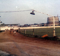
Demise of Greyhound Stadium
|
|
blank |
On 25th June, 1996, the West Suffolk Greyhound Stadium at Tayfen Meadows off Spring Lane, closed for the last time. This stadium had held greyhound races on Thursdays and Saturdays since December, 1949, and news of the closure led to protests outside the homes of the Duttons, who had owned the stadium since its opening. It was a flapper track, that is, a track not licensed by the National Greyhound racing Board, but anyone with the entry fee could enter their dog in a race. The annual Magna Carta stakes, held each July, had the biggest prizes, ranging from £200 in 1964, to £1000 for a winner in 1984. Most races were over 300 yards or 510 yards, with occasional hurdle races. Usually there would be six races with six dogs a race. Peak crowds reached over 600 people, but most nights saw 250 to 300 people. Racing began at 7.00pm with the last race at 9.15 pm., and there was a social club to provide refreshments. The closure of the greyhound stadium was initially because of a proposed relief road from Tayfen to Beetons Way, but this never materialised. Within a couple of years the sites of the Dog Track, the adjacent steel yard of Percy Fulcher and the Spring lane Caravan Park, were all demolished to make way for the Tayfen Meadows housing estate, built by Bloor Homes.
|
|
Great Churchyard History
|
|
blank |
In August, 1996, St Edmundsbury Borough Council published this pamphlet on the History of the Great Churchyard. It was part of the Leisure Services effort to make more facilities available to the public. A management plan had been finally agreed for the maintenance of the churchyard to help preserve its "historical and floral wealth."
The eight page glossy History contained 35 colour pictures of the buildings and monuments around the Churchyard. It was a valuable guide for visitors, and pointed out many of the often overlooked features of interest within the precinct. Parking restrictions within the area had contributed to transforming it into the tranquil oasis of calm which had been desired.
You can view this leaflet by clicking on the thumbnail.
In September of 1996 the St Edmundsbury Borough council took the decision to proceed without delay to promote a multiplex cinema for Bury. It was seen as a "Quick Win" by the newly elected Labour Council, but unfortunately this decision met a great deal of local opposition and was not to be finally achieved until nine years later, when the Parkway Multiplex Cinema opened its doors on November 18th 2005.
|
|
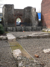
St Saviour's Excavation.
|
|
blank |
In 1996, Tesco's supermarket opened for business off the St Saviours roundabout. As the store abutted the old St Saviour's Hospital, dating from monastic days, the developers funded an extensive archaeological excavation of the site. The public were invited to open days and the dig was well attended by onlookers. A part of the site with exposed remains is open to the public off Fornham Road.
Ridley's Grocers shop in Abbeygate Street closed in October 1996, citing the high levels of Business Rates in town centres as its reason. Although there had been a grocer's shop on this site, on the corner of Angel Lane, since around 1700, food items were now mainly bought from massive stores like Sainsbury's and Tesco in out of town locations. Land costs were lower, free parking could be offered on site, and rating valuations per square foot were lower in such places. The large numbers who used them allowed massive economies of scale in management and purchasing power, thus reducing consumer prices to levels at which smaller shops could no longer compete. Waitrose supermarket had even arrived on the edge of town centre, on the old Boby's site, off St Andrews Street, competing directly with the specialist quality foods sold at Ridleys, and also competing for the custom of the non-car users within the town centre itself.
Also in October, St Edmundsbury Borough Council began using Document Image Processing for the management of the paperwork involved in the collection of Council Tax and Business Rates. It was thought that this technology would be widely adopted throughout the council, but this did not happen except for Benefits processing, also within the Finance Department.
In November, No Mans Meadows were opened as a nature reserve with a circular footpath. This represented a major initiative by the Guildhall Feoffees to allow public access to their land, in partnership with the Council.
|
|
Old Inns and Beerhouses
|
|
blank |
The West Suffolk Branch of CAMRA, the Campaign for Real Ale, published "Old Inns and Beerhouses of Bury St Edmunds". Not only was this an indispensible guide to Bury's licensed premises of the past, the author, Gerry Nixon, included lots of material illuminating the society of the past, travel and communications, and other historical information on Bury, past and present. An updated version would be issued in 2002.
By the end of 1996 the USAFE had only 246 planes in Europe, its lowest ever level.
Microsoft realigned its policy to concentrate not upon desktop computers, but on the internet. It launched three versions of Internet Explorer in the one year, and by supplying it free with Windows, it all but destroyed Netscape's market share. A long running legal battle would follow in the USA, and the growth of use of the world wide web in the next few years would be extraordinary.
|
|
1997 |
Kidzown at Haverhill Leisure Centre was a major success as an activity area for younger children, after opening in January.
In February the Council's Planning Committee selected the Parkway Carpark as the site best suited to the quick achievement of a multiplex cinema. In April a developer was selected by competition. This development was universally welcomed by the people of Bury except for bitter opposition from residents in Chalk Road and other streets quite close nearby.
During April 1997 the old Mustard Gas facility at Little Heath, Barnham was released by the Ministry of Defence for sale. It became a dumping ground for the shredding of old tyres, but the operator did not have the proper licenses to undertake this operation.
|
|
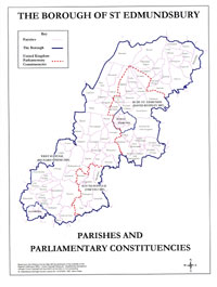
New Constituencies
|
|
blank |
For the General Election in May 1997, the constituencies in western Suffolk were reorganised. The area of St Edmundsbury became covered by three seats. Richard Spring, the sitting Conservative MP at Bury stood for, and won, the seat of West Suffolk. The reorganised Bury St Edmunds constituency was won for the Conservatives by Mr David Ruffley, and South Suffolk was won by Mr Tim yeo, also Conservative.
Nationally, the Labour Party won the General Election by a landslide in May and within four days the Chancellor of the Exchequer handed over his power to set the Base Rate to the Bank of England's new Monetary Policy Committee.
British Railways was privatised by the government, following a long process over several years. Various regional companies were set up, but the track itself was sold to a seperate body called RailTrack, who would sell its usage to the railway operators. Anglia Railways now runs the passenger services at Bury.
St Saviours Hospital ruins were opened to the public in June, a joint initiative of Tescos development, Suffolk Archaelogical Service and St Edmundsbury Council.
During 1997 the Bury Corn Market, still held in the Corn Exchange every Wednesday, dwindled to the extent that no merchants bothered to turn up any more.
|
|
St Edmundsbury Borough website
|
|
blank |
In July, St Edmundsbury Borough Council launched its first ever website at its Tourism Forum. Clearly it was aimed to promote tourism by including local places of interest, and lists of accomodation for visitors. At this time it was not seen as a tool for local people to use to access local services. However, it was given a local angle by including items of local history interest. These included the story of the USAF in Europe, and links between Suffolk and the USA. As this was designed in-house, the look and feel of the site was created by the Council's IT Services Manager at the time, Chris Woodhouse. The design was developed to include more information on council services, until it reached the version seen here, dated to 2002. The design would be changed by consultants in 2003.
St Edmundsbury had also already begun to provide its leading councillors with e-mail facilities using the text based ICL Officepower office automation product used throughout the council. At this point the council was ahead of many others in its use of IT, but the market was to become dominated by Microsoft's products, which would eventually leave the council's e-mail system isolated and more and more incompatible with other users.
In August the New Inn in Northgate Street closed. The New Inn was new in 1863, and it was opposed by the four other pubs in the vicinity. However, it was welcomed by the magistrates as it was built on a derelict site, considered to be an eyesore at the time.
The Intel Pentium MMX processor was launched in January. 56K modems became the norm. By June the Pentium II processor was launched and Windows 98 was released.
A surprise for pension funds arrived when in July the Tax Credit on Advance Corporation Tax was abolished for them. This move would become increasingly controversial in the years ahead as the financial position of most pension funds deteriorated.
|
|

Lakenheath Fen RSPB Reserve
|
|
blank |
The year 1997 was another year of drought, and the period from 1995 was described as the driest period for 200 years. By now scientists were becoming seriously worried by the idea of global warming and blamed it on the emission of greenhouse gasses, from burning fossil fuels, and the extensive use of certain industrial gasses.
By the end of 1997 the RSPB had made considerable progress with creating its new bird reserve at Lakenheath Fen. With funding from the national lottery the RSPB purchased a further 25 hectares at its eastern end, and 31 hectares to the west. The reserve was now 300 hectares in size, or over 700 acres, and work was continuing to turn the whole area back into a wetland habitat from its existing mainly arable land use. The reserve was already being colonised by 40 new plant species, large numbers of insects, including dragonflies, and large numbers of birds.
|
|
West Suffolk Athletics Arena
|
|
blank |
In September, the West Suffolk Athletics Arena was opened in Bury by Roger Black and Jane Sixsmith. The Sports Lottery Fund gave a grant of £880,000, which met most of the cost. The running track and jumping pits were located next to the Bury Sports and Leisure Centre, and shared its car parking facilities.
|
|
The Eriswell Excavation
|
|
blank |
In October it was announced that a significant archaeological excavation had taken place at Eriswell, on a site on the USAF air base of RAF Lakenheath. The main excitement was caused by the finding of an anglo saxon nobleman buried with his horse and harness. This was only the fifth such burial to have been found in East Anglia, and was dated at around 550AD. The site was discovered in 1997 under a baseball pitch scheduled for redevelopment as dormitories for the USAF base. Some 200 graves were located on the site, spanning a period of 150 years.
Over the next 5 years more graves would be discovered. Three cemeteries with 446 graves would be finally identified by 2002. This was a major find for East Anglia. Although there would be other horse burials found, this first one in 1997 aroused the most excitement.
|
|
Mount Road Cycle Path
|
|
blank |
On November 10th, 1997, a new cycle path was opened to link Moreton Hall estate with the Eastgate Street on the line of Mount Road. The cycle path was completely separate from the road which it accompanied. It was opened by Euro MP, David Thomas, accompanied by a civic party and a class of schoolchildren undertaking their cycle tests. St Johns Church and the Watertower can be easily seen from this high point above the town.
|
|

Chequer Square improvements
|
|
blank |
The civic party, having successfully opened the cycle path, moved on to another opening on the same morning. This time it was to the refurbished Chequer Square, where a further plaque was to be unveiled. The square had been repaved, and the monument slightly moved to improve circulation of cars in the area. New ironwork was also included for the road signs. The Mayor, Councillor Mike Ames, officially re-opened the Square.
In December the refurbished Haverhill Bus Station was opened with new shelters and layout.
Haverhill Provision Market was moved temporarily into the High Street to allow the Peas Market Square to be refurbished.
|
|
Brewery Brigade in the 1900s
|
|
blank |
December, 1997, also saw the demise of Greene King's private Fire Brigade. At the end it had only nine volunteers on duty, not enough to operate a safe system. Although it was financed by the brewer Greene King, the fire tenders were always available to support the Suffolk Fire Service when required. They had been called to between 60 and 120 incidents each year. The Greene King Fire Brigade had been established in 1888 to protect the brewery and its public houses. The fire station in Bridewell Lane had been opened in 1968.
|
|
Brafields closes in Northgate Street
|
|
blank |
Another old Bury institution closed on December 31st, 1997, when Brafield and Sons closed their family butchers in Northgate Street after 71 years trading. The firm was established in 1929, and had prided itself on slaughtering its own meat behind the shop, the yard being accessed from Cotton Lane. Supermarkets had taken many of their customers, but, more recently, the beef trade had been hit by the disease BSE, followed by the subsequent ban on the sale of beef on the bone. The livestock market at Campsea Ashe, by Wickham Market, had also recently closed because of falling trade and tighter regulation of slurry disposal at markets.
|
|
Peter Bishop's History
|
|
1998 |
During 1998, a book entitled "The Sacred and Profane History of Bury St Edmunds" was published by Peter Bishop. Histories of Bury seemed to be coming thick and fast. Modern printing techniques allowed a few colour plates to be included without making the price of the book prohibitive.
|
|
British Archaeological Association Transactions Vol XX
|
|
blank |
Of a much more specialised nature was another book published by the British Archaeological Association book entitled "Bury St Edmunds Medieval Art, Architecture, Archaeology and Economy", edited by Antonia Gransden. This was volume 20 of the Associations Transactions, and was based upon a series of lectures given at the Association's Annual Conference held in April 1994 at Culford School. The conference was inspired by Dr Antonia Gransden, author of several scholarly works on Bury St Edmunds Abbey. The book contains twenty separate papers on aspects of the Abbey and its land holdings and manuscripts, including a discussion upon the Norman town planning of Bury St Edmunds.
In January the Haverhill Friday Market was returned to the Market Square but traders staged a boycott on its first day. After that, things returned to normal.
Early in the year the Lord Chancellor's Department rejected appeals against the proposed closure of Magistrates' Courts in Haverhill, Newmarket and Stowmarket.
In January Lacy Scott started a Monday livestock market to replace the market they were forced to close at Wickham Market, in East Suffolk.
In June 1998, the Banbury Cattle Market closed after 800 years. In August, following a drop in cattle sales caused by the BSE crisis, and a disastrous fall in pig prices, Lacy Scott gave up the lease on Simpson's market area in Bury and the Council demolished it to provide 80 car park spaces in time for Christmas. A new Cattle Market Redevelopment Working Party was set up in April to discuss the whole future of this site again. In December, Lacy Scott and Knight announced the complete closure of the livestock market in Bury St Edmunds, and they gave up their lease of the Council's pig pens and lorry wash. Not only were economic factors in play, but throughout the year animal rights protestors had harried the operators and the council about the market. The so-called "Deadstock" market still remained open, but 370 car parking spaces now became available to the general public every Wednesday.
W H Smith closed their store in the Butter Market at Bury. They would take over Martins and move into their premises next to the Post Office.
|
|
Richard Green - greengrocer
|
|
blank |
The last town centre greengrocers shop was Richard Green's, at the top of Risbygate Street and St Andrews Street. The shop was purchased in 1936 as a greengrocer's by Harry Green. His son, Richard, eventually took it over in 1955. It finally closed in 1998, as it could no longer find enough in-town customers to continue. The big food supermarkets now provided most of peoples' food requirements, and all of their vegetable needs.
|
|
The Virtual Abbey Project
|
|
blank |
In July 1998 a virtual reality computer model of the Abbey at Bury was put on display in the Moyse's Hall museum with the support of Greene King. This model was far too large to be easily viewable on an ordinary personal computer of 1998, or to be transmitted at 56kbs over the acoustic modems used by internet users at the time. A much smaller model was developed by 1999 to be added to the council's website and it could be downloaded for viewing by users of the web site.
Compulsory Competitive Tendering of local government services rolled on as the Revenues section of the Borough Council set up a bidding team to lead the in-house tender.
|
|
Oswald Jarman at work
|
|
blank |
During 1998 the Spanton/Jarman collection of glass negatives was donated to the Bury St Edmunds Past and Present Society by Michael Jarman, to ensure their preservation. Talks had begun back in 1997, a few years after Oswald's death in 1993. The 4000 photographs pictured Bury St Edmunds from the mid 19th century to the Second World War. Michael's father, Oswald Jarman, had deposited this collection in the Suffolk Record Office at Bury St Edmunds in 1975 upon his retirement. It was thought that the Society was best placed to to preserve the collection as a unique source of local history and to make it widely available to the public. The Society would embark upon fund raising to conserve the collection, catalogue its contents, and would eventually proceed to digitise it for publication on-line. This work continues in 2016.
See the Society website at www.burypastandpresent.org.uk. for more details.
In June, a set of pay data was published which led base rates to be raised to 7.5%. This data became discredited and in October interest rates were reduced by one quarter per cent, a half per cent in November and another quarter in December to 6.25%. Fifteen F15 fighters left Lakenheath for Italy to support airstrikes against Serbia in an attempt to halt ethnic cleansing in Kosovo. Greene King ceased its bottling operations in Bury. Its maltings in Westgate Street were also to be shut down when Pauls Malt opened a new £27.7 million malting complex in Eastern Way overlooking the A14.
|
|
 Petrol pumps c1920s Petrol pumps c1920s
|
|
blank |
These petrol pumps in Ixworth High Street were given Grade II listed status in August, 1998. They stand outside the redundant Mulley's garage, and are thought to date to the 1920s. They were listed partly because the same Grade II status was already in place for the building to which they are attached. Jack Mulley, the owner, had died in July 1998, aged 80. He was well known for his fleet of coaches and lorries, trading as "Mulley's Motorways". The Chairman of the Ixworth Business Association, Graham Hemingway, is shown in the picture. He was hopeful that the yard could be brought back into business use.
By 1998 the fear of a "Millenium Bug" in computer systems across the world was being taken more and more seriously. The fear was that computers had been programmed to use only two digits to define the year in any date, and that 00 would cause errors to occur. It was also feared that the machines would fail to calculate that the year 2000 was a leap year, as in most centuries it was not.
In Haverhill bollards had to be erected at Queens Street to enforce the pedestrianisation, which motorists had been ignoring.
An important part of the information superhighway was completed when contractors laid a trunk cable from London to Haverhill, Bury, Diss, Lowestoft and across the Channel to the continent to create a giant loop. They passed through St Edmundsbury from September to December. The BBC also started transmission of digital television, taking space in the On Digital Terrestrial service, and on Sky.
In October the Borough had its first council houses declared listed buildings. These were numbers 1 to 8 Stow Road, Ixworth, built in 1893/94 under the Housing of the Working Classes Act of 1890. At the time it was felt they needed land to grow food, so each had about one-third of an acre in garden attached. The work was initiated by Thingoe Rural Sanitary Authority, soon to become a Rural District Council.
|
|
New 81 space car park
|
|
blank |
Constructing as many car parking spaces as possible was a priority for St Edmundsbury Borough Council at this time. After Simpson's Cattle auction mart closed and the site was cleared, it was converted into 81 new car parking spaces. The new car park was opened in December, 1998, just in time for the Christmas rush. The picture shows a vintage Rolls Royce brought in to celebrate the event. A second vintage car is just visible in the background.
During 1998 the Cathedral Appeal was launched to raise £10 million to complete the Cathedral extensions, and the Tower in particular. The Patron of the appeal was Prince Charles.
In Sicklesmere Road the old Shepherd and Dog pub was closed in March. It seems to have dated back to the early 19th century as a Drovers "first and last" pub as they entered and left the town in this direction. Like the Spread Eagle and the Tollgate it had land attached where animals driven to market could be rested while the drovers relaxed as well. The premises are now offices.
|
|
Old postcards by Mary Basham
|
|
1999 |
The year opened with some attempts to rescue the livestock market operations, but what trade remained was carried out on a local farm. In May, the Chelmsford Livestock Market ceased animal sales. The European Community beef ban was lifted in August, having been in force since March 1996. In its wake, only Colchester and Norwich were left with livestock markets operating to serve the whole of East Anglia.
With nostalgia and interest in the past increasing, Mary Basham published this book of old pictures and postcards from Bury St Edmunds. Mary Basham had long written a column in the Bury Free Press and its sister publications, and her descriptions of each picture flow with journalistic ease. Many of the details mentioned were gleaned from her contributors to her newspaper columns, and to her radio series on the former Saxon Radio.
Most of the European Community had entered into European Monetary Union on 1st January. Britain decided not to join until economic conditions were right, and following a referendum.
In April Grampian Country Foods closed its chicken processing factory in Cotton Lane in Bury, with the loss of 255 jobs.
|
|
 Historic Core Zone Entrance Historic Core Zone Entrance
|
|
blank |
A controversial part of the enhancement of the town centre historic core zone was finally completed when wrought iron pillars were erected in the highway at St Mary's Church in Bury. Their purpose was to signal to motorists that they were entering into a 20 mph zone, and as such, were called a "gateway feature". These gates had previously been designed following a public competition and selection process, but the winning design was rejected by the council. Even so, the compromise final structures became a hot election issue, along with the issue of whether to proceed or not with a Cinema at Parkway car park.
On May 6th, the Borough elections, held every four years, returned a Conservative majority. Haverhill continued to be strongly Labour.
|
|
Anglo-Saxon Centre
|
|
blank |
In July a new building was opened at West Stow on two levels. The lower level was given over to interpretation and display of archaeological finds related to the Anglo-Saxons. The upper level contained a bright new cafeteria and the site's shop. The project was now called the Anglo-Saxon Centre, and the Heritage Lottery Fund met most of the cost.
In July the English Schools Athletics Championships were held at the West Suffolk Athletics Arena, with 2,000 competitors from all over the country.
|
|
 Angel Hill streetscene 1999 Angel Hill streetscene 1999
|
|
blank |
At Bury St Edmunds the works to improve the Angel Hill were substantially completed, with a new walkway to the Abbey Gate and planters installed into York paving. Reproduction lighting columns were installed, copied from old Bury photos, and special lighting brackets and lamp bowls supplied by Urbis Lighting. These works have proved to be extremely popular, and gained immediate acceptance with the public. The work was designed and installed by St Edmundsbury's Highways staff, working as agents for Suffolk County Council. Their work was accepted as being of the highest quality, but by 2002, the County Council wanted to withdraw from the Agency Agreement.
|
|
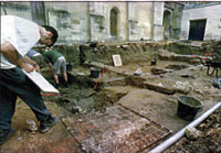 Cathedral excavations 1999 Cathedral excavations 1999
|
|
blank |
In August, Suffolk archaeologist David Gill announced that an 11th century building had been identified under the precinct of St James Cathedral in Bury St Edmunds. The site was being investigated prior to work being able to begin on the new millenium tower for the cathedral. This was a secular building in use before the medieval abbey was begun. Construction work on the tower was due to start in September, 1999. The evidence of the building was a metre below the surface and covered nine metres by seven metres in floorplan. This was an important building in the 11th century, in the most important part of town. It had a chalk floor, and a large hearth, and fronted a main road. This road had been previously identified in a dig in 1990, undertaken in advance of the refectory building.
In Haverhill the old Cangle School was re-opened under a new name in September 1999.
The Cangle Project was now called the Cangle Junction and offered supported housing, employment and training opportunities to young people aged 16 to 25 in housing need. The Junction included a cyber cafe with four internet computers offering free internet use to all. The project was run by English Churches Housing Group.
In September, St Edmundsbury Council acquired the old Cleales site behind the south side of Haverhill High Street to improve the infrastructure of the town. A bandstand was opened at Haverhill Town Park, also called the Recreation Ground.
Bus services were criticised in Haverhill, but there were hopes for a new railway study of a Cambridge-Haverhill-Sudbury link.
Interest rates were progressively reduced so that by June, they were at 5%. House prices responded by rising significantly in favoured areas, particularly London, while in some places in the North some streets were being left empty or houses sold at ridiculously low prices.
|
|
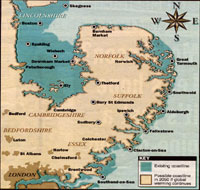 East Anglia 2050 East Anglia 2050
|
|
blank |
In October the Environment Agency launched a Floodline telephone service to raise awareness of the risks of flooding arising from Global Warming and resultant climate change. In 1998 there had been 21 deaths from flooding in parts of Britain, and £400 million of property damage.
The East Anglian Daily Times published this map in its October 19th issue, showing the possible effects of inundation by the sea by 2050 if warming continued. With 20% of East Anglia below sea level, Thetford and Cambridge would become seaside towns, while Great Yarmouth and Lowestoft could disappear.
Two judicial review hearings overturned the Borough Council decisions on granting planning permission for a brewery access road across the Butts, and the granting of planning permission for a multiplex cinema. Both planning applications were re-submitted. However in December a second judicial review was launched against the cinema application.
Greene King shut down its in-house malting operation in Westgate Street. By 2004 the site would be redeveloped as luxury dwellings.
The UN intervened in Bosnia and military units from our area were involved including Lakenheath and RAF Honington.
Sixteen new F15E's were delivered to RAF Lakenheath to replace some of the 48th Fighter Wings older versions. The total assigned numbers of 48 F15E's and 24 F15C's remain the same.
|
|
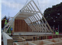
Marlows return to Timber Frames
|
|
blank |
With pressure for development increasing, the Government announced that 1.1 million new homes were needed in the south east by 2016. Haverhill could increase by five to six thousand people by 2016. By the end of 1999, Marlow's had completely withdrawn from the role of Builders' Merchants. All of their eleven branch network was sold off as merchanting was now producing a very low return on capital invested for the old family firm. At Hollow Road in Bury, the site retained its Garden Centre but the warehouses were now available to expand the timber fabrication side of the business. The 32 acre site had just had a major investment to make more trussed rafters, floor decks, and in particular to allow a return to the manufacture of timber-frame house systems, formerly abandoned in 1983.
The Intel Pentium III processor was launched.
In December the news came that the Borough had been declared a Beacon Council for Sustainable Development - Dealing with Waste, for its work on recycling domestic waste.
In December work began on the north transept of the St James Cathedral, following an archaeological excavation of the site.
|
|
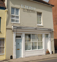 Berry's shop as a house Berry's shop as a house
|
|
blank |
Yet another small trader in the town centre closed down when Berry's the Bakers closed in Churchgate Street. Berry's had been there since 1906, but bread had probably been baked in the old Georgian ovens through the 19th century. The premises were converted into a private house, with the brick ovens preserved. Originally wood fired, they were converted to coal fired in the 20th century. On Christmas eve, Berry's closed down, after their final bake. The premises were converted into domestic accomodation.
Finches Bakery continued to operate in Westgate Street, but this old bakery (at least back to 1900) had been fully modernised into new bakery premises in 1961.
The Anglo Saxon Chronicle had recorded the death of a Bishop Alfhun at Sudbury in 798, and his subsequent burial at Dunwich. This mention of Sudbury places it as one of the oldest recorded towns in the country. To celebrate their 1,200 years of history, the town erected a statue of Alfhun on the Croft, by St Gregory's Church, in 1999. It was sculpted in 1998 by Alan Micklethwaite, a stone carver at Lincoln Cathedral.
During December the Old Cannon Brewery was opened in Cannon Street. This was in the premises of the St Edmunds Head pub, which had closed in 1994. It was now a pub and restaurant, with the added feature of a Micro-Brewery, located in view of customers, where their own beer could be brewed.
The Otter Trust was a registered charity and was founded by Philip and Jeanne Wayre in 1971. In 1975 they purchased River Farm at Earsham near Bungay and set up the Trust's headquarters. In 1983 the Otter Trust in co-operation with the Nature Conservancy Council (now called English Nature) began an otter reintroduction programme in order to save the otter from extinction in Eastern England and the Midlands. This programme was to prove highly successful and by 1999 the Trust had bred and released 117 otters. This programme saved the otter from extinction in lowland England, and by 1999 it was deemed such a success that the Otter Trust stopped its captive breeding programme and stopped the further release of otters into the wild.
As December 31st, 1999 became the year 2000 there were fireworks in Bury and a laser show in Haverhill.
|
|
2000
|
The year 2000 did not bring the widespread devastation that had been predicted from the Millenium Bug. This may have been due to the extensive preparations carried out nationwide, including at local councils. Only one PC at the Borough Council proved vulnerable and had to be replaced, the conversion that had been undertaken having apparently failed.
A basic personal computer at the start of the year 2000 consisted of a Pentium III processor running at 600MHz with 128 Megabytes of RAM, a fixed hard disc of 12 to 20 Gigabytes, DVD and CD-ROM drives and a built in modem, and a sound system with speakers, running Windows 98 second edition operating system. The price is typically £1,200 and the pace of change in personal computing and the spread of e-commerce on the internet and the uptake of the world-wide-web became extremely rapid and widespread in 1999 and 2000.
The internet was still being held back by the one aspect which did not advance for several years. This was the restricted speed of the telephone lines when using acoustic modems limited to 56kbs. No matter how much the desktop PC improved, the speed of access to websites remained the same.
Every month seemed to bring new announcements of faster machines. In February, Windows 2000 was launched and in March AMD announced that it now had 1000 MHz, or 1 Gigahertz, Athlon processors available. However, the US Justice Department declared, following a long trial, that Microsoft had abused its dominant market position to harm other software suppliers like Netscape. Such was the importance of the internet now judged to be by the government, that it announced that 100% of government transactions would be electronically available by 2005.
Along with this development was a demand to own shares in "High - Tech" companies who, it was thought, would make fortunes out of the demand for more and more computing power. Share prices rose, driven by what we now call the "technology bubble". The Dow Jones index had reached a peak of 11,723 by January 14th, 2000.
In Bury, a skateboard park was opened at Olding Road. The project had been initiated and largely designed by a committee of young people, and funded in partnership with the Council. A new Community Centre was opened at Moreton Hall financed by lottery funding together with Council money.
In March, 2000, the old established hardware store of Andrews and Plumptons closed its doors for the last time. It had been in Guildhall Street from 1862 until 1988, when it was decided to downsize to the shop in St Andrews Street, (South). This shop was now forced to close by continued competition from the DIY superstores on edge of town locations.
In Bury, work began on building a new tower for the Cathedral. St Edmundsbury were winners of the Nations in Bloom award for small towns, held in Japan.
|
|
 Bury's growth by 2000
|
|
blank |
The growth of homes predicted by the Government in 1999 was replaced by a new target of 43,000 homes a year in the south east for the next five years.
At Bury, the firm of Marlow and Co was contributing to this growth by investing over £1 million in a state of the art production facility for timber framed houses, with a capacity of 1,000 houses a year. Plans were laid to expand to 4,000 a year.
The old pig sheds on the ex-Livestock market site in Bury were demolished and replaced by 103 new car parking spaces. As if to seal the fate of the livestock market, the old Market Tavern, at the top of Risbygate Street, was turned into a wine bar called Number Three. The Market Tavern is traceable back to a document of 1674, and seems to have been called the Wagon until the 1920's.
Planning permission was granted to Greene King for the second time to build a short access road across the Butts to Cullum Road. The first permission was quashed by the High Court following a judicial review hearing. This development led to some excavation work prior to building the road.
Bury St Edmunds had produced no evidence of any occupation in the Roman period, until these excavations in 2000 found some remains off Cullum Road. A ditch was discovered after topsoil was removed which proved to be 1.2 metres deep and 2.5 metres wide which ran parallel to the River Linnet and 100 metres from it. It contained sherds of Roman era pottery from the late 3rd to the 4th century, including black burnished ware and Nene valley ware. Together with animal bones, it represented the first clear evidence of Roman settlement within the area of the town of Bury St Edmunds. (Excavation reference BSE 187.)
Meanwhile, Greene King continued to expand. In 2000 the firm acquired Morlands Brewery in Abingdon, also acquiring the rights to make Morlands well respected beer called "Old Speckled Hen". This brew would become a major feature in Greene King's portfolio of beers, selling well as a bottled beer, as well as from the barrel.
A further judicial review of the planning permission given to the Parkway site Multiplex cinema resulted in dismissal of the objections. However the process to obtain a new cinema for the town had by now been delayed by 18 months, and had already taken four years to date.
|
|
Last Boby building demolished |
|
blank |
Much of the old Robert Boby site had already been bulldozed to make way for new Waitrose and Halfords stores.
In May, 2000, the final demolition of the Boby's site began. This part of the factory was being removed to make way for an extension to the adjacent Waitrose store, and three new shops. Bennetts Electrical held one unit for several years, and was later joined by PC World. The existing Robert Boby Way would be realigned as part of this development.
After this the only remnant of Boby's works would be their main office on St Andrews Street which was the Careers Office and in 2015 remains as a public service building.
In May hot weather followed by heavy rain and thunderstorms caused flash floods in Sudbury and Haverhill as well as other parts of Suffolk. July was characterised by heavy rains and local flooding in Bury.
In July the population of the Borough of St Edmundsbury was officially estimated at 97,200.
|
|
History of St Edmunds Catholic School
|
|
blank |
In 2000, John E Saunders published a history of the St Edmund's Roman Catholic School from 1882 to 2000. Entitled "Taught to be Good" . He found that once the Catholic Church opened in Westgate Street in 1837 a free school had been held in the Crypt. Not until 1882 was a school built in the garden of the presbytery which could take 100 pupils, and although more than half were Catholics, other poor children were also admitted. It met the standards required by the 1870 Education Act and was thus elegible for increased government grant. By 1898 the school had grown to take in 250 pupils.
|
|
History of St Alban's School
|
|
blank |
In July, 2000, the St Alban's Roman Catholic Primary School in Beard Road, on the Howard Estate, was forced to close. Its numbers had dwindled down to only 25 by the end. It had opened in 1971 with a rollcall of around 70, to serve the west Suffolk area north of the railway line up as far as Thetford. However, many parents had continued to send their children to the established St Edmunds Catholic School. After closure the land and its buildings were leased to Suffolk County Council for use as a referral unit for approximately 30 pupils who had difficulty adapting to mainstream education.
John Saunders produced this history of the school entitled "Ahead of its Time" in 2018.
Several World War II Memorial Associations decided to lay up their standards as the numbers of fit veterans dwindled. The Bury branches of the Dunkirk Veterans Association and the Burma Star Association decided to disband after more than forty years. Some of the American Bomb Group Associations also made this their final re-union.
|
|
 America Week logo
|
|
blank |
However, in August, St Edmundsbury Borough Council held America week, culminating in the granting of the Honorary Freedom of the Borough to the Third Air Force of the United States of America. There is a special section dedicated to the events of America Week, to be found by clicking here.
The Local Government Act of 2000 would change the way in which all councils took decisions in future. The committee system had been in operation since the 19th century, but would be replaced by either a system of elected mayors or a system of Leader and Cabinet. Councils had to carry out this change by May 2002.
News was also received that objectors to the planning permission for the multiplex cinema at Parkway were refused leave to appeal. However, they soon scheduled another High Court hearing for November.
Also in August the pig industry in Suffolk was struck by an outbreak of classical swine fever. Exports of pig meat were banned.
September produced another national crisis when on the 7th a blockade of fuel depots was started by a coalition of hauliers and farmers groups, protesting against the escalating cost of road fuel. Fuel protests spread with popular support and shortages soon arose, resulting in considerable disruption to ordinary life within a surprisingly short time. Local authorities were asked to supply volunteers to man the few petrol stations where petrol would be made available to essential workers. When the government agreed to consider a reduction in fuel duty, the protests ended, but the vulnerability of the economy to such shocks had been quickly exposed by this action.
Heavy rains in October and November led to widespread flooding on a national scale. West Suffolk fortunately escaped the wide-scale disaster with only fairly local inconvenience.
Bloor homes submitted plans for a revised development of 163 houses at Tayfen Meadows, off Spring Lane. It also provided for 10 acres of open space. This development was accepted and work could now commence on land once occupied by the Greyhound Stadium, which closed in 1996.
The Human Rights Act came into force in October.
From 1982 to 2000 the rising, or Bull, stock market had been the longest such run in history. A slight fall back in December would lead to a long decline over the next two years.
In December, 100 jobs were announced as lost in the textile industry at Great Cornard when Guilford Europe decided to move production to its central plant in Derbyshire. Later these jobs would get reprieved.
|
|
Quick links on this page
Top of Page 1946
Mildenhall goes American 1950
London overspill official 1954
Fighters, bombers, rail cuts 1960
WSWB set up, Gas ends 1964
Flooding and Growth 1968
Pageant of St Edmund 1970
Boby's closes 1972
A45 Bury Bypass opens 1973
Local councils reorganised 1974
London overspill stalls 1979
Winter of Discontent 1980
Nowton Court purchased 1985
Western Way, the Hurricane, and Black Monday 1987
Poll Tax introduced 1990
Council Tax, Manor House 1993
Police Authorities set up 1995
Corn Market dies out 1997
Cattle Market closes 1998
Town Centre Gateways 1999
Millenium Bug? 2000
|
|
Twenty - First Century
Please click here to join us in writing the story of the twenty - first century in our local area
Prepared for the St Edmundsbury Local History project
by David Addy December 1998 to October 2012 Mapping by Chris Williams
Photography of Museum exhibits and pictures by Graham Portlock
Books consulted
"The Book of Bury St Edmunds"
by Margaret Statham.
"Yesterdays Town" by Margaret Statham
"The Sacred and Profane History of Bury St Edmunds" by Peter Bishop
" A History of Suffolk" by David Dymond and Peter Northeast
Borough of St Edmundsbury Official Guide
1976 edition.
"Bury St Edmunds - a photographic history" by Clive Paine
The River Lark Navigation, unpublished manuscript by D E Weston in West Suffolk Record Office c1980
The Lark Navigation by D E Weston, 1980
Lord Bristol's Amazing Steam Venture by D E Weston, 1981
Bury St Edmunds and the Urban Crisis, 1290 - 1539 by Robert S Gottfried, 1982
"Chevington" by Frank Cooper 1984
"Greene King, a Business and Family History", by Richard G Wilson, 1983
"Bury St Edmunds Past and Present" by Robert Halliday.
"Sutton Hoo through the rear view Mirror" by Robert Markham
'A Century of Service' by Suffolk County Council, 1989
"Women on the Land" by Carol Twinch, 1990
"Lost Railways of East Anglia" by Leslie Oppitz, 1999
"The Story of Bury St Edmunds Golf Club" by Michael Sibley and Roy Christie, 1999
"Old Inns and Beerhouses of Bury St Edmunds" by Gerry Nixon 1996 and 2002
"Wings over Westley" by Frank Whitnall, 2004
"Around Bury St Edmunds" by Robert Halliday 2004
"A Blight at the End of the Tunnel" by Derek Pole, (Brian Cross), 2007
www.subrit.org.uk/sb-sites
"The Mammals of Suffolk" by Simone Bullion, for the Suffolk Wildlife Trust and Suffolk Naturalist's Society, 2009
"www.burystedmundsadventistchurch.co.uk/missionhall.html" by Gloria J Abbot
"Lost Country Houses of Suffolk" by W M Roberts, 2010
"Ahead Of Its Time" by John E Saunders, 2018 -
The History of St Alban’s Voluntary Aided Primary School, Bury St Edmunds
"The Railway Goods Shed and
Warehouse in England " by John Minnis with Simon Hickman for Historic England 2016
Theatre Royal website: https://theatreroyal.org/about-us/timeline/
http://www.airfieldinformationexchange.org/community/showthread.php?1564-Shepherds-Grove/page12
"Website documenting Polish Displaced Persons" by Zosia Biegus Hartman
: http://www.polishresettlementcampsintheuk.co.uk/northwick01.htm
|
|


