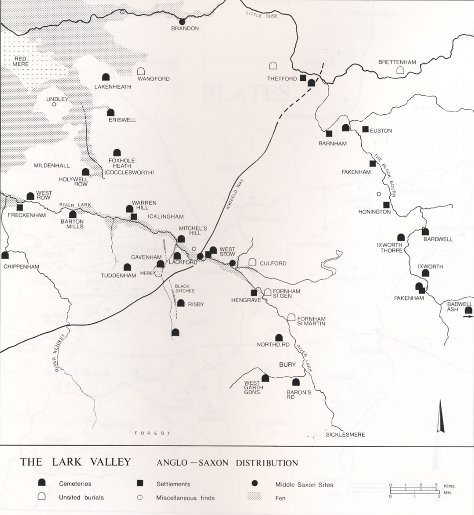
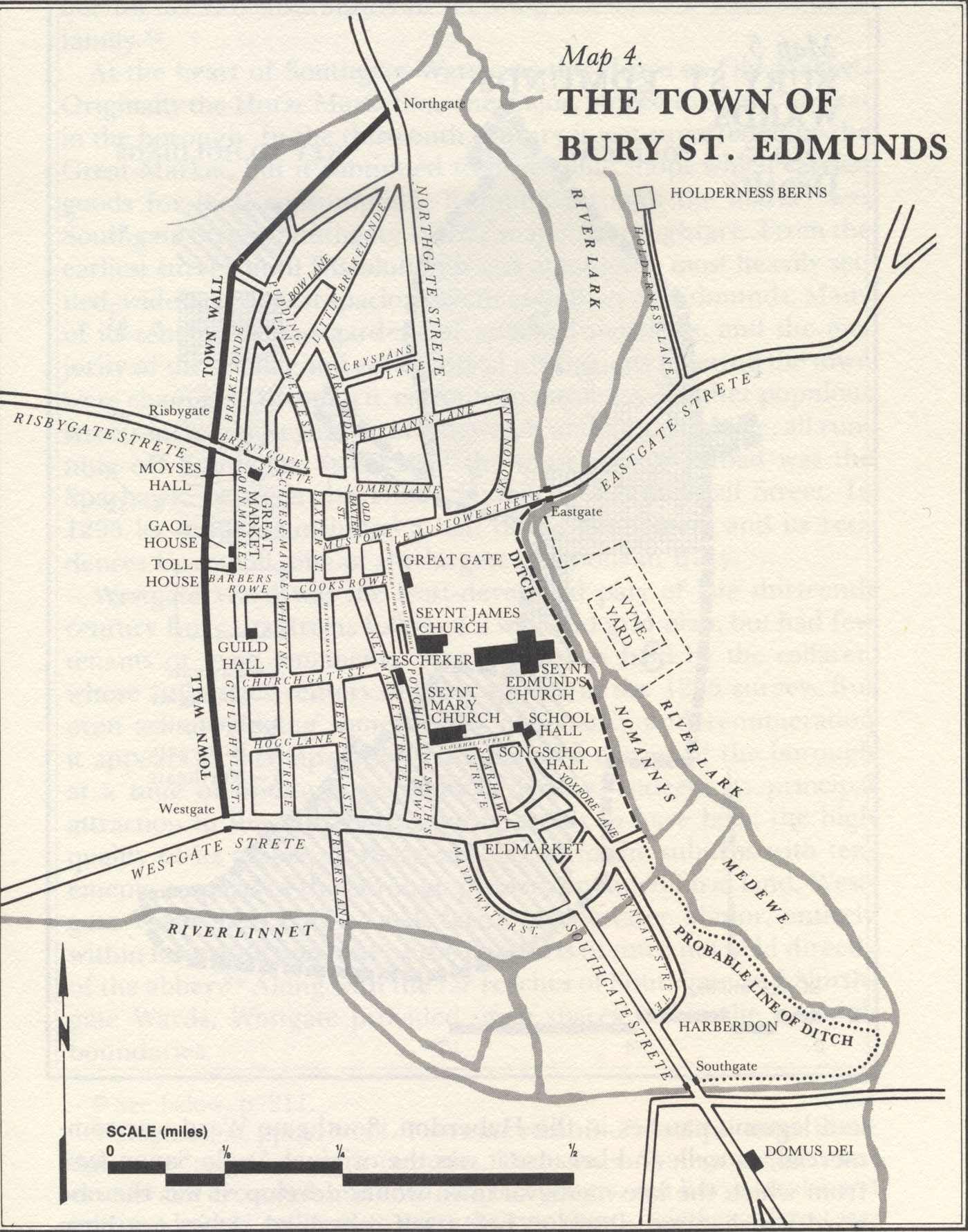
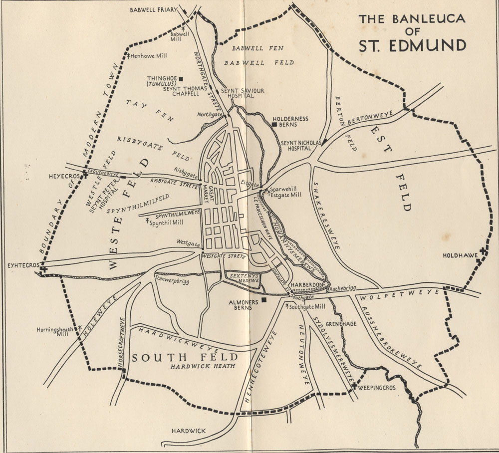
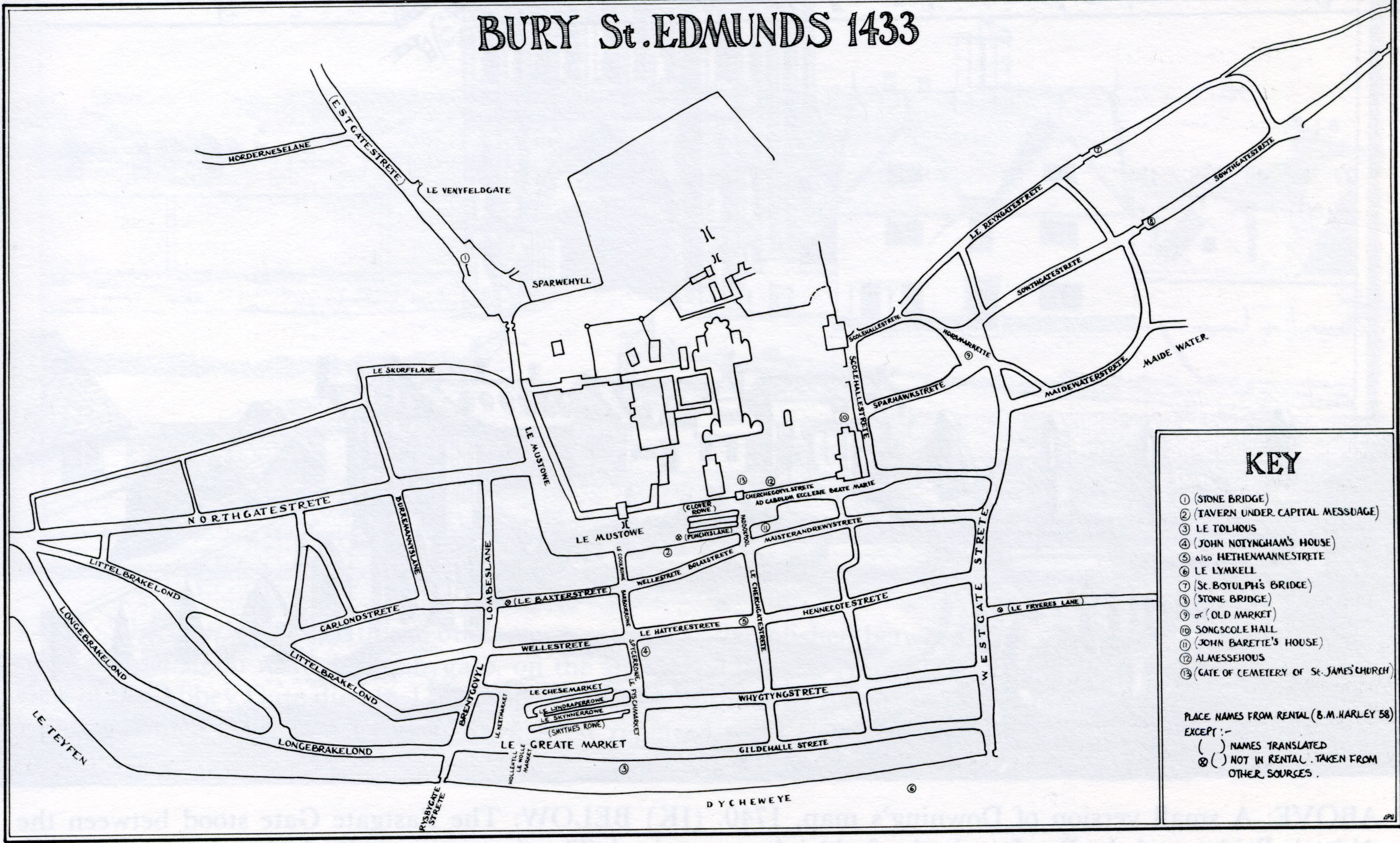
Written evidence Introduction Local activity before the Romans came The Roman period followed by the Anglo-Saxons and Danes up to 1066 The Normans after 1066 and up to the Tudor Reformation A Ph.D. Thesis on the Origins of Bury Abby Antrobus on the origins of Bury, volume 1 - text Abby Antrobus on the origins of Bury, volume 2 - illustrations Maps and Plans Surface geology- close up on Bury St Edmunds Anglo-Saxon settlements on Rivers Lark and Blackbourne by Stanley West (EAA24 vol 2) Cyril Hart's Perambulation of the Banleuca Boundaries The measured layout of Norman Bury St Edmunds by Eric Fernie Bury in 1066, 1086 and 1150 by Bernard Gauthiez Bury St Edmunds in 1295 by R Gottfried (1982) The Banleuca of St Edmund's by M D Lobel (1935) The Banleuca of St Edmund's by R S Gottfried (1982) Map of Bury in 1433 from M Statham's Book of BSE (1988)