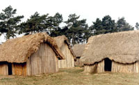
Village scene 1985
Quick links on this page
Anglian Glaciation 478,000 BC
Abandoned by Rome 410 AD
West Stow village in 440 AD
Sigeberht at Bury 635
End of West Stow? 720
Domesday West Stow 1086
John Croftes 1526
Basil Brown on site 1940
Stanley West excavations 1965
Reconstructions begin 1973
Site WSW 030 1979
Visitor Centre 1988
Anglo Saxon Centre 1999
New Centre Dig 2007
New Development Plan 2010
Organisational changes 2013
Foot of Page
|
The History of West Stow Manor,
West Stow Heath and
Anglo-Saxon Village Site
|
500,000 BP
|
Before the Ice Ages
Five hundred thousand years ago, before the time known to us as the Ice Ages, the British landscape was very different to what we see today. Britain was a peninsula of the continent of Europe and Asia. Many of the major rivers we know today either did not exist, or flowed along a different course, as did the River Thames. There were also rivers that have since disappeared.
One major, now extinct, river was 310km in length, which has been named the Bytham River. It drained from the southwest Midlands and the Pennines through Warwickshire and parts of Leicestershire before turning south through the centre of East Anglia and eventually eastwards into what is now the North Sea but was then dry land. Its gravels included red quartzite pebbles and they are visible at Mildenhall and Icklingham. The deposits laid down by the Bytham River are called the Ingham series, after the prototype description derived from layers exposed in the gravel workings at Ingham in Suffolk.
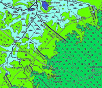
This river, which was already some 250,000 years old at least, is traced along its presumed course through West Suffolk on the attached diagram. The diagram relies upon connecting up known sites of deposits of the Ingham series of sands and gravels. However, it should be noted that most of the gravel extraction along the Lark Valley, including West Stow and Lackford pits, comes from much later glacial and post glacial deposits. The Ingham deposits are, in contrast, much rarer and deeper layers.
A large proportion of known human occupation sites, dating from before the Anglian Ice Age, have been shown to lie along the course of this river.
|
|
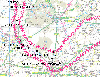
Bytham River in West Suffolk |
|
blank9999 |
The Bytham River was probably one of the most important routes of colonisation for Britain’s first human inhabitants. Professor Rose considered that its wide sand and gravel banks would have provided an easy route to travel along and the river would have provided water, vegetation and attracted animals making it a useful place for humans to exploit. So far 14 important archaeological sites have been discovered along the route of this lost river. These include High Lodge, West Dereham, Feltwell, Brick Kiln farm at Brandon, Hengrave, Lakenheath and Warren Hill in East Anglia, as well as Waverley Wood near Coventry in Warwickshire. This means that at this early time man knew the area around Bury St Edmunds and Lakenheath, when the landscape was very different to today. It would have been the largest river in Britain at the time although the second largest river, which was to become the River Thames, shows no similar indication of pre-Anglian human occupation.
These first colonisers of Britain, before 500,000 years ago, probably belonged to the ancient human species Homo heidelbergensis, an ancestor of the Neanderthals. The stone tools of this period are classified as Lower Palaeolithic, with the most characteristic tool type being the handaxe. Handaxes associated with this early colonisation of Britain have been found at sites along both the south coast route, such as Boxgrove, and along the Bytham River route, such as High Lodge and those already mentioned.
High Lodge itself is an important geological site just outside Mildenhall. Deposits indicate that it was in the lower middle part of the
Bytham river catchment (Ashton et al., 1992). High Lodge provides evidence for human occupance of this area dated to about 500,000 years ago, a time now linked to Marine Isotope Stage 13, or MIS 13.
Early man must therefore have been present in our area by this time, but the Ice Ages would probably have either swept away the bulk of any evidence, or muddled up the stratigraphy. This does not, however, mean that man has lived here ever since then. Britain and the British people of today are new arrivals, products of only the last 12,000 years.
|
|
The Anglian Glaciation |
|
478,000 BP
|
The Anglian Glaciation
According to the Shotton project of the University of Birmingham, the Anglian Glacial epoch began around 478,000 years ago, and probably lasted to about 424,000 BP. It is usually safe to attribute it to around 450,000 BP, or MIS 12, if you prefer the more recent nomenclature.
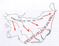
This glaciation arrived from the north-west and the ice sheet reached the coast south of Lowestoft and aligned itself roughly from there to Ipswich at its edge. The Anglian ice sheet thus covered all of Suffolk except perhaps for the very south east. It also covered the Midlands and reached south of Essex. Early man now retreated or he died out in our area. Suffolk was never again completely covered by ice in later ice ages. There followed a series of Ice advances, followed by warmer periods called Inter-Glacial phases. Although there is evidence of man returning to Britain during these periods, evidence at West Stow is missing until about 7000 years ago.
|
|
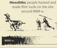
Mesolithic hunters
|
| 8000 BC |
The site on West Stow Heath has been occupied by a succession of peoples since the end of the last ice age. The site was used by mesolithic stone age hunter-gatherer groups six or seven thousand years ago, who left behind concentrations of flint tools and waste flakes in eleven concentrations on that hill.
Altogether, with a scatter of such artefacts, some 21,000 flint flakes and tools were recovered during excavations.
No evidence of domestic settlement was found, apart from the concentration of flint tools, which included many arrowheads. These mesolithic hunters seemed to have simply camped on the low hill at West Stow, and made their stone tools here, on the same site as the anglo-saxon village would be located several thousand years later.
|
|
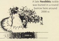
Neolithic round barrow
|
| c.2500 BC |
At the west end of the hill there had been a circular late Neolithic burial mound surrounded by a broad ditch. In the centre of the mound there was a large pit with traces of a crouched burial with a single stone bead. This mound acts as a focal point for later Neolithic cremations, buried in the ditch-fill and the southern edges of the mound area. The mound itself had been much damaged by later activity and has long since been eroded away.
These people were farming the light soils after clearing away the woodland which covered it. Their large stone tools could fell trees and cultivate soil. They were the first peoples to farm the soil instead of just hunting and gathering over the existing landscape.
|
|
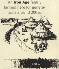
Iron Age farmstead
|
| From c.300 BC |
Centuries later the hill was occupied by an Iron Age settlement, consisting of a number of circular huts, storage or rubbish pits and ditched enclosures for stock and small field plots. Two larger ditch systems, which had been recut many times, crossed the site from East to West and may have been a modest defence, or some form of boundary. The settlement, which lasted from the 3rd Century BC to AD 60, probably represents the growth of a successful farmstead rather than a community. This settlement, or farm, is part of the widespread valley-bottom occupation of the Lark Valley at this time.
Iron Age technology allowed more woodland to be cleared for farming. Small farming settlements spread rapidly. We would refer to these people as part of the Iceni tribe. Their southern boundaries must have been more or less along the River Lark valley bottom. They may well have had a larger settlement just west of here, at Icklingham, as Icklingham would later develop into a small Romano-British town.
|
|
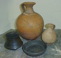 Roman flagons, dish
& carinated bowl |
| From 70 AD |
Local changes and a new Roman administration may have lead to the abandonment of the farm before the setting up of a Romano-British pottery industry about AD 70. At least ten pottery kilns have been found at West Stow, five of them in a tight group on the hill, together with two small rectangular buildings and eighty-four pits. Great quantities of waste pottery from these kilns were found which shows that the pottery industry continued for some seventy years.
|
|
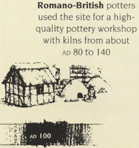
Romano British pottery industry
|
| 100 AD |
In the early years the Romano-British pottery kilns at West Stow produced a great variety of very fine wares, ranging from white flagons to black bowls, some decorated with distinctive stamps and inscribed lines. Some vessels were stamped with the maker's mark.
There is some evidence that the products were distributed well beyond the immediate area as some of the makers' stamps have been found at Colchester and as far away as Doncaster.
|
| 150 AD |
The site seems to have lain abandoned again from the mid 2nd Century until the coming of the Anglo-Saxon settlers in the 5th Century, used only perhaps for grazing. |
| 367 AD |
From about 367 to 370 AD, Picts and Scots raided Britain in the North while Saxons raided in the South and Theodosius had to come from Rome to restore order again. |
|
410 AD |
The Romano-British people were told to look after themselves without the aid of Roman soldiers as the army had been taken to Gaul in 406.
|
|
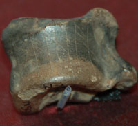
Runic gaming counter |
|
430
|
After a short time the number of Saxons allowed to settle increased and new areas were penetrated. Very early remains have been found at Caistor by Norwich, Luton and Abingdon. This roe deer foot bone was excavated at Caistor by Norwich, and was used as a gaming counter. The runic inscription indicates that it was of north german origin, showing evidence of the new language penetrating British life. The runes spell "raihan", meaning roe deer, and such cryptic inscriptions typify the earliest runes found in this country.
These were strategic defensive settlements, established to protect the British Cotswold heartlands, and Norfolk was particularly well settled by these Saxon merceneries. Because the north still had the army in place, there was less need for reinforcements to be sent there. Forces were placed to protect the North road, the Thames estuary and the major intersections of the Icknield Way. These inland posts were really a defence line of last resort.
One of these posts might have been at West Stow, sitting on the River Lark crossing of the Icknield Way.
Just two miles to the west there was an important, large and apparently undefended settlement at Icklingham which continued to be occupied until the very last years of Roman Britain.
In the east and south, Germanic forces were accepted nearly everywhere, with the exception of Verulamium, the capital of the Catevellauni.
In the absence of a Pictish or Irish attack, the Kentish Chronicle reported that Hengest and Vortigern invited Germanic reinforcements under Octha to bring 40 ships over to attack the Picts on their own territory. They plundered the Orkneys and then settled in North Northumberland.
|
|
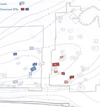
Two family groups at West Stow |
|
440
|
In his book "West Stow Revisited" (2001) Dr Stanley West modified his 1985 views of the chronology of buildings at West Stow. He now believed that from c440 AD to c480 AD there were these two family groups of buildings located at the site at West Stow. The buildings marked in blue were located around the hall which he referred to as H3. The dwellings marked in red were associated around hall reference H2. The dwellings marked in red on the plan are basically in the area where the reconstructed village was built in the years after 1973. The gap between the two groups has not been excavated because of the 19th century tree belt which now bisects the knoll on which the village stood.
Contour lines outline the knoll on which the village stood. The whole settlement would extend to about 5 acres over its two centuries of existence, and the knoll stood at up to 15 feet above the surrounding ground level.
|
|

Anglo Saxon Village |
|
blank |
By 440 we believe that the village at West Stow was now well under occupation by the early Anglo-Saxon settlers.
What was it like here when the Anglo-Saxons arrived? There was a 'managed' landscape with Romano-British field systems; grazing for sheep on higher ground, water meadows and arable land all rather run down, as the economy collapsed.
Useful timber for building was to hand, and there were deserted sites, like the Icklingham Roman town nearby, where all kinds of useful things could be found and recycled such as tiles for hearths, bronze, iron and even bits of pottery.
It is believed that many of the Romano-British population survived the collapse of Roman Britain and were absorbed into early Anglo-Saxon society, some at least, as slaves.
There were no forests of pine trees - these are all 19th-20th Century plantations.
From about 440 AD for the next 200 years into the 7th Century the landscape in our area was settled by the Anglo-Saxons, whose little villages controlled areas of land which were to become the 'parishes' of later saxon and medieval times.
West Stow, sitting in the centre of the Lark Valley, was one of a number of similar 'villages' extending from the three round the later Bury St Edmunds to Mildenhall on the fen edge. The Blackbourn valley to the north-east has a similar distribution of sites. They are spaced out along the river banks with territories extending behind. Beyond these settled valleys, central Suffolk, a region of heavy, damp clay was returning to dense scrub and forest after the collapse of Roman settlement. This area was not occupied by the earliest Anglo-Saxon settlers. To the east, settlement penetrated the lighter sandlings of the coastal region much as in the west. To the west and south the river systems of Cambridgeshire were densely settled by Anglo-Saxons and were clearly related by their possessions to those in Suffolk.
Connections were maintained with the continent and Scandinavia with the import of articles of dress and fashion as well as technologies and art.
|
|
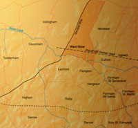
Parishes on River Lark |
|
450
|
The Lark, Blackbourne and Ouse valleys of West Suffolk had been settled by a mix of Angles, Saxons and Friesians by this time, including at West Stow. These early Saxon settlements in West Suffolk divided up the land in a way which is believed to be reflected in the much later ecclesiastical parishes. In many places they seemed to have adopted boundaries already in place from earlier times.
|
|
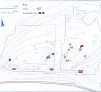
West Stow around 480 |
|
480
|
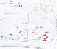
This plan by Stanley West is his view of the evolution of the village at West Stow as described in his book entitled "West Stow Revisited" of 2001. Hall group 3, marked in blue is dated to 450 to 500 AD, while the group marked in red, Halls 2 and 5A, are dated from 480 to 520 AD. These datings are very approximate based upon knowledge of the artefacts found within the buildings, and their lifespan based upon experience from the reconstructions.
|
|
West Stow around 550 |
|
550
|
This plan by Stanley West is also taken from "West Stow Revisited" of 2001. Hall group 4, marked in blue is dated to 500 to 550 AD, while the group marked in red, Hall 5B, are dated from 520 to 600 AD. Hall group 5B also covers the period known as the Illington/Lackford pottery phase, which is thought to be in the late 6th to early 7th centuries.
|
|
Defensive dykes on Icknield Way |
|
c.575
|
The Devil's Dyke at Newmarket, and the Fleam Dyke, a few miles further to its south west have long been believed by some historians to date from around this time to defend from attack from the west. Recent detailed work has confirmed that these earthworks date from the 5th to the 7th centuries. They are also aligned to face an attack from the south west. There are other earthworks within the area of the East Anglian kingdom, such as Black Ditches on Cavenham Heath and Risby in Suffolk, and the War Banks at Lawshall. These may have more obscure origins.
Only a great king of a prosperous nation could undertake such feats of engineering. Whether the young men of West Stow and the other Lark valley villages were involved in the construction of such defence works must at present remain in our imaginations.
|
|
Lackford Cremation Urn & potmarks
|
|
585
|
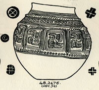
In 1947 T C Lethbridge excavated a pagan Saxon cemetery at Mill Heath, Lackford. The site is above the 50 foot contour on a peninsula of land between the south bank of the River Lark and the Cavenham Mill stream. He found between 400 and 500 cremation urns, a concentration which is unusual for the Lark Valley, where earth burials, or inhumations, are more prevalent. There were swastikas present upon a number of cremation urns, and the Anglo-Saxon cemetery at Lackford has yielded some of the most exquisite designs of this image.
Lethbridge called some of the pottery the Icklingham type, as he assumed that Anglo-Saxon potters had used the same local clay as had the Romano-British potters who had left kilns at Icklingham and on West Stow Heath. For some years the Icklingham potter has also been identified as the Illington/Lackford potter. He has been known to have working during the late-sixth century somewhere along the west Norfolk/west Suffolk borders. His output was cinerary urns of a number of standard types decorated in two or three routine styles. Decoration was stamped on to the vessels while they were still damp. One of these stamps has been found and it was made out of a red-deer antler and bore a cross die. Stamps frequently used by the potter, or potters, were a cross-in-circle, a St Andrew’s cross and a concentric circle with a blob centre. Decoration in the main was restricted to pots used as cinerary urns. Distribution of the products was roughly within a radius of some thirty miles centred on Lackford with one outlying example some eighteen miles further on at Castle Acre in Norfolk.
We do not know what the relationship was between the village at West Stow and the Lackford cremation cemetery, but there must have been close connections of some kind or other. Many more cemeteries have been found than settlements, simply because human remains and grave goods have been more easily identified than the soil marks remaining from decayed dwellings. Thus we know of cemeteries at Lackford and in Bury at Northumberland Avenue, Barons Road and Westgarth Gardens, but do not know where their settlements lay.
|
|
West Stow by 600 AD |
|
600
|
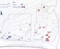
This plan is Stanley West's view of the village at West Stow in the years from 550 to 600 AD. Hall group 6 is marked in blue and Hall group 5B is in red. Also in red is the the early phase of Hall 7. (Hall group 5B also covers the period known as the Illington/Lackford pottery phase, which is thought to be in the late 6th to early 7th centuries.)
|
|
635
|
Around 635, Sigeberht had founded a monastery at Bedericsworth, today called Bury St Edmunds. Bede states that he built the monastery for his own use. It was one of the earliest schools of English literacy, but it was not the type of structure whose ruins we see today, but was probably made of wood. The site may have been very close to the later abbey site at Bury. Bede recorded that Sigeberht now retired to live in his monastery
|
|
West Stow by 650 AD |
| c.650 AD |
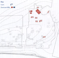
It used to be thought that the period of occupation on the West Stow site lasted for about 200 years from 450 to 650. This plan shows how Stanley West thought the village would have looked by 650 AD. The village had shifted its focus over its life away from the river to the north-east corner of the higher ground.
After this time, over a period of perhaps 25 years, the village was thought to have moved about a mile to the east perhaps around a new church. West Stow today is therefore centred on this new site. The original site was gradually deserted. There is evidence that other pagan Saxon settlements in Suffolk were abandoned at around this time, possibly to make a clean start on a new Christian site.
However, new research about a type of pottery called Ipswich ware, found at West Stow, now casts doubt on this dating. Please see the entry for 720 AD. Stanley West discussed this issue in "West Stow Revisited", (2001), but found several problems with it.
|
|
c.720 |
In his book "West Stow Revisited", Stanley West referred to Helen Geake's 1997 paper on "Grave Goods in Conversion period England, 600 to 850 AD", which
referred to research on the dating of Ipswich ware pottery which might put a new complexion on the dating of the settlement at West Stow. In 2008, further reference to a study by Paul Blinkhorn, suggested that Ipswich Ware was not produced before the end of the 7th century, with truly significant production and distribution not taking off until as late as the second quarter or middle of the 8th century. Until now it has been assumed
that production began in the second quarter or middle of the 7th century. ("Ipswich: Development and contexts of an urban precursor in the seventh century", by Christopher Scull of English Heritage.)
This research brings into question the date when the village at West Stow was finally abandoned. The presence of Ipswich ware on the site may now indicate that at least some inhabitants might still have lived at the site after say 720, and possibly up to 750. Hitherto it had been thought that the village was abandoned around 650 AD.
Stanley West considered some of this evidence in the light of the distribution of Ipswich ware quite widely over the eastern part of the site in particular. He found a conflict with the experimental evidence of the lifespan attributable to the buildings, and the issue remains unresolved.
|
|
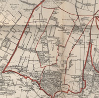
Blackbourne and West Stow C19
|
|
1086
|
The Domesday Book was produced in 1086. West Stow was called Stowa, and the entry for Stowa is under the heading of "Lands belonging to St Edmund", landowner number 14, section 71. It does not seem to have been a manor in its own right at this time. The entry reads as follows:
SUF 14,71
In [West] STOW 21 free men with 2 carucates of land. Always 6
ploughs between them all.
Meadow, 2 acres.
These [free men] belong to St [Edmund's] with full jurisdiction
and every customary due; they do service in Lackford.
Value always 20s.
In the same [West Stow] 1 free man with 1/2 carucate of land. Always
1 plough.
Value always 4s.
A church with 12 acres of free land in alms. It lies in another
Hundred.
It has 9 furlongs in length and 7 in width; 17d in tax.
It is noteworthy that the men of West Stow owed a duty to the lord at Lackford, and that their church was "in another Hundred". It is unclear whether this means that the village did not have its own church at this time, or whether it means that the boundary of Thingoe Hundred penetrated across the River Lark to encompass West Stow church at this date. Neither idea is particularly convincing.
Alternatively, this may be something to do with the mystery Hundred of Bradmere, which had "disappeared" by the 12th century. By about 1100, it seems that the Hundreds of Blackbourne and Bradmere were combined, to make the double-hundred of Blackbourne with Bradmere Hundred. This was possibly because their boundaries had become hopelessly intertwined. West Stow seems to have been in Bradmere, so possibly its church had been assigned to Blackbourne in 1086, and thus "in another hundred".
|
| c.1200 |
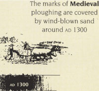
In Early Medieval times, the site was ploughed by the techniques which produced 'ridge and furrow' formations which can still be seen under grass elsewhere in England.
|
|
Sand covers West Stow
|
| c.1280 |
In the later 13th Century the site was covered by blown sand, a phenomenon which was to continue to plague the Breckland sand areas into the 20th Century. The worked out and exhausted farmland now became poor heathland. The site lay undisturbed for nearly 500 years, grazed over only by sheep.
|
| 1526 |
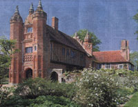
As part of its money raising exercise at this time, the manor of West Stow was leased to Sir John Croftes, by the Abbey of Bury St Edmunds. Sir John was a substantial flockmaster, or sheep farmer, who would eventually purchase these lands from the Crown in 1540, after the Dissolution of Bury Abbey. The building of West Stow Hall possibly pre-dates Sir John's acquisition of it and therefore might in fact have been built by the then owner of the manor, the Abbot of Bury. The ornamental gatehouse is thought to have been added around 1530, and therefore this addition would have been built by Croftes. Sir John Croftes other distinction was that he was 'Master of the Horse to Mary Tudor', Dowager Queen of France and Duchess of Suffolk.
|
|
West Stow Gatehouse
|
| 1540 |
After the Dissolution of the Abbey at Bury St Edmunds the manor of West Stow was bought from the crown by Sir John Croftes of that parish. Sir John was a substantial sheep farmer (or flockmaster as he was termed) who had leased the manor and lands in West Stow from the Abbot of Bury St Edmunds in 1526. He had made improvements to the old manor house, including the addition of the magnificant gatehouse in 1530, which still stands today. He must have been pleased to to be able to purchase the freehold of the manor house and lands for £497.
|
| 1652 |
The Denver Sluice was constructed at the head of the River Great Ouse. This construction isolated the Great Ouse and its tributaries from the tidal effects of the sea, and is thought to have contributed to the silting up of the Little Ouse and the River Lark. This, in turn, would lead to the need to improve the waterways for navigation after the needs of drainage had been catered for.
|
|
1682
|
The River Lark was by now silted up and unsuitable for navigation by barge.
|
|
1700
|
Henry Ashley, his heirs and successors, were empowered to make the River Lark navigable from Long Common, which was just below Mildenhall Mill, to Eastgate Bridge in Bury St Edmunds. At this time the river was still navigable from Kings Lynn up to Long Common in Mildenhall.
It took until 1715 for the works to be completed.
The River Lark had clearly acquired its name by this time, but was alternatively known as the Burn, or the Bourne. There is a theory that the River Lark was named after Lackford, as the village name implied that it was a ford for the Lack or Lark in earlier times.
Canal technology at this date did not include the use of "pound locks", as we know them today. Instead they used staunches and sluices. A staunche, or stanche, was like a single lock gate, controlling the level in a stretch of river. Staunches controlled a weir which was made into a slope so that boats could pass from one level to another. Boats either had to navigate with, or against, the rush of water or to wait for the whole of pounds on either side of the weir to become equal. This system is also called a Navigation Weir or Flash Lock. A sluice is a confined water channel that is controlled at its head and foot by gates, and to all intents and purposes appears to have been very similar to a modern lock.
|
| 1716 |
The Lark navigation was finally opened from Mildenhall to Bury St Edmunds under an Act of Parliament passed in 1700. The canal seems to have been profitable immediately, largely for bringing in coal. Between 1716 and 1855 the River Lark would be a busy waterway linking Bury St Edmunds with Ely, Cambridge and Kings Lynn.
|
| 1735 |
Goods were not just delivered to Bury St Edmunds, but were dropped off at villages along the river as required. The miller at Icklingham was being paid 40/- a year in 1735 to look after the Temple Staunch, and £5 a year for collecting the tolls payable on deliveries to Icklingham.
|
| 1795 |
In 1795 the Marquis of Cornwallis finally managed to add West Stow parish to his Culford Estate. He exchanged it with Robert Rushbrooke for part of Little Saxham. At West Stow he added 3,047 acres to his estates, and timber valued at £2,800. West Stow made him an annual income of £700. He would purchase the adjacent parish of Wordwell in 1799.
In 1795 an Act of Parliament was passed for improving drainage of the Middle and South Levels of the Fens, and for improving the navigation of several rivers. One of these rivers was the River Lark, and a new set of tolls was laid down to pay for improvements.
|
|
1797
|
Despite the passing of the Improvement Act in 1795, the state of the Lark Navigation was still causing concern among the local coal merchants. The Navigation was owned by the Palmer family, and had been allowed to fall into disrepair. Ashley Palmer had died in 1792, leaving his widow Susanna to manage the waterway on her own. By now she was 61 years old. This decay in the river was hindering the deliveries of bulky goods like coal, which could not economically be brought in by road.
|
|
1802
|
In November 1802 the poor state of the Lark Navigation, combined with a drought, left the coal yards of Bury St Edmunds empty. There was not enough water to float the barges. Susanna Cullum, the proprietor of the river, was perhaps too old to carry out the necessary improvements.
Records tell us that in 1802, goods were being landed at the villages of Icklingham, Lackford, Flempton, and Chimney Mills, as well as at the Fornham Wharf. Coal was not delivered to most villages as it was too expensive. Coal was landed at Icklingham, probably for the mill, but other villages had turves delivered instead. Nowadays we would call these peat blocks, as peat was a cheaper fuel than coal.
|
|
1807
|
Mrs Susanna Palmer, proprietor of the Lark Navigation, was 70 years old in 1806. By 1807 it seems that her nephew, Sir Thomas Gery Cullum of Hardwick House, was managing her affairs on her behalf. These included the River Lark, and part of the Great Ouse, and he was to become an enthusiastic improver of the Navigation. Provisions of the 1795 Act included several for improving the River Lark, and Cullum seems to have felt that it was now up to him to carry them out.
|
|
1815
|
In 1815 Sir Thomas Gery Cullum was carrying out improvements to the river at Mildenhall. The Mildenhall sluice was being built at this time, but like many of Cullum's works, it is unclear whether these are rebuilds of older installations, or completely new constructions. He would continue to repair and rebuild features along the river until his death in 1831.
His son, the Reverend Thomas Gery Cullum, then carried on this work into the 1840s and early 1850s. Because both men had the same name, and both were titled by way of the baronetcy, it can be difficult to sort out which man undertook which works. Sir Thomas the elder became 7th baronet in 1785, and died in 1831. The Reverend Thomas became the Reverend Sir Thomas in 1831, and the title became extinct upon his death in 1855.
In 1815 there were floods along the River Lark, and some landowners saw their meadows under water. This was blamed on the River Lark, and so Sir Thomas Cullum sent Mr Bevan to survey the situation. He concluded that in most cases the flooding was no worse than it had been in times past. However, he identified three locations where the river level was normally high enough to prevent meadows draining properly into the river. He proposed that for these three spots it would be possible to build tunnels beneath the bed of the river to carry this water away. Ditches would then take the water away to below the next lock or staunch, where it would drain naturally into the river. Such works can still be seen today at Fornham All Saints, Ducksluice and at West Stow. At West Stow, the Culford Stream is still carried under the river to join it downstream at Fullers Mill.
|
|
1821
|
In 1793 the Eau Brink Bill went before Parliament. Susanna Palmer had objected to the Bill, and managed to stave off the project for twenty years. In 1821 the Eau Brink Cut was finally made, which entailed digging a deep channel on the Great Ouse near Kings Lynn. This caused Great Ouse tributaries like the Lark to drain more quickly, thus losing water, and hindering navigation.
|
| 1823 |
In August, 1823, Charles, the second Marquis of Cornwallis, died and the Culford Estate and its five villages, which included West Stow, were put up for sale. The estate failed to meet its reserve and not until August 1824 was it sold to Richard Benyon de Beauvoir of Reading.
|
| 1824 |
The estate at Culford, together with the villages of Culford, West Stow, Timworth, Ingham, and Wordwell, several advowsons (church livings), and a brick kiln, were finally sold for £195,000 to Richard Benyon de Beauvoir of Reading. The estate was said to be one of the finest shooting domains in the county, "offering an excellent investment for a Capitalist rarely to be met with , the present Rent Roll exceeding £7,000 per annum." Despite this, the estate had failed to meet its reserve at auction in 1823, and was finally sold privately to Benyon a year after the death of the Marquis of Cornwallis. Richard Benyon spent very little time at Culford right up until his death in 1852.
|
|
1829
|
Susanna Palmer, the proprietor of the River Lark Navigation, died in 1829, aged 93. The Lark navigation now passed into the hands of Sir Thomas Gery Cullum. In practice he seems to have been managing it on her behalf for some years past.
|
| 1836 |
The first one-inch ordnance survey maps were published. One map shows that the area west of the village was known as Leech Moor before it was called West Stow Heath.
|
| 1839 |
During the 1830's the Great Bustard became extinct in the Breckland, partly as a result of shooting, as well as the agricultural improvements made since 1812. The Pine belts had become established by now, and much of the hitherto great open landscape now appeared more enclosed.
Some of these great "improvements" had taken place on the Culford Estate which, since 1824, had been owned by the wealthy Richard Benyon de Beauvoir, who had diverted roads, planted trees, and tried to make the estate efficient and well ordered. By emparking the area around Culford Hall itself he imposed a new order on the landscape. West Stow was an adjacent part of this estate.
Richard Benyon rarely visited Culford and in 1839 he granted a life tenancy of Culford hall to his nephew the Reverend Edward Richard Benyon. Edward might have been the joint owner of the Benyon fortune, but for the fact that he was born out of wedlock. Edward enthusiastically took over the management of the Culford Estate. Until his death in 1883 he would build four schools, restore the five parish churches and build a new church at Culford Heath, three new rectories, two almshouses, a public house at Ingham and many new cottages on the estate.
However, Edward Benyon was a man of strict principles and he would run the estate under his own strict rules. The thousand people living on the Culford estate came under his social and moral control. Tenants in arrears when he took over were soon evicted. Any tenant convicted of an offence like poaching, for example, could expect to suffer under the law, and then find that he lost his job, was evicted from his cottage, and other tenants were forbidden to help the dispossessed family in any way. The human weaknesses and sufferings of the poor received no sympathy from the new master at Culford.
Numbers 1 to 3, Wideham Cottages were built between April and September, 1839, and the Reverend Edward Benyon arrived on the estate during their construction. These cottages are now associated with staff at West Stow Country Park, but in 1839, they were built to house workers on the Culford Estate. They were built of white bricks from the Culford estate's own claypits and brick kilns. The first three families in the cottages were all agricultural labourers moved from estate homes on the Icklingham Road, which were then demolished. At first they were known as Heath Cottages.
|
| 1842 |
Some of Sir Thomas Cullum's major improvements to the River Lark were finished in 1842. The Cherry Ground lock was built by Sir Thomas, and once had a plaque stating "TGC 1842". This lock is now within the West Stow Country Park, and has been fenced off because the brickwork is crumbling away. It currently bears an Anglian Water sign calling it Cherry Tree Lock.
The Cherry Ground lock was a key part of the improvements to the river. It was built on a bend where the lock was fashioned into a crescent shape, much longer and wider than the usual locks on the Lark. It could hold 8 gangs of lighters at one time if necessary, lined up side by side. Such a lock justified a full time resident lock keeper.
So Sir Thomas Cullum also built River House nearby for the use of the lock keeper, or lengthsman, as he was also known. This was completely demolished in 1979 as part of the preparations for the opening of the West Stow Country Park to the public. The house had stood in ruins for years, and was unsafe. According to D E Weston, this house also bore the Cullum plaque, "TGC 1842".
|
|
1844
|
By 1844 the River Lark navigation was thriving. White's Directory of Suffolk for 1844 recorded that barges went on a daily basis from Mildenhall Bridge to Bury St Edmunds and Kings Lynn. White's recorded that there was much greater traffic to and from Lynn than previously. Tolls had been cut from 7/- and 8/- a ton to 4/6 and 5/- a ton by Sir Thomas Gery Cullum, who was also responsible for major improvements along the river.
|
|
1845
|
Records show that some 10,000 tons of goods and coals were sent from Kings Lynn to Bury St Edmunds by barge in 1845.
|
| 1846 |
Through 1846 the River Lark navigation enjoyed its last 12 months of prosperity until disaster arrived for it at Bury St Edmunds in the shape of the railway. Navigation company records show that some 10,000 tons of goods and coals were sent from Kings Lynn to Bury St Edmunds by barge in 1845. In December, 1846 the long hoped for railway line arrived at Bury St Edmunds from Ipswich. By 1852 the trade on the River Lark would have dwindled to almost nothing.
|
| 1847 |
In 1847 men 'raising gravel for ballast' found skeletons and numerous cremation urns. It is unclear which site this refers to. It could be that it referred to the cemetery located behind Wideham Cottages. The ballast is probably meant to mean material for road building, not ballast for barge traffic.
|
| 1848 |
A railway link was established from Cambridge to Newmarket, but there was as yet no link to Bury from this direction.
Since 1831 the Reverend Sir Thomas Gery Cullum had been proprietor of the Lark Navigation Company, inheriting it from his father, also called Sir Thomas Gery Cullum. Both Sir Thomas the elder and Sir Thomas the younger had invested large sums of money and enthusiasm into the River Lark.
In this year the Ipswich and Suffolk Railway company agreed to pay the Reverend Sir Thomas Cullum £500 a year to let the Lark Navigation decay for ten years. The agreement started on 1st January 1849, and despite the protests of the Bury Corporation, the deal was done. The corporation's legal advice was that this was contrary to the original Navigation Act.
|
|
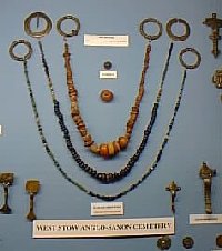 Collection of grave goods
 |
| | 1849 |
Between 1849 and 1852 a number of local 'antiquarians', as they were then called, made collections of Anglo-Saxon objects from this cemetery. About 100 graves were identified and dug. Parts of these collections, made by John Gwilt of Icklingham, the Reverend Banks of Dillingham, Cambs and the Reverend Benyon of Culford, have survived and are to be found in the Anglo-Saxon Centre at West Stow, the British Museum (London), the Ashmolean (Oxford), the Museum of Archaeology (Cambridge), Thetford Museum and until recently, in Moyses Hall (Bury St Edmunds). The Moyse's Hall collection is now housed at the West Stow Visitor Centre.
These diggers tended to discard material which would be invaluable today, but the spoils included a stone coffin, one sword and numerous cremation urns. The coffin was assumed to have been plundered from the Roman site at Icklingham, and re-used by an Anglo-Saxon.
|
| 1851 |
On the Culford estate The Reverend Edward Benyon had designed and built many new cottages for his workforce, including Wideham Cottages at West Stow Heath. However, Benyon expected all his tenants and workers to adhere to his own strict rules. In January 1851 the Bury and Norwich Post carried a letter from a Mr William Devereaux, who had been evicted from his home at Wideham Cottages in West Stow. Devereaux claimed that he had been convicted of poaching on perjured evidence. He received a five shilling fine, with 19s 6d costs, and £1 1s 8d in surcharges. However, Benyon also had him evicted from his home, and he was now living with a wife and eight children in a shelter of wood and sods on Icklingham Heath. "No one around dare take me into shelter me, nor no one to let me have a house." Upon being ordered by Benyon to dismantle his makeshift home on the heath, Devereaux was eventually housed by the Reverend Daniel Gwilt of Icklingham. John Vale, a witness in Devereaux's defence, was also evicted from the estate.
|
| 1853 |
The Proceedings of the Suffolk Institute of Archaeology published details of finds made in a cemetery or cemeteries on West Stow Heath. Unfortunately the exact locations of these finds was not recorded. Therefore our knowledge today is somewhat restricted to the artefacts themselves, without the vital contexts in which they were found.
|
| 1854 |
The Lark navigation suffered another blow when the existing railway link from Cambridge to Newmarket was extended to Bury St Edmunds. Bury was already linked by rail to Ipswich and beyond. The railways also destroyed the mail and stage coach networks in the country. Coaching inns lost the business generated by passenger stops, and also the money they made from providing fresh horses to the coaches.
|
|
1856
|
Following the death of Sir Thomas Gery Cullum in 1855, his widow, Lady Ann Cullum, was now ready and willing to sell the Lark Navigation to the Borough Council of Bury St Edmunds for £8,000. The Council failed to raise the money for this. By this date the river was only used for trade up as far as Lackford.
|
|
1859
|
Following the agreement made 10 years earlier with the railways, the Lark Navigation was now in a badly decayed state. The agreement now expired in 1859. This meant that any new operator could reduce tolls to compete with the railways, but would need to spend money to repair the dilapidations of the last decade.
|
|
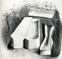
Four Roman burials
|
| 1871 |
In December 1871, a labourer discovered a stone coffin in Hunt's Field at Icklingham. Henry Prigg, a local antiquarian, was called in and pronounced it part of a Roman period cemetery. He soon excavated four graves, and finding well worn coins of Probus c282, and Crispus, assigned the burials to the early 4th century. He ended up with two stone coffins, one lead coffin, and one burial without a coffin, but covered by a pavement of large Roman tiles. Prigg noted that the stone coffins were similar to a coffin already found at West Stow Heath.
|
|
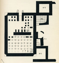
Prigg's Roman House
|
|
1877
|
Early in 1877, Henry Prigg announced that he had discovered a Roman Villa in the field called "Horselands" in Icklingham All Saints. In April he began an excavation, and exposed four rooms of the villa. Further digging was stopped by the field being sown with barley. The main room had a hypocaust for underfloor heating, with the furnace visible at the top of the diagram. Prigg estimated from coin finds that the house was dismantled in the latter half of the 5th century.
In July, a workman ploughed up a hoarde of silver Roman coins in a nearby field in Icklingham. Prigg dated these to late 4th century, and in his "Icklingham Papers" he suggested that the hoarde was deposited around 408 AD, when Saxon incursions may have made this necessary.
|
|
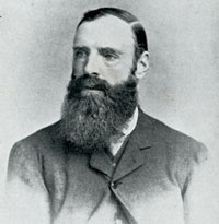
Henry Prigg
|
| 1878 |
From 1878 to the 1890s, Henry Prigg of Icklingham was excavating Roman pottery kilns on the West Stow Heath and found 'Anglo-Saxon urns etc' on the site of the then unsuspected Anglo-Saxon village. He published his paper "West Stow Pottery Kilns" in the proceedings of the Suffolk Institute of Archaeology.
|
| 1882 |
The Mildenhall Almanack for 1882 reported that:
"The River Lark as a water highway, at least the upper portion of it is practically closed. Within a few years the traffic extended to Fornham, now, above Mildenhall, a barge is never seen. The whole course of the river is choked with weeds, on which, during floods, heavy deposits of soil have accumulated, which renders navigation impossible..."
|
| 1883 |
In 1883 the resident landlord of the Culford Estate, the Reverend Edward R Benyon, died. The estate included West Stow, and now passed to a nephew called Richard Benyon Berens. By 1889 he would sell it.
|
|
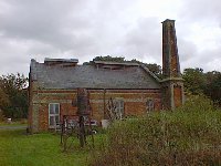 The Pump House
 |
| 1886 |
Some 112 acres were purchased from the Culford estate by the Borough Council for a new sewage farm to be constructed on the east side of the site to serve the town of Bury St Edmunds. Building took place from 1885 to 1887. This would replace the works built in 1863 at Bell Meadow in Bury. Like most sewerage schemes, it relied on gravity to provide the flow, and so the pipes were laid, as far as possible, along the river valleys. A pumping station was built by the River Lark at West Stow, at the end of the line, to pump effluent up into the site from a tank at the end of the pipeline. This is the only building now remaining from this work. The expression sewage 'farm' came about because 20 acres of the site were to be used to grow crops such as tomatoes and black currents to be irrigated from the outfall.
The pump was driven by a steam engine, and apparently the coal needed to fire the boiler was intended to be delivered by barge up the River Lark. Whether this was ever possible at this time is unclear, but it soon became possible with the new improvements which would take place on the river within a few years.
Several improvements and changes were needed to the new sewage works within a decade to improve its operation.
|
| 1889 |
The great estate at Culford, which included the village of West Stow, but not the area around the sewage works site, was sold by Richard Benyon Berens to the Fifth Earl of Cadogan. The Cadogans would own the estate until 1934. George was the 5th Earl of Cadogan of Chelsea House, Cadogan Place, in London. His property included the 200 acres of the Chelsea estate in London. Since the 1870s, George had redeveloped Chelsea into a fashionable collection of streets and squares, making a vast fortune in the process. He could now spend £250,000 on acquiring and improving the Culford Estate.
In June 1889, Mr F Woodbridge sold the Lark Navigation to the Marquis of Bristol and the Mayor of Bury St Edmunds for just £26.5.0.. They were acting on behalf of the new company which was in the process of being formed, to be called "The Eastern Counties Navigation and Transport Company Limited", or the "ECN & TCL", as their new lighters would soon be blazoned.
Things moved swiftly and improvements to the river Lark at Mildenhall began straight away in August 1889, as did the construction of the new wharf at St Saviours, in Bury St Edmunds. The dredging and canalisation of the river from Fornham Wharf to St Saviours had already begun in July 1889.
|
| 1890 |
At Icklingham the Temple Bridge was awaiting reconstruction. Because the intention was to use steam tugs to replace the horse for towing lighters, some bridges needed to be raised to allow clearance for the funnels of the tugs. Lackford Bridge was already being heightened.
The Cherryground Lock, which had been built by The Reverend T G Cullum in 1842, could hold 8 whole gangs of barges at one time. Repairs had been carried out. Locks at Fullers Mill, Flempton and Chimney Mills had all been repaired. They were still awaiting new lock-gates.
|
|
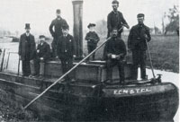
Directors welcome first gang of barges |
|
1892
|
In January 1892 the contractors for the Lark Navigation improvement works were forced to resume work on the River Lark, following the decision of the Court of Appeal. They had ended their contract without making the Lark navigable again. It took another 10 months before river traffic could reach Bury St Edmunds.
Not until October, 1892 was the new wharf on the River Lark at St Saviours finally able to receive its first consignments of goods. The first gang of six barges were welcomed to Bury by Lord Francis Hervey, Mr George Cornish, the Mayor of Bury St Edmunds, Mr H C Bunbury, Mr Manners, and Mr Thomas, the company's manager. These six barges carried mainly granite, amounting to about 100 tons.
|
| 1893 |
The river was being dredged from the West Stow sewerage plant staunch through the Cherry Lock, and work was intended to continue up to Jack Tree staunch. From Lackford to the double lock the river suffered a "great accumulation of matter." Pike were being caught at these locks.
|
| 1894 |
On the River Lark, barge traffic was as low as one gang of barges a week passing up to Bury St Edmunds. As for the Eastern Counties Navigation and Transport Company, it was in deep financial trouble. On 7th December 1894, a receiver was appointed by the Chancery Division of the High Court. He was Mr Bevan, the local banker who had issued the writ. A few days later the business was handed to a new Receiver, Charles Baker, an accountant. He was to try to run the business until April 1895. Despite all the new engineering work carried out in the last three years, the business was a failure.
|
|
1895
|
In March 1895 Mr Howlett again walked the river Lark, intending to continue his reports on the canal progress which were published regularly in the Bury Free Press. This time he met one barge at Stow Lock. Coal was still apparently being delivered to the sewage pumping station, which can still be seen in West Stow Country Park. There were two Lancaster boilers generating steam to drive the pumps. Deliveries were also made to the Icklingham mills at this time.
|
|
1896
|
By January 1896 the river above Icklingham mill and its lock was becoming seriously neglected. William Howlett reported in the Bury Free Press that from Icklingham to Flempton the lock gates were sometimes left permanently open, and then there was scarcely enough water for the fish to survive.
|
| 1897 |
Windpumps were added to the sewage farm at West Stow to help distribute liquid to higher ground. This was an attempt to give the waste water a longer period of filtration before it seeped down to the river.
|
| 1904 |
In 1904 and 1905 the sewage works underwent extensive additional works.
|
|
1906
|
In August, 1906, William Howlett found the river Lark above Mildenhall, "in a shocking neglected state.....places scarcely enough water sufficient to cover the fish. The famous old Jack Tree staunch nearly silted up, also the Temple deep; Icklingham mill and lock still worse. The Double lock and approach are very bad indeed. The fine old Cherry Lock is so grown up that a bed of bullrushes and nettles has formed right in the centre of the lock. Stow lock looked very bad and the weeds were so bad you could scarcely move. I never saw the whole river and the gates in a worse state."
|
|
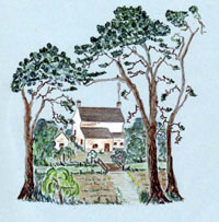 Audrey's sketch of White House
 |
|
1930
|
The River House on West Stow Heath had been built in 1842 as a lockkeepers cottage for the Cherry Ground Lock on the River Lark. Since the navigation closed for the final time in about 1900, the house had been let as a small holder's farmhouse. Audrey Morley was born there in 1921 and has written a manuscript about her early life which included summer holidays with her grandparents in the house. At this time the house was also known as the White House. This view is from the north, approaching the house from the road.
|
|
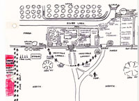
White House smallholding |
|
blank |
Audrey Morley produced this sketch of the layout of the house and garden at the White House. Note the blackcurrent bushes shown in red beyond the pine belt. Buildings on the site include the River House, outdoor lavatory, wash house, dairy, chaff house and a cow shed. Ouside the main garden hedge are shown stables, with a drinking place for the livestock on the bend in the river.
|
|
1936
|
In 1936 the Bury St Edmunds Borough Council extended its land holdings at West Stow. It purchased further land here in July for £60. The original purchase had been in 1886.
|
|
1938
|
Copies of the Borough Council's Accounts for 1937-1938 indicate that the irrigation of crops at West Stow was still under way. It had always been the intention for the sewage farm to make money by re-cycling waste water for irrigation. The sale of blackcurrents made £25.12.4, drastically down on the previous year's total of £79. Also sold were £4 worth of Osiers and £14.18.9 was received for the sale of fodder. Willow sales for the previous year had made £200, but no willow was sold in 1937-1938.
|
| 1940 |
In 1940 to 1942 Basil Brown, the excavator of the royal ship at Sutton Hoo, identified two Roman pottery kilns on the site.
|
|
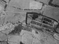 Aerial view in 1946
 |
| 1946 |
This aerial photograph shows the site of the Anglo-Saxon village adjacent to the sewage works in 1946. The sewage works was still very much active at this time, although it had never been a totally successful scheme. The sewage works and the site where the reconstructed houses will be built are enclosed by a clearly visible tree belt. For a more detailed view, clicking on the adjacent thumbnail will give a larger version of the scene. Note how the sewage settling beds wrap around the north of the raised knoll which was the village site. Had the village been on slightly lower ground, it would have been swallowed up by the works. There are no flooded gravel workings at this time, and the Icklingham Road appears to be an unmade track at this time. There are a few belts of conifers visible, but no sign of the regimented plantations which would arrive in a few years. The Icknield Way track looks well used at this time.
|
|
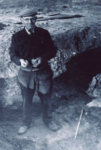 Basil Brown excavating kilns
 |
| 1947 |
In 1947 Basil Brown returned to the site to excavate the Romano-British pottery kilns. He was joined here by Stanley West, who was working as an assistant at Ipswich Museum, where Brown was based. This picture shows Basil Brown in 1947, in the process of excavating one of the Roman kilns that he had found here in 1940-1942.
Early Anglo-Saxon potsherds were evident in rabbit scrapes all over the knoll. At what turned out to be the north east corner of the settlement site, a sand pit was being dug for building material. This sand pit revealed sections of Anglo-Saxon buildings, and was the first evidence of the existence of a settlement here.
Meanwhile the sewage farm to the south of the site was having problems.
Consultants were asked to advise on restructuring the sewage farm as it had suffered continuously from smells and operational problems. Progress was slow and difficult. |
| 1951 |
Plans to upgrade West Stow Sewage Farm were abandoned. It was decided that a new works was to be commissioned in Fornham Park at Fornham St Genevieve instead.
|
| 1952 |
The full report on the excavations of the kilns was published as "Romano-British Pottery Kilns on West Stow Heath", in volume 26 of the Proceedings of the Suffolk Institute of Archaeology, and was written by Stanley West.
|
|
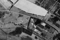
Aerial view in 1956
|
| 1956 |
This aerial photograph shows the site of the Anglo-Saxon village and the adjacent sewage works in 1956. The sewage works was still in operation at this time, and the settling beds make up the grid pattern in the picture. The Icklingham Road is now tarmaced, but the Icknield Way is clearly less used than a decade earlier. The Forestry Commission has now planted up its conifer plantations in this part of the King's Forest. At the western edge (left hand side) of the settling beds can be seen the quarry for sand and gravel which had exposed the existence of the Anglo-Saxon settlement. The major gravel extractions which will leave large lakes behind them are still some years in the future.
|
|
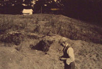 Basil Brown investigating the sandpit
 |
| 1958 |
From 1958 to 1961 the saxon village site was excavated by Miss (later Professor) Vera Evison. She had been alerted to the site by Stanley West, who pointed out that the settlement was threatened by the sandpit which was still being quarried at the north-east corner of the site. As with so many important finds in East Anglia, the West Stow village site was discovered by Basil Brown in 1947. This picture shows Basil in the sandpit in 1947.
|
| 1959 |
Work began on the Pigeon Lane pumping station and the Fornham Park treatment works to replace the West Stow works.
|
|
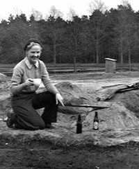
Vera Evison at West Stow
|
| 1961 |
Vera Evison started excavations at West Stow in 1958 before Dr. Stanley West's more detailed excavations of 1965-72. Her excavations ceased in summer 1961. She retired in 1983 as Professor at Birkbeck College, London.
|
| 1962 |
The Fornham Park treatment works was opened and the West Stow sewage farm was de-commissioned.
The old settling beds were to become used as a landfill site for rubbish from Bury St Edmunds to replace tipping at the Haberden and Mount Road. |
| 1963 |
The Bury St Edmunds Motor Cycle Club was given a licence to hold three one-day scrambling events a year on land to the west of the village. They were allowed to occupy the site for 2 weeks prior to an event and 1 week after. This continued up to 1978.
|
|
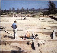 Dr Stanley West during excavations 1967
 |
|
1965 |
Dr Stanley West was contracted for three months a year to undertake excavations on behalf of, and funded by the Ministry of Public Buildings and Works, later to be part of the Department of the Environment. These continued in the summers up to 1972. It was in this period that the major part of the settlement was explored.
The archaeological evidence was well preserved under a great mound of blown sand deposited here during the medieval period. The non acidic nature of the soil preserved many pieces of 'evidence' not normally found, including thousands of animal bones, iron and bronze objects, and even seeds and grain, all of which have been used to extend our knowledge of the life of villagers.
All the buildings were of wood. In a few rare cases houses had been burnt, so that types of timber could be identified from the charcoal. Otherwise, house sites could be identified from the post holes where the wooden parts had long since decayed.
|
|
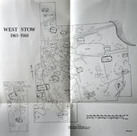 Excavated area 1965-1968
 |
| 1969 |
Stanley West published an Interim Report on the Anglo-Saxon Village at West Stow in volume 13 of Medieval Archaeology. His report covered the four digging seasons from 1965 to 1968 inclusive. In that time the eastern half of the knoll had been excavated, and just a small part of the site to the west of the tree belt. He had identified 34 sunken huts or grubenhauser by this time. It was normal to use the term "hut" to describe Anglo-Saxon dwellings at this time. Dr West also suggested that "some,if not all, grubenhauser were not strictly sunken huts", but were constructed with a space below a wooden floor.
He also emphasised that "the huts themselves were competent structures built by craftsmen well able to work in wood."
Both of these conclusions went against the received wisdom at the time, but are now much more widely accepted.
|
| 1971 |
In 1971 the West Suffolk County Planning Officer proposed the idea of a Country Park at West Stow under the 1968 Countryside Act. Both sides of the river were considered and at the time there were a variety of uses being carried out here. Gravel was being extracted at Lackford, south of the river and lakes were expected to result. Gravel beds were also identified on the West Stow side of the river. Refuse tipping was in full swing east of the village site, and one of the three dwellings known as Wideham Cottages was occupied by a tip worker, the other two being vacant and in disrepair. The river had fishing rights let, and there were shooting rights owned by the Council. The area west of the site was used for motor cycle scrambling events, and this was served by car parking in a field west of Wideham Cottages.
|
|
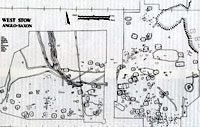 Excavated area 1965-1972
 |
| 1972 |
The excavations were wound up in 1972. About 5 acres of sand covered knoll had been fully excavated, except for the area of the tree belt which bisected the small hill. As far as was known, the entire area of the settlement had been dug. However, at least four dwellings had already been destroyed by quarrying for sand at the north east corner of the area. Possibly other buildings had already been lost before the dwellings had been identified by Basil Brown in 1947.
Stanley West now had the idea of launching a practical archaeology project based upon actually rebuilding some of the dwellings. His idea for a "living, experimental reconstruction of the past" was supported by the County Planner.
From the beginning, the site owners, Bury St Edmunds Borough Council, also supported the project in association with Dr West. However, the passing of the Local Government Act of 1972 meant that on 1st April 1974 the old Borough Council was to be replaced by a new District Council amalgamating the towns of Bury St Edmunds and Haverhill with the surrounding Rural Districts of Thingoe and Clare. The West Suffolk County Council was also to merge with East Suffolk to produce Suffolk County Council.
In order to safeguard the site against the uncertainties surrounding the transfer of ownership under Local Government reorganisation, various ideas were considered. |
|
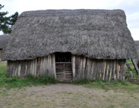 SFB 21 in 2009
 |
| 1973 |
In 1973, a unique programme of reconstructions of Anglo Saxon dwellings was started with the aid of a group of Cambridge students enrolled and directed by Stanley West. The genesis of the project arose from a student protest in February 1973, when there was a sit-in in support of Faculty Reform at Cambridge University, as reported by Jess Davies, one of the protesters. There was a plan hatched to extend the protest by building a reproduction Saxon hut on site to provide additional accomodation. Davies and other students had worked as volunteers with Stanley West on th earlier excavations at West Stow, and sought his advice as to the form of structure to erect. West persuaded them that any such reconstruction would best be done on site at West Stow.
The group began as the "West Stow Experimental Archaeology Group", but this name was thought to be rather too radical by some, and they were advised that funding would be more easily found if the word "experimental" was changed to "environmental". So finally they became "West Stow Environmental Archaeology Group". Ironically, the term "experimental archaeology" is now accepted as a completely valid avenue of research.
Their aim was to explore the techniques of building and woodworking thought to have been used by the early Anglo-Saxons. Little or nothing was known about this and various theories were explored. For about 50 years people had suggested the Anglo-Saxons lived in a hole in the ground with a simple roof over it. On the continent this type of house was called a Grubenhaus. Stanley West's excavations at West Stow had led him to believe that, on the contrary, the Anglo-Saxons lived on a plank floor suspended above a pit. His evidence was based upon the fact that two houses had burned down in Anglo-Saxon times, and their charred timber did not rot away like the rest of the wood used in the construction. This showed that wide oak planks were used as walls and floorboards and ash and hazel made the roof framework for the thatch.
|
|
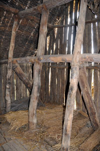
SFB 21 Three end posts
|
|
blank |
Therefore it was decided that the first house to be re-constructed would be built to demonstrate how such a Sunken Featured Building could be made to be consistent with this evidence. The example selected was referred to as SFB 21 on West's original plan of the excavations. It had the usual pit feature and three post holes at each end of the pit, making it what was referred to as a Six Post type. Timbers were left rough, without any finishing applied, and the simplest possible building techniques were used in order to avoid accusations of over-sophistication for the period. Timbers were merely lashed together with leather and twine. The building would be rebuilt on the actual site of the 5th century original.
They made contact with Dick Joice, who presented a programme called "Bygones" for Anglia Television. He agreed to part fund the project and to film some of the work. Thus they won a grant of £500 from Anglia Television and this was matched by another £500 from Bury St Edmunds Borough Council. The Council also gave them the use of one of the derelict Wideham Cottages, and a weekly subsistence allowance of £5 each.
Because of the ad-hoc nature of these arrangements, it was felt that the project's long term management and control needed to be placed upon a more formal basis.
In August 1973 it was suggested that the best body to oversee the village project would be a trust formed from members of the Borough Council, the County Council and outside archaeological experts. It would be called the West Stow Saxon Village Trust. Meanwhile the constructors continued working as before, while the new arrangements were put in place. When the summer ended the group returned to normal activities, but SFB 21 was practically completed.
|
|
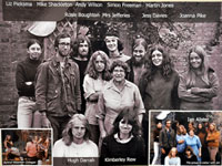 The Environmental Archaeology Group
 |
| 1974 |
In March 1974 the Borough of Bury St Edmunds entered into a deed of covenant committing its successors to lease the site to trustees and to allocate the project the sum of £10,000, subject to the setting up of a Trust. The money was to be earmarked from the proceeds of new gravel workings on land it owned adjacent to the site. It also leased the gravel rights to Amy Roadstone Corporation.
On 1st April the Borough Council ceased to exist and it was replaced by St Edmundsbury District Council, (later to become St Edmundsbury Borough Council). Suffolk County Council was also created on 1st April, and one consequence of this was the establishment of the Suffolk Archaeological Unit with Stanley West in charge. Part of his duties were to continue overseeing the work at West Stow. In July 1974 the first meeting was held of the potential trustees to agree a Trust deed and consider progress on the project.
The building of SFB 21 was completed, showing how the Stanley West's new view of Anglo-Saxon construction might be achieved, even with very basic techniques. The first experimental building was a success, and Dr West was keen to try other methods of construction on a further building project.
|
|
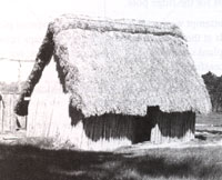
SFB 24 with 55 degree roof pitch
|
|
blank |
Meanwhile, the The West Stow Environmental Archaeology Group reconvened in the Spring of 1974 to build the second house.
Work now began on re-building SFB24, which also had a pit feature, but only one post hole at each end. This two post design was modified by an experiment to try out a roof pitch of 55 degrees instead of 45 degrees. It was built on the original site of SFB 24, and completed within the year. In 1987 this building would be dismantled, as the higher pitch of the roof had made it very susceptible to wind pressure. This demonstrated that such a roof design was unlikely to have been used by the Anglo-Saxons.
Work again ceased until it was convenient for the group to meet again in the Summer of 1974, when work began upon a third house. This continued into Summer 1975.
|
|
 Richard Darrah first Warden of the site
 |
| 1975 |
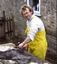
In May, 1975, Richard Darrah was appointed as Warden to oversee the reconstruction projects. His association with the site began when he visited his younger brother Hugh Darrah during the first year of the reconstruction by the Experimental Archaeology Group from Cambridge University. Here he is seen in 1984 in a picture supplied by Alan Baxter. Mr Darrah remained on site as a staff member until 1993.
It was thought desirable to contrast the two new buildings with the building of a grubenhaus, based on the old idea of living in a pit. Its performance and decay could then be assessed and a view taken on whether it was really a practical idea or not. Work now continued on the building of the sunken house. To emphasise its controversial nature, it was decided to build this example on a virgin site, albeit adjacent to the other buildings.
Work also began on the preparation of timbers for the reconstruction of Hall 1, but on the site of Hall 2. The location was necessary to maintain the integrity of the "family group" of dwellings, but the interpretation of Hall 2 itself was far from clear, whereas Hall 1 seemed to be of a simpler design. The final thatching of the Hall would not occur until 1980 and 1981. The buildings interpreted as Halls, were thought to be the main communal space of the family group, whose sleeping and working buildings were clustered around it.
|
|
 Sunken house in 2009
 |
| 1976 |
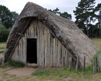
The Environmental Archaeology Group completed their third reconstructed dwelling with the completion of the grubenhaus, or sunken house. It was built so that the roof extended down to the ground, with access down three steps into the pit below. Prior to the excavations at West Stow, this was the main idea of how the Anglo-Saxons lived. The reconstructions now being undertaken at West Stow were designed to test that idea and to test the theory that houses had actually been built with a plank floor above a pit.
Work on the Hall was still confined to ground level timbers. Posts were tenoned into wall plates on all four sides, but in common with the other buildings at this time, there were no pegs used.
The West Stow Anglo-Saxon Village Trust was formally established on 27th May, 1976, to manage the site and employ the necessary staff. A licence relating to 4.59 acres of land was granted to Trustees. The Trust inherited three completed huts and a start on the first hall. The Environmental Archaeology Group was wound up, and remaining constructors transferred to the new Trust. Refuse tipping had virtually ceased by now. Up to this date the Council had managed the financing of the archaeology group through a holding account. The Trust now formally controlled its own finances and it was set up with £10,000 from St Edmundsbury Borough Council, £1,000 from Suffolk County Council and £25 from Breckland District Council.
|
|
 From the air 1976
 |
|
blank |
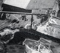
This photograph from the air was taken in 1976. It shows that gravel was still being taken from the area, and that the lake had not yet formed. To the left of the picture is the scramble track. It is an irregular track and natural contours had been excavated and banked up to give excitement to the track. In the centre of the picture you can just see the three reconstructed anglo-saxon dwellings finished by this time. Evidence of tipping is still visible, but part of the car park has already been laid out.
|
| 1977 |
The walls and roof of the Hall were raised during 1977, with the help of the Suffolk Archaeological Unit.
The West Stow Saxon Village Trust was registered as a Charity by the Charity Commissioners in 1977. On 1st November, 1977, an additional 9.72 acres were allocated to the Trust by licence.
|
|
 Audrey's farewell to White House
 |
| 1978 |
The licence to the Motor Cycling Club to run scrambling events was ended in December, 1978. Although the sport was popularly known as scrambling, the official name for it was Moto-Cross. These events were very popular locally because several national moto-cross champions lived in and around Bury St Edmunds. You can view a typical programme of events by clicking on this link:-
The St Edmund Grand National held in September, 1974.
The Trust agreed to the setting up of a "Friends of West Stow Village" scheme.
In November five special temporary employment workers (Manpower Services Commission or MSC) were taken on for 6 months to help reconstruct village.
The Job Creation Scheme supplied two men to build the Information Centre.
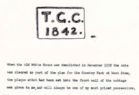
The White House on West Stow Heath had been built in 1842 as a lockkeepers cottage for the Cherry Ground Lock on the River Lark. Since the navigation closed for the final time in about 1900, the house had been let as a small holder's farmhouse. Audrey Morley was born there in 1921 and has written a manuscript about her early life which included summer holidays with her grandparents in the house. In December, 1978 the house was finally demolished after standing derelict for many years. Audrey was given the TGC 1842 plaque which had been attached to the house. Her words can be read by clicking on the thumbnail seen here. In later years the house was also known as River House.
|
| 1979 |
In January, 1979, Richard Darrah, warden of the village, was transferred to the staff of the Country Park and
his salary was now met by St Edmundsbury Borough Council, instead of by the Trust.
During December 1978 and January 1979 further fieldwork was undertaken at West Stow Heath by the Suffolk Archaeological Unit (now Suffolk County Council Archaeological Service), under the direction of Linden Elmhirst. A final rescue excavation, some 2,160m2 in extent, was carried out in advance of sand and gravel extraction at Lackford Bridge Quarry, operated by Amey Roadstone Corporation.
The site lay above the floodplain on the north side of the
River Lark in an extension to, and final phase of, the Lackford Bridge Quarry. The southern edge of the site was marked by the northern edge of
the floodplain; the edge of the terrace rising steeply above the floodplain. The western side of the
quarry extension was bounded by the Icknield Way footpath. The eastern edge was
marked by a former ditched boundary (marked on the earliest OS map), aligned NNE to SSW, which
ran from Icklingham Road to the catch drain along the edge of the floodplain.
Excavations revealed evidence from many periods of occupation, but the Anglo-Saxon period revealed the remains of one probable earth-fast wall-post building and two sunken features, indicative of
sunken-featured buildings. These were characteristic of early Anglo-
Saxon settlement dating, probably, to the 6th and first half of the 7th century AD
The report on this site, now called WSW 030, was written up by Jess Tipper in 2007, and had some interesting conclusions. The evidence indicated there was settlement on, and probably close, to the Lackford Bridge site
during both the early and late Neolithic, Iron Age and early Anglo-Saxon periods, although with no
evidence of continuity between periods. In particular, the evidence from Lackford Bridge suggested that
the early Anglo-Saxon settlement at West Stow was not an
isolated settlement knoll, and indicated a densely occupied and historic landscape from the Neolithic
onwards, preserved below the later medieval wind-blown sand. The evidence hinted at more extensive
settlement in the immediate vicinity, along the edge of the terrace.
Most of the excavated site was then destroyed by the last gravel diggings undertaken at West Stow, leaving a relatively shallow bay, later to be much loved by carp for spawning grounds.
During 1979 the Hall was taking shape. All the cladding was fixed to the walls, and the roof was completed ready for thatching.
The rubbish tip was landscaped and West Stow Country Park was opened to the public in June, 1979, after the River House was demolished and the shooting rights were extinguished. The car park was given a hard surface and the toilet block erected with grant aid from the Countryside Commission and the West Stow Country Park had its official opening in August, 1979.
In November The Friends of West Stow Anglo-Saxon Settlement was formed.
Gravel working continued at the western end of the site, and there was no public access to this area at this time.
|
|
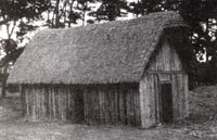 The Hall completed
 |
| 1980 |
In March 1980 the Friends of West Stow Anglo-Saxon Settlement held their inaugural meeting. The Friends would organise many volunteer events, and raise funds to provide extra facilities at the village site.
In 1980 the thatching of the Hall was completed but would not get its final capping until 1981.
Using the experience gained from the first four reconstructions, it was decided that the next building would be on the site of SFB 19 or SFB 20. These were two adjacent sites in the grouping around Hall 2. The basic structure would remain the same but all joints and planks would now be pegged. Evidence for this was that two spoon bits had been found during the excavations. The new building would be a two post structure, based upon the postholes found in the ground. However, support was needed for the tie beams and wall plates, and load bearing timbers would now be located on the ground sills which support the walls. In effect a six post structure was to be built, but it would still leave behind evidence of a two post construction in the soil.
Work began on the timber preparation for SFB 20 in 1980, and construction would last until 1982.
|
|
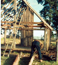 SFB 20 under construction
 |
| 1981 |
Throughout 1981 the new building, SFB 20, was being constructed.
The Friends of the West Stow Village decided to finance the cost of materials of another new reconstruction on the site of SFB 5. During 1981 the ground sills were laid for this building. SFB 5 would later become called the Living House. This would be a six post construction, incorporating the technique of pegging, as was being used with success on SFB 20.
Gravel extraction ceased within the Park area, and the fishing lake was created. Public access now became available to the whole of the area which remains open today.
In May, 1981, the reconstructed village area was fenced and admission charges introduced.
|
| 1982 |
Having been started in 1980, another building was finally reaching structural completion at West Stow. This was the two post structure on the site of SFB 20. It is nowadays referred to on the Visitor's Plan as the Weaving House. It had been decided that it would be built to a higher standard than hitherto. Basically all the planks and joints would enjoy the benefit of pegging with oaken pegs. This has proved to be a successful innovation. It would not be thatched until March 1983.
In June 1982, Sir David Wilson, Director of the British Museum, visited the site. He participated in raising the east ridge post of SFB 5, which was now well under way.
|
|
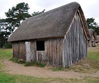 SFB 20 The Weaving House
 |
| 1983 |
In March 1983 thatching began on SFB 20, the Weaving House. A clay hearth was laid directly on the plank floor on the north side. This interesting experiment would eventually demonstrate that this method would cause failure of the hearth from vibration in the plank floor from foot traffic.
Suffolk County Council joined the Borough in giving annual grant aid to the village, although it had been funding Dr West's post since 1974. The County Council agreed to give £2,000 in 1983/84 and, subject to the Borough
Council matching their grant and the Trust preparing a development plan, to give
a grant of £6,250 in 1984/85.
|
|
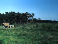 Site with Reception c1984
 |
| 1984 |
Facilities for the public were minimal in 1984, with just a small site hut and kiosk at the village entrance.
The main structure of SFB 5, the Living House, was now in place. The walls and rafters now had to be added and the last stage would be the thatching. The use of more complex techniques was making each reconstruction a longer job.
Also, as the earlier buildings began to age, it became necessary to spend more time on their maintenance. SFB 24 was now leaning dangerously to the east, and its long term viability was coming under question.
To address these issues the first Development Plan for the village was drawn up.
In February Roger H. Austin was appointed as Senior Ranger of the Country Park. The appointment was funded by St Edmundsbury Borough Council and this began an unofficial co-operation between Trust staff and Council staff.
In June the council's Recreation & Amenities committee agreed to make a grant of £6,250 in 1984/85, matching that of the County Council.
|
|
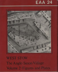
EAA Report 24, volume 2
|
| 1985 |
In December 1984 the newly appointed Senior Ranger had resigned. After a recruitment campaign Alan Baxter was appointed as Senior Ranger in April, 1985. Staff also included also one part—time
constructor, Alan Armer, and a retired teacher (Jean Lloyd) who took parties around the site.
By March the rafters had been fitted to SFB 5, as had the wall planks along north and south walls.
In June 1985 SFB 24 had become a danger, and was closed to the public. On the oldest house, SFB 21, thatching repairs were now needed, and took place in March and October.
Suffolk County Council published Volume 24 of "East Anglian Archaeology" entitled "West Stow, the Anglo-Saxon Village". This was the full account of the excavation campaign at West Stow for professional consumption. It was divided into two volumes, the first being 'the text', and the second, 'the figures and plates'. It had taken 13 years to organise the material to a point suitable for publication.
This remains the major work on the excavations and finds at the Anglo-Saxon village site at West Stow. (Dr West would re-examine some of his findings following the years of experimental archaeology and reconstructions in his book, "West Stow Revisited," published in 2001.)
In June, livestock was first introduced to the site in the form of six free range hens.
|
|
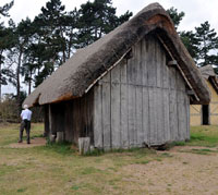 SFB 5 the Living House
 |
| 1986 |
The addition of a few hens to the site helped to give it a lived in feel, and a new atmosphere. Sheep were introduced to the surrounding areas of the old tip site, and this also added to the rural ambience of the area.
In the reconstructed village the walls and rafters of SFB 5 were in place by June 1986, and thatching could now take place.
In January The first Assistant Constructor, Sean Welsh, was appointed, and in March a permanent contract was accepted by Alan Armer.
|
|
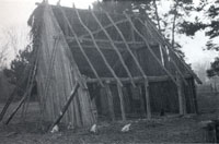 SFB 24 under demolition
 |
| 1987 |
In January, Sean Welsh resigned as Assistant Constructor and was replaced in February by Francis Wand.
In the Living House, SFB 5, the finishing touches were now added. A bed box was built, and the loft put in place. Along the west end, a raised bench was constructed.
In December 1987, the building on the site of SFB 24 was dismantled. The steeply pitched roof had produced such a large area exposed to wind and weather that the whole building was now leaning dangerously towards the east.
|
|
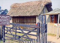 Site hut and reception 1987
 |
|
blank |
This picture shows the site hut in 1987, which was the only facility catering to visitors. It was obvious that if visitor number were to grow, then better, more welcoming, facilities would be needed.
|
|
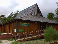
|
| 1988 |
With the plans to create a new Visitor Centre in place, staffing needed adjustment. In August The first Education Officer was appointed (Keith Matthews) by the Council. Three new Assistant Constructors were appointed (Ken Holt, Bob Holden). Alan Armer was transferred to St. Edmundsbury Borough Council staff as Ranger/Village.
The first Visitor Centre was opened in October, 1988, and immediately attracted a large increase in visitors to the Country Park and the Anglo-Saxon re-constructions. It was operated to serve both the Country Park and the village site. It was of a timber construction on raised piers to fit into the rural environment.
|
|
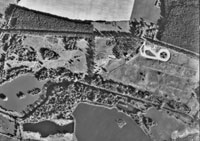
Aerial view in 1990
|
| 1989 |
This aerial photograph shows the site of the Anglo-Saxon village and the adjacent sewage works by 1990. The old rubbish tip overlaid most of the sewage works settling beds, and by 1990 it had been landscaped and grassed over. The visitor carpark is clearly seen in the shape of figure eight on its side. The River Lark runs between the fishing lake within the West Stow Country Park and the sailing lake which is the other side of the river in the parish of Lackford. The new Visitor Centre is visible, and tiny dots mark the positions of the reconstructed Anglo-Saxon dwellings. Many more trees are now visible all across this area.
|
|
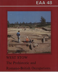
EAA Report 48
|
| 1990 |
Two more scholarly reports were published about West Stow in 1990. East Anglian Archaeology Report 47 was entitled "West Stow, Early Anglo-Saxon Husbandry", by Professor Pam Crabtree.
EAA Report 48 was "West Stow, the Prehistoric and Romano-British Occupations", by Stanley West.
|
|
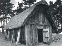
Hall with Buttresses
|
|
blank |
The Hall had been built between 1975 and 1981 on the site of Hall 1, but to the design of Hall 2. As this was one of the earlier structures attempted on the site, the use of wooden pegs to clamp the joints together had not yet been included in the experiment. This had resulted in the structure taking on a dangerous lean so that in 1990 it was decided to add four raking buttresses to the south wall. These were bedded on to large horizontal timbers set just below ground level. At the same time the plank infilling between the posts was raised where they had dropped.
By August 1999 the Hall would have to be closed to the public. A new Hall reconstruction would be completed by 2005.
|
|
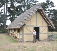 The Workshop
 |
| 1991 |
In 1991 the building now known as the Workshop was completed at West Stow. Unlike most of the reconstructions, it was not placed on the site of an original Anglo-Saxon building. However, it was based upon evidence from Hall 7 on the northern slope of the village. Post holes here were much more widely spaced than the other buildings referred to as Halls. It is possible that it was a barn, although it may have been a large hall. The spaces between the upright posts were probably infilled by either wattle and daub panels, or possibly by horizontal planks. Both of these options are based on evidence from other Saxon sites, but wattle and clay daub was selected for this building. The total size of this project was 39 feet by 14 ft 6 inches. An internal wall was included to give some secure storage space.
|
|
 Introduction of pigs
 |
| 1992 |
Work now began on what is called the Farmer's House, on the site of SFB 12. This was one of the three SFBs which had a wooden lining to the pit below the floorboards. It was decided to reconstruct this six post building with its cellar, which would be accessible by a simple trapdoor. The above ground structure would be the same as SFB 5, the Living House. From July to September, 1992 the cellar timbers were prepared.
An ambitious ten year Development Plan was produced to increase the rate of progress on reconstructions and to formalise programmes of education about the site and the Anglo-Saxons.
Foreseeing the potential difficulties of the Trust managing the growing demands of the project and recognising the growing together of the Country Park and the village, the Trust and Borough Council entered a formal partnership. Under the partnership agreement the Borough now took over the employment of the construction staff together with day to day management. The Trust remained as the guardian of the village's authenticity and integrity. The Trust then appointed Dr Stanley West as its consultant archaeologist to carry out this role, oversee the reconstructions and keep records of progress.
Pigs were introduced to the village site within a penned off area. The needs of modern animal welfare and the requirements of Health and Safety legislation meant that they could not be allowed to roam as freely as they might have done in the original Anglo-Saxon village.
|
|
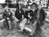
Construction team 1992
|
|
blank |
This picture shows the Construction Team in 1992. Picture supplied by Alan Baxter. He gives the names as follows from left to right:-
- Ken Holt,
- Bob Holden,
- Martin Swindles,
- Alan Armer
|
| 1993 |
By July the timber frame for SFB 12 was pre-fabricated, but not erected.
Meanwhile repairs were carried out on the older buildings. At the Sunken House a hole in the roof was refilled, wallplanks needed repair, as did the door. The west gable wall had to be pegged to the mid-line beam to prevent further leaning. The oldest construction, SFB21, also had to have its west gable wall planks pegged to a new tie timber.
SFB 5 needed attention to a broken floorboard, and the door was repaired.
In 1993 many of the activities which we now take for granted as part of the West Stow experience were begun. In April came the first Saxon Market with input from the Friends of West Stow and publicity in the Radio Times.
Fingerposts and maps were installed around Visitor Centre, the Willow beds were extended for use of cut willow in Village.
Flax was grown for the first time as well as the biggest ever wheat crop.
"Volunteer Villagers" guidance was drawn up and social events held for volunteers in the Village.
The new Assistant Constructor was asked to become more involved with school visits.
In August a second Saxon Market was extended to two days.
In November a seven minute introductory video for visitors starts to be shown.
Richard Darrah left West Stow in 1993, eventually setting up "Riven Oak", his own business specialising in historic re-creations in wood. His main achievement in this field was a reproduction of the Dover Boat, a bronze age craft excavated in Kent in 1992, that was the world’s oldest known sea-going boat. Richard’s half-scale reconstruction was a huge success. It has been displayed in many museums around Europe and featured in the Time Team TV programme.
Richard Darrah died aged 67 in 2017.
|
|
Guide Book 1994
|
| 1994 |
For the 1994 season a new Guide Book to the site was produced, entitled "West Stow Country Park and Anglo-Saxon Village." It described the man made landscape at West Stow, the reconstructed village, the Country Park, park wildlife and the Visitor centre. There was also a site map of the park, showing the lake , the village and other features. Published by Jarrolds of Norwich it was a 16 page production with mainly colour pictures.
The first Events Leaflet was produced .
|
|
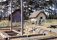
Farmer's House SFB 12
|
|
blank |
Work on the building of SFB 12, later to be called the Farmer's House, continued. The pit was dug, and the cellar's wooden lining inserted. The sills, the main posts and some floor planks were put in place.
|
|
Video and Booklet
|
| 1995 |
This booklet was produced in 1995 to accompany a video-tape also entitled "In Search of the Anglo-Saxons". The video was funded by the Friends of West Stow, and produced by Take-1 Video Productions for the West Stow Anglo-Saxon Village Trust. It takes the form of short stories told by the villagers of Stow, and was filmed entirely within the village. Well illustrated in colour, the booklet tells Aelmaer's story, a village boy, Coelred's story, a visiting trader, Emma's story, a village matriarch, Seaxwulf's story, a village slave, and Salwyn's story, a young girl. Lastly the village archaeology and the reconstructions are described. In 2004 this video would be incorporated into a a new DVD-Rom entitled "West Stow".
The Development Plan was revised to incorporate a new Anglo-Saxon Centre adjacent to the existing centre to house and to display and interpret many of the finds from the site. The new centre would also display the wider background to the Anglo-Saxon period, and provide for the sale of refreshments.
|
|
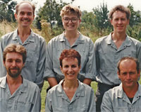
Full West Stow team 1995
|
|
blank |
This picture shows the full West Stow Team (excluding constructors) in 1995, both for the village and the Country Park. Picture supplied by Alan Baxter. He gives the names as follows from left to right:-
- back row: Alan Baxter, Judith Roberts, Chris Gregory;
- front row: Will Wall, Glynis Baxter, Alan Armer
All these improvements to the Park and Village "offer" made 1995 the best year for Village visits so far with a total of 37,773 (22,884 individual admissions plus 14,889 group visits).
|
|
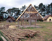
Farmer's House SFB 12
|
|
blank |
Work continued on rebuilding SFB 12, the Farmer's House. The ridge pole and rafters were now in place, and the planks for the north wall and part of the south wall were put in place.
|
|
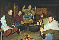
Celebrating lottery award
|
| 1996 |
The Heritage Lottery Fund agreed to give a grant of £491,000 towards the capital cost of £641,00 for this new Visitor Centre project. St Edmundsbury Borough Council found £150,000 for the project. Council Leader Ray Nowak, (2nd from left) joined other re-enactors to celebrate the award. Alan Baxter is wielding the spear.
In June the Trust adopted a Policy for Animal Husbandry at the village site.
SFB 12 was still not completed, but the south wall and the gable walls were begun.
|
| 1997 |
The walls of SFB 12, the Farmer's House, were finally fully completed.
The Village Trust is enrolled as an Environmental Body under ENTRUST so that it can apply for landfill tax credits, opening up a potential new source of funding.
|
| 1998 |
Following tenders for the new Visitor Centre, it was found that additional money was needed. The Heritage Lottery Fund agreed to contribute an additional £21,970 and St Edmundsbury Borough Council found another £19,000. With a scheme budget of £682,000, the project was let to Hills of Ipswich.
Thatching was started on SFB 12, the Farmer's House.
|
|
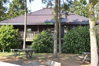
Angles cafe
|
| 1999 |
In July 1999, the new Anglo-Saxon Centre, cafe and shop were formally opened by Dr Stanley West and the Mayor of St.Edmundsbury. The cafe is now called "Angles".
A brand new type of event took place in the shop and cafe in November, and was one of the most successful of the year. Yule Fest , as its name suggests, was a celebration of Yule (the precursor to Christmas) and involved staff in costume, hot mince pies and cheerful live music.
|
|
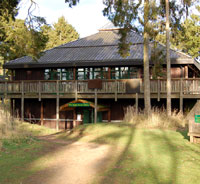
Anglo-Saxon Centre
|
|
blank |
The Anglo-Saxon Centre was also opened on 20th July, 1999, and it was located in the ground floor of the Cafe. Its entrance cannot be seen from the Cafe itself, as entry was included as part of the price of admission to the reconstructed village. The displays illustrate the lives of people who had lived on this site since Neolithic times, although the bulk of the exhibits relate to the Anglo-Saxons who lived in the village. Anglo-Saxon articles found nearby at Lackford, Icklingham and the Westgarth Gardens cemetery, are all on display here. Some of the exhibits can be seen by clicking here:
Some Anglo-Saxon Centre Exhibits
It was decided in August 1999 that the Hall was now in an unstable condition, and it was closed to the public. It was decided to plan to rebuild it, but using more sophisticated building techniques.
After seven years of slow construction, SFB 12, the Farmer's House, had its thatching finished in 1999.
|
|
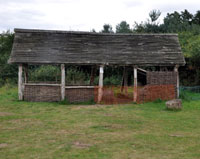
Craft building by 2009
|
|
blank |
The Craft Building was also completed to give some cover for the demonstrations of metal working, bread making, etc which take place several times a year at special events. It also allows for some separation from the public of the red hot forge and ovens. It was built with horizontal plank sides, and placed away from the main group of reconstructions. However, its form and function continue to be controversial in the village context.
1999 was a record year for TV coverage of the Anglo-Saxon Village. It was featured no less than 16 times locally, nationally and internationally. The programmes included "The Dark Ages", "Meet the Ancestors", "Secrets of the Dead", "One foot in the Past" and "1000AD". Even two American TV companies, CBS and ABC, filmed at the site as part of their millennium focus.
|
|
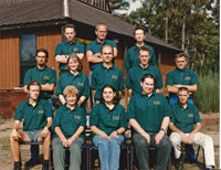
West Stow staff 1999
|
|
blank |
This team photograph of West Stow staff taken in 1999 was supplied by Alan Baxter. Alan remembers most of the names as:
- back row: Lance Alexander, Alan Armer, Glynis Baxter,
- middle row: Mike Neave, Liz Proctor , Alan Baxter, Chris Gregory, Bob Holden,
- front row: David Rogers, Janet Blades, Karen Bellagamba, Tristan ? , Julian Carter
|
|
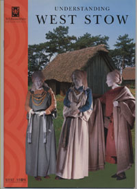
Understanding West Stow
|
| 2000 |
The winter of 1999/2000 was busier than any previous winter, but the Summers are favoured by visiting school groups.
A new popular descriptive book about West Stow Anglo-Saxon Village, "Understanding West Stow", was now officially launched.
Written by Dr Stanley West, who supervised the major excavation of the site, the book was designed to be easy to follow and explains the new ideas about the site. Full use was made of illustrations. It covered all aspects of the village, the new Anglo-Saxon centre and their historical context. The aim of the book was to help to answer some of the many questions prompted by the site, and to introduce readers to the exhibits in the new Anglo-Saxon Centre.
A new Advisory Panel was set up by the Anglo-Saxon Village Trust to help Dr. West make the most of this opportunity to further the experimental archaeology at West Stow. Members at the time were S.E. West, K. Wade, C. Hills, H.
Geake and A. Baxter. One of the first jobs was to work on the Development of the site. This panel would later become known as the Academic Committee.
The Trust's Development Plan, first written in 1992, and revised in 1995, was replaced by a new Plan. Resources were now to be concentrated upon reconstruction works, and one of the major projects for 2000 was the beginning of the rebuilding of the Hall.
The existing building, which was now leaning over considerably, was taken down. Reconstruction of the building began in 1975, but there were delays before completion in 1981. As many of the timbers as possible were reused, along with new materials as needed, to rebuild it.
Free entry days, when visitors could look around the site without charge, were a new idea for 2000. The idea was to encourage as many people as possible-especially those who live relatively close by- to better appreciate this important site.
There was a new opportunity for members of The Friends of West Stow to be involved in the Anglo-Saxon Centre. The friends intended to begin recruiting and training Volunteer Guides whose aim will be to help visitors understand the Anglo-Saxon Village through guided tours of the Anglo-Saxon Centre and discussions of issues raised.
|
|
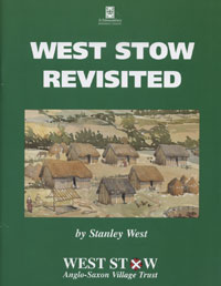
West Stow Revisited
|
| 2001 |
Foot and Mouth precautions meant that site closed for 8 weeks during 2001.
In 2001 Stanley West published a new book entitled "West Stow Revisited". This was a larger work than "Understanding West Stow", and had 81 pages and was meant to be a more technical account of the excavations for the more serious amateur enthusiast. This book concentrated upon the reconstructed buildings on the site at West Stow. It explained the construction techniques used in each building, and the evidence upon which these techniques were selected. The amount of timber used for each unit was carefully recorded, and any subsequent decay was noted. The book could be used as a manual for the building of such Anglo-Saxon reconstructions.
|
|
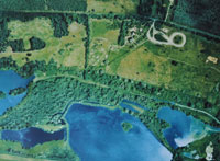
From the air
|
| 2002 |
This aerial view of the West Stow Country Park and the reconstructed village dates from around 2002. The Visitor Centre and the Angles Cafeteria can just be seen to the left of the distinctive figure eight shape of the car park. The fishing lake within the country park is seen at the upper left of the photograph. All of the other lakes and ponds are to the south of the River Lark, situated within the parish of Lackford. The largest lake is known as the Sailing Lake, and the Sailing Club headquarters and parked boats can be seen at the bottom edge of the Sailing lake. To the right of the sailing lake is the Lackford Wildfowl Reserve of the Suffolk Wildlife Trust.
This photograph hung for some time in the Angles Cafeteria with south at the top, but here it has been reversed to put north at the top.
Ray Nowak (Trust Chairman) set up a fund of £2,000 (from his County Councillor locality budget) to help with third party funding requirements from landfill tax.
|
|
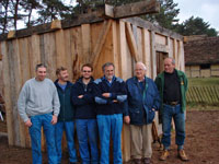
Construction team in 2002
|
|
blank |
Alan Baxter has kindly supplied this picture of the construction team standing in front of the partly rebuilt Hall with Dr West in 2002. Their names are as follows from left to right:-
- Julian Carter,
- Kevin Wilson,
- Unknown,
- Bob Holden,
- Stanley West,
- Alan Armer
In 2002 the documentation of the Anglo-Saxon collections was started by the then Manager (Alan Baxter) and Suffolk Association for Museums volunteer Dr. Alan Lower. Dr Stanley West (Archaeological Consultant to the West Stow Anglo-Saxon Village Trust) provided invaluable advice and support. As well as rationalising the store and archive, Alan Lower documented the small finds collection by hand for three years until 2005. This work has proved invaluable to the Digital Finds Project.
|
|
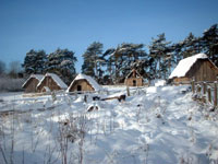
Snow at West Stow 2003 |
| 2003 |
This view of the village in the snow includes a partly built view of the Hall in the background. The original rebuilt Hall had been taken down in August, 2000. The view here shows it part way through its second rebuild. This time all the joints and planks included wooden pegs as well as the regular joints.
In March, 2003, the Advisory Panel was asked to consider its terms of reference for next Trust meeting in
June. A New Academic Committee was set up with additional members (Angus Wainwright from the National Trust and Jess Tipper, Suffolk Archaeological Service).
|
|
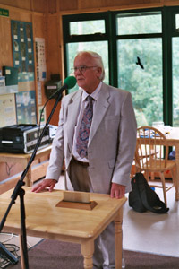
Stanley West's retirement
|
| 2004 |
In 2004, the close association of Dr Stanley West and West Stow came to an end when Stanley finally moved away from Suffolk to the west country for family reasons. He had been associated with West Stow since his teenage years with Basil Brown.
In July, 2004, there was a presentation to Stanley West at West Stow, to mark his final retirement from involvement with the West Stow Anglo Saxon Village Trust. Stanley became the Trust's Archaeological Consultant following his retirement from Suffolk County Council. He was now moving away to Shropshire to be nearer to family members. Stanley had excavated the site of the village in the 1960's and come up with the idea of a reconstruction project to investigate building methods that Saxons may have used, to test theories and ideas, and to measure the decay process that the village would go through. He has written books on West Stow, as well as other topics, and is an expert on the Anglo Saxons.
After Dr. Stanley West retired, and in the subsequent years, he organised the transfer of all his slides, photographs, plans, notebooks and Ancient Monument Lab documents to West Stow to complete the invaluable archive of the material he excavated at the original location.
He was replaced as Archaeological Consultant by Dr Jess Tipper of the Suffolk Archaeological Unit.
|
|
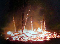
Fire destroys SFB 12
|
| 2005 |
One of the reconstructed houses at West Stow, known as SFB 12, or the Farmer's House, was destroyed by fire on 19th February, 2005. A firefighting crew arrived, but were too late to save the building. The subsequent insurance settlement of £80,000 illustrates the costs of labour which were required to build such a structure under modern conditions. The opportunity would taken to try out a new form of oak walling and an experimental thatching programme on the rebuilt structure, but work could not begin until 2007.
|
|
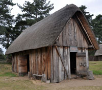
Hall rebuild finished
|
|
blank |
The Hall had been built between 1975 and 1981 on the site of Hall 1, but to the design of Hall 2. As this was one of the early structures attempted on the site, the use of wooden pegs to clamp the joints together had not yet been included in the experiment. This had resulted in the structure taking on a dangerous lean so that in 1990 it was decided to add four raking buttresses to the south wall. By August 1999 it was closed to the public, and was then taken down. A new reconstruction was completed by 2005, but this time it included the pegging of all posts and planks, and diagonal bracing to all four corners.
At the end of 2005, the St Edmundsbury Borough Council adopted the recommendations of its Heritage Services Review. This review was a fundamental reappraisal of all the Council's museum services together with West Stow Country Park and the Anglo-Saxon Village. The most controversial decision was the closure of the Manor House Museum in Bury St Edmunds, and the development of the site at West Stow as a centre for the archaeological exhibits. Meanwhile, Moyse's Hall Museum would be re-focussed upon the history of Bury St Edmunds itself.
West Stow Country Park was to form the basis of a new Heritage Service within the existing Museums Service, led by Alan Baxter. This had the benefit of pooling the staff expertise in both services to produce better exhibitions, events, school programmes and lectures. The merger of the two services also provided significant revenue savings. It would also facilitate West Stow gaining Museums Libraries and Archives Council (MLA) accreditation for its visitor centre (application submitted 2010).
The effect upon West Stow would be a period of growth and expansion.
|
| 2006 |
In 2006, the Manor House Museum in Bury St Edmunds was closed, and some of its exhibits were moved to Moyse's Hall Museum. To make room for them, it was decided to move the archaeology display to West Stow. This would replace the natural history exhibit which was old and of little interest to visitors by this time. Planning work and design was well under way by the end of the year.
Fuller details are as follows:-
A new store building was planned for West Stow as part of Heritage Review.
In April the New Heritage Service began with Alan Baxter as Heritage Manager covering Moyse's Hall Museum, West Stow Anglo-Saxon Village and supporting Haverhill Local History Group and Clare Ancient House Museum.
Manor House Museum is closed on March 31st as detailed in resolution 4 of council report W343, 13 December, 2005.
In June Contractors began West Stow phase 1 alterations in existing Visitor Centre (new hot desk office, shop and toilets) and new security fence for the Village. Two Experimental Archaeologists (Hannah Simons and Mary Ellen Crothers) appointed and start work at West Stow.
In July the Weaving House is re-roofed and thatched, Information Hut repaired, Sunken House re-capped (part of Landfill tax funded works on 5 reconstructed buildings). Crop plots improved and new paths added.
In December the Archaeology displays from Moyse’s Hall are installed at West Stow. Online shopping for West Stow heritage shop begins via Council website.
|
|
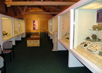
Museum displays in West Stow Centre
|
| 2007 |
During the previous year it had been decided to move the archaeology display from Moyses Hall in Bury St Edmunds out to West Stow. This meant detailed planning and the careful relocation of exhibition cases and their contents to their new home.
By the beginning of March 2007 the new museum exhibition was opened at the West Stow Visitor Centre. Cases of exhibits had been succesfully moved from Moyse's Hall Museum for display at West Stow. The displays ranged from Pre-Historic fossils to Stone Age artefacts, through the Bronze and Iron Ages to Roman times and up to medieval pottery and items. There was included a small display of Anglo-Saxon material, and, at first, this was all on view free of charge as part of a visit to West Stow Country Park.
The displays in the Anglo-Saxon Centre continued to be open in their own setting below the cafeteria.
In June 2007, the work began on replacing the burnt down Farmer's House, SFB 12. It would now have a lined cellar as before, but its alignment was slightly different to the original, as that was judged to have been slightly off the actual site of the Anglo-Saxon equivalent. The finance came from the insurance settlement, and the frame and floorboards were made off site. The other main difference from the original rebuild was in the thatching. This time it would be thatched without the use of twine, a technique known as "fleeking". In November the Farmer’s House roof works began with Alan Jones, Master Thatcher.
|
|
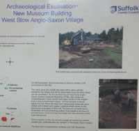
Excavating site of Collections Centre
|
|
blank |
During December 2007 there was a new excavation carried out by the Suffolk Archaeological Service on the site of the proposed collections study building. This location was several hundred metres to the north east of all previous excavations. It revealed the sites of five hitherto unknown sunken featured buildings and a post built structure. This discovery raised new issues regarding the nature and extent of the original early Anglo-Saxon settlement.
As work progressed there were a series of information boards erected to let the visiting public know what was happening on the site. Three boards were used in all, and were subsequently incorporated into the Museum gallery display. The implications of these discoveries are still under consideration, and must await a full report from the Suffolk Archaeology Unit.
Suffolk County Council Grant was reduced from £7,200 to £4,100 due to financial restrictions. The grant is paid to SCC Archaeological Service for the Archaeological Consultant to West Stow. The one day per week allocated for this work is now reduced to 1 day per fortnight, or the equivalent.
The July meeting heard that West Stow attracts the largest number of school pupils (2006/7 12,073) of all museums in the county. Ipswich Museum with about 6,000 is its closest rival.
In August the ‘Aggregates Project’ at West Stow involved 20 young people from Mildenhall and Bury St Edmunds using experimental archaeology as stimulus for learning; this was in partnership with Landfill Tax, Suffolk County Council's Archaeology Service and Suffolk Wildlife Trust.
During 2007 and 2008 a 2 year extra funding package (totalling nearly £35,000) was awarded by St Edmundsbury Borough Council to ensure major backlog maintenance work was carried out following structural and thatching surveys. Grant aid was secured from the Landfill Tax Credit Scheme to maximise the value of this funding for the Village. An annual grant for maintenance of £10,000 was agreed. In addition, the burned building was completely rebuilt under the insurance settlement of £80,000.
|
|
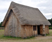
Rebuilt Farmer's House seen in 2009
|
| 2008 |
In January 2008, the Farmer's House, burnt down in 2005, was re-opened. This followed a rapid rebuild period, achieved by the use of the insurance settlement. This new version of SFB 12 was on a slightly different alignment to its predecessor, and its thatching was carried out without the use of twine.
In June 2008, the author of this Chronicle was appointed as one of the three Trustees appointed by the Anglo-Saxon Village Trust. Work began on revising the Village Development Plan.
In April a team from Birmingham University record the Anglo-Saxon Village buildings digitally, by way of Laser scanning of the reconstructions. This is the first time that the experimental reconstructions have ever been properly recorded – a milestone for West Stow.
|
|
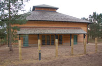
Collections study centre
|
|
blank |
By the end of 2008 the new Collections Study Building was completed, having started in January. The Borough’s stored collections were moved to new Collections Building at West Stow, beginning in September.
The new Education Room at West Stow was used by school parties for the first time.
The final fitting out and official opening of the new facilities would not take place until 2009.
During 2008 news of research by Paul Blinkhorn on the dating of Ipswich ware pottery would suddenly put a new complexion on the dating of the settlement at West Stow. Paul Blinkhorn’s study suggests that Ipswich Ware was not produced before the end of the 7th century with truly significant production and distribution not taking off until as late as the second quarter or middle of the 8th century. Until now it has been assumed
that production began in the second quarter or middle of the 7th century. ("Ipswich: Development and contexts of an urban precursor in the seventh century", by Christopher Scull of English Heritage.)
This gives a rather different view of when the village at West Stow was finally abandoned. The presence of Ipswich ware on the site now indicates that at least some inhabitants still lived at the site after say 720, and possibly up to 750. Hitherto it had been thought that the village was abandoned around 650 AD.
|
|
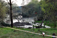
Landslip at West Stow lake
|
| 2009 |
At the end of March there was an unprecedented event at the fishing lake when a large section of bank collapsed into the lake. This took place around the original site known as WSW 030, and was the last area to be dug out for gravel. The landslip took place into the shallow bay known as spawning grounds for the carp in the lake. It took away a number of trees, a park bench, and a large section of the lakeside footpath with it. The footpath had to be diverted as far as the Icknield Way to skirt around the affected area. Apart from coastal cliff erosion, this was the largest inland landslip in Suffolk.
The expansion of the services on-site at West Stow led the Anglo-Saxon Village Trust to embark upon a new Development Plan for the future of the Anglo-Saxon Village. After two years of concerted effort, supported by funding of £35,000 from the Borough Council, together with funds from the Landfill Tax Credit Scheme, the constructions in the village were at the highest level of maintenance so far achieved.
In April the Angles Cafe was handed over to a firm of outside caterers to manage, rather than being managed by the Country Park's own Heritage staff.
|
|
Collections Study Centre Education Room
|
|
blank |
On July 8th the new Collections Study Centre was opened officially for use by visiting groups and for individuals needing to consult the stored collections of the Museums Service. This picture shows St Edmundsbury Cabinet Portfolio holder for Culture and Sport, Councillor Lynsey Alexander, addressing an invited audience, including schoolchildren, and introducing the new building. Immediately afterwards, the opening ribbon was cut by Madam Mayor, Cllr Pat Warby, in the Long Store.
|
|
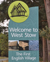
The First English Village
|
|
blank |
By August a new set of signs were welcoming visitors to West Stow. The reconstructed village was now announced to be the "First English Village", a bold re-branding of the site. The case of medieval displays in the Visitor Centre Archaeology gallery had already been removed back to Moyse's Hall, in order to focus West Stow more clearly upon the Anglo-Saxons and their predecessors in the area. The space had been taken up by the display boards from the 2007 excavations prior to building the Collections Study Centre. The archaeology gallery was now removed from free display and included as part of a paid visit to the Anglo-Saxon Village. New display boards were set up within the Visitor Centre.
During 2009 the village became a member of EXARC, the European Network of Experimental Archaeology Sites.
|
|
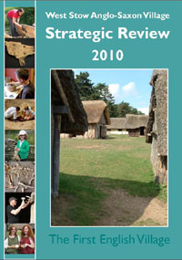
Strategic Review 2010
|
| 2010 |
The revised Development Plan, currently undergoing revision, was being expanded into a full scale Strategic Review to prepare the Trust for the expected imminent changes to the structure of local government. In the event these proposed changes fizzled out, but the new government demanded public sector savings of 7% a year for the forseeable future. This continued to make publication of a full scale review a necessity.
So, in December 2010 the West Stow Anglo-Saxon Village Trust published its Strategic Review of the state of the village project. The purpose of this Strategic Review was to describe the history of the Anglo-Saxon Village at West
Stow, to assess its present state of development together with its management structure,
and to develop a new set of aims and objectives to move the project forward into a secure and
sustainable future.
The review included chapters covering:
- The history of the archaeology of the site
- The village and the West Stow Anglo-Saxon Trust
- The importance of Visitors
- Experimental Archaeology discussion
- Future Strategic Development
- Site management and external partnerships
- Resources and future funding
Its conclusions included the following:
- West Stow is of international significance for the programme of reconstructions of Anglo-Saxon
houses that began in 1973. It is a unique centre of historic building (re-) construction for this
formative period of English history.
-
By 2010, a programme of experimental reconstructions of one family group comprising one part
of these settlements has been almost completed. Only one additional building is now required to
complete the group.
-
The reconstructions at West Stow provide a unique opportunity for further experimental
archaeology while also presenting the public with the settlement at West Stow as one of the first
English villages.
- West Stow village and Country Park should be seen positively as an asset, not a liability.....tourism economy “will grow by
2.6%a year between 2009 and 2018” creating more jobs.......Developing the potential for tourism at West Stow could help improve the local economy,
employment, amenities and the appreciation of local history and environment.
Further political uncertainty had arisen when Suffolk County Council proposed a policy of "divestment" of many of its existing services. The Archaeology Service and the Suffolk Record Office were now investigating the setting up of an independent Heritage Trust, and were considering other partners for inclusion.
In a bid to increase visitor numbers at both Moyse's Hall museum and at West Stow, a discounted Heritage Ticket was introduced. This obtained some initial success for both venues.
|
|
Mini-Dig in 2012
|
| 2011 |
In April 2011, the West Stow Country Park carpark became a chargeable service. This was all part of the drive to make public service savings.
Another saving was found by the non-replacement of an Experimental Archaeologist post at West Stow.
Plans were in hand for the formation of a Suffolk Heritage Trust to include the Archaeology Service of the County Council and the Museum of East Anglian Life at Stowmarket.
Alan Jones, the thatcher employed at the village, was experimenting with a thatch of heather, which was being installed on SFB 21, the first rebuilt house on the site, dating back to 1973. A lean-to shelter was added to the Living House, and the Sunken House was buttressed and its thatch improved. A new bed was installed in the Farmers House, based upon evidence of the Coddenham Bed Burial. Signs were replaced in the Information Hut.
A new Mini-Dig project was installed on the site to give children a chance to test their skills as archaeologists.
The volunteer programme was extended in order to increase personnel on site for the many minor jobs around the site.
Despite all this activity visitor numbers were down for the year. Economic conditions were thought to be to blame. The consultant Tim Schadla-Hall was assisting the village in developing further public attractions.
Uncertainty about the future dominated discussions throughout the year.
|
|
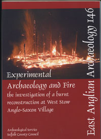
Report on the fire of 2005
|
| 2012 |
Early in 2012 the St Edmundsbury Borough Council had formally responded to the County Council Consultation paper on the proposed formation of a Suffolk Heritage Trust. By March it was reported that there had been 800 responses to the consultation, and the County's Scrutiny Committee had decided to extend the timetable to allow the fullest possible number of options to be considered for the future of the Aerchaeology Service and the Suffolk Record Offices.
Meanwhile the Borough Council Heritage Service had to reduce its annual costs by a further £120,000.
Clay could no longer be obtained from the nearby Beeches Pit for experimental kiln work because it had been made a Site of Special Scientific Interest.
It was decided that the Grubenhaus, or sunken house, now needed to be replaced or rebuilt. Options would be drawn up for the best way forward to balance cost, maximise experimental archaeology value, and ensure good visitor attractiveness.
The April season began with prolonged rain so that visitor numbers were depressed. Unfortunately this pattern would continue throughout the year, which would turn out to be one of the wettest for years.
Future uncertainty increased when the Forest Heath District Council and St Edmundsbury agreed to appoint a joint Chief Executive with a view to merging many of their service provisions with a view to long term cost savings and efficiency. Forest Heath Council did not have a Heritage Service provision. By September a number of Heritage staff had been made redundant and two more had left.
The new Mini-Dig facility was now fully open and proving successful, particularly because special care had been taken in selecting items to be "found".
The County Archaeologist, Keith Wade, reported that the County Council had decided to divide the archaeology service into two. The excavation service would be turned into a trading company, headed by a Contract Manager and the Conservation Team would remain in-house. Mr Wade would retire in December 2012, while it was hoped to build a new central heritage centre to house the Conservation Service and the Record Office, possibly linked to a university department. Trustees expressed concern if there was to be a loss of service provision of the Record Office and the Archaeology service in Bury St Edmunds.
In November, the Trust's Archaeological consultant, Dr Jess Tipper presented a full Options Appraisal for the future of the Sunken House.
A new Day Ticket was introduced for the site in 2012 at a reduced price. Although the Heritage ticket had been seen as a success, and was better value for money, more people appeared to want to spend as little as possible in the current depressed economic climate.
Dr Tipper's report on the archaeology of the fire in the Farmers House in 2005 was published in 2012 as EAA 146, while a reprint of 50 copies of the two volume 1985 report on the excavations, reference EAA 24, was made available for sale during the year.
|
|
Seven original re-constructors
|
| 2013 |
Following the retirement of Keith Wade, Dr Jess Tipper had been appointed County Archaeologist. As this left a vacancy for a consultant archaeologist, Dr Richard Hoggett was appointed to this position in June 2013.
The options had been considered for the Grubenhaus and the preferred option was to dismantle the existing building and replace it with a new construction in an adjacent location. This was scheduled for 2014/2015.
In 2013, the Anglo-Saxon Village team hosted a reunion for the students who had undertaken the earliest reconstructions on the site. It was 40 years since the first "Saxon" building was re-erected in 1973 on the site of one of the original buildings dating back to the 5th century.
Clicking on the small thumbnail will reveal a larger picture of those reconstructors who could attend the reunion, held on Saturday 17th August.
From the left, the picture shows:-
- Ian Allister,
- Rosie Boughton,
- Andrew Wilson,
- Simon Freeman,
- Jess Davies,
- Liz Pieksma and
- Kimberley Rew.
Perhaps the name most well known to the general public today is Kimberley Rew, who played guitar in Katrina and the Waves, and wrote their world wide hit, "Walking on Sunshine." Katrina and the Waves went on to win the
1997 Eurovision Song Contest for the United Kingdom on 3 May 1997 with another Kimberley Rew song "Love Shine a Light".
Other members of the original team, from 1973 to 1975, included Mike Shackleton, Martin Jones and Richard and Hugh Darrah. Between 1975 and 1993 Richard Darrah worked reconstructing the Anglo-Saxon houses and as a warden for West Stow Anglo-Saxon village. Since then he has appeared on television demonstrating early timber technologies, and has a website at www.riven-oak.appspot.com.
During 2013 the District councils of Forest Heath and St Edmundsbury were in the process of combining many of their departments with accompanying job losses throughout the year. At West Stow the Experimental Archaeologists Posts were extinguished, and the loss of other Heritage posts meant an inevitable reduction in the resouces available to the Anglo-Saxon village project.
Alan Baxter left the post of Heritage Manager in December 2013 following these reductions and became an independent Heritage Consultant, after 29 years associated with West Stow.
Suffolk County Council had planned to float off their Record Offices and Archaeology Services into a charitable Trust. Bury St Edmunds was the home of the West Suffolk Record Office, as well as a major part of the Archaeology service. When this option appeared unfavourable, a move of these services to a central point in Ipswich became the favourite option. At the end of 2013 their future was still uncertain. West Stow had bid unsuccessfully to be a site for part of these changes.
|
|
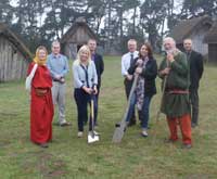
Cutting the first turf for new SFB
|
| 2014 |
West Stow, which is a site of international archaeological importance and one of the first large-scale investigations of an early Anglo-Saxon settlement, is replacing one of the original buildings that was put up nearly 40 years ago.
To celebrate the breaking of ground for a new sunken house construction there was a photo call in the West Stow Anglo-Saxon Village on the 19th September. The old sunken house or 'grubenhaus', will eventually be demolished.
The timber framework for the new building, prepared by Traditional Oak Carpentry (Rick Lewis), was raised on Wednesday 24th September. There was press interest from the BBC , the East Anglian Daily Times and Radio Suffolk.
The people shown in the adjacent picture are: - Back L-R: Rick Hoggart (consultant archaeologist), Jess Tipper (archaeology project manager), Damien Parker (Operations manager - leisure and cultural services), and Lance Alexander (West Stow),
- Front L-R: Janet Connelly 'Edith' (village elder), Cllr Sarah Broughton, Cllr Sarah Stamp and Bob Connelly 'Wulfnoth' (village elder.)
|
|

Arnor Heritage
|
|
blank |
Meanwhile Alan Baxter, now an independent Heritage Consultant, had set up Arnor Heritage to provide services to museums and other heritage projects. Arnor Heritage specialises in Heritage Education and Interpretation for medieval and earlier periods but is also involved in Heritage Lottery Fund projects. See this website for further details www.arnor.org.uk
|
|
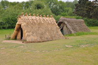
The new SFB in front of the old
|
| 2015 |
By June, 2015, the new Sunken Featured Building was in place. Here it is shown in front of the old one, which it will replace. The old SFB is in a dangerous state and will be dismantled in an archaeological experiment to chronicle its decay since it was built in 1974. In order to test different methods of construction the ridge used to top modern thatches has been replaced by a wooden framework as often seen on the continent. This is a simpler system allied to a different type of thatch to see if its use was feasible in the past.
|
|
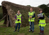
Sunken House ready for demolition
|
|
blank |
In October, the Bury Free Press reported as follows:
" The original Sunken House at West Stow Anglo-Saxon Village was built by a team of experimental archaeologists and has now has reached the end of its natural life.
But the Heritage Lottery Fund Young Roots project now means a team of young people, aged 11 to 25, working with professional archaeologists, can dismantle the house and excavate the pit that remains. The picture shows Team leader Pippa Smith, centre, with two of the HLF Young Roots participants, Ethan Dracocardos, 11, and Rosie Bound, 16.
Archaeology and heritage education specialist Pippa Smith said: “Each stage of the deconstruction will be systematically recorded using photographs and measured drawings, which we then hope will give further insight into the ways these buildings decayed over their lifetime.
“By recording how the building has decayed, this will give us more understanding how long Anglo-Saxon buildings would have lasted with different building techniques; something which the original archaeological team set out to explore with this particular house for instance, some 40 years ago.”
|
|
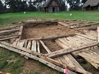
Old SFB dismantled
|
|
blank |
The first stage in the demolition of the old SFB was to remove the thatch which was stacked separately. The timbers were then taken down, with some parts collapsing in the process. The timbers were then laid out around the pit to show how the structure had been built originally.
As part of the Heritage Lottery Fund Young Roots project, a group of young people also worked to record each stage of the deconstruction, taking detailed photographs and measured drawings of the structure to help experts understand the way it has decayed.
By mid-November the plan was then to excavate the remaining pit and to compare their findings with those from the original excavation of the archaeological site.
|
|
Digital Finds Project
|
|
blank |
The West Stow Digital Finds Project was designed to provide a digital catalogue of Anglo-Saxon finds from the excavations at West Stow. The aim was to update that information into a digital form so that it is accessible on line to anyone who might be interested. Universities, schools, archaeologists and individuals from all over the world have studied West Stow and we hope to make that easier for them and for future generations.
In November 2015 Friends of West Stow volunteers started work on this project, co-ordinated by qualified museum professional (Alan Baxter), now no longer a member of staff but a Friends member and Heritage Consultant. At the time of writing there are a total of five volunteers on the project – Elaine Pitt, Rodney Cox, Maritta Matthias, Shaun Cooley and Alan Baxter. By November 2016 this team have catalogued and repacked 1,500 objects in 800 hours work.
|
|
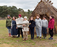
Sunken House Autopsy
|
| 2016 |
During the last half of 2015 some community archaeological work had been carried out locally at West Stow. A group of young people aged 11 to 18, under the banner of the Young Roots, excavated and dismantled the sunken house at the village to determine whether its construction in 1974 was based on accurate interpretations of building methods in Anglo Saxon times. This was part of a Heritage Lottery Funded project, styled the 'Sunken House Autopsy.'
They presented their findings in March, 2016, at the Brecks Fest along with a short film about the project, which was carried out over a six month period.
Dr Richard Hoggett, senior archeologist at Suffolk County Council and advisor to West Stow, said : “This has been an important piece of work and the completion of the 40 year experiment of this building.”
|
|
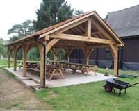
New building September 2017
|
| 2017 |
In order to accommodate larger and more frequent school groups this new building was completed by October, 2017. It sits between the education building and the Visitor Centre and can seat large groups under cover. At this date it is largely completed, but awaiting decking over the concrete pad floor. It has already been used for Breaking New Ground skills training. It will be used in the future to bring in income for use by schools, forest schools, possible private hires, and displays by the Friends of West Stow etc. It has come in slightly over budget, which has been covered by the Borough, as the concrete pad and drainage have been additional costs to the Arts Council Grant of £30,000. The area around it is to be improved and lighting and an electricity supply will be considered in the future.
|
|
Academic committee review new displays
|
|
blank |
During the summer of 2017 a revision of the displays in the Anglo Saxon Gallery at West Stow was begun. Here we see three members of the Academic Committee reviewing progress to date in early October. From left to right we see Alan Hamilton (Chairman of the Friends of West Stow), Dr. Catherine Hills (Trustee), and Faye Minter (Archaeological Consultant and Academic Committee Chair).
At this time new titles have been made for the cases and the first six cases stripped out and re-painted. Text and images and most objects have been finalised for cases 1 and 2 and are with the Designer. Text is prepared for Cases 3-5 and images are being sought and objects selected for the themes.
|
|

Professor Evison at West Stow
|
| 2018 |
On 31st May, 2018, the Guardian newspaper published an obituary of Vera Ivy Evison, archaeologist, who was born on 23rd January 1918, and died on 19th March 2018, aged 100. Although well known at a national level for her study of early medieval vessel glass, which culminated in a Catalogue of Anglo-Saxon Glass in the British Museum, 2008, she earlier had contributed to the excavation of the West Stow Anglo-Saxon village. Professor Evison started excavations at West Stow in 1958-61 before Dr. Stanley West's more detailed excavations of 1965-72. She retired in 1983 as Professor at Birkbeck College, London.
|
| 2020 |
Like all other museums, the corona virus caused restrictions to be applied throughout the summer. The site was closed from 23rd March, 2020 and re-opened on Wednesday 8th July. However, social distancing rules remained in place.
- contactless payment for entry and the shops (no cash payments),
- hand contactless available on entry and exit and
- restricted numbers being admitted
- visitors are required to wear a face mask whilst inside the museum, but not outdoors in the Anglo-Saxon Village.
|
|
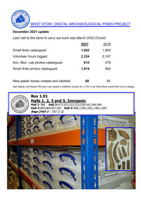
Digital Finds Report update
|
| 2021 |
By December, 2021, despite Coronavirus restrictions, the Friends of West Stow Digital Archaeological Finds Project could announce that 2,324 hours of volunteer hours had allowed 1,952 small finds to be catalogued, as well as 612 lab photos and 1,814 small finds photos to be catalogued.
This project has not just resulted in a catalogue. This project has been successful to date because of the co-operation between staff and volunteers. It has a number of significant outcomes, including:
- The first digital catalogue of West Stow small finds
- The first access to small finds details on the internet
- The first photographic catalogue of small finds before and after cleaning
- The first repacking of small finds to improve collections care in 50 years
- The first accurate location system for small finds
- The new clear storage boxes will result in less disturbance of the collection by researchers
- The new storage system saves a lot of space in the store compared to the old
- A greatly enhanced ability to interpret the site through the original finds, using photos, cards and handling boxes
- Cost effective as carried out by volunteers from The Friends working with staff
|
|
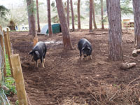
New pig enclosure
|
| 2023 |
As part of the reorganisation of the garden area, a new pig enclosure was made under the pine trees behind the Visitor Centre. Two pigs were moved in known as Apple and Acorn, and they are Tamworth/Wild Boar and Gloucestershire Old Spot cross-breeds believed to be the closest to how Iron Age pigs looked. They had been on-site in the old enclosure since July, 2022. Produce will now be grown on their former enclosure.
|
|
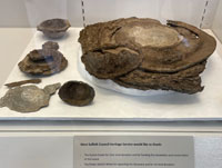
Euston Estate pewter hoard
|
|
blank |
A Roman pewter hoard discovered on the Euston Estate has been donated to West Stow for exhibition. The visitor centre has a temporary exhibition, by the reception, of the donated pewter horde. This item was secured for West Stow by the consultant Archaeologist Faye Minter. This find adds to the story of what was happening in this area just before the Anglo-Saxons arrived. It will be available to see for the new few months in the free entry area of reception to comply with the request of the donors.
|
|
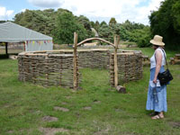
Roundhouse phase 1
|
|
blank |
In April work on the construction of a Iron Age Roundhouse commenced on site. This project is being funded via the Brecks, Fen Edge and Rivers (BFER) National Lottery Heritage Fund grant. The Trust supported the initiative as it will expand on the multi-period nature of West Stow and will be used to show people how human habitations changed between these two historical periods. This project is led by the village team and supported by the FOWS and volunteers. There are 200 spaces available throughout the project for members of the public to get involved. The first 40 spaces were used during the easter holidays. The teamwork included debarking and splitting Ash, experimental digging holes, mallet making workshop, and hazel weaving.
|
|
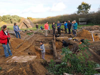
Oldest hut excavation
|
| 2024 |
A plan and timetable are now in place is dismantle and record the oldest house working with the West Stow Team, Rick Lewis, Stuart Brookes and Tim Lemley- a IoA UCL MA student, Faye Minter and her SCCAS colleagues.
Recording of the structure will take place on July 19th and dismantling on 4th September. By November there will be an excavation of the pit and post holes. The picture shows the position on 11th November, 2024.
|
|
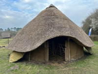
Iron Age round house
|
| 2025 |
The round house is largely complete by March, 2025, ready to be decorated and fitted out by the summer.
SCC Archaeology Service have been successful with a new lottery project application and that Faye Minter will be managing a new NHLF project "Romans Unearthed: Suffolk’s Hidden Villas". This project will involve local communities and priority groups in various fieldwork on villas, work in the archives and also experimental archaeology. In the project there is allocated funding for various types of experimental work around Roman crafts and industry and buildings which will be done at West Stow and can be used to display and bring West Stow's Roman archaeology to the public. The development stage of the project begins Oct 2025-Oct 2026 and if the second phase funding application is successful the project will then have a four-year delivery phase running March 2027-March 2031.
In addition, a grant of £15,000 has been confirmed from the British Museum to create a new Palaeolithic case and microscope table in the Archaeology gallery.
|
|
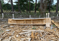
Dugout canoe
|
|
blank |
In the summer this dugout canoe was made and would be used to extend the village connection to the river.
|
|
New bookshelves
|
|
blank |
Bookshelves, financed by the Friends of West Stow, were installed in the Education Room to house the Stanley West Library in July, 2025
|
|
Quick links on this page
Anglian Glaciation 478,000 BC
Abandoned by Rome 410 AD
West Stow village in 440 AD
Sigeberht at Bury 635
End of West Stow? 720
Domesday West Stow 1086
John Croftes 1526
Basil Brown on site 1940
Stanley West excavations 1965
Reconstructions begin 1973
Site WSW 030 1979
Visitor Centre 1988
Anglo Saxon Centre 1999
New Centre Dig 2007
New Development Plan 2010
Organisational changes 2013
Head of Page
|
Adapted for the St Edmundsbury History Project
by David Addy from the work of
Dr Stanley West on archaeology
and Brian Coley on sewage disposal
Also "West Stow, Lackford Bridge Quarry
(WSW 030)" by Jess Tipper. Suffolk County Council Archaeological Service
March 2007
Report No. 2007/039
Many pictures and some chronology supplied by Alan Baxter
|
|


