 |
 |
|
|
Free Resources for home map-makers Links to Software and Map Sources
INTRODUCTION
By 2015 , along with the development of QGIS, has come more and more freely available maps on the internet. However, not all these maps come with geo-location data. We are here concerned with maps which include geo-references and which can be read by QGIS, and displayed in their 'correct' map projection and Co-ordinate Reference System.
It has only been since 2010 that the UK user has enjoyed the release of a set of such maps covering Great Britain from the Ordnance Survey.
There is a host of websites with maps and tutorials about GIS and about QGIS in particular; many more than listed here. The links shown here are the most useful for people wishing to re-create some of the example home-made maps shown on this website.
QGIS software and Documentation
The QGIS home page is found here:-
Follow the 'Download Now' link to load a copy of the program. You have a choice of 32 bit or 64 bit versions, depending upon your computer. Also a choice of the latest version, or the Long Term Release (LTR) version. The LTR is for businesses and individuals who do not want to keep updating their installation, or retraining their users. LTR is an older version, but is kept up to date with all bug fixes. It is your choice.
Are you an ArcGIS user looking to change?
For existing users of the oldest established commercial GIS system ArcGIS, used in UK universities and across the globe, who are looking for a free alternative, there is a useful comparison between the two systems here:
GIS Geography website 27 differences between ArcGIS and QGIS
However, you should bear in mind that QGIS is updated every four months, and so some of these comparisons may become out of date.
Priority one for new UK QGIS users
All the manuals and books tend to omit something I would suggest first for any new UK user. Having got your QGIS program installed, click on the word 'Project' in the top left hand corner. A drop down menu appears, and click on 'Project Properties..', to open a new menu with several tabs down the side. Click on 'General' find the entry 'Save paths' and change the entry to 'relative' if it is not already set to that.
Click on the next tab down, labelled 'CRS' and we want to set the default CRS to the OS British National Grid. If you cannot see it, click to put a check mark in 'Enable' on the fly' CRS transformation' and type '27700' in the filter box. You should see 'OSGB 1936 / British National Grid EPSG:27700' appear in the box. Click on it so that it appears inthe 'Selected CRS' box. Click OK to load these options and close the window.
These very useful settings will pay off later.
Returning to the QGIS software and Documentation website
The 'Documentation' tab on the QGIS website gives access to the QGIS USER GUIDE, which is not always bang up to date with the latest release. It is a massive document, but even so, you will quickly discover that it cannot cover every little quirk of the software.
There is also a QGIS TRAINING MANUAL which takes you through some examples using maps of Alaska, which are available as part of the main program download, if selected.
There is also A GENTLE INTRODUCTION IN GIS which beginners may find useful to read.
An independent source of tutorials is available from Ujaval Gandhi here:-
Ujaval works for Google, and lives in Bangalore, India, which demonstrates the global reach of QGIS, and its developers. These tutorials are particularly scrupulous in their detail and accuracy.
There is a specific forum where both QGIS developers and QGIS users can raise issues, seek advice and discuss possible bugs:
There is a UK QGIS Users Group where issues specific to the UK can be discussed. Any general queries about QGIS issues or bugs are best addressed to the Forum above. The UK User Group is found here:
|
 |
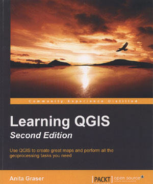
Books on QGIS It can be difficult to follow on-line instructions and tutorials, and being able to use a book is a good alternative. The various QGIS Training Manuals and QGIS User guide can be downloaded as .PDF files. Printing these off at home would be a long costly exercise, and you may wish to get a local printer to print and bind them for you. Get a quote first!! An invaluable and recommended introduction to the subject is "LEARNING QGIS - third edition" by Anita Graser, avalable online from PACKT publishing, or via Amazon. In 2016 the third edition was published, updating the book to correspond with the release of QGIS 2.14, a Long Term Release. A larger and more complex book for those who have some experience of the program is "MASTERING QGIS" by Kurt Mencke, and others. It is from the same publisher, PACKT publishing. I have both these books and refer to them often.
|
 |
Ordnance Survey OpenData Probably your first and best source for a range of UK maps The Ordnance Survey OpenData homepage claims that:
"Get started with free digital map data... I find the OS website a maze of useful data, but it is full of dead ends, and often mixes up links to chargeable products along with the free OpenData. Some of the product names are obscure or even misleading, and much valuable and useful information can easily be missed in the murk. So I have given more links than might seem necessary below. OS provide an overview of the available products here: OS 'Getting Started' round up of available datasets I find that this information is a bit short on detail. The datasets of most use are :
Also lurking on the website is a .PDF file entitled "OS OpenData Getting started Guides", which does give a greater overview of each type of product. Load it from here:- The link to the ORDNANCE SURVEY OPENDATA homepage is:- You have to click on 'Order now', OR you can go straight to the downloads page from here:- The Ordnance Survey offers a number of different maps, and it is quite daunting to decide which product is required. Users may have them all, but when it comes to using them, there is a choice to be made based upon the prospective end product desired by the user. If one is going to work at a regional or County wide level, then the product known as Strategi® is useful for a regional overview of road networks, railway lines, cities and rural wooded areas. Rivers and the coastline are also included, although OS does not mention these on their Order Page. Strategi works well at around 1:150,000 scale. It displays a little too small to be of use by 1:250,000. Strategi is a vector map product, while the equivalent raster product is called "1:250 000 Scale Colour Raster" and is equivalent to the former OS Travel Map, but in an image format. For work on an individual town, OS Street View® is marketed as a generalised and simplified street level map, ideal for city-centre plans. However, it is available solely as a raster file at scale 1:10,000. On the other hand, OS VectorMap™ District, despite its name, can be supplied as either a set of vectors, or as a set of rasters. The nominal viewing scale is 1:25,000, with a recommended scale range of 1:15,000 to 1:30,000. The OS provides User Guides in .PDF format for its various products, but these can only be found by searching the OS website. OS also provides Stylesheets for its vector products, which can be found here: |
 |
|
 |
Edina's ShareGeo Open website of freely available GIS maps Edina is well known to students on Higher Education courses for its wealth of maps available to University affiliated students. The general public may not have access to the main Edina map source. However, Edinburgh University have developed a second website, which they call ShareGeo Open, which contains over 200 GIS maps which are freely available to everyone. Some of the maps offered are OS OpenData sourced, but produced in a more user friendly fashion. For example, the OS present many of their maps as tiles covering a small area. Some ShareGeo Open offerings have amalgamated these tiles to give a national coverage in one download, complete with all the necessary associated files. It is worth browsing this site to see if the OS data in which you are interested has been pre-processed in this way. The home page is here: Edina ShareGeo Open website homepage In case you find it difficult to make your way through the menus, try this first page of 244 maps: All collections in date issued order One example of a contributor pre-processing OS files is the Land Form Panorama for England, made by Edina's Carol Blackwood, entitled, "England Land-Form Panorama DTM:- Another contributor with similar products derived from the SRTM or Shuttle Radar Topography Mission is Addy Pope. I give these names because it is one of the search criteria to help you find your way around the ShareGeo website. This mission has mapped the world at 90 metre contours, if you prefer to try this source.
|
 |
The British Geological Survey The BGS says, "We provide expert services and impartial advice in all areas of geoscience. Our client base is drawn from the public and private sectors both in the UK and internationally. " Their website contains a mass of useful information for the historian, as well as allowing the downloading of many geological maps. British Geological Survey Homepage One failing of the BGS website is that there are no stylesheets available for its maps. As geological maps rely upon a complex array of colours to represent different rocks or deposits, this is an omission. Luckily EDINA has already addressed this issue. This is the link to get geology styles:- QGIS uses two formats of stylesheets, namely, .SLD files and its own native .QML files. Edina supplies .SLD files. Select the appropriate .SLD file for the scale map you want. Once downloaded, open the folder, and "extract all files" to unzip the files.
|
 |
UK Data Service Some of the information useful to us has been transferred to this site from the ESDS website, which no longer functions. The UK Data Service website Homepage The GIS map of the 1851 parishes of England and Wales, 1500 - 1850, is available here, and is referred to as Document 4828. You will have to register first and describe your usage requirement.:- Ancient parishes of England and Wales
|
 |
Environment Agency LIDAR data The situation is still a bit confused in October 2015. The old Environment Agency Geomatics website used to host the LIDAR data for Britain, which was chargeable to commercial organisations, but free to Non Profits and individuals. The Agency has decided to make all this data Open Source to allcomers, and so has moved data away from Geomatics. Environment Agency Datashare Website
|
 |
Suffolk Rights of Way This website, which specialises in Rights of Way, and is operated by Barry Cornelius, contains data supplied by Suffolk County Council in MapInfo format, (.MIF). QGIS can read this format without difficulty, so do not let that put you off. Not all county councils release these datasets, so we are lucky in Suffolk. Click here: Suffolk Rights of Way at June 2014
|
 |
Property Boundaries The details of property boundaries are sometimes known as cadastral data, which is a term much used abroad, but not much in the UK. Details are available to download fror St Edmundsbury Borough Council area supplied by the Land Registry, but hosted by GOV.UK here: St Edmundsbury Cadastral details
|
 |
FREE GIS DATA from R T Wilson This website is actually a list of links to other websites, but provides a daunting list of map sources which are said to be freely available to use at no cost. This site claims:- "This page contains a categorised list of links to over 300 sites providing freely available geographic datasets - all ready for loading into a Geographic Information System. We have links to everything from arctic permafrost maps to gridded population data - simply scroll through the list, or use the dropdown menus above to jump to a specific section of interest. See the FAQ for more information on the what, who, how and why of the list."
The link is:
|
| Go to Digital Mapping Homepage |
This page originally produced by David Addy on 26th September 2015 Last Updated 29th August, 2016 | Go to Main Home Page |